Drone as First Responder for Fire Service
Get eyes on scene faster to keep your community safe
Real-time aerial intelligence helps firefighters make informed decisions, deploy the right resources, and stay safe.
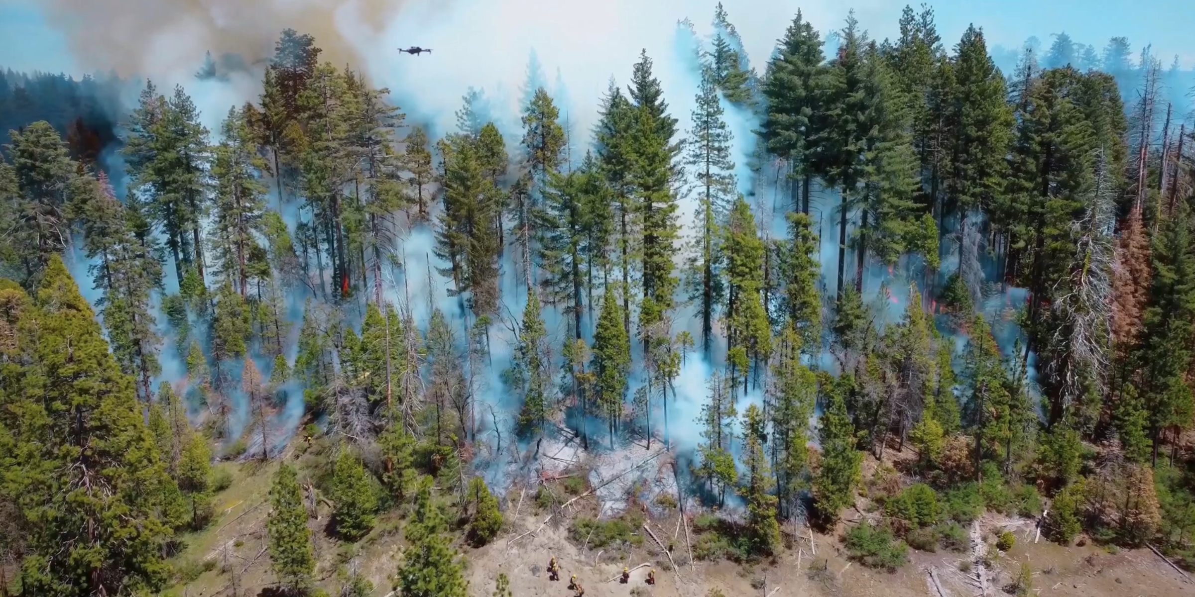
Gain situational awareness over fast moving blazes
A fire doubles in size every thirty seconds
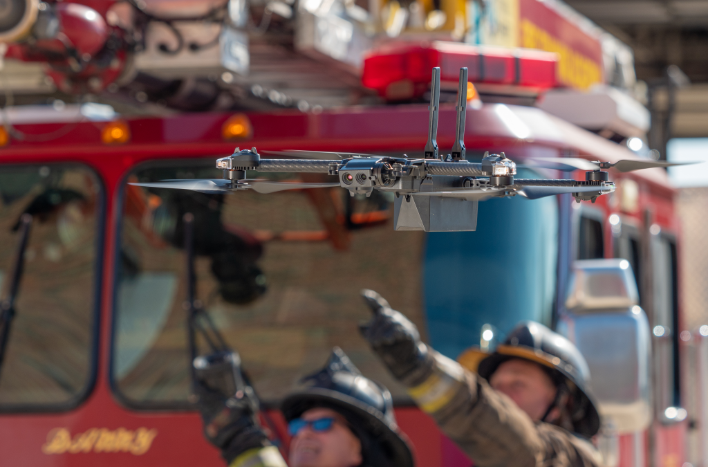
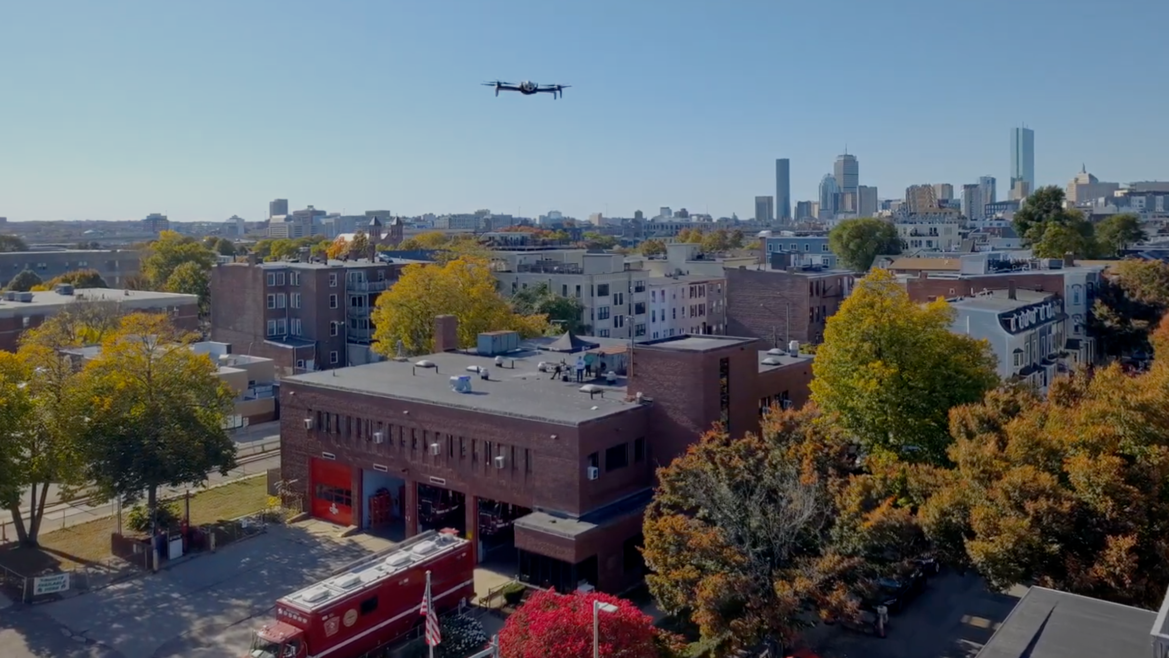
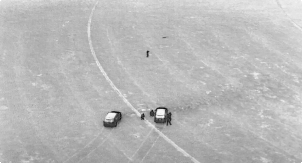
When lives are on the line there’s no time to wait. Drones that beat you to the scene enable an initial size up before the first due engine arrives. That will help you get the right resources deployed faster, gather aerial intelligence, coordinate emergency response, and keep your crews safer.
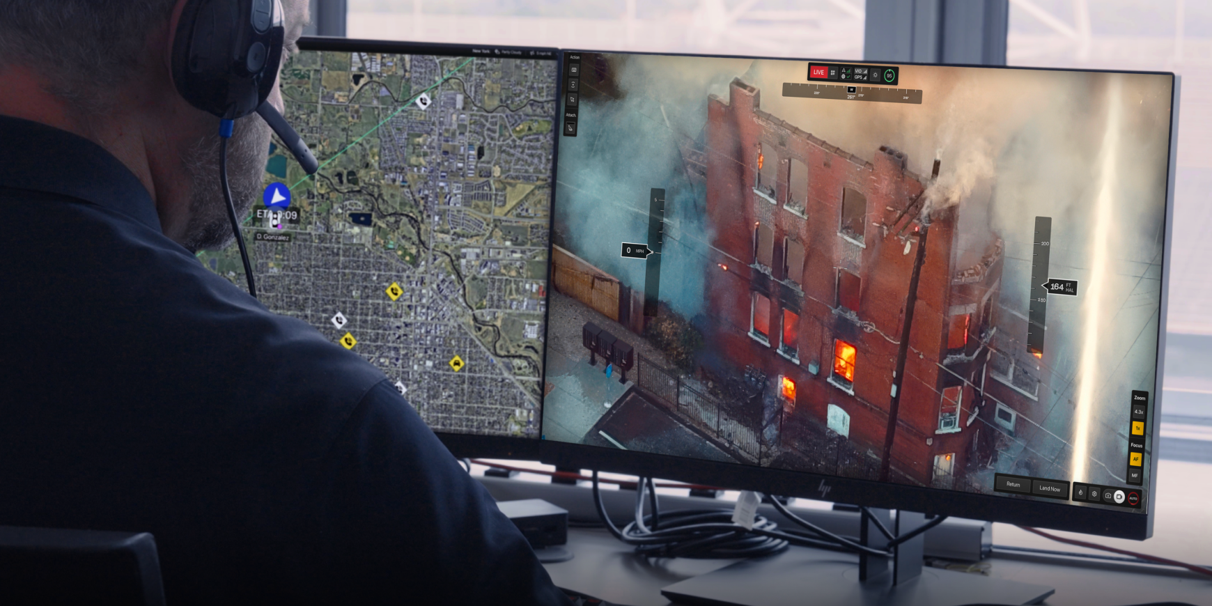
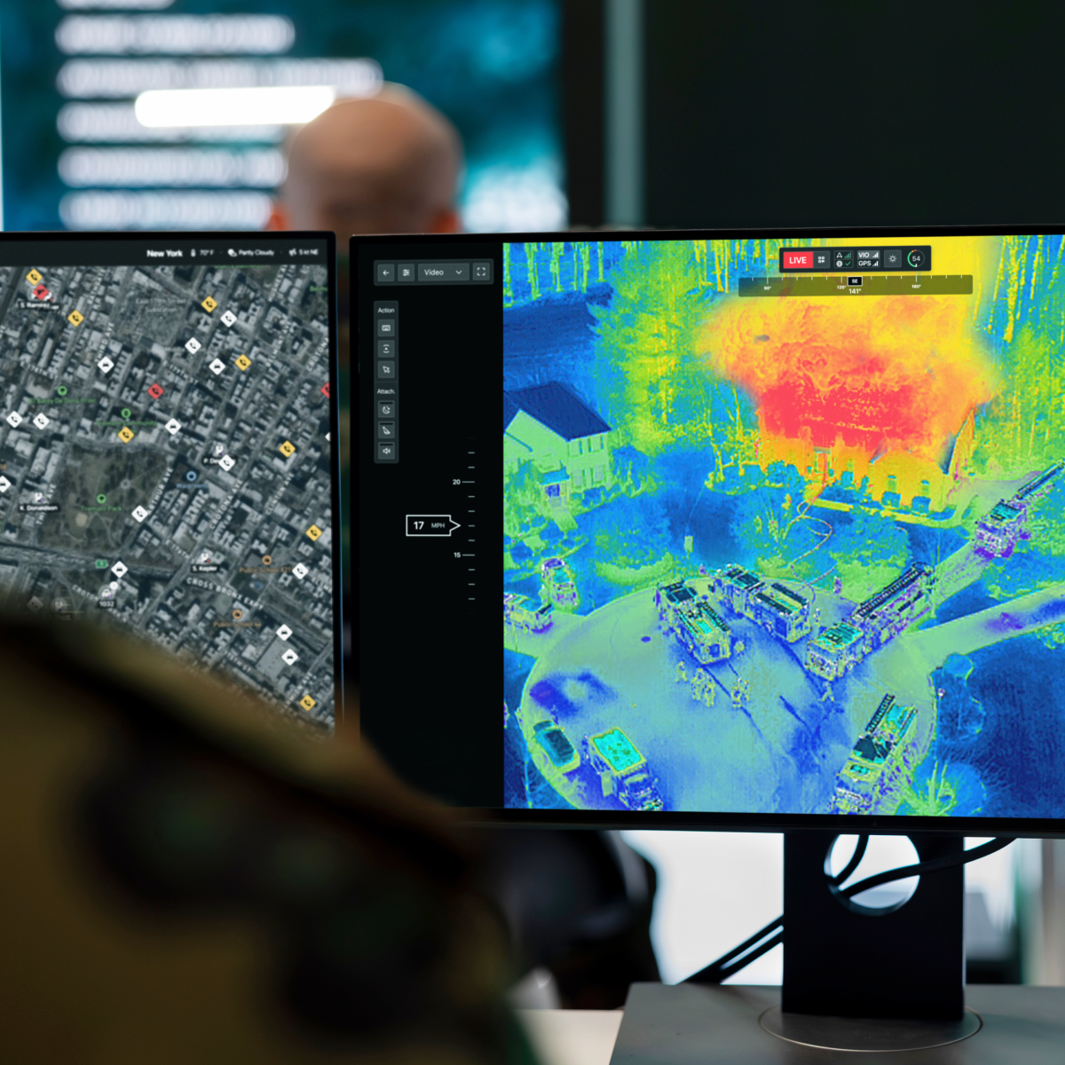
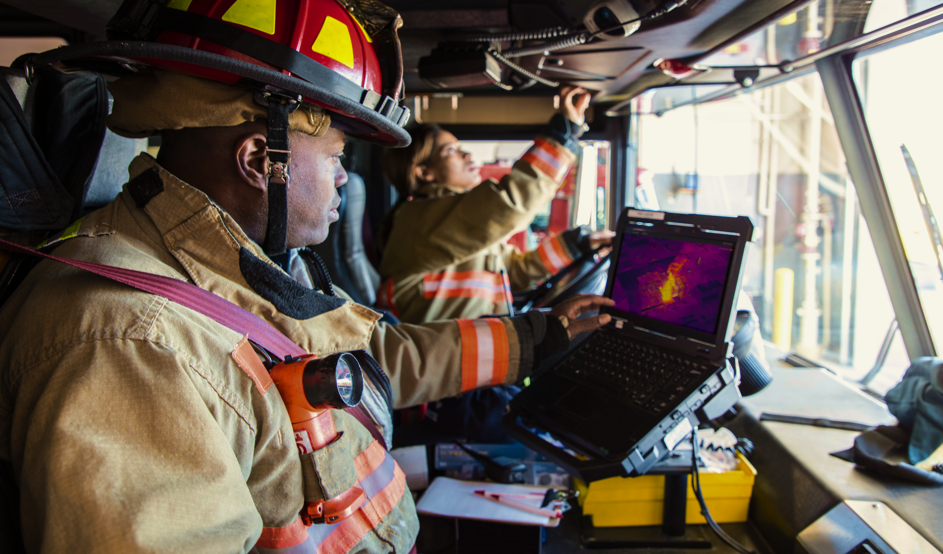
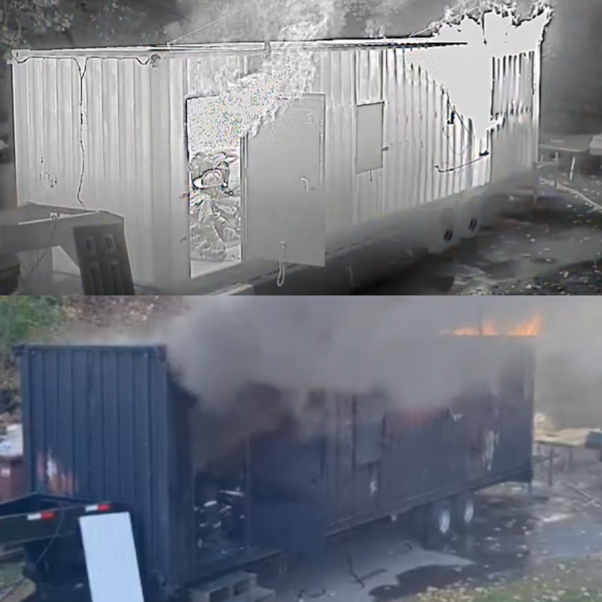
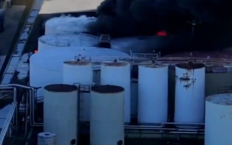
Improve your sight through blinding smoke using Skydio X10's thermal camera in both structure and wildfires. Thermal imaging to locate hot spots, real-time fire mapping, and the ability to assess structural damage instantly give firefighters critical insights that empower them to make better decisions.
Make the most efficient
use of your resources
Arrive first for a better response plan
Assess fire conditions before responding units reach the scene. A drone can be on the way in less than 20 seconds and start providing a live aerial video feed of the situation in minutes. Deploy the right resources, in the right places, as early as possible to more efficiently track and contain any blaze.
Coordinate response with real-time incident intelligence
Monitor fire conditions as situations evolve – on the scene or from the command center – with a real-time live stream. Evaluate structural integrity before sending crews in and keep crews safe as the fire progresses, continuously monitoring points of egress to ensure your firefighters always have a way out. See beyond the smoke using thermal imaging to identify hotspots.
Understand the spread pattern and ignition point
Post-fire cause and origin (C&O) investigations are faster and more efficient using Skydio X10 with 3D Scan software. Autonomous flight makes it easy to capture every detail you need for 2D mapping and 3D reconstruction in order to provide documentation for insurance, legal cases, and training. Securely upload to Axon Evidence with a pre-built integration.
Ready to serve before, during, and after the fire
Assess and track fire spread, wind direction, exposures, and containment progress to reach containment faster.
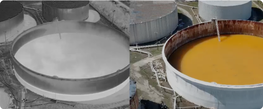
Protect your hazmat team by putting space between them and the incident, and use thermal imaging to monitor invisible dangers like toxic gas.
Search a larger area with fewer people and easily direct first responders to the right locations to reconnect community members with loved ones.
Three more reasons why fire service leaders love Skydio
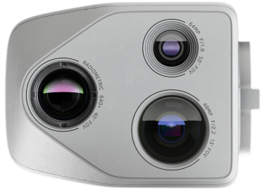
Radiometric Thermal Equipped
Identify hotspots and understand exact temperatures of fires and materials.

Trusted Source
Invest in a platform that is designed, assembled, and supported in the USA.

Regulatory Guidance
Engage our team of experts to help you through the Beyond Visual Line of Sight (BVLOS) waiver process.

Accelerate response with the Skydio Solution for Fire Service


Services

Let us show you how Skydio can help improve your fire response with a successful DFR Program
Join a live online demo
See Skydio DFR in action, as we fly real-time missions in a quick 30-minute small group session.
Fly in Skydio Paraverse
Get hands on. Fly Dock-based DFR in your own city in our virtual environment, navigating from your browser using DFR Command.
Start building a plan
Let us help you turn your vision into a plan that provides immediate results and a path to grow.
Resources
Learn more about drones for fire service

LVMPD Drone as First Responder supports firefighters in major blaze

DFR Operational Readiness Guide

Drone as First Responder in action: Real results
Drones helped Southern Manatee Fire & Rescue tackle a hazmat incident after hurricane
Tulsa Fire Department makes history with largest-ever drone response to chemical fire