


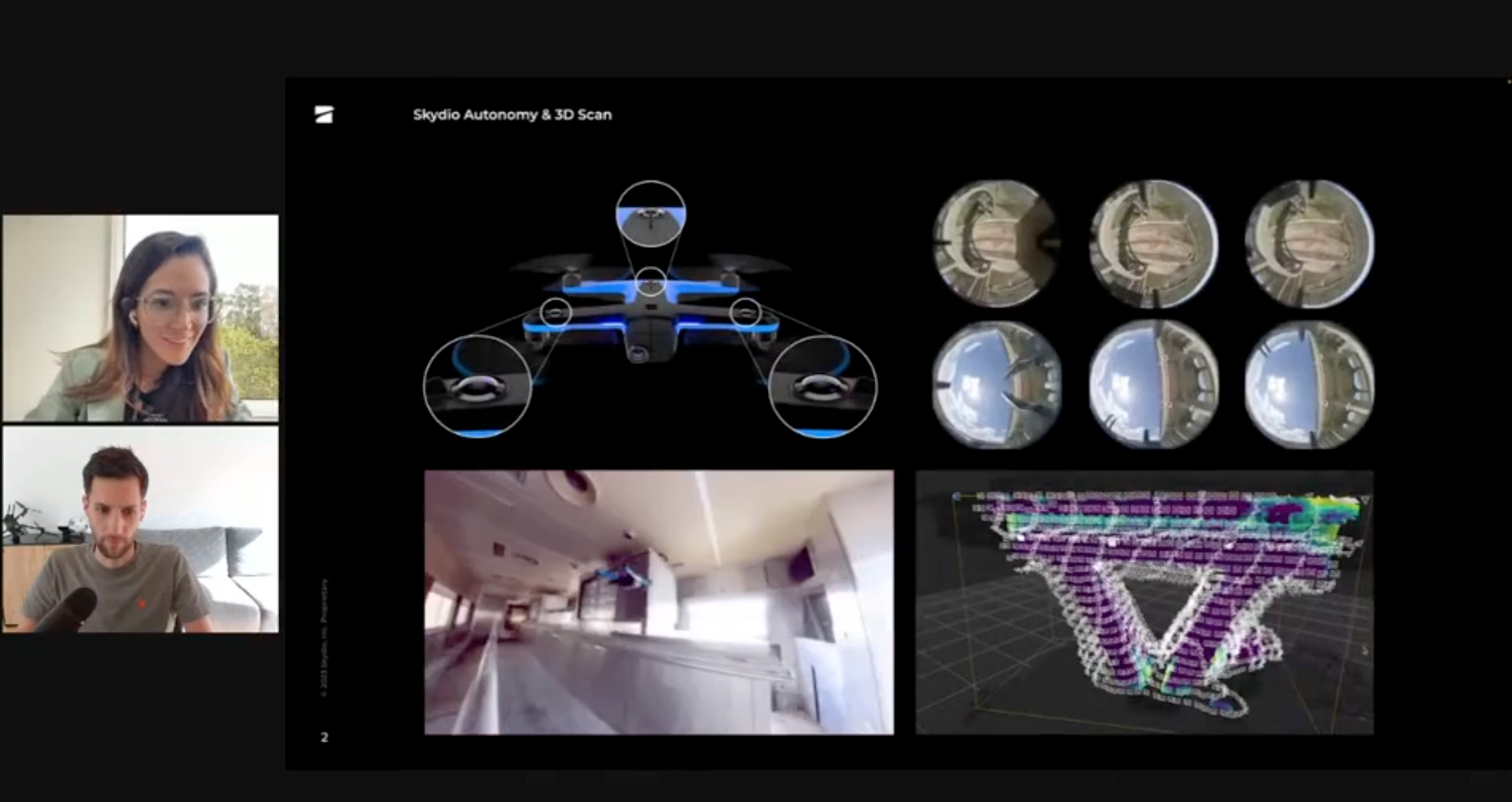
We went from a three-person crew onsite—pilot, visual observer, engineer—to one: the engineer with Skydio 3D Scan. It's a huge game changer.”
3D SCAN
Point at the asset. X10 does the rest.
Autonomous capture with intelligent flight path for any asset.
Reality is complex. Capture shouldn’t be. 3D Scan adapts each X10 flight to the scene, managing proximity, coverage, and overlap to produce complete, repeatable datasets for both 3D models and 2D maps.
Built for sites that don’t fit into rectangles.
Asset-aware capture.
Surface-hugging autonomy discovers the geometry before capture and plans the optimal path, ensuring complete coverage of complex structures while keeping crews safely on the ground.

Complete coverage in a single pass.
Autonomy maintains overlap in GNSS-challenged areas around structures so no surfaces are missed.
Mapping without surprises.
Flight altitude adapts to terrain and site conditions to maintain consistent overlap and geometry for reliable maps.

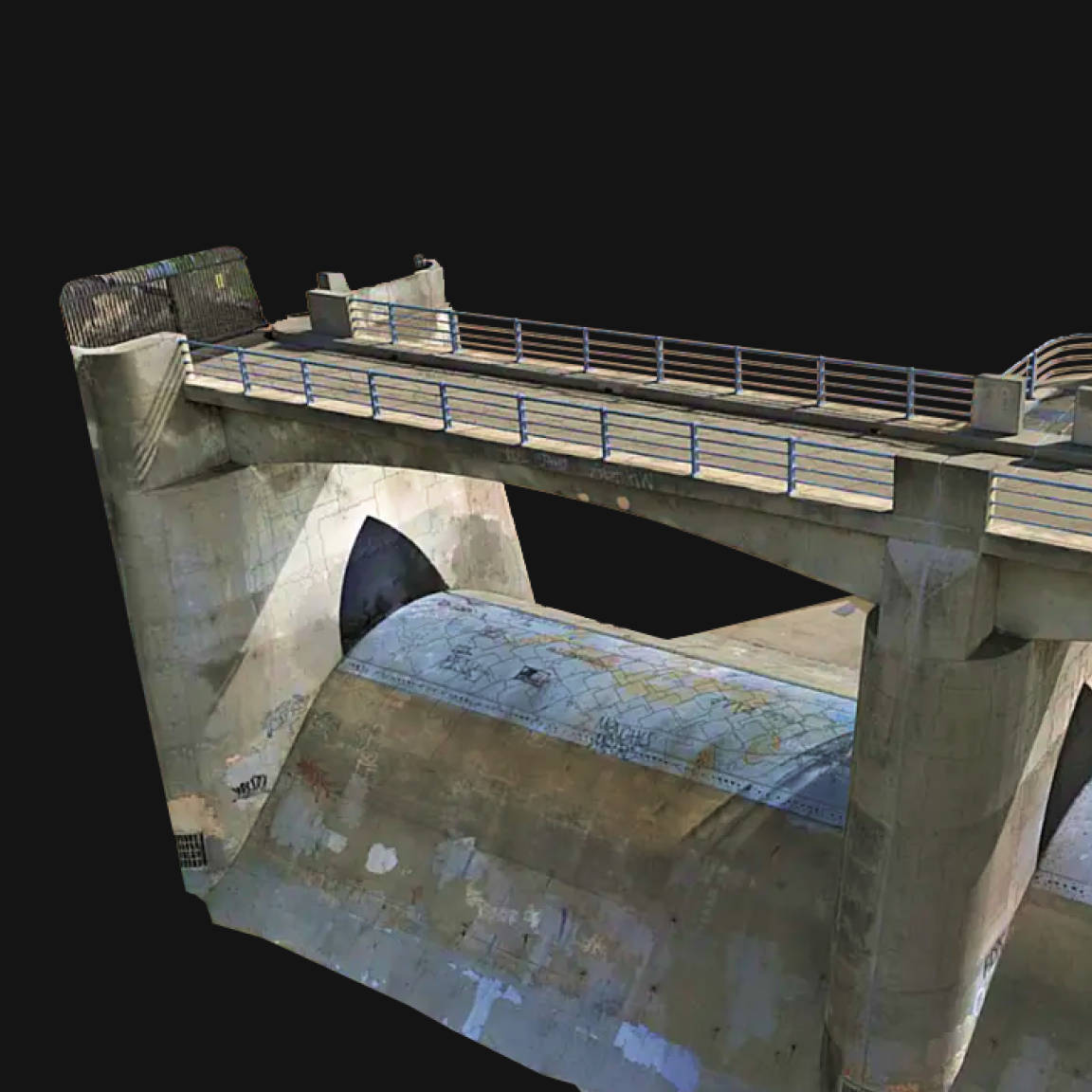
High-fidelity digital twins.
The result is clean, inspection-grade 3D models and maps, so teams can analyze, measure, and act with confidence.
From asset to dataset.
Step 1. Define your area
Select what to capture. For 3D, X10 flies closely, reads geometry, and creates an optimal mission grid; for maps, it plans a repeatable grid based on your parameters.
Step 2. Capture data autonomously
Obstacle-aware execution with rolling-shutter correction and RTK support delivers predictable geometry.
Step 3. Use your data
Review coverage on site, confirm completeness, and export to your existing photogrammetry workflow.

Export-ready for photogrammetry.
High-resolution imagery flows directly into your photogrammetry software for modeling and measurement workflows.

Seamlessly integrates with your existing photogrammetry software through Skydio Extend, making captured high-resolution data immediately actionable.
See what Skydio Autonomy enables.
Create digital twins of critical assets
Capture intricate details of complex structures and generate accurate high-resolution digital twins. Perfect for engineering, maintenance, and safety inspections.
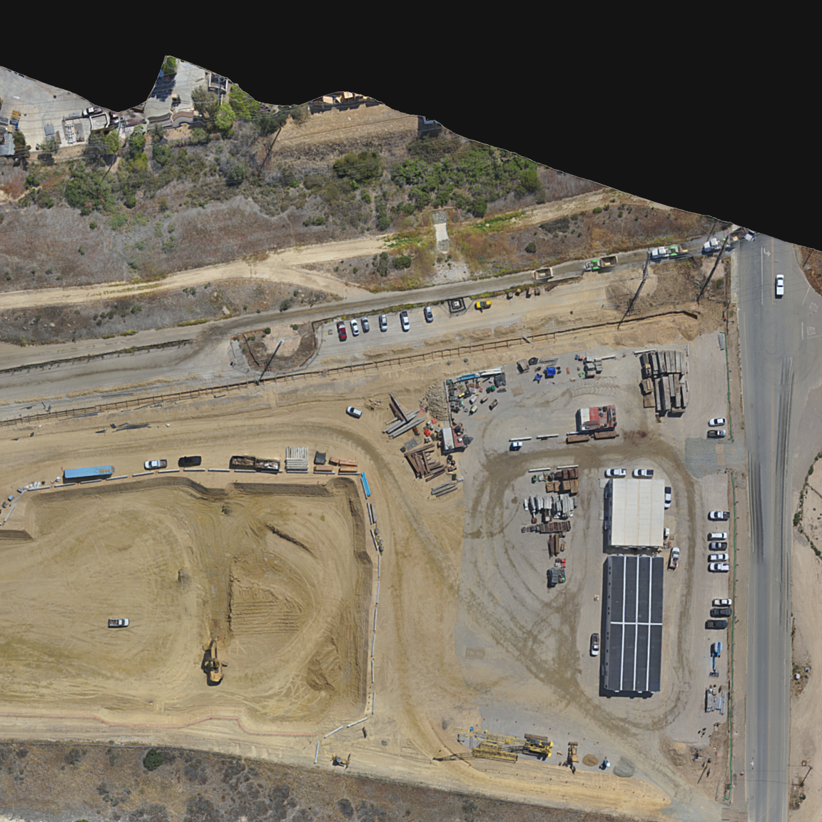
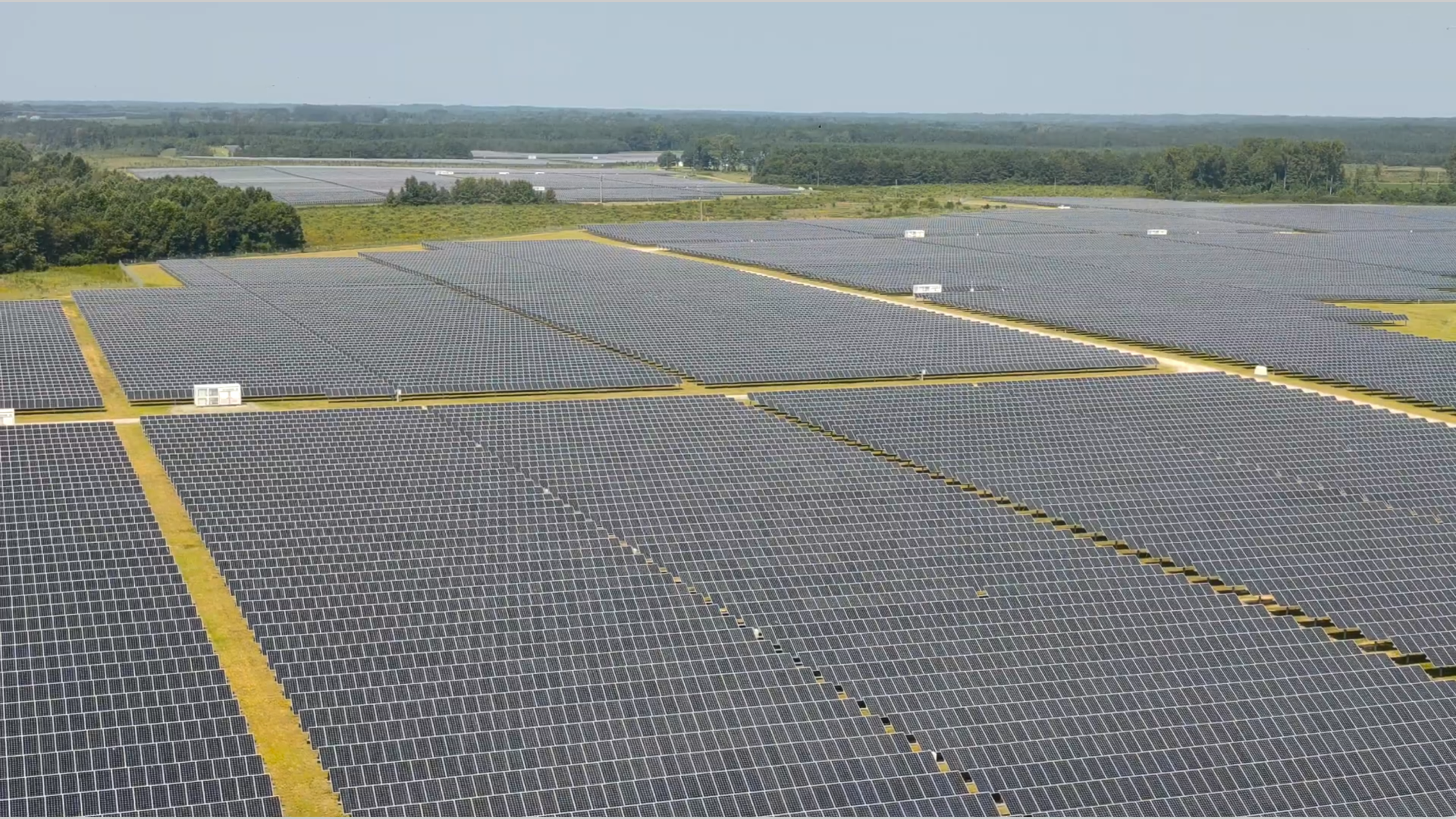
Map large areas
Create high-resolution orthomosaics and digital elevation maps for land surveying, agriculture, and urban planning with precision.
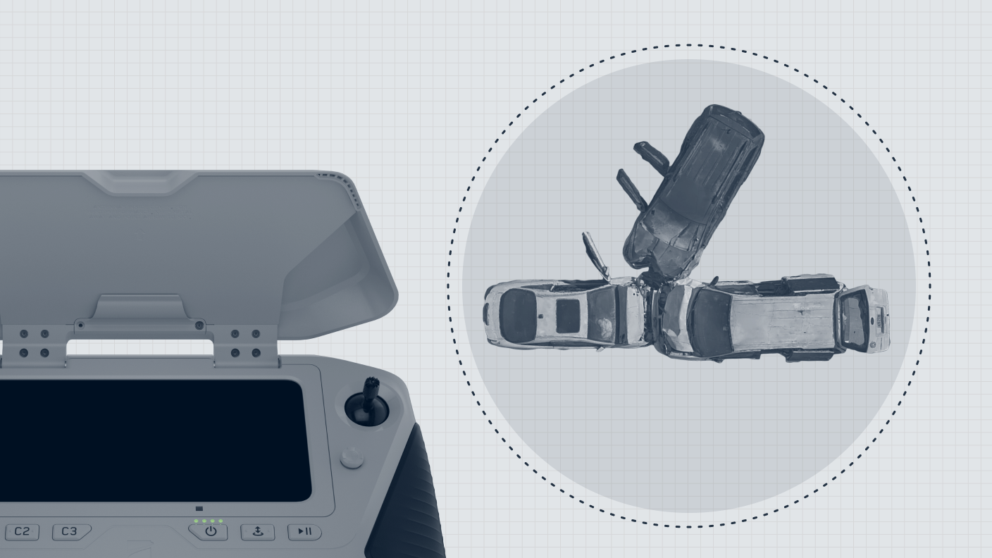
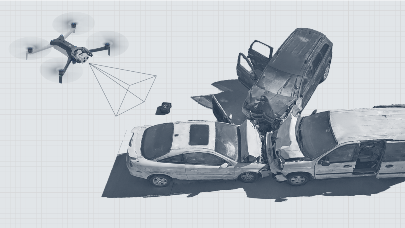
Document incident scenes
Accurately document crash scenes, crime scenes, and other critical areas with detailed 3D models that provide a comprehensive view.

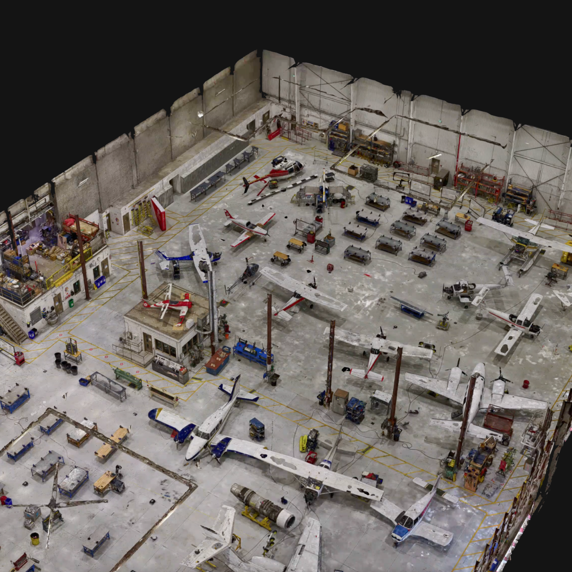
Scan indoor spaces
Generate 3D models of indoor environments like warehouses and industrial spaces, streamlining inventory management and space utilization.
Focus on your asset, not flight mechanics.
RESOURCES
Learn more about 3D Scan
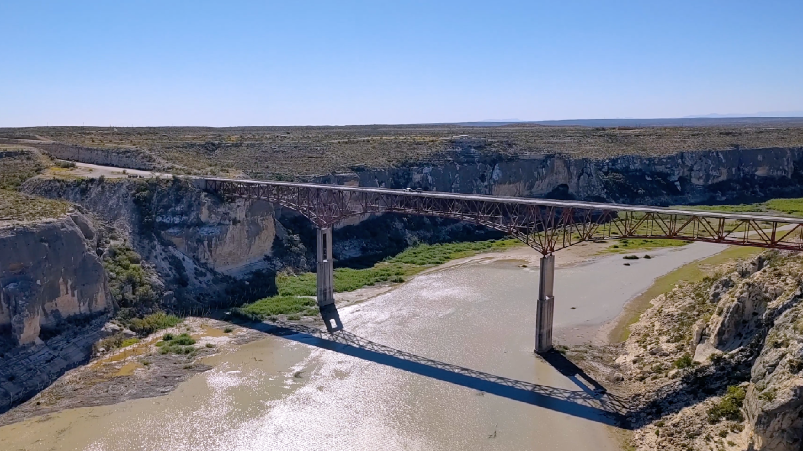
Texas DOT conducts safer, more efficient bridge inspections
See how the Texas Department of Transportation (DOT) conducts infrastructure inspections on challenging structures like the iconic Pecos River High Bridge using Skydio X10.
How Dominion Energy leverages Skydio, Esri, and seamless integration to enable data flow and optimize grid maintenance
Skydio’s integration with ESRI automates data collection and analysis, helping Dominion save time, cut costs, and reduce outages.
Live Talk: Optimizing Workflows with Skydio 3D Scan Indoor Capture
Learn how Skydio 3D Scan indoor capture streamlines digitization workflows, improves measurement accuracy and reduces overall time and costs associated with 3D modeling large factory facilities and indoor assets.
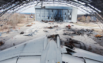
Drone Evidence Collection to Document War Crimes
See how Skydio drones with 3D Scan document strike sites in the Ukraine, capturing the detailed data needed to create digital twins without sending people into the wreckage.
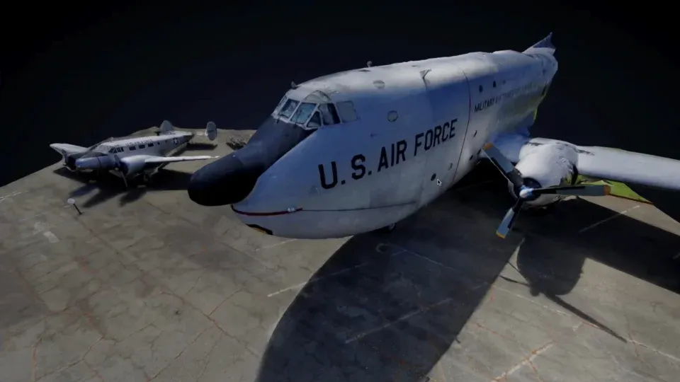
Virtual Inspection of Military Assets with 3D Scan
See how automated drone flight with Skydio 3D Scan makes it easy to create digital twins of hard to reach assets.