

With 3D Scan, we are going to be able to efficiently capture high-quality images for 3D Reconstruction, saving us tons of time and energy in the field. It’ll be easier for the pilots, safer for our assets, and faster for our teams.
3D SCAN
See every dimension of your assets in detail
Generate ultra-high resolution digital twins with AI-enabled adaptive scanning software.
With 3D Scan, powered by Skydio's world-leading AI-driven autonomy, you can easily create precise high-resolution digital twins, orthomosaics, and 3D models. It’s the go-to solution for professionals who need accurate and efficient aerial data for inspections, surveying, and documentation.
Digital outputs for the real world
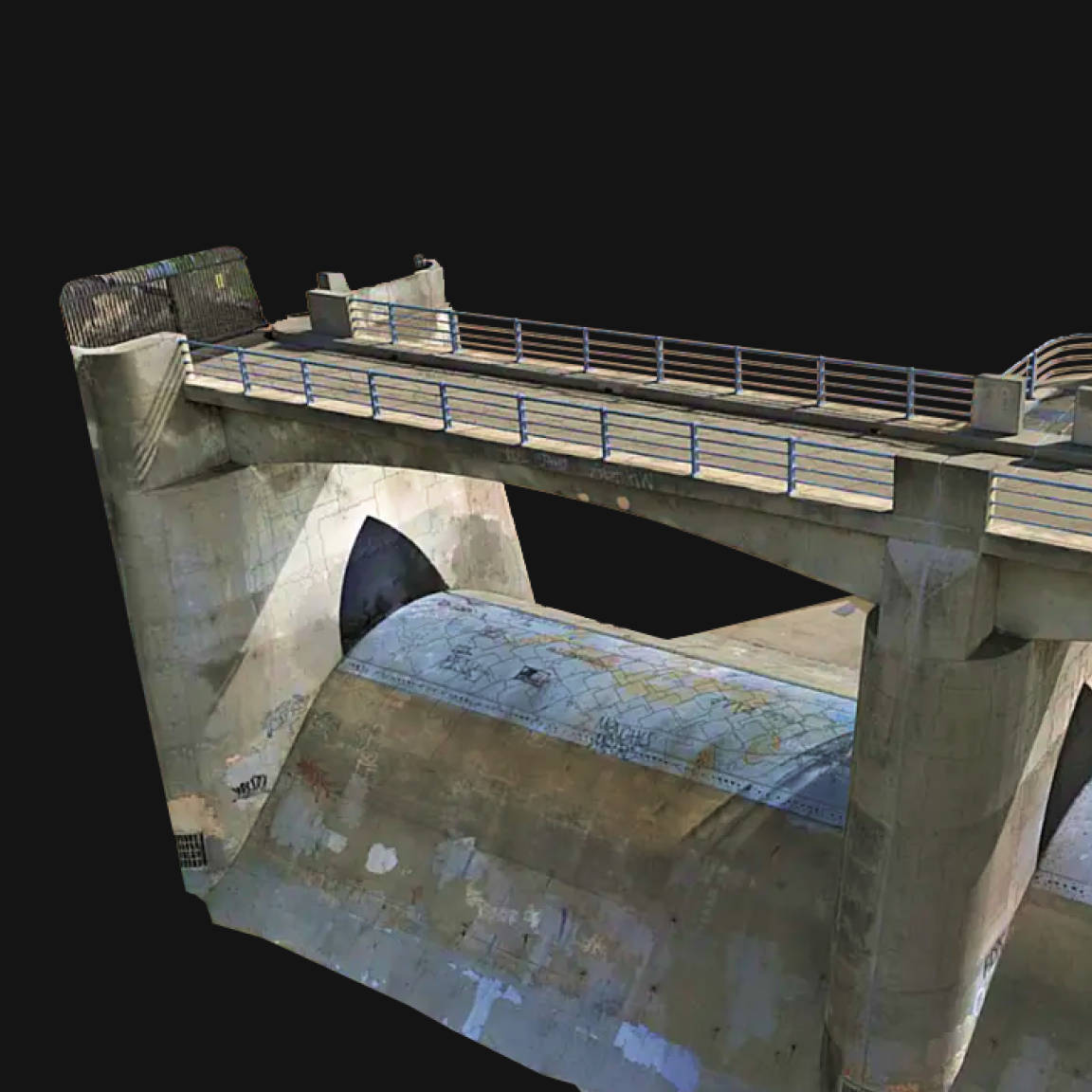
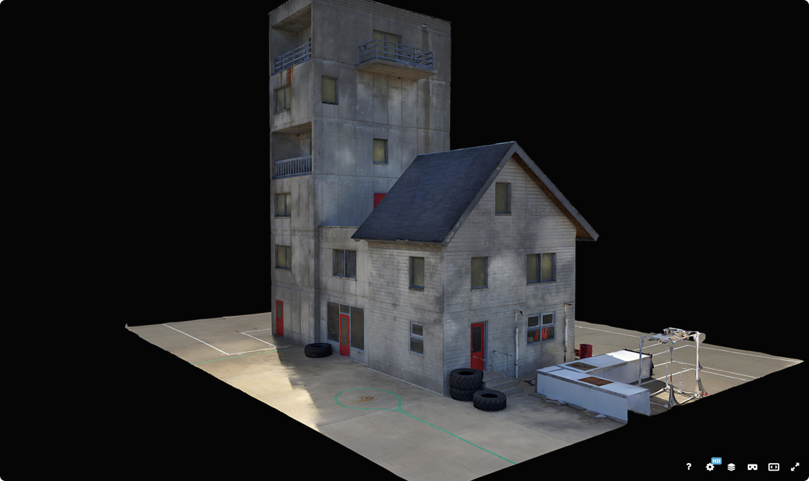
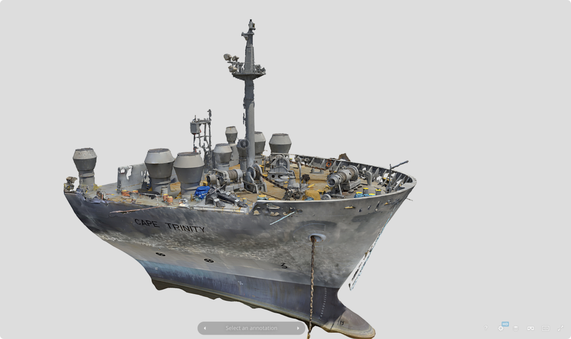
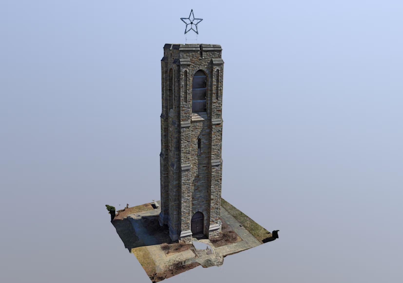
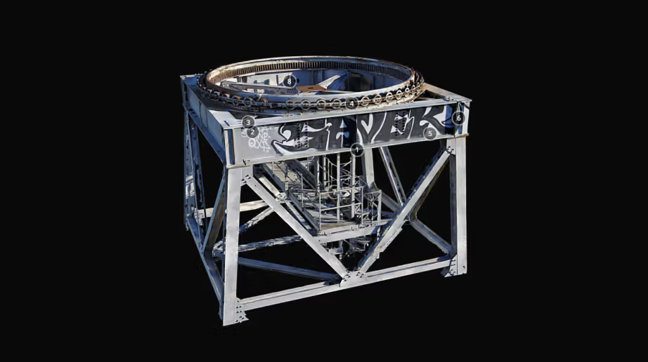
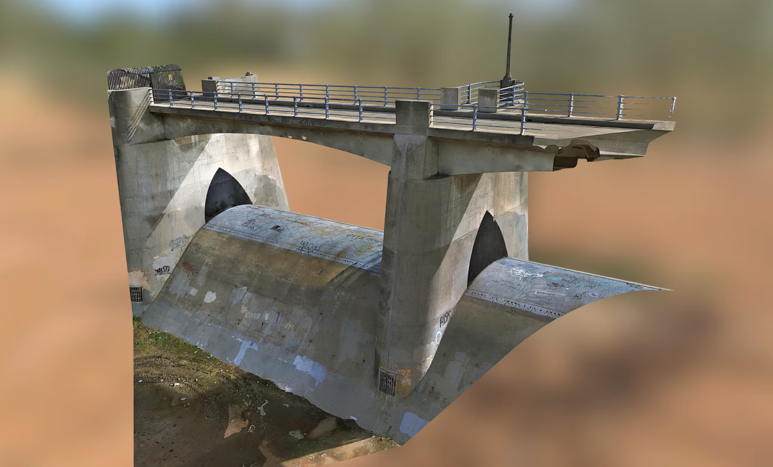
Create digital twins of critical assets
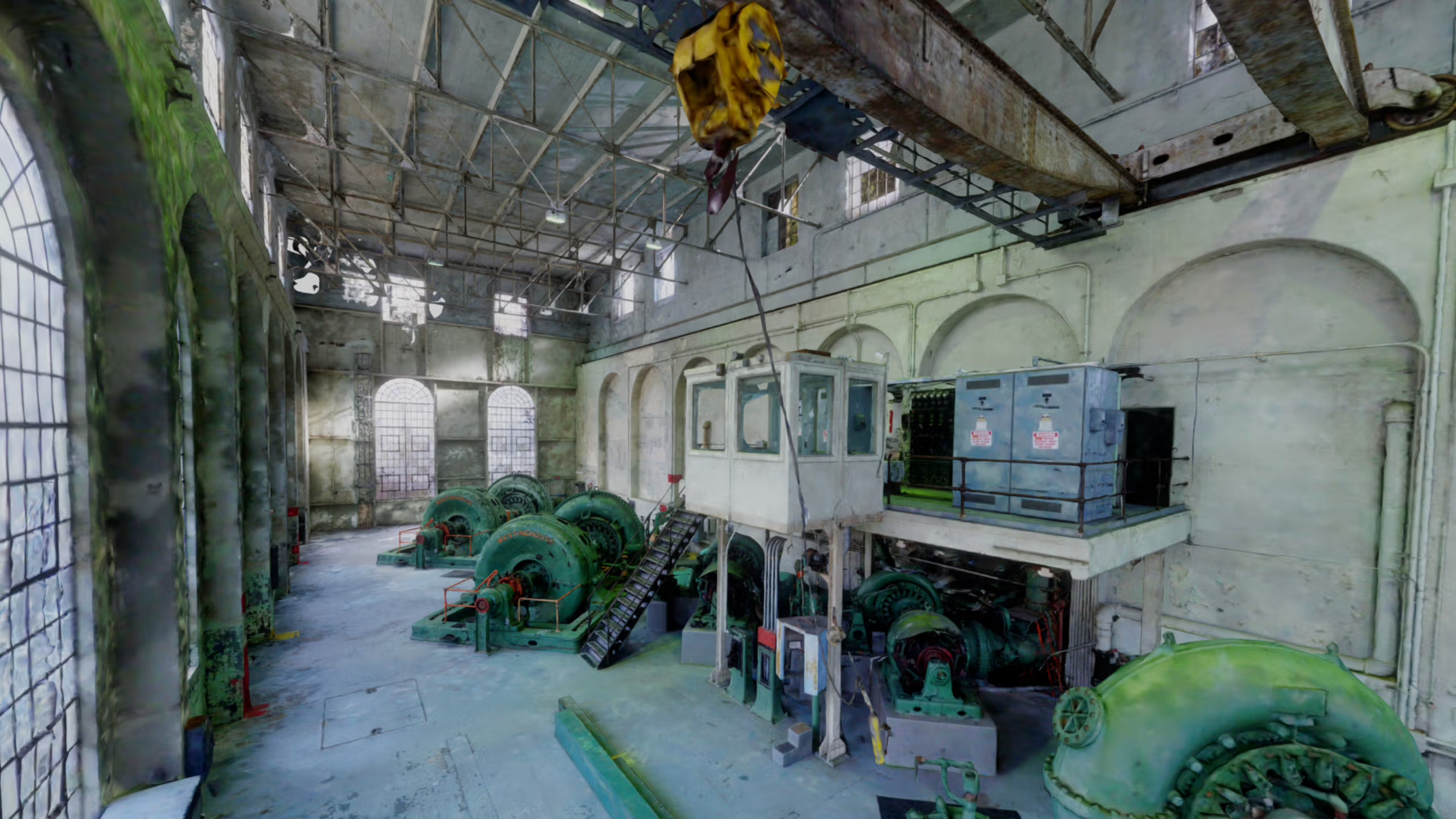
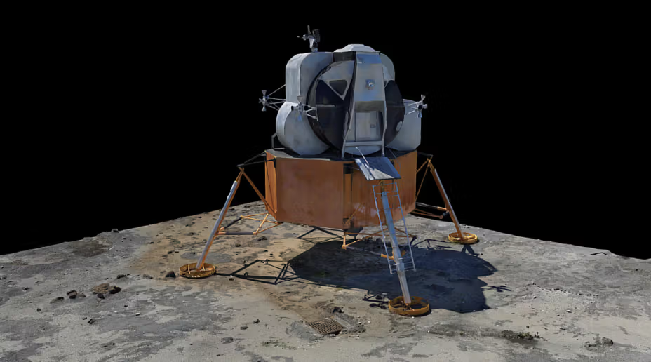
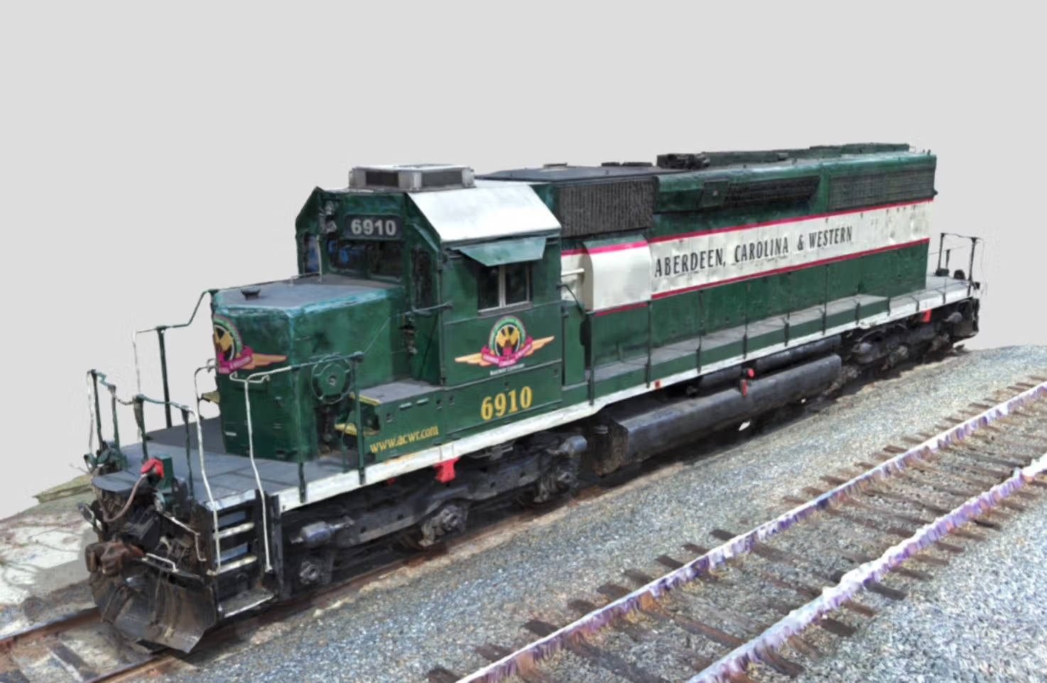
Capture intricate details of complex structures and generate accurate high-resolution digital twins. Perfect for engineering, maintenance, and safety inspections.
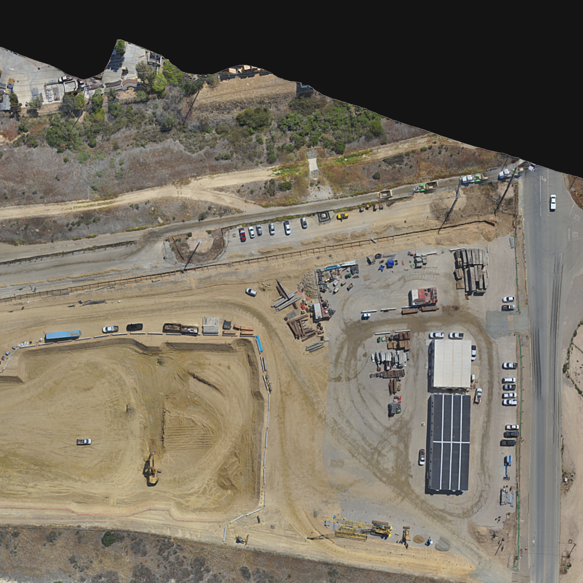
Map large areas
Create high-resolution orthomosaics and digital elevation maps for land surveying, agriculture, and urban planning with precision.
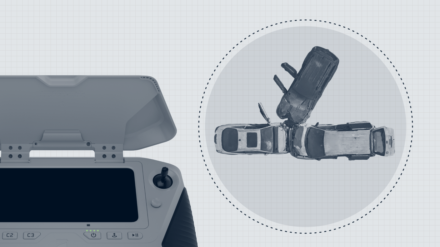
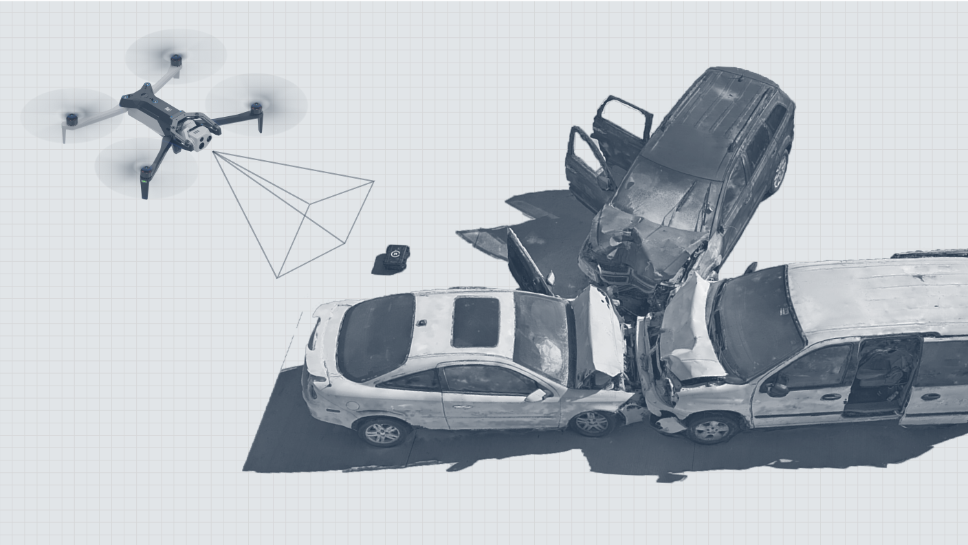
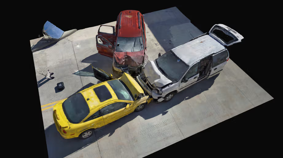
Document incident scenes
Accurately document crash scenes, crime scenes, and other critical areas with detailed 3D models that provide a comprehensive view.

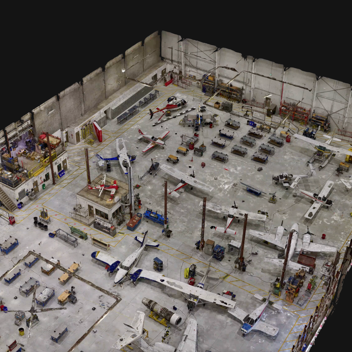
Scan indoor spaces
Generate 3D models of indoor environments like warehouses and industrial spaces, streamlining inventory management and space utilization.
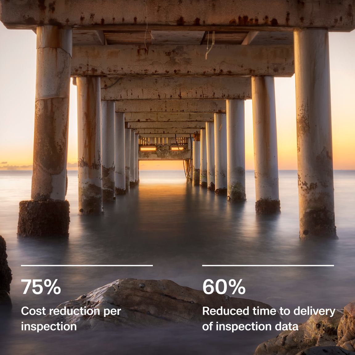
75%
Faster Data Capture
Get more done in less time with Skydio 3D Scan, optimizing your operations and reducing labor costs.
30%
Lower Reinspect Rates
Achieve greater accuracy on the first pass, reducing the need for costly reinspections.
30%
Lower Hardware Costs
Maximize your budget with Skydio’s cost-effective hardware solutions.
Easy as 1-2-3
3D Scan makes the entire data capture-to-output process simple and user friendly.
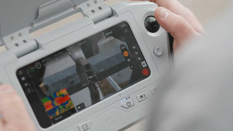
Step 1. Define your area
Simply mark the area you want to scan by selecting height, length, and depth on the controller. No complex setup required.
Step 2. Capture data autonomously
Let your Skydio drone, powered by advanced AI, autonomously fly the most efficient and effective data capture mission. It calculates the best flight paths to ensure every detail is captured accurately.
Step 3. Use your data
Use Skydio onboard modeling right on the controller to preview your 3D model, ensuring you have exactly what you need before you leave the site. Then export to your choice of photogrammetry or GIS applications.

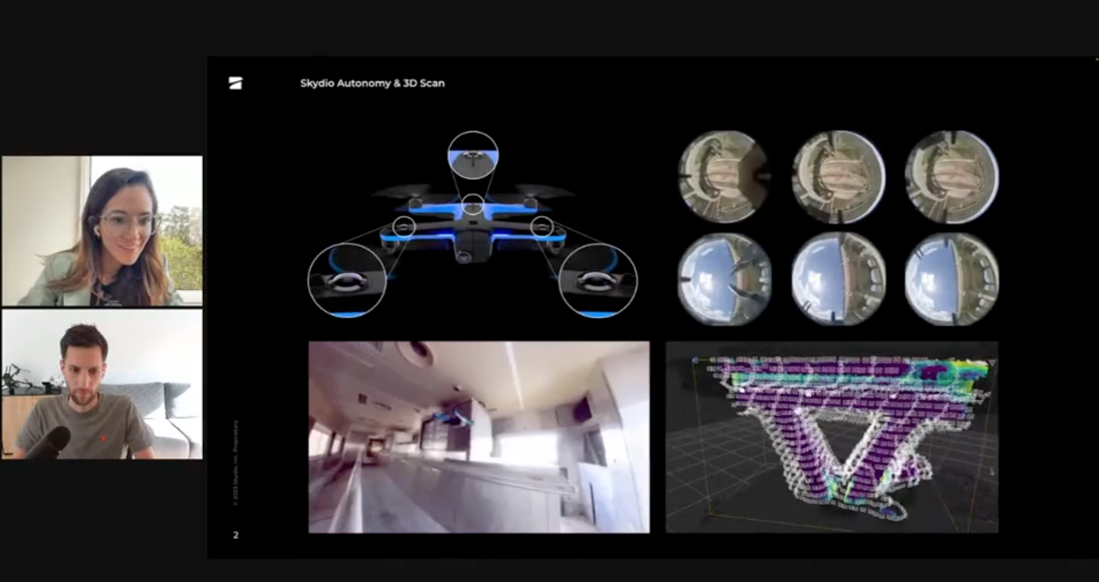
Autonomous and precise
Skydio 3D Scan uses AI-driven autonomy to capture every detail with the precision of an expert operator, ensuring accurate and comprehensive data every time.
Pro-level results for all skill levels
With an intuitive interface and autonomous flight capabilities, 3D Scan enables anyone — from novice to expert — to achieve professional-grade results, capturing high-quality digital twins with ease.
Effortless integration
Seamlessly integrates with your existing photogrammetry software through Skydio Extend, making captured high-resolution data immediately actionable.
Bring critical assets to life with digital twins
“
RESOURCES
Learn more about 3D scan
Live Talk: Optimizing Workflows with Skydio 3D Scan Indoor Capture
Learn how Skydio 3D Scan indoor capture streamlines digitization workflows, improves measurement accuracy and reduces overall time and costs associated with 3D modeling large factory facilities and indoor assets.
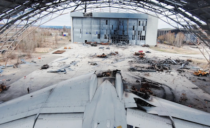
Drone Evidence Collection to Document War Crimes
See how Skydio drones with 3D Scan document strike sites in the Ukraine, capturing the detailed data needed to create digital twins without sending people into the wreckage.

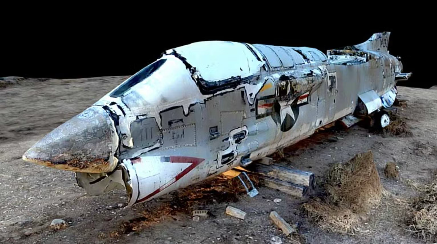
Virtual Inspection of Military Assets with 3D Scan
See how automated drone flight with Skydio 3D Scan makes it easy to create digital twins of hard to reach assets.