Skydio 3D Scan Example - Mock Helicopter Crash Site
 Skydio
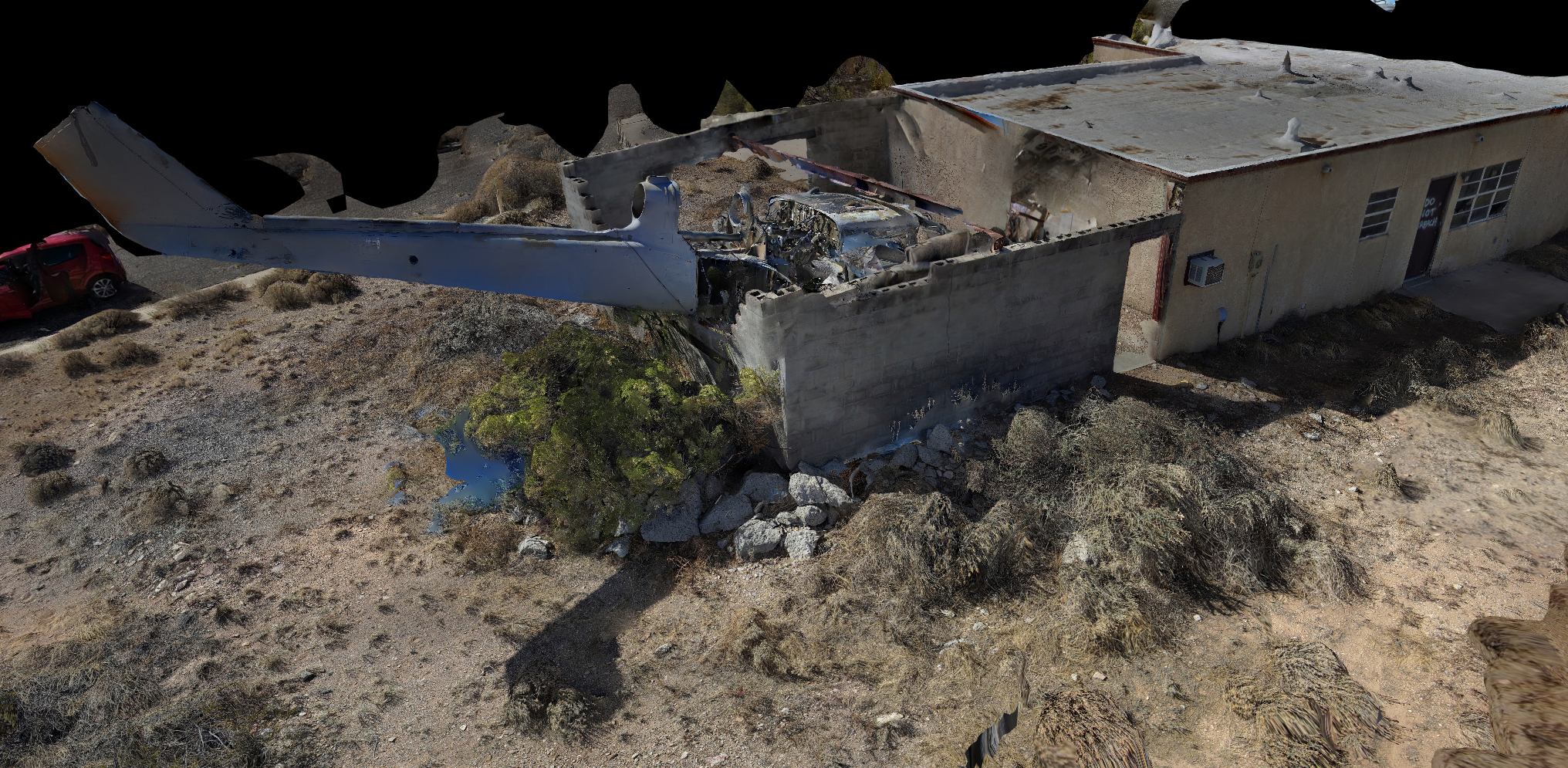
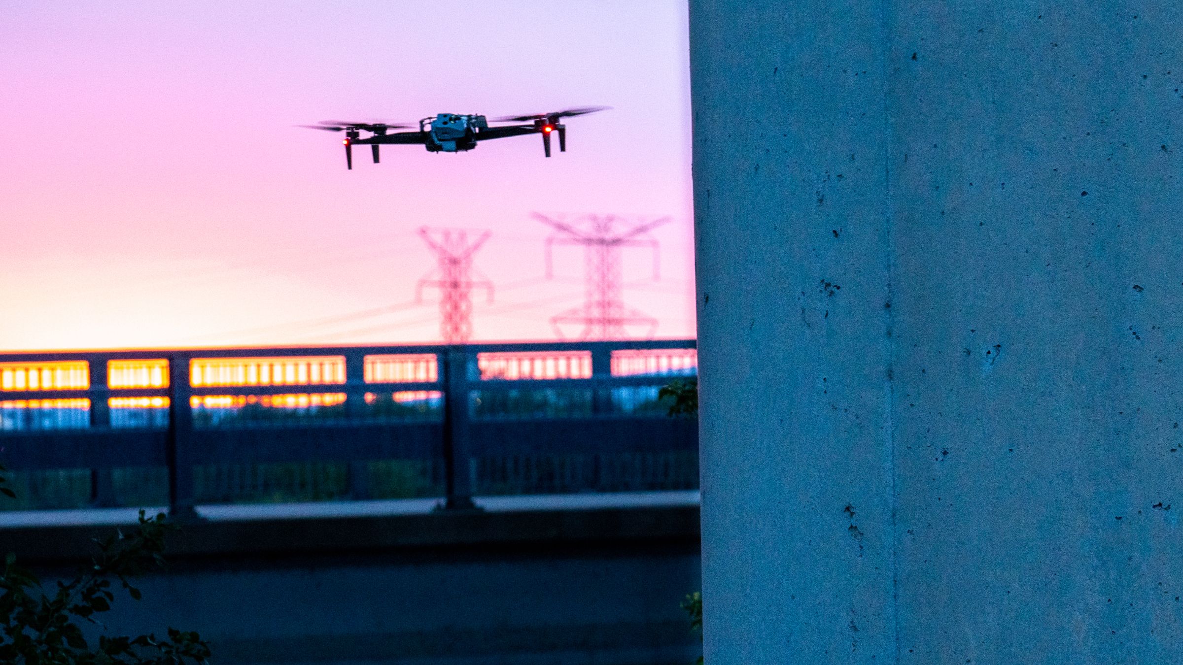
Skydio 3D Scan is rapidly maturing, and results from early access program testing are showing its incredible potential. We are excited to showcase another spectacular scan taken by Skydio’s very own Enterprise Program Manager, Marc Flamm. As a reminder, 3D Scan is first-of-its-kind adaptive scanning software built on top of Skydio Autonomy. 3D Scan automates data capture of any scene with comprehensive coverage and ultra-high resolution, so that crews can perform higher quality inspections in less time and with minimal pilot training.
Last time, we shared an amazing rendering of an abandoned American fighter jet. Today’s model (click here to see it in 3D on the Skydio Sketchfab) is of a mock helicopter crash site in Playas, New Mexico. The site is located in a research and testing facility for first responders and used for various training exercises including helicopter crashes. In most crash scenarios, whether they involve aircraft, cars, or other vehicles, first responders need to focus on many things at once, including saving lives, clearing the site as fast as possible to minimize disruption, and documenting the scene of the incident. Drone technology promises first responders the opportunity to inspect these crash sites efficiently and accurately and generate high-quality data documentation with ease. This model showcases the stunning quality and accuracy with which Skydio 3D Scan can capture a complex site. In this scan, the pilot was able to supplement the scan with a few manually captured photos from chosen angles, a workflow that is supported as part of the fully automated 3D Scan workflow.
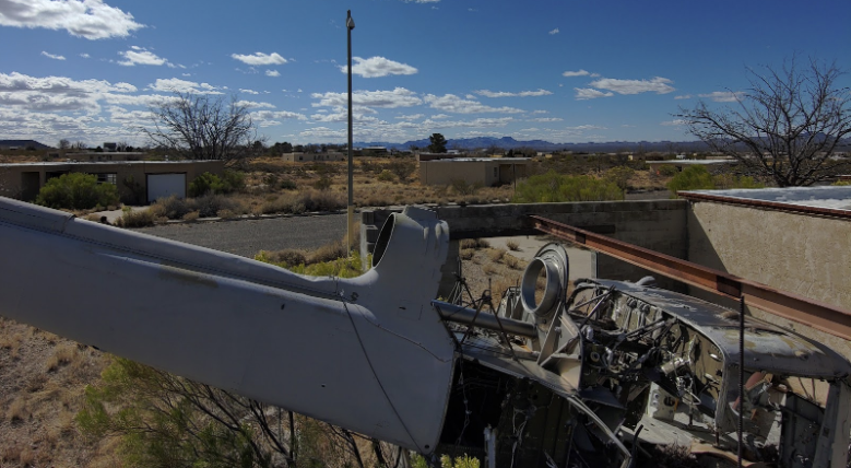
The mock helicopter crash site. This is an image taken from the drone (not to be confused with the 3D Model screenshots below).
In contrast to using a Skydio, inspecting the metallic structure and debris of a crash site is challenging with a manual drone. Manual drones have untrustworthy obstacle avoidance and cannot fly up close to the metal body of the helicopter or below the I-Beam prominent in the above photo, where GPS fails and magnetometers are unreliable in close proximity to metal structures. So, to inspect a crash site like this one, a typical manual drone inspector would have to maintain a long standoff distance from the subject, relying on an expensive and delicate zoom camera to generate precision imagery from a high-altitude grid pattern, and would be completely unable to capture the valuable low-angled shots in the center of the wreckage.
“ If I were trying to fly a manual drone here, I would expect to lose GPS when the drone got in close proximity and when that happens there is a high likelihood of a crash. You cannot trust a DJI drone to go below the roof line as they are reliant on traditional GPS and do not have nearly the same obstacle avoidance as a Skydio.
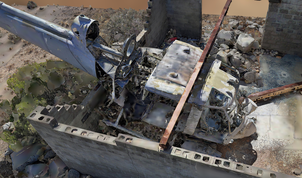
The metallic structure of a helicopter is difficult for a manual drone to navigate near, requiring long standoff distances and expensive hardware to compensate for conservative flight patterns. This is a screenshot from the 3D model.
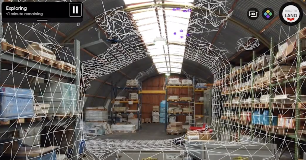
Not so with 3D Scan. The 3D Scan Adaptive Mapping algorithms help the drone iteratively design a structure-specific 3D scanning path, and follow it with full obstacle avoidance engaged. The Skydio autonomously explores and models the structure as it flies, and then automatically executes an image capture plan that provides efficient and complete coverage. As a result, the drone can capture imagery up close, from multiple angles, of every point in the pilot-specified scan volume. On this structure, it is clear how the drone designs a unique pattern for the subject at hand, enabling the generation of a spectacular 3D model. The flight pattern closely hugs the structure, allowing operators to cordon off a much smaller area than they would if trying to scan the scene with a drone requiring longer standoff distances.
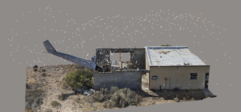
With its Adaptive Scanning algorithms, Skydio autonomously discovers structures while in flight and generates optimized flight patterns that provide the best possible output.
“ All I had to do was show up, easily define the 3D scan volume, dial in a few settings and press go. The scan was fast, safe, and accurate, with no gaps in the dataset, and we were able to capture detailed imagery on all sides.
Skydio 3D Scan allows pilots to view an edge-computed model in the field, rapidly perform quick assessments of the photos they have captured, and also export their data to their chosen photogrammetry software. This model features 542 photos stitched together in Bentley ContextCapture. As you will notice if you follow the link to our Sketchfab account, the model is unique in its coverage and detail of an occluded area that would be impossible to document with a manual drone’s simplistic top-down flight.
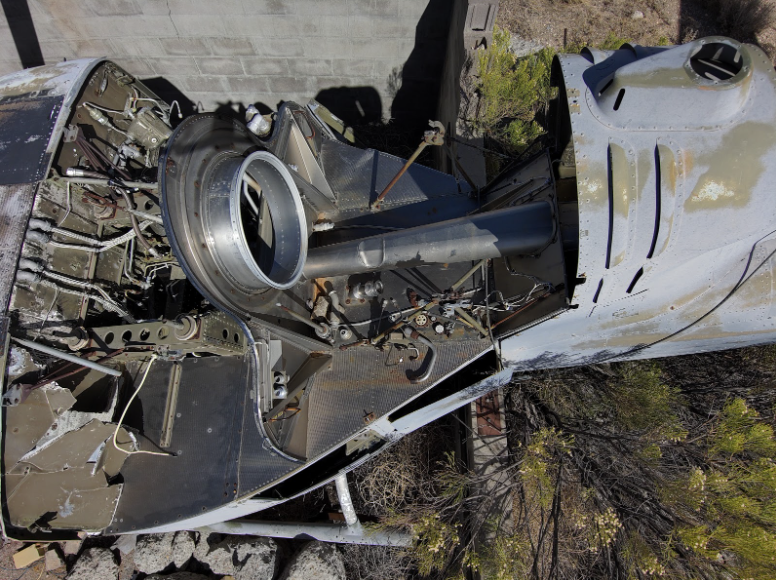
One of nearly 600 photos that comprise the scan, this image shows the benefits of being able to fly up close - capturing incredible detail at up-close angles inaccessible to any camera flying at the long standoff distances required by manual drones, all while under an I-Beam and surrounded by concrete walls.
Additional capture details are below. To learn how you can apply this incredible new technology to your inspection operations, please do not hesitate to contact us.
Capture
- Platform: Skydio 2
- Date: Feb 16, 2021
- Distance: 10 feet
- GSD: 1.25 mm
- Overlap / Sidelap: 75 / 70%
- Photos: 542
- Flight Time: 43 minutes (2 batteries)
- Structure Dimensions: 77ft by 24ft by 10ft
Processing
- Package: Bentley
- Computer: Cloud
Pilot Spotlight: Marc Flamm (LinkedIn)

Marc has been in the commercial drone industry since 2014. Focusing on support, sales and training, he has worked with thousands of enterprise drone users to help them integrate UAS into their workflows. Marc is the Enterprise Program Manager at Skydio and is focusing on the successful implementation and delivery of Skydio solutions for Enterprise customers. Marc is a current FAA part 107 remote pilot and ITC certified Thermographer. He is an avid aerial photographer and when he is not flying for work, he is flying for fun!