
Skydio 3D Scan Example - Sepulveda Dam
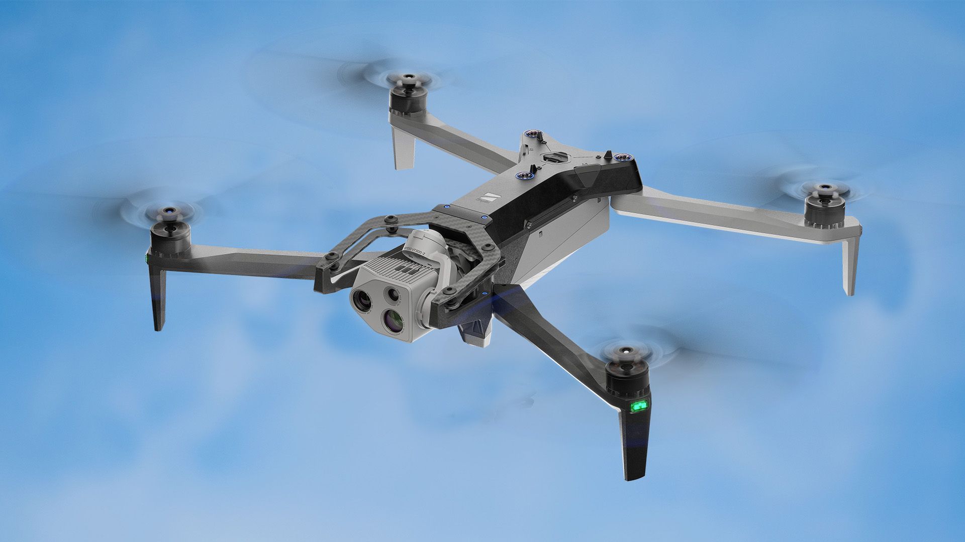
 Skydio
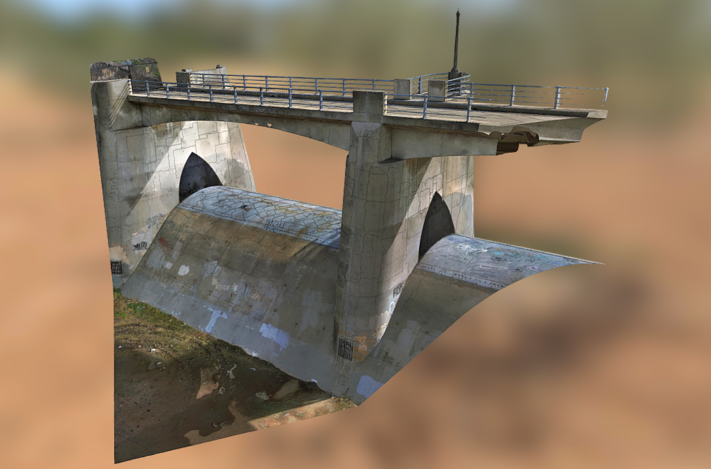
3D Scan continues to rapidly mature, showcasing its potential for broad applications across multiple industries. Today we are showcasing another incredible 3D Scan of the Sepulveda Dam in Los Angeles, California, built in 1941 to control flooding along the Los Angeles River. Marc Flamm scanned this iconic structure in only 62 minutes using Skydio 3D Scan (click here to view the model in our Skydio Sketchfab). In case you missed it, this software is coming soon, and we have been offering sneak peeks of our favorite scans, such as a mock helicopter crash site, an abandoned Corsair Jet, and a crane mast. Soon, pilots will be able to use 3D Scan to automate data capture of any scene with comprehensive coverage and ultra-high resolution to perform higher quality inspections in less time and with minimal training.
Before drones, inspecting this dam would have been a dangerous exercise. In order to examine the underside of the bridge up close, inspectors would need to use snooper trucks or other expensive machinery to see over the side of the bridge or scale tall ladders while balancing on the curve of the dam, potentially putting their safety in jeopardy. On top of that, inspectors must make their own judgments about the level of damage, which can lead to inconsistent inspection results and a lack of dependable documentation.
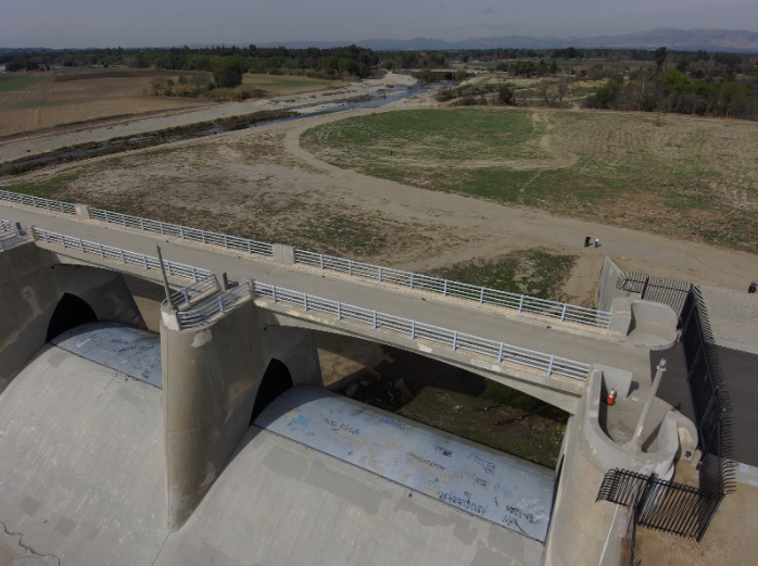
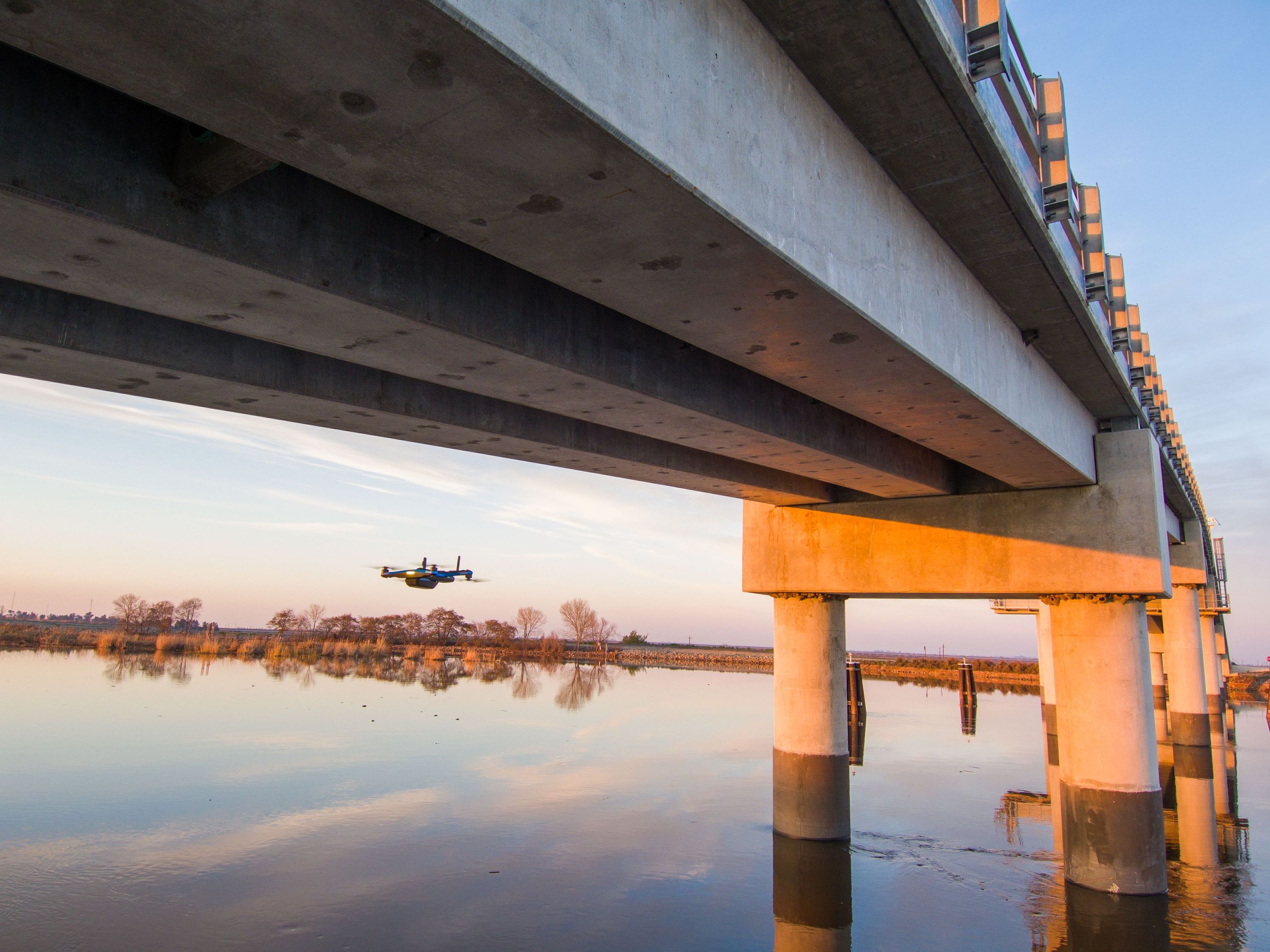
The Sepulveda Dam, with person for scale. This is an image taken from the drone (not to be confused with the 3D Model screenshots below).
A pilot inspecting a structure like the Sepulveda Dam with a manual drone would also run into a number of issues. Since the structure is made of metal and concrete, a manual drone would have to rely on long standoff distances and expensive zoom lenses to achieve the precision necessary to identify small cracks and make judgments about the structure’s integrity. Manual drones have untrustworthy obstacle avoidance and would be unable to capture up-close footage of the underside of the bridge. If the pilot tried to fly the manual drone under the bridge above the dam, it would lose GPS connection, causing the drone to drift dangerously, requiring an expert pilot maneuver just to land safely. On top of that, a flight report by an inspector operating a drone manually on foot likely consists of a set of photos with a few notes, which is much harder for a manager or repair crew to work with than a high-fidelity 3D model that can be navigated in 3D.
“ If you tried to fly a manual drone right up against the dam, you’d lose GPS. Now your drone is very close to something and you’ve lost the ability to fly stably, and that’s how crashes happen.
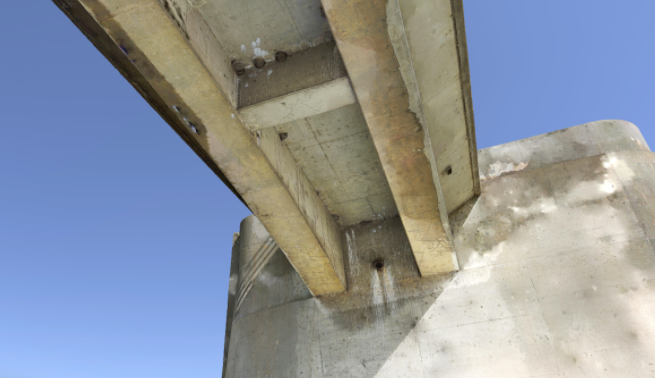
The metal-reinforced concrete structure of the Sepulveda Dam is difficult for a manual drone to navigate near, requiring long standoff distances and expensive hardware to compensate for conservative flight patterns. This is a screenshot from the 3D model.
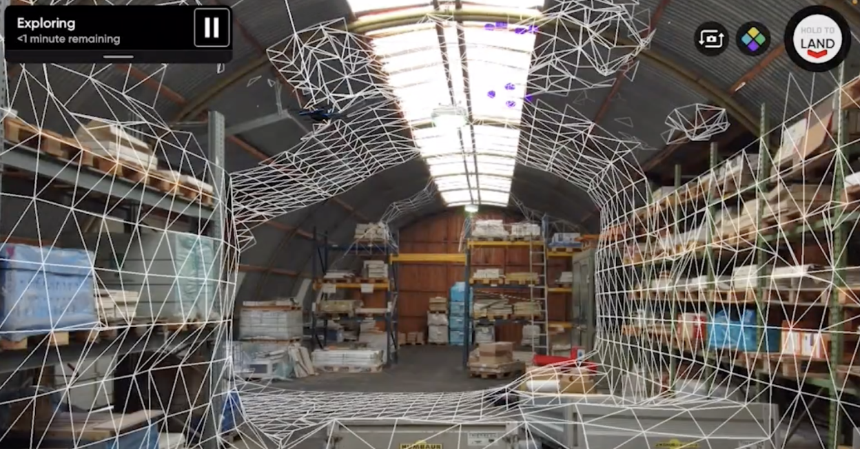
This 3D Scan is a glimpse into the future of asset inspections. With its automated workflows and 360 degree obstacle avoidance, 3D Scan will revolutionize the way infrastructure assets like this dam are digitized in order to be inspected. Skydio’s Adaptive Mapping algorithms help the drone iteratively design a unique flight path specific to the structure. The Skydio vehicle autonomously explores and models the structure as it flies, and then automatically executes an image capture plan that provides efficient and complete coverage. As a result, the drone can capture imagery up close, from multiple angles, of every point in the pilot-specified scan volume, even those not visible from above.
3D Scan’s sub-millimeter precision helps inspectors detect even the smallest cracks in concrete. Additionally, using the 3D model to identify other characteristics of the structure, such as the hornets’ nests or the rust underneath the bridge, can help arm maintenance crews with actionable data for preventative maintenance.
This is a screenshot from the 3D model showing hornets’ nests clustered underneath the Sepulveda Dam. Surrounded by concrete and with weak GPS signal under the structure, this shot would be nearly impossible to capture with a manual drone.
“ The Skydio can fly underneath the dam, look straight up, and identify any potential issues such as cracks or sealing degeneration which will help crews perform more targeted preventative maintenance.
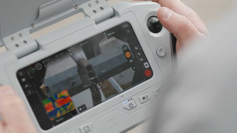
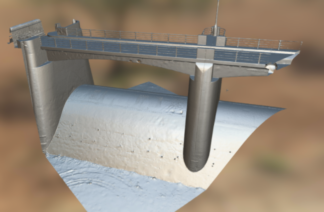
Skydio 3D Scan allows pilots to view an edge-computed model in the field, to rapidly perform quick assessments of the photos they have captured, and also export their data to their chosen photogrammetry software. “With 3D Scan's Edge Model Viewer, I was able to browse all my photos in a 3D index, as soon as I landed my drone. That gave me confidence that there were no blind spots, and I wouldn’t have to hike back out to the dam to take more photos,” said the pilot, Marc Flamm. This model features 568 photos stitched together in Bentley ContextCapture. As you will notice if you follow the link to our Sketchfab account, the model is unique in its detail of the underside of the dam, which would be impossible to document with a manual drone’s simplistic top-down flight.
“ This is a really hard dataset to capture at this resolution without a Skydio - you couldn’t fly your drone so close to the structure and you certainly wouldn’t be able to fly underneath and look up.
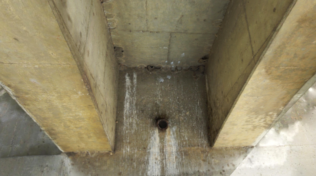
One of nearly 600 photos to comprise the scan, this image shows the benefits of being able to fly up close - capturing incredible detail at angles inaccessible to any camera flying at the long standoff distances required by manual drones.
Additional capture details are below. To learn how you can apply this incredible new technology to your inspection operations, please do not hesitate to contact us.
Capture
- Platform: Skydio 2
- Date: Feb 13, 2021
- Distance: 20 feet
- Ground Sampling Distance (GSD): 2.6 mm
- Overlap / Sidelap: 65 / 65%
- Photos: 568
- Flight Time: 62 minutes (approx. 3 batteries)
- Structure Dimensions: 75 ft (length) by 55 ft (height) by 35 ft (width)
Processing
- Package: Bentley ContextCapture
- Computer: Cloud
Pilot Spotlight: Marc Flamm
Marc has been in the commercial drone industry since 2014. Focusing on support, sales and training, he has worked with thousands of enterprise drone users to help them integrate UAS into their workflows. Marc is the Enterprise Program Manager at Skydio and is focusing on the successful implementation and delivery of Skydio solutions for Enterprise customers. Marc is a current FAA part 107 remote pilot and ITC certified Thermographer.