What's New: The Latest Capture Mode Enhancements for 3D Scan
 Skydio
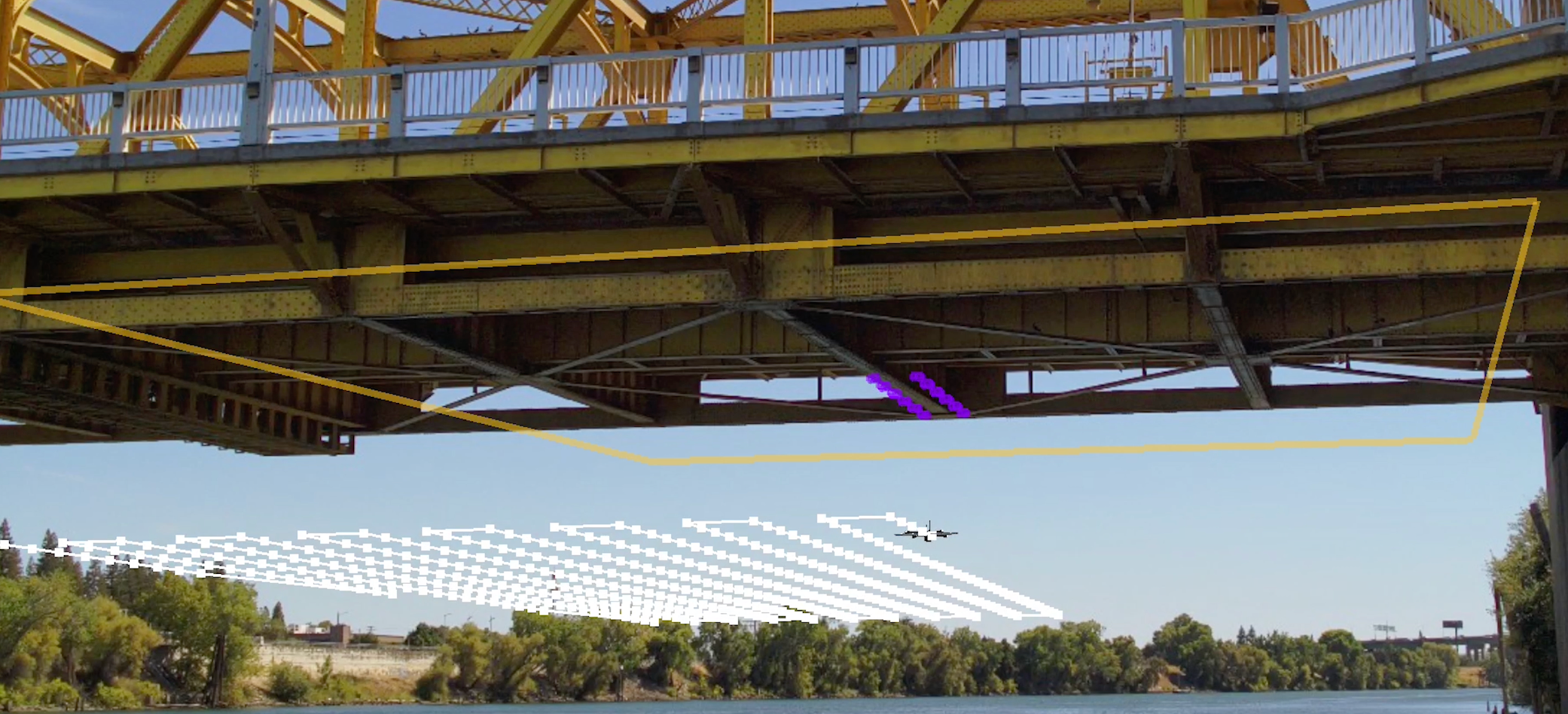
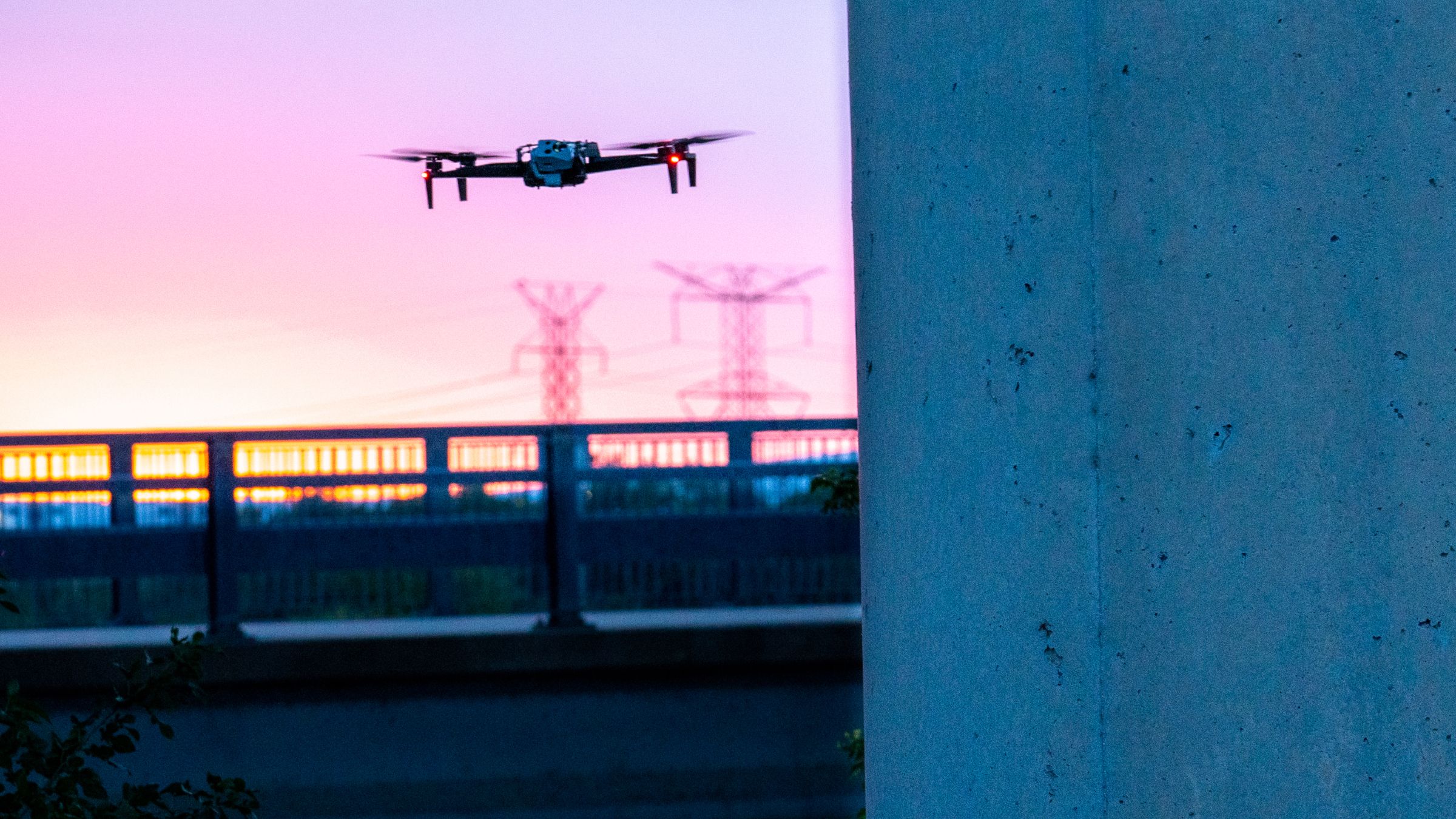
Skydio pilots are leveraging Skydio 3D Scan for a vast number of applications. From close inspections of utility assets to digital twin capture of bridges to accident scene reconstruction, operators equipped with autonomous drones are capturing better data faster than they ever realized they could.
In October of last year, Skydio introduced the first significant feature addition of 3D Scan: 2D GPS Capture. This top-down mission planner enables teams to easily capture and generate 2D stitched images (orthomosaics). Today, we’re excited to announce the next prominent feature set addition to 3D Scan. In our latest release available to existing 3D Scan Customers, we’ve expanded the capabilities of 2D capture with a suite of new mapping features that enable enterprises to get better data faster and safer.
- Repeat 2D GPS Captures: simplifies mission planning for recurring flights at the same site so that operators can fly, save, and repeat a flight plan with maximum efficiency.
- 2D GPS Night Flight with Skydio X2: enables emergency response teams to perform mapping missions at night on artificially lit scenes rather than waiting for daylight.
- 2D Upward Capture: streamlines the data capture workflow and enables teams to capture the underside of infrastructure, such as the bottom of a bridge or interior roofs of a warehouse.
Save & repeat 2D GPS captures
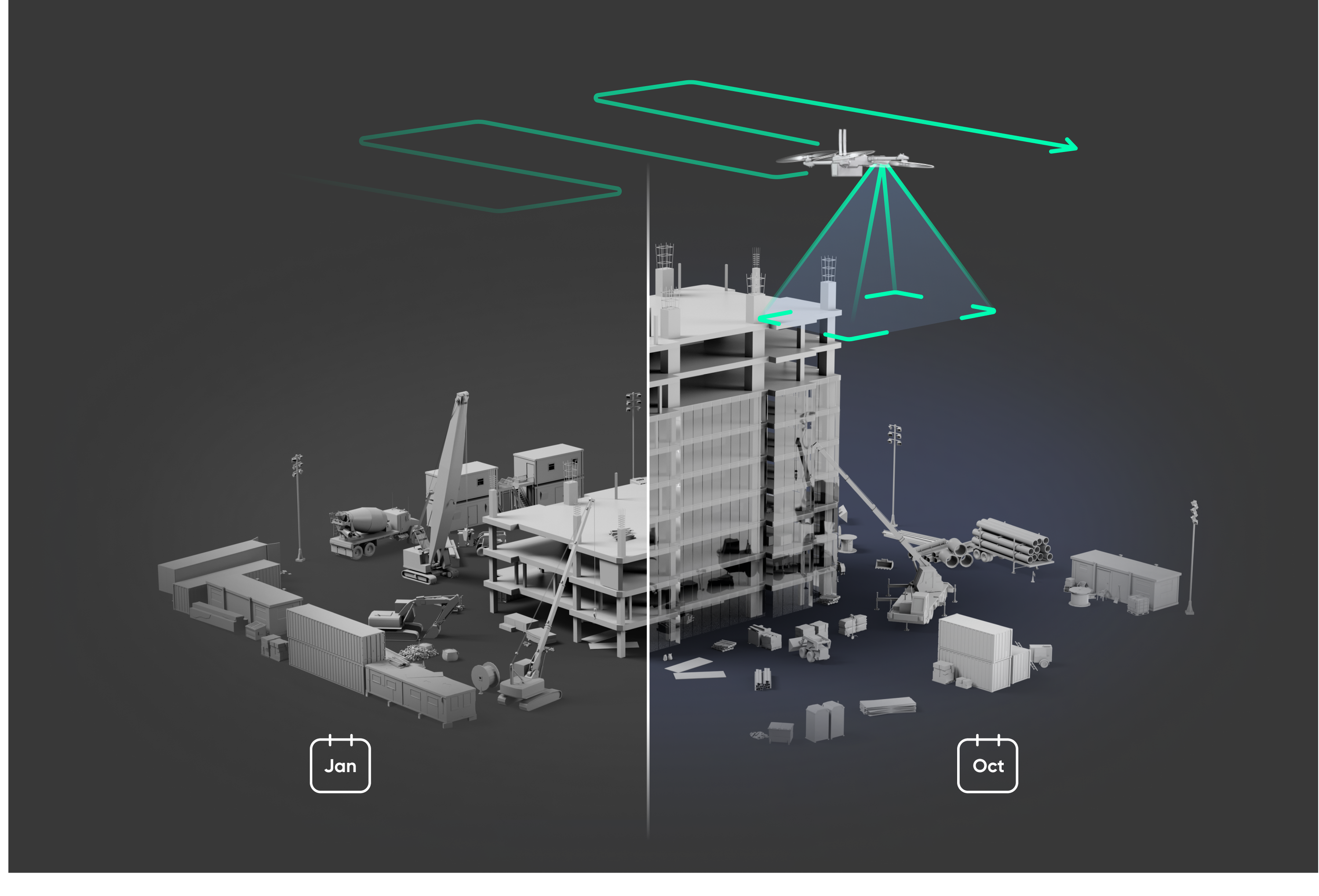
The key to scaling drone inspections is creating a simple, repeatable workflow that any operator can utilize. Recurring inspections with drones on a regular cadence are commonplace in the construction, telecom, utilities, and transportation industries to track infrastructure health, mitigate risk, and simplify asset management.
The latest 3D Scan release introduces the ability to save a scan after completion, streamlining the workflow for pilots that regularly fly the same sites with similar flight parameters such as the scan area, flight altitude, and overlap settings.
To save a scan, simply create a scan in the map-based interface and conduct the flight. You will have the option to save the scan to your Scan Library upon completion. Saved scans are accessible in the Scan Library under the Maps and Libraries tab, where you can choose a saved scan to review all previous settings and make adjustments before initiating a flight.
Import and export saved scans with ease
Whether you have an existing scan you’re planning to import, or you’d like to export a scan you’ve built in 3D Scan, you can now import and export scan .mission files seamlessly. Saved scans are stored in the local folder accessible via your device's “Files” app and can be exported to any folder on your device or an external flash drive.
Map scenes at night with the X2
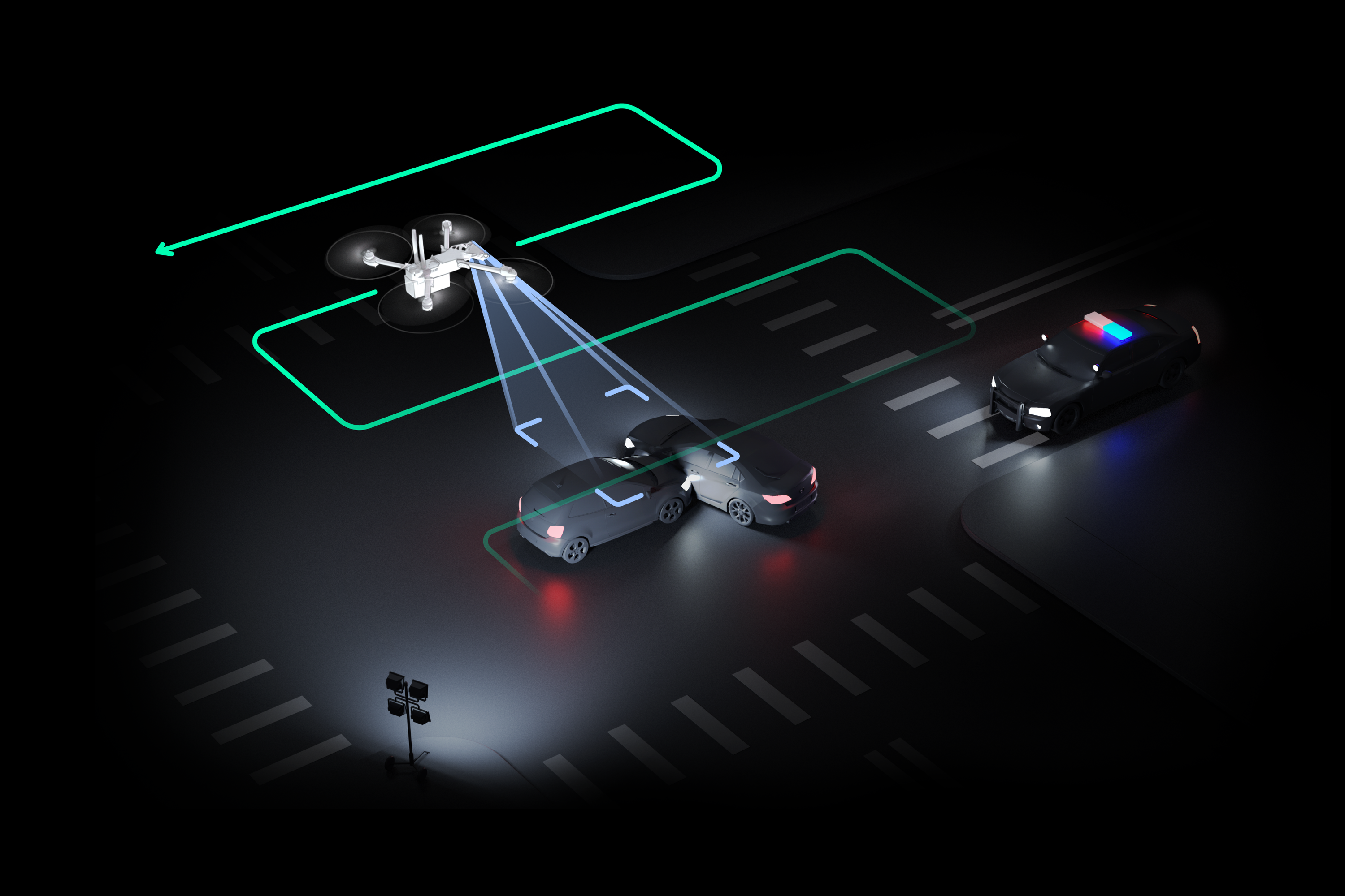
When a roadway accident occurs, time is of the essence. Passenger safety is of the utmost importance, but the following steps to capturing the incident and clearing the roadway are similarly critical. According to a 2020 study conducted by the National Safety Council (NSC), a disproportionate amount of crashes, approximately 59%, occur between 4 pm - 4 am.
With our latest update for the Skydio X2, new functionality in 3D Scan’s capture modes introduces 2D GPS Night Flight, the ability to perform 2D GPS Captures at night, enabling accident scene reconstruction teams to inspect artificially lit crash scenes throughout the night.
There are two ways to initiate a 2D GPS Night Flight with the X2:
- Enable GPS Night Flight within your settings and start the flight by selecting “Begin Scan.” On-screen messaging will notify you that Obstacle Avoidance is disabled.
- If the drone senses insufficient light during a scan, you will receive a prompt with a safety disclaimer to switch to GPS Night Flight and resume the scan or take control of the drone.
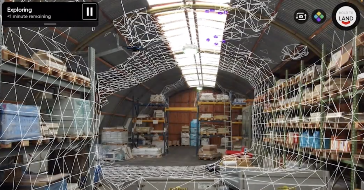
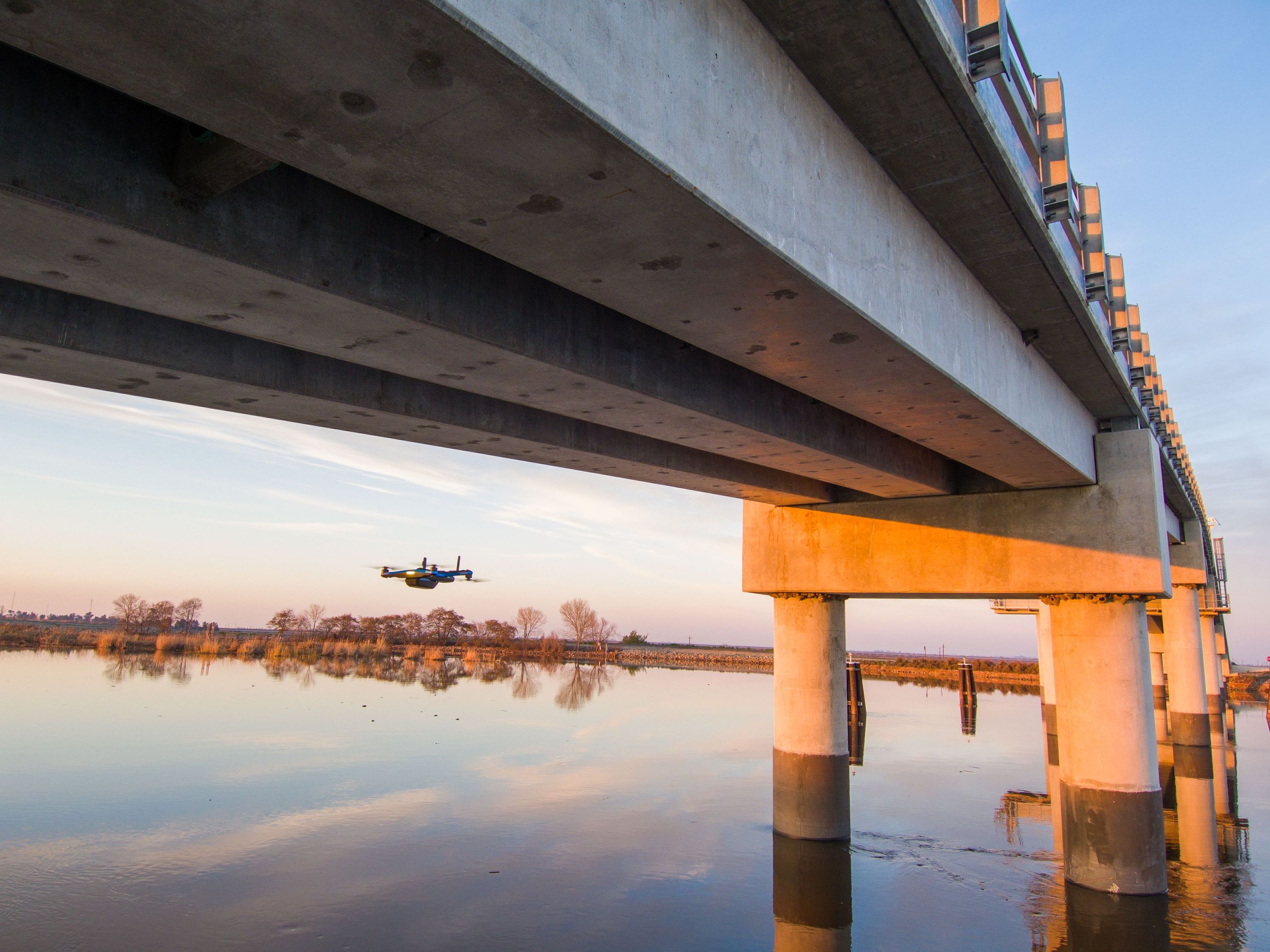
Inspect the underside of structures with 2D upward capture
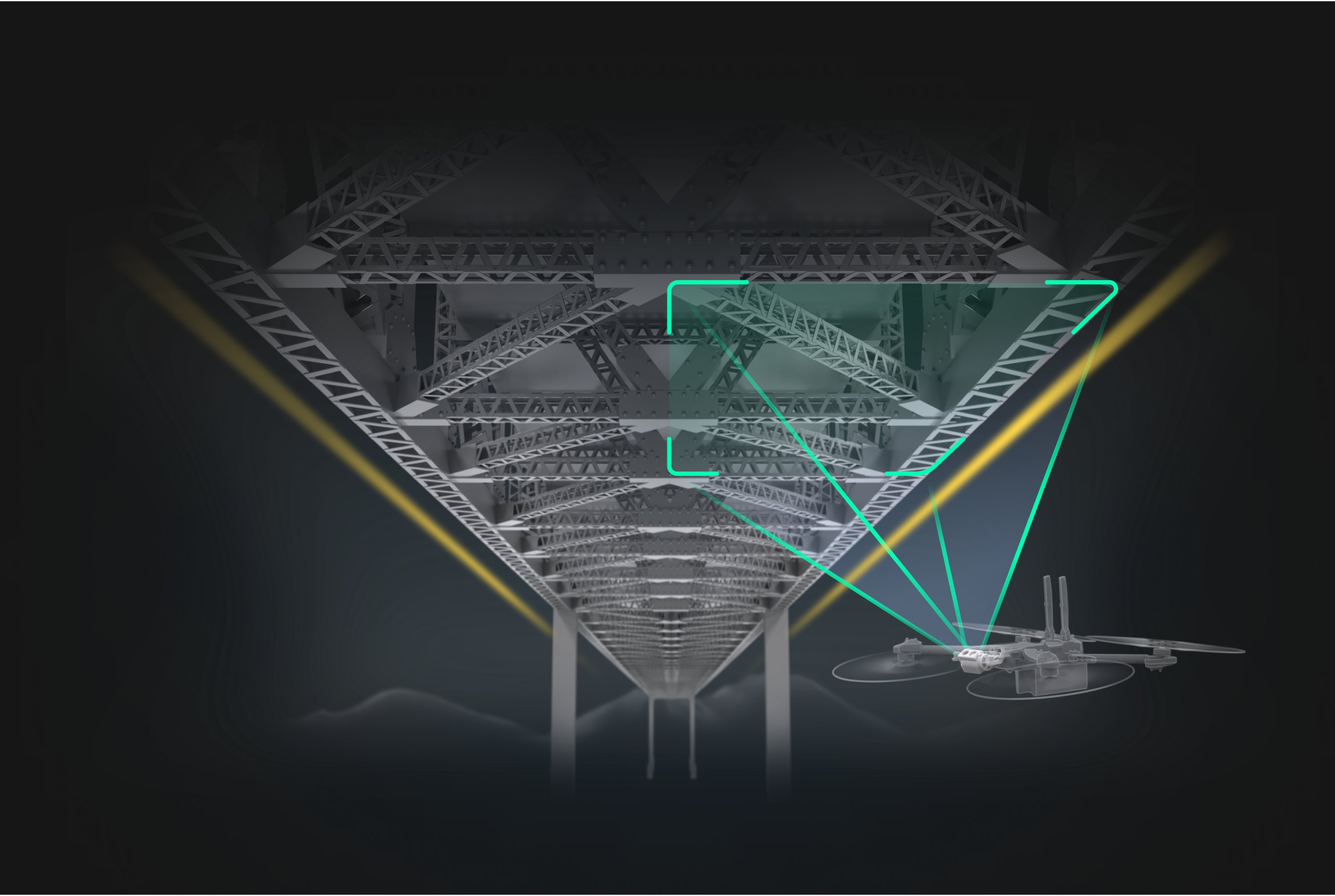
You’ve spoken, and we’ve heard you loud and clear. Skydio drones are the ideal tool for inspecting bridges with the ability to fly in obstacle-dense, GPS-denied environments. However, mapping the underside of infrastructure like the bottom of a bridge deck with consistent overlap is a challenge - until now.
Whether you are inspecting the underside of a bridge, imaging a parking garage ceiling, or assessing interior roofs, you can now leverage Skydio drones with the camera facing upward to map the underside of structures better, faster, and safer.
- Better - get better quality data operating in GPS-denied environments with consistent overlap to generate high-quality orthomosaics.
- Faster - automate the data capture process and distance yourself from inefficient, manual data collection methods that sacrifice quality for safety.
- Safer - Avoid putting workers in potentially hazardous situations or crashes with expensive manual drones.
The 2D Capture workflow will not change. Operators will continue to define the Scan Surface and boundaries the same way they would during a standard 2D Capture. However, Skydio will now automatically face the camera upward when it detects the drone's height is below the user-specified Scan Surface.
“ “We are proud to see our skills evolve and improve through feedback from our customers. 2D Upward Capture is a great example of how the Skydio 3D scan suite constantly expands its capabilities, and how a realm previously known to be very difficult to reach and operate in, is being transformed into an automated, efficient, and safe workflow.”
We continue to partner with our Skydio customers and pilots to ensure they get the most possible out of their aircraft. For now, we look forward to seeing new, incredible orthomosaics captured in more complex environments than any other drone can enter. If you’re interested in learning more or would like to connect with a member of our team, don’t hesitate to get in touch.