Why I Joined: Alicia Llorens, Solutions Engineer
 Skydio
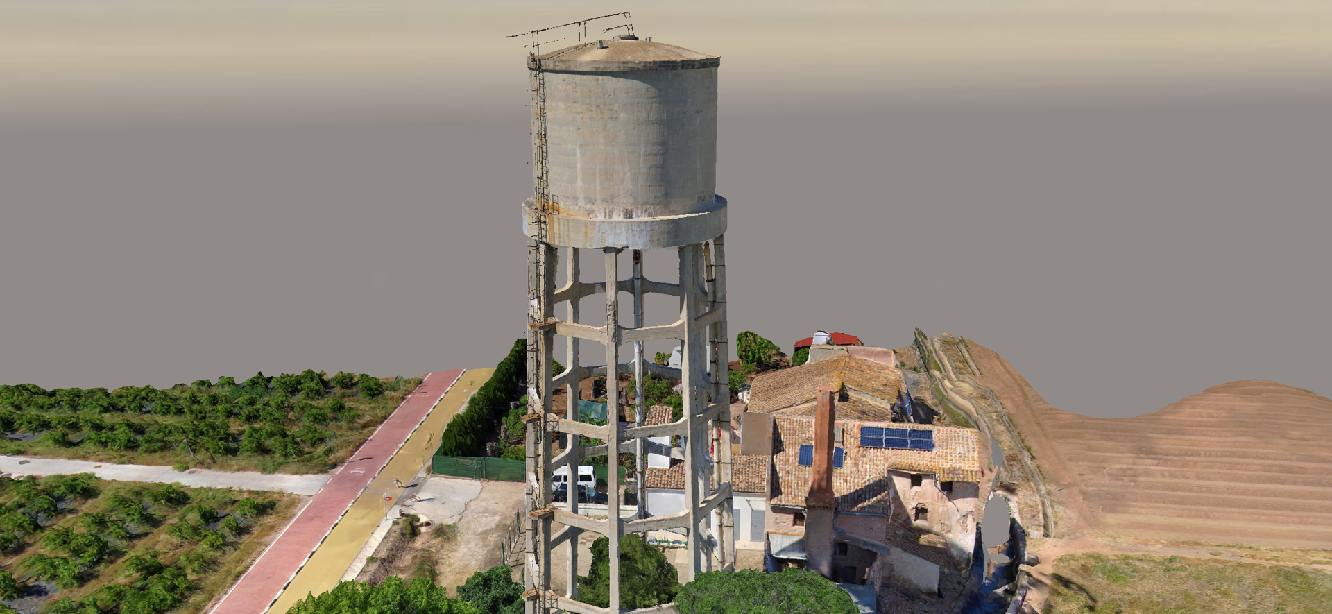
Drone photogrammetry is an incredibly powerful tool, one that can transform a team's ability to efficiently gather critical data without putting operators at risk. As a surveying engineer specializing in photogrammetry and mapping applications, I've worked in the drone industry for more than 10 years. In my roles supporting industry leaders like Trimble Navigation Limited and Bentley Systems, I played a key role in bringing drone photogrammetry products to market — supporting, training, and educating drone early adopters and operators to successfully integrate drone photogrammetry into their workflows.
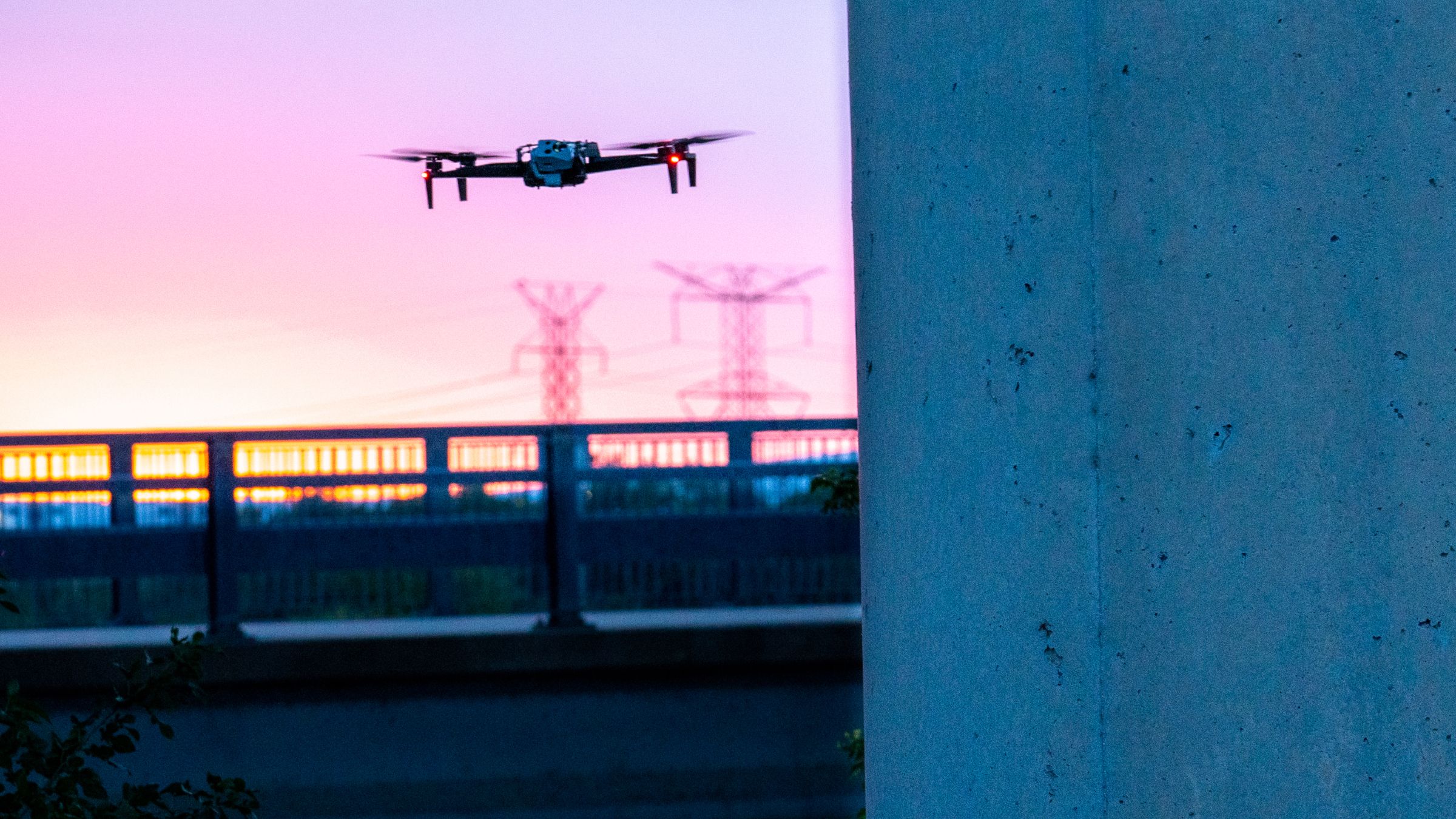
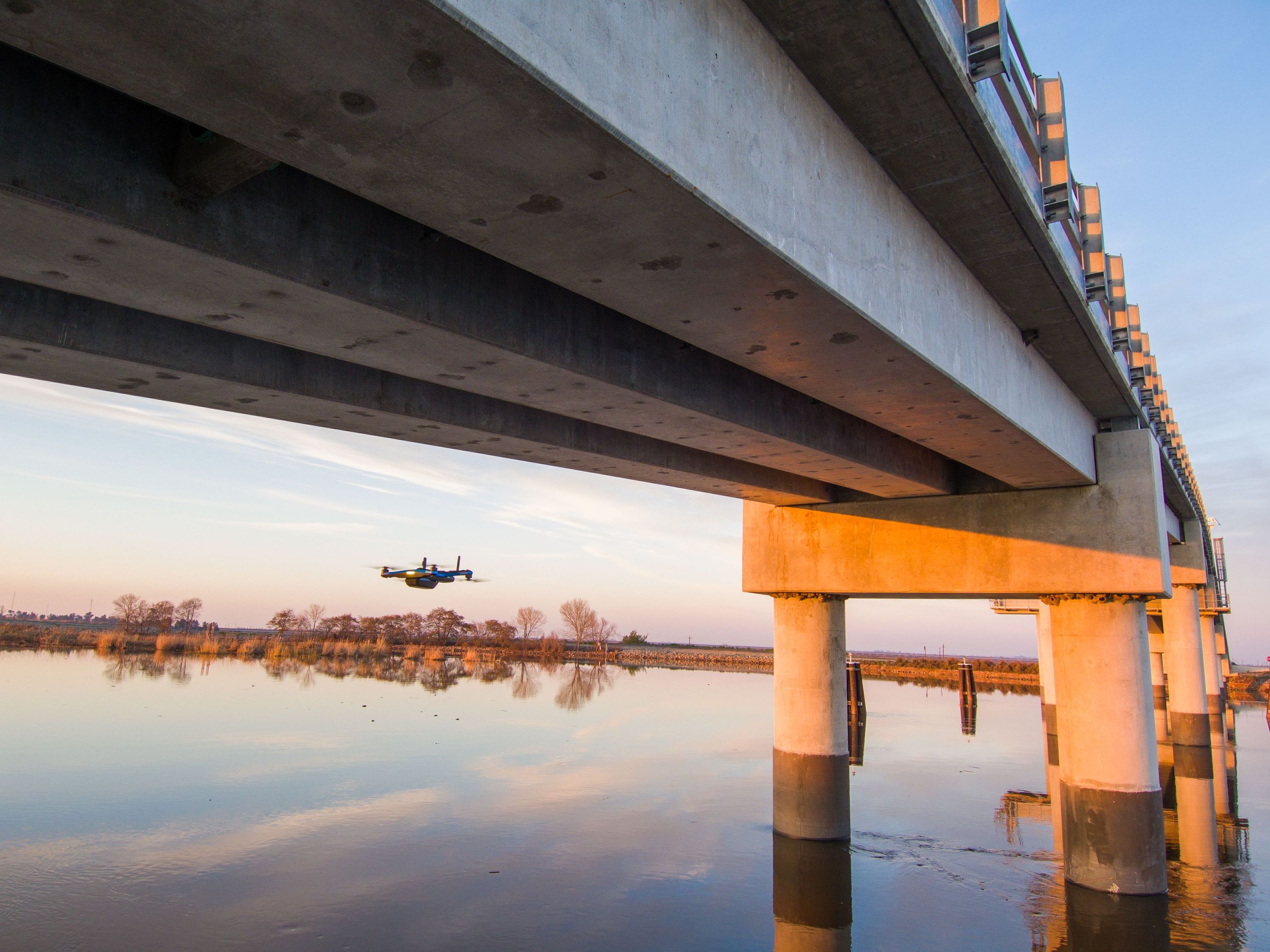
Drone inspection for the digital age
The infrastructure industry is going through a massive digital transformation, with leaders moving to digitize their existing infrastructure to maximize dynamic optimization and predictive maintenance. More and more, tower inspectors, facilities managers, engineers, surveyors, and the like will be asked to augment their traditional workflows with drones. Regardless of sector or application, the most critical part of the process will always come down to two elements: getting the data right and getting the drone back to the office in one piece.
Ensuring the data a drone collects meets the necessary photogrammetry processing requirements is one of the biggest struggles for drone surveyors, and getting it right takes time, training, and experience. Moreover, most surveyors have little or no previous experience with drone photogrammetry — let alone flying drones in challenging environments such as a manufacturing facility, a warehouse, or a refinery. As a result, operators can spend hours capturing and processing deliverables that are ultimately “not good enough”, with many having holes or distortions in the final images. Over 50% of support cases I dealt with at Bentley came from data-acquisition-related issues. And, to our customers' dismay, most issues had only one workaround: going back to the field and capturing more data, or starting from scratch and doing it all over again. We had a saying: “rubbish in, rubbish out!”
Enter, Skydio.
A smarter way to scan
I have been in the drone photogrammetry space since 2013 when I joined the Gatewing Team, one of the first drone manufacturers for mapping and surveying applications based in Europe (now part of Delair). I never left the drone industry and naturally, I have been following Skydio since the very early days. But it was only after the release of Skydio 3D Scan that I realized it was going to change the future of drone mapping for enterprises. And I wanted to be part of that.
The level of autonomy of Skydio's solutions is just unparalleled to any other solution in the drone space. And now in combination with Skydio 3D Scan, Skydio is enabling anyone to be a data capture expert with very little training or expertise required.
Skydio 3D Scan is an adaptive scanning software which automatically defines the flight plan to generate the required 3D model, ensuring the correct coverage and image resolution. It empowers customers to perform high-quality drone inspections with minimal drone and photogrammetry training. Skydio solutions literally do the job for you! 3D Scan democratizes drone photogrammetry, enabling anyone to be a drone surveyor and photogrammetry expert, and get the job done faster, safer, and in a less costly way than traditional methodologies. We also recently announced the availability of 3D Tower Capture, the latest autonomous capture mode of 3D Scan optimized for vertical structures, beginning with telecommunications towers.
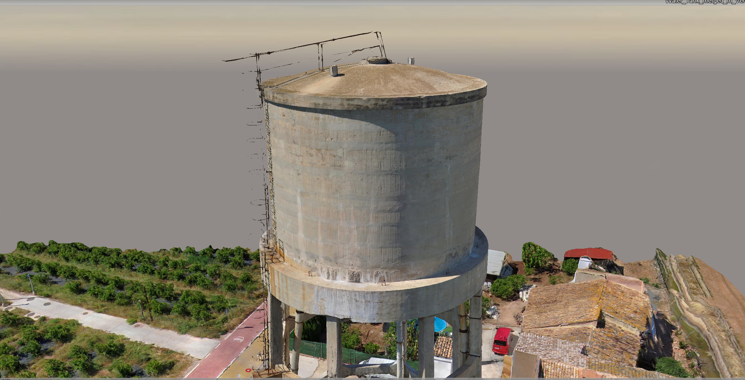
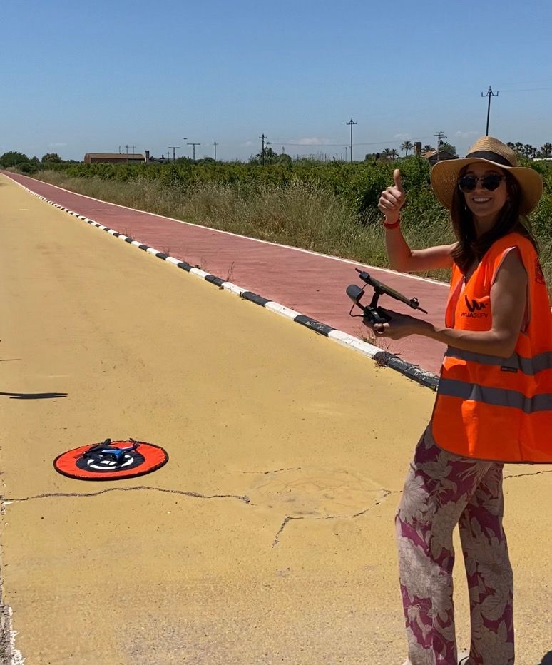
In my first outing with 3D scan, I wanted to try the new 3D Tower Capture mode in my hometown of Valencia, in Spain. I found a water tank no longer in use attached to a farm site, of about 35 meter height, and open airspace.
The first flight on my own was such a positive experience, from beginning to end. Most of my previous drone mapping experience was with fixed wings, so this was a bit of a challenge for me.
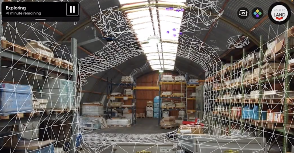
Getting the system ready and in the air took me literally a couple of minutes. Which was a very good start! The workflow in 3D Scan is extremely intuitive and user friendly. Once you select the Scan Mode, it takes you through a very simple step-by-step workflow to define your 3D mission.
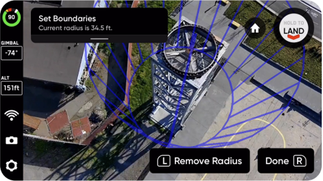
From scan floor and ceiling (top and bottom of your 3D scan), to the boundaries (center and radius of the tower/object of interest), or the "Safe Distance", which allows you to set the distance from which Skydio will stay away from the object of interest. This all happens in a matter of minutes using your Controller (phone/tablet/Skydio Controller) and the Skydio.
As part of the 3D Scan workflow, and before the actual scan, the drone will autonomously fly around the object of interest to automatically predict, depending on project requirements, overall scan time, number of pictures required, GSD, etc. This is extremely powerful to maximize the time in the field.
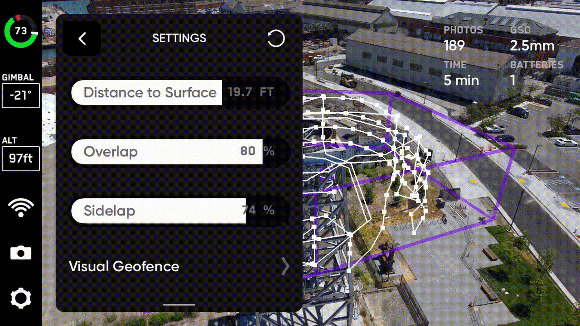
After the exploration step, I tweaked some of the capture settings and began the scan. And when I saw the Skydio flying in and out the water tank, going up and down, avoiding the trees, and executing the flight mission fully autonomously...it's just incredible.
Skydio technology truly enables fully autonomous drone inspection data capture, ensuring complete coverage and ultra-high-definition imagery, requiring minimal pilot oversight and maximizing the efficiency of time spent in the field.
In less than an hour I was able to successfully plan and execute my flight mission, fully autonomously. With very little prior experience or training on the Skydio solutions.
My experience in this industry tells me that Skydio 3D Scan can help so many businesses scaling up their drone operations, working smarter, generating more revenue and spending less time (but better quality time) in the field.
As a new Skydio Solutions Engineer, I'm excited to bring a photogrammetry-first mindset to helping our enterprise customers capture and consume 2D and 3D data in a smarter, safer, and less costly way.