


We went from shelf-based to dock-based in under a year. Now, our supervisors are asking for the drone before the call is even dispatched.

Building a data-driven DFR program that delivers.
How San Mateo PD’s path to DFR will cover 86% of priority calls in under 2 minutes—and the blueprint behind It.

Rethinking DFR: How San Mateo went from SWAT missions to incident response.
The rise of Drone as First Responder (DFR) marks a shift from static, range-based coverage to precision-based response. The most effective DFR programs aren’t defined by how much ground they cover. They’re defined by how fast and intelligently they respond to calls for service (CFS).
The turning point: San Mateo PD’s path to 2-minute response.
When the San Mateo Police Department (SMPD) began exploring drones, they didn’t start with a large-scale rollout. Like many agencies, their first deployments were limited to SWAT callouts, crash investigations with fatal collisions, and major incidents, proving drones’ value but also exposing a gap: response came too late to influence early outcomes.
That changed with a simple but transformative question:
What if patrol had access to drones right from the start?
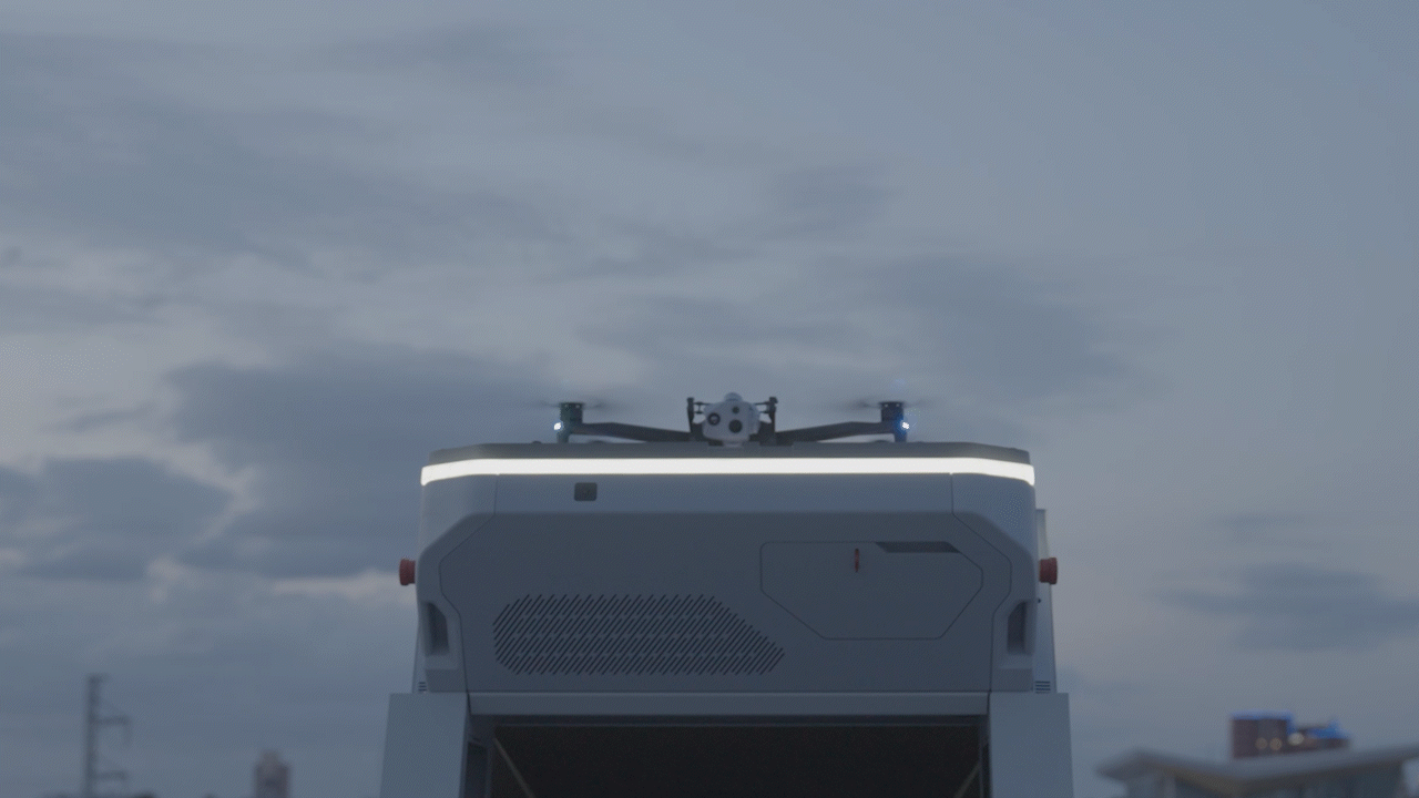
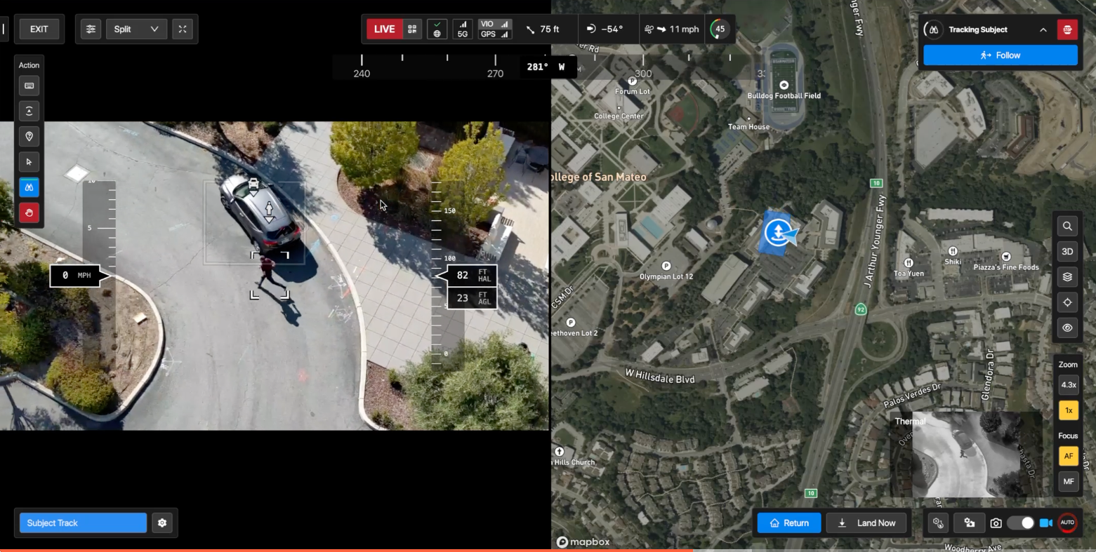
Instead of trying to “cover” a 12-square-mile city, SMPD shifted its focus to incident density and call response times. With Skydio’s autonomous flight and smart dock technology, they moved away from drawing theoretical circles on a map and toward placing drones exactly where they’re needed most.
Here's their path:
Crawl: Drones in patrol cars.
They stopped treating drones like special equipment and made them part of the shift. Officers launched from their trunks, getting eyes on scene faster. But when one flies, they're no longer available to respond, meaning fewer officers at the call.
Walk: Remote pilot takes over.
To fix that, they kept the drone in the field but moved the pilot off-scene. Officers powered it on, called it in, and Real-Time Information Center (RTIC) took over. The drone got airborne, and the officer stayed engaged.
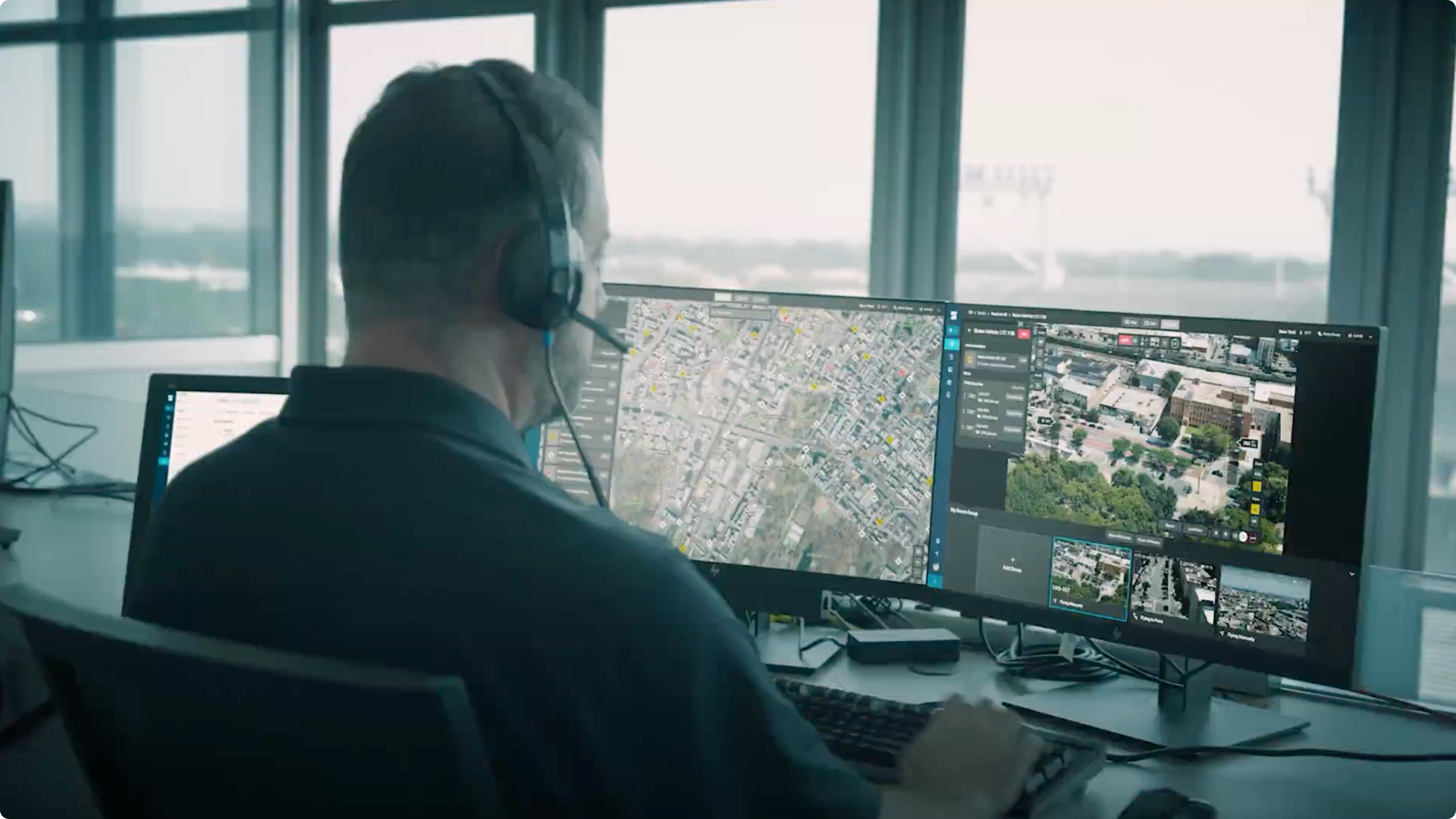
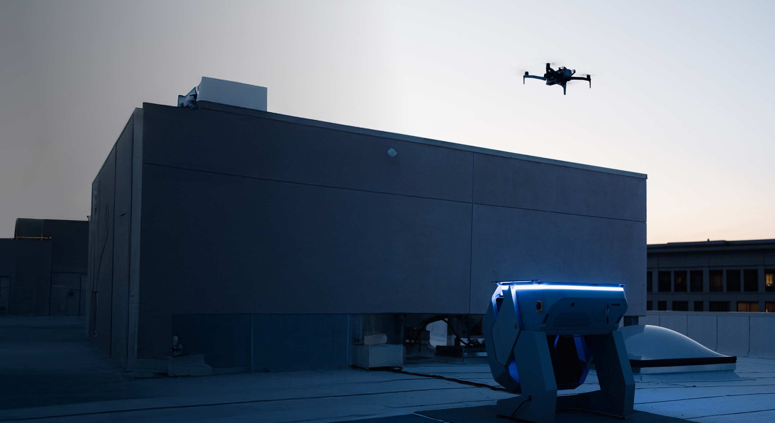
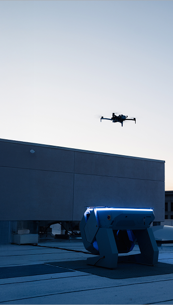
Run: Dock-based response.
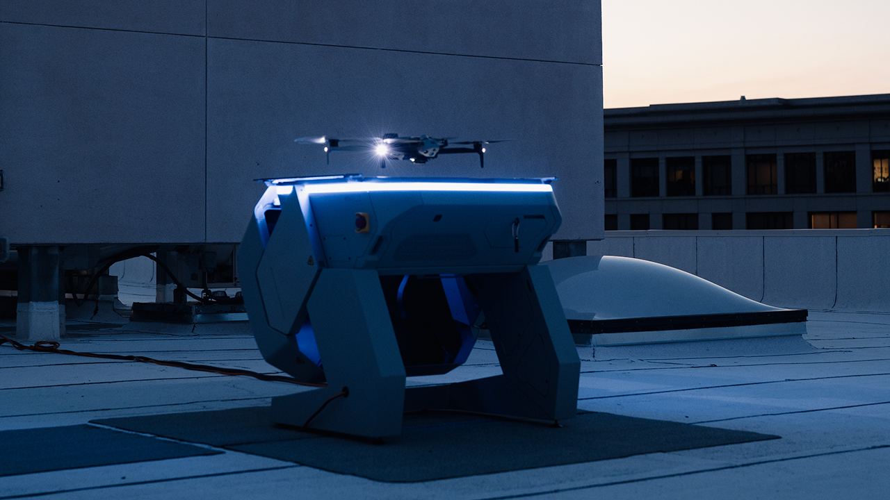
Once they saw how fast it worked, they leveled up. Instead of manual launches, they placed docks where calls were highest. Now drones launch on demand from rooftops.
What P1 and P2 calls mean.

Priority 1 (P1)
Immediately dispatched, high-urgency incidents such as robberies, in-progress violent crimes, or major-injury collisions.

Priority 2 (P2)
Disturbances or suspicious person calls that can usually pend for 5–10 minutes before dispatch.
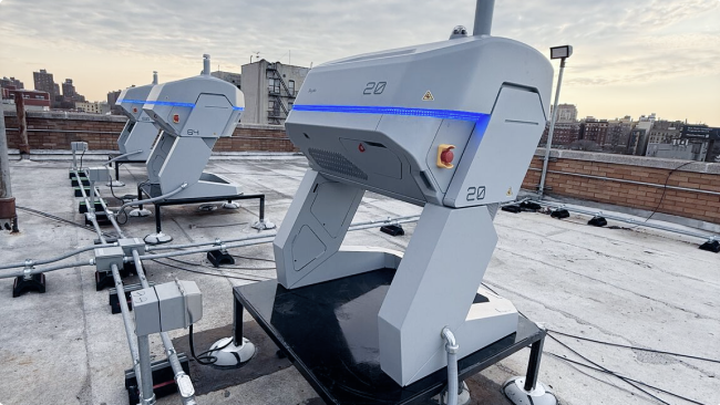
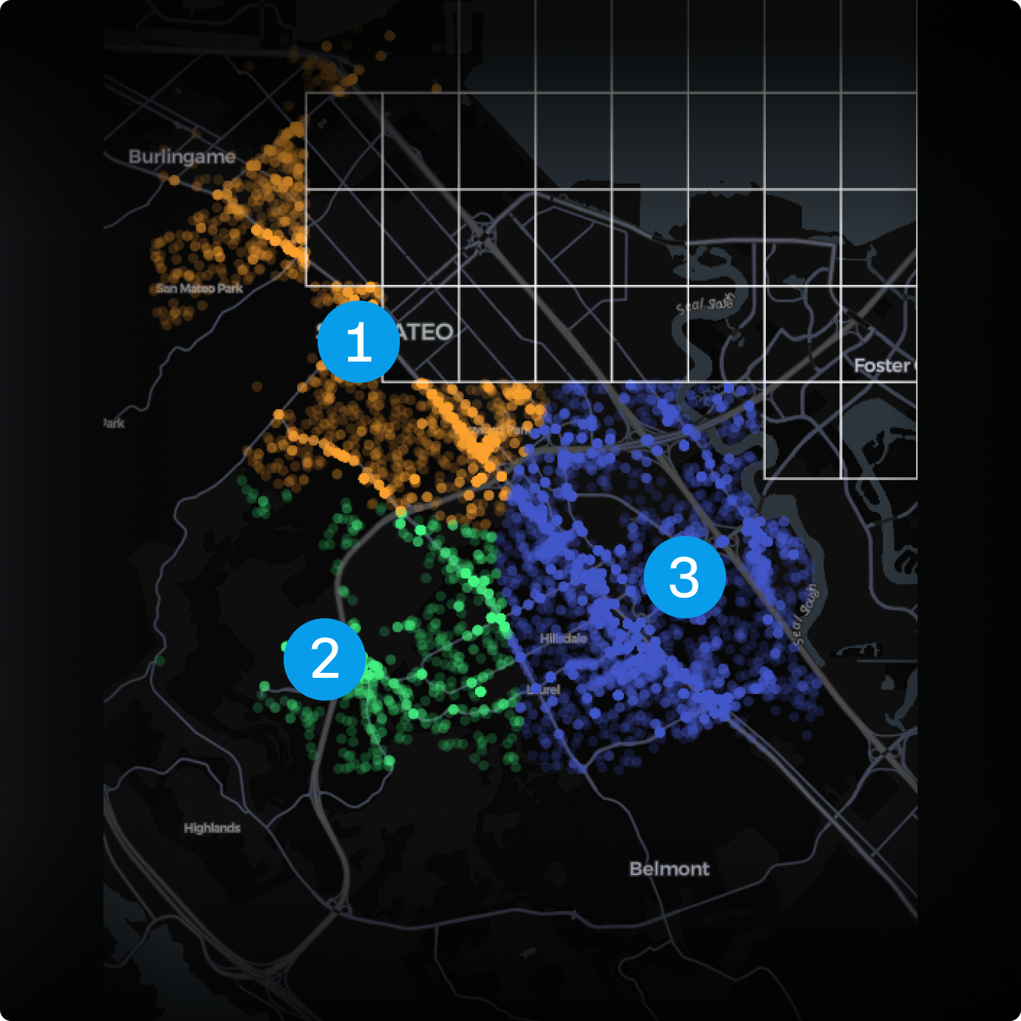
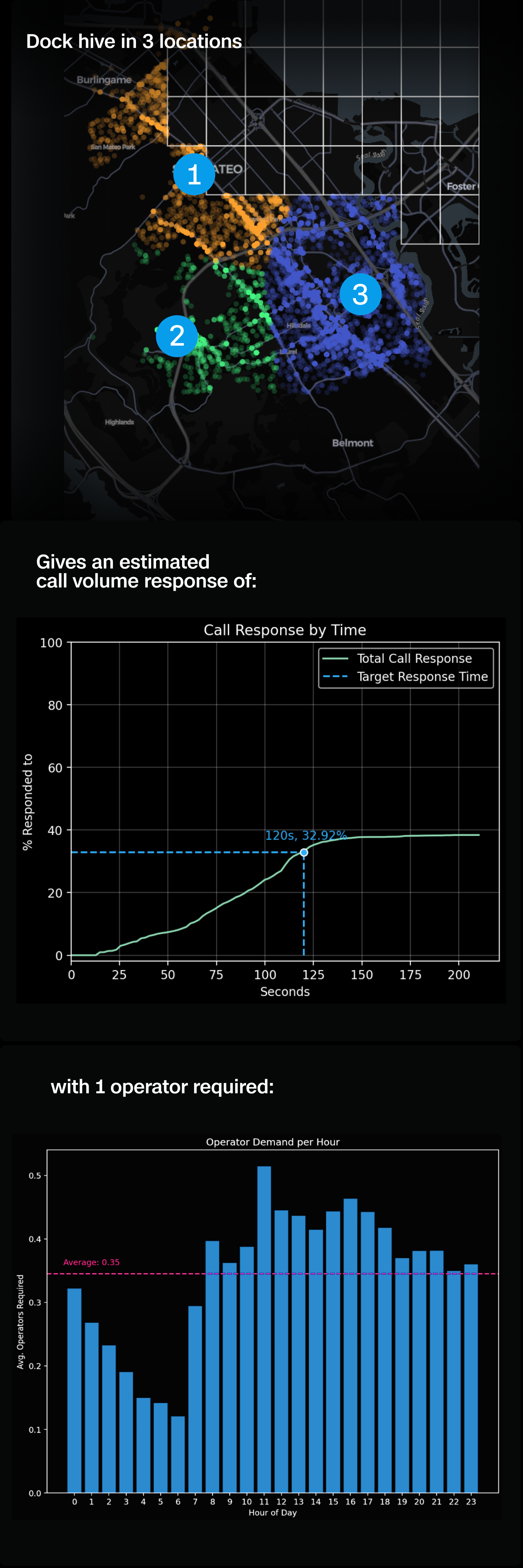
Coverage that keeps up: The case for multi-drone hives.
What is a hive?
A hive is more than one dock at a single site. Instead of relying on a single docked drone to handle every call, a hive of docks ensures continuous aerial coverage and redundancy. This is exactly what real-world incident data demands.
Why multiple docks are necessary:
Incident volume, not land area.
Two calls can occur simultaneously in the same hotspot. If there is only one drone, someone goes without coverage.
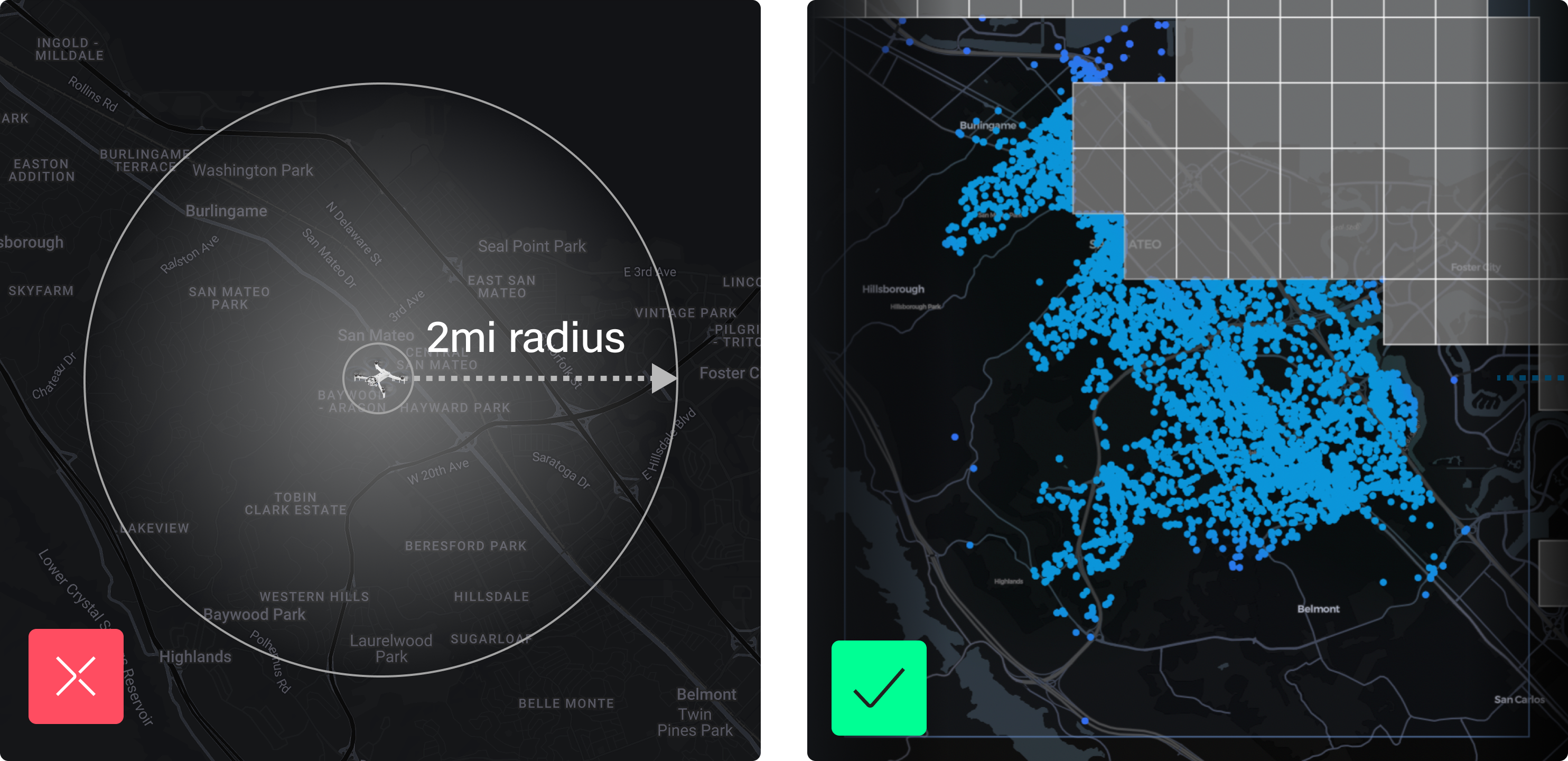
Range isn’t the limiting factor.
Skydio X10 isn’t restricted by a 2-mile radius. Agencies have flown 10 miles round-trip from a dock. The real limiter is battery life, not land area.
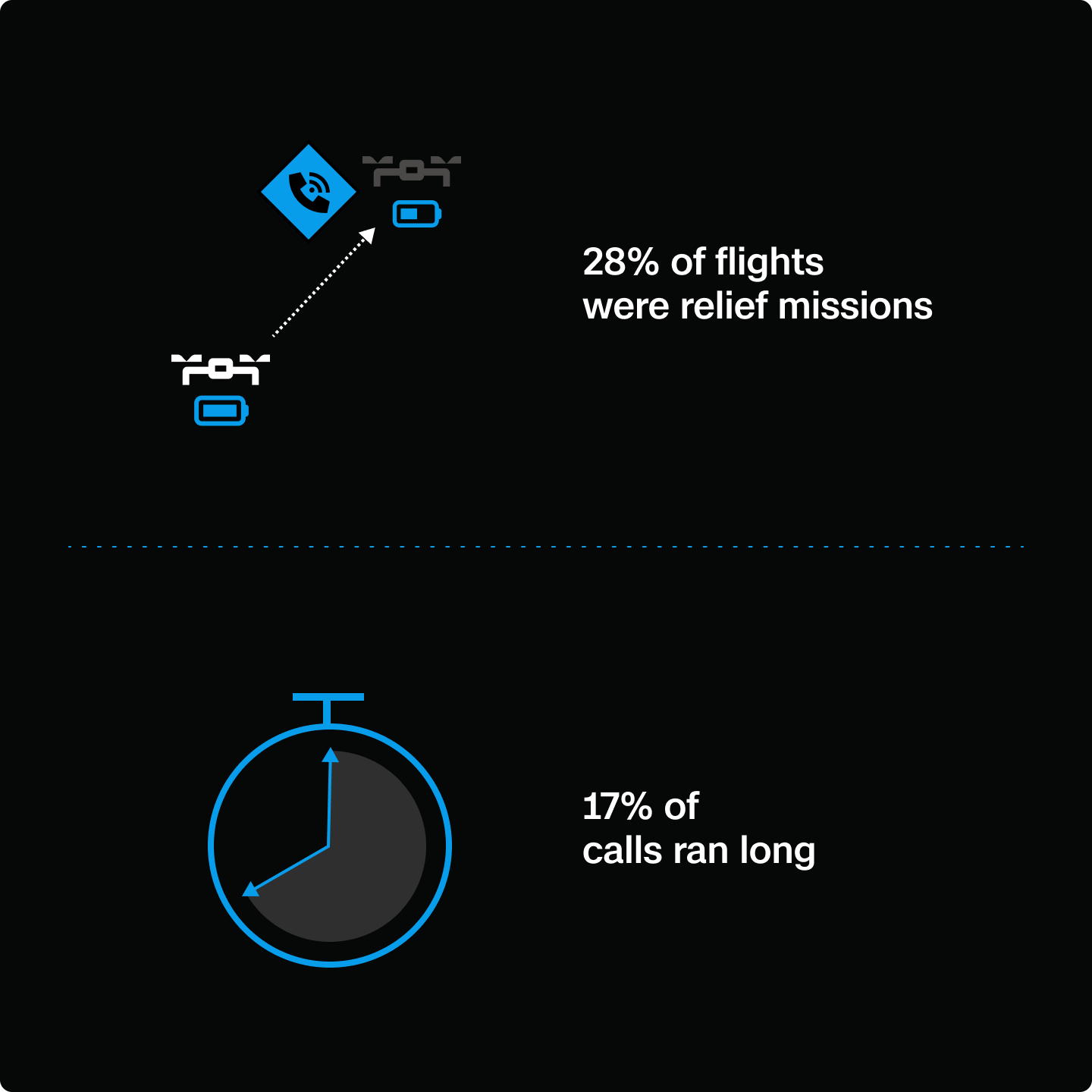
Relief flights are common.
In San Mateo’s data, 28% of flights required a relief launch when the first drone’s battery ran low. With a hive, a second drone rotates in without losing eyes on the scene.
Redundancy matters.
Whether it’s a long call, a vehicle pursuit, or simultaneous incidents, a hive means the operator does not have to choose which officer gets support. The result is continuous overwatch built for the realities of call volume.
Not all square miles are equal: Planning DFR by demand.
Traditional DFR planning often starts with maps and mile markers. But SMPD flipped that script. Instead of drawing coverage circles or focusing on square mileage, they asked the more strategic question:
Where, when, and how often do our high-priority calls happen?
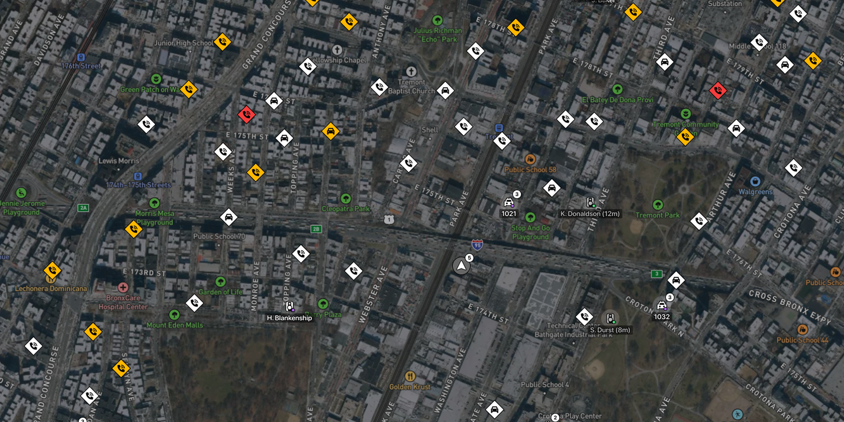
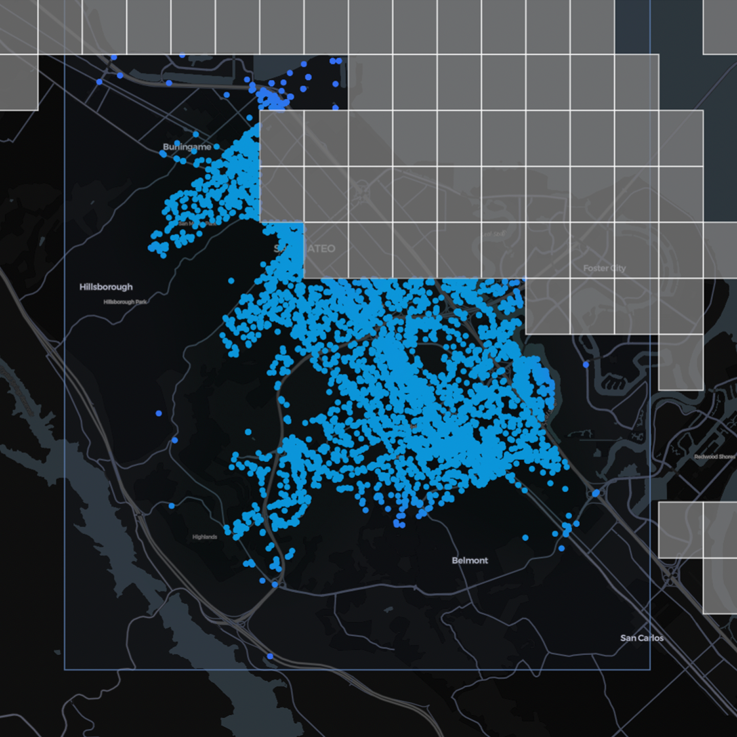
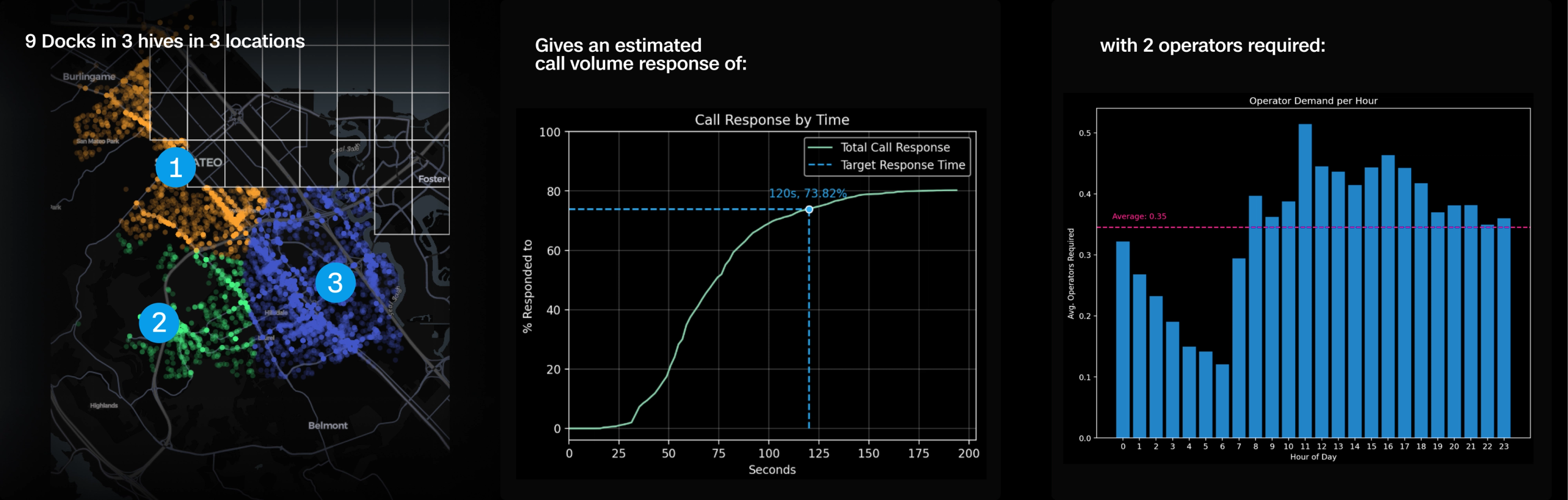
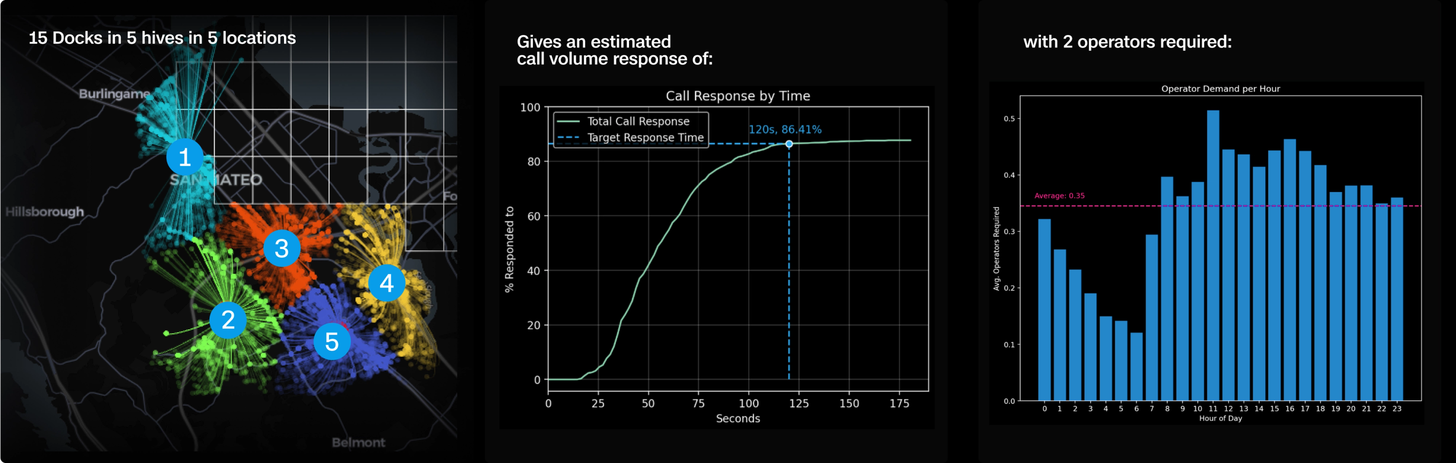
To answer that, they partnered with Skydio to analyze 12 months of CFS data—over 27,000 Priority 1 and 2 calls. Their goal wasn’t to maximize theoretical coverage; it was to maximize response impact using the truth in their data.
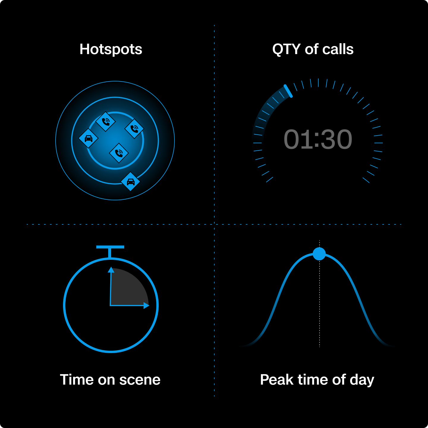
After analyzing call data, patterns emerged.
- Where clusters were concentrated: malls, corridors, and dense residential areas.
- When calls stacked up: afternoon and evening spikes in thefts, fights, and traffic incidents.
- How long drones needed to stay overhead, especially for longer incidents like domestic violence or pursuits.
- How often multiple calls required simultaneous coverage, making a strong case for hives and on-station relief flights.
This shift from land-based assumptions to call-based modeling helped SMPD:
- Place drones where they deliver the most value.
- Understand that up to 86% of P1 and P2 calls will be reached in under two minutes with just 15 drones across 5 hives.
- Build a DFR model that responds to the reality of their call volume and community expectations, not arbitrary range limits.
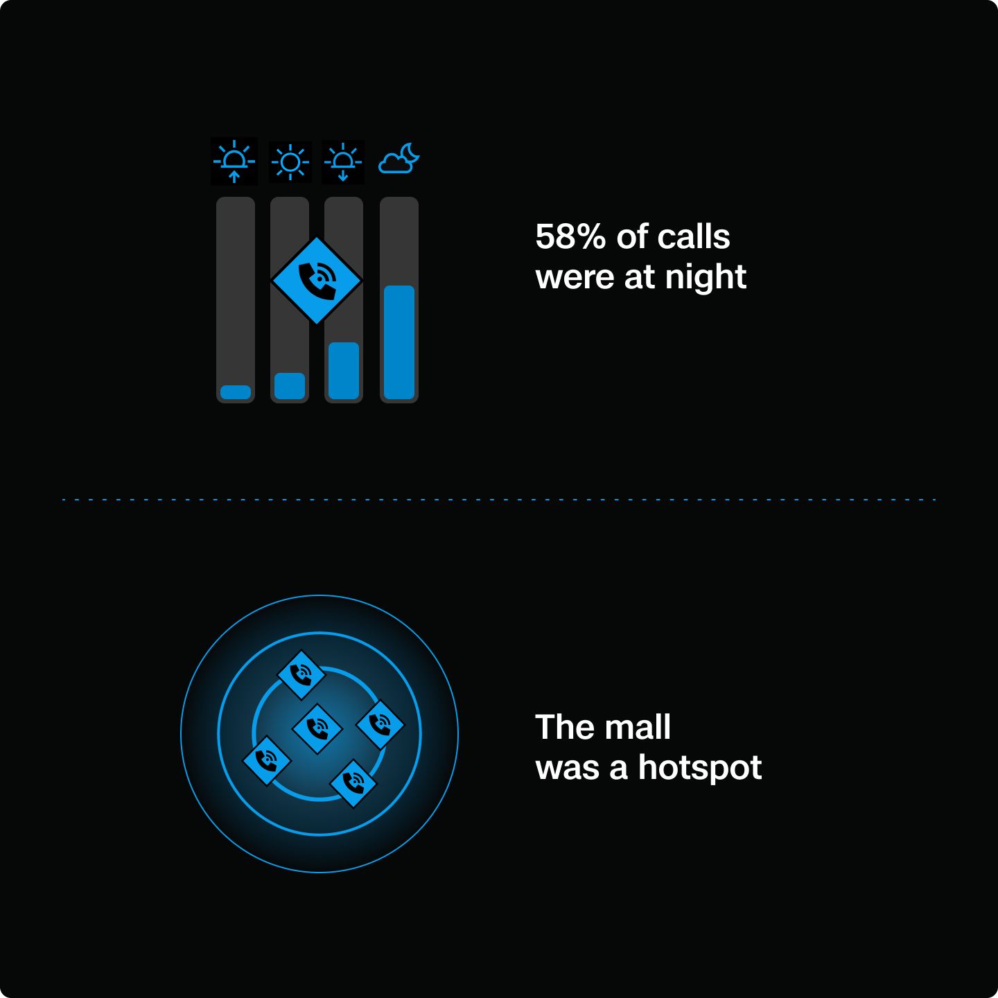
Many of the highest-risk calls happen after dark. In fact, 58% of San Mateo’s drone flights occurred at night. SMPD equipped their fleet with Skydio NightSense, enabling autonomous night flight with sensors and thermal cameras. This gives officers the same confidence and situational awareness in low-light conditions as they have in daylight, allowing for fewer drones, placed more strategically, to cover more ground.
One of those strategic locations was the mall, a frequent hotspot for in-progress thefts, fights, and disturbances. And that’s the point: agencies already know their busiest areas. Skydio’s modeling doesn’t reinvent those insights. It confirms them, quantifies the demand, and helps leaders plan with facts.
SMPD identified where incidents clustered, how long drones needed to stay overhead, and when simultaneous calls created overlapping demand. This approach led to the creation of precision response zones—not just dots on a map, but areas validated by call volume and incident duration.
Data-driven deployment with Skydio.
What was necessary for the analysis:
- Clean CFS data (location, time, priority)
- Clear response goals (which calls, how fast)
- Deployment modeling with the Skydio team.
- A tested Concept of Operations (CONOPS) — including launch, handoff, and relief rotations.
What was measured?
Launch times:
- From PD rooftop to mall: ~120 seconds
- With a second dock on the east side: <60 seconds
Call characteristics:
- Clusters of activity by location and time.
- Duration of drone presence required.
- Overlapping incidents and response strain.
What the analysis confirmed.
Traditional coverage models based on radius or theoretical range fall short when calls overlap, span longer durations, or spread across multiple locations. San Mateo’s data confirmed this gap, especially in high-urgency moments where sending a drone back to dock could mean losing vital situational awareness. This made it clear that shifting to a “hive model” was the right approach. Multiple drones at one site, rotating in to maintain continuous on-station presence would be most effective to reach SMPD's goals.
Ultimately, range alone doesn’t ensure readiness. Docks need to be positioned where demand is real and urgent. By aligning call data, launch speeds, drone flight time, and staffing, San Mateo PD built a deployment model that delivers faster response with fewer drones and greater impact for their community.
How to build a scalable DFR program.
A phased approach to smarter, faster drone response.

Phase 1: Start small. Launch fast.
You don’t need a massive rollout to get started. The most effective DFR programs typically begin with a single drone dock located in a strategic location, such as a police station rooftop, library, or city-owned building.
Key actions:
- Place the first dock where call volume and visibility justify early deployment.Use existing staff: Assign light-duty officers or use overtime shifts to support operations.
- Deploy during peak hours, when the impact on call response is highest.
- Rely on remote pilots from a RTIC or similar facility. No need for officers to fly the drone themselves.
- Avoid increasing headcount: Make smart use of current personnel and schedules.
Early outcomes you should expect:
- A significant percentage of Priority 1 and 2 calls reached in under 2 minutes. In fact, SMPD was able to reach 86% of their Priority 1 and 2 calls in that time frame.
- The ability to cover more calls with fewer officers.
- Internal momentum as officers and leadership see real impact from early flights.
Impact on your community:
- Drones can locate fleeing suspects before officers arrive, providing real-time visibility that helps contain situations faster and reduces risk to the public and responding units.
- Drones provide overwatch during active domestic violence scenes.
- Command staff will see value early, helping to accelerate program buy-in.
Phase 2: Use your call data to plan for scale.
Once your initial deployment is up and running, use your CFS data to inform strategic expansion. Partner with Skydio to analyze at least 12 months of Priority 1 and 2 call data.
What to analyze:
When and where calls spike throughout the day and week.
Hotspot locations: Areas with consistent incident clusters (e.g., malls, corridors, residential zones).
Average drone on-scene time to inform relief flight planning.
Simultaneous call volume to determine how many drones are needed per site.
Modeled outcomes to target.
For SMPD, strategic placement of 9 docks across 3 “hives” will help them:
Scaling principle:
Only expand where the data supports it. Every dock should add measurable value to response time, coverage, or resource optimization.
Phase 3: Build for full-city coverage.
With your model refined and results proven, you can scale toward citywide coverage. For San Mateo, this was 15 docks across five hives. How many you’ll need will depend on your call volumes and data analysis.
SMPD modeled outcomes.
DFR at scale becomes more than a drone program. It’s a public safety infrastructure layer that:
- Reduces emergency response times.
- Enhances situational awareness.
- Frees officers for higher-priority work.
- Increases public trust and visibility.
What makes a DFR program deliver?
A high-performing DFR program is more than just drones. Use this guide to see what's involved and how Skydio brings the pieces together to get your DFR program off the ground with immediate results.
A Future Plan for the City: DFR as Infrastructure
A drone isn’t just a tool for law enforcement; it’s a mobile, autonomous asset that can serve every part of a city’s emergency and operational response, if it’s built to.
SMPD’s deployment model shows what that looks like. By placing docks on city-owned buildings like libraries, they created a foundation that other departments can use, too. The same drone that supports a robbery call can also scan a flood zone, inspect infrastructure, or monitor traffic during a city event.
That kind of shared access turns DFR from a police resource into a civic one. Fire departments use it for real-time overwatch on active incidents. Public works uses it for inspections. Emergency managers rely on it during evacuations or major events. And because it’s all running through a centralized, remote operations model, it’s seamless. Giving cities access to the system and the intelligence via a web browser or even a mobile phone.
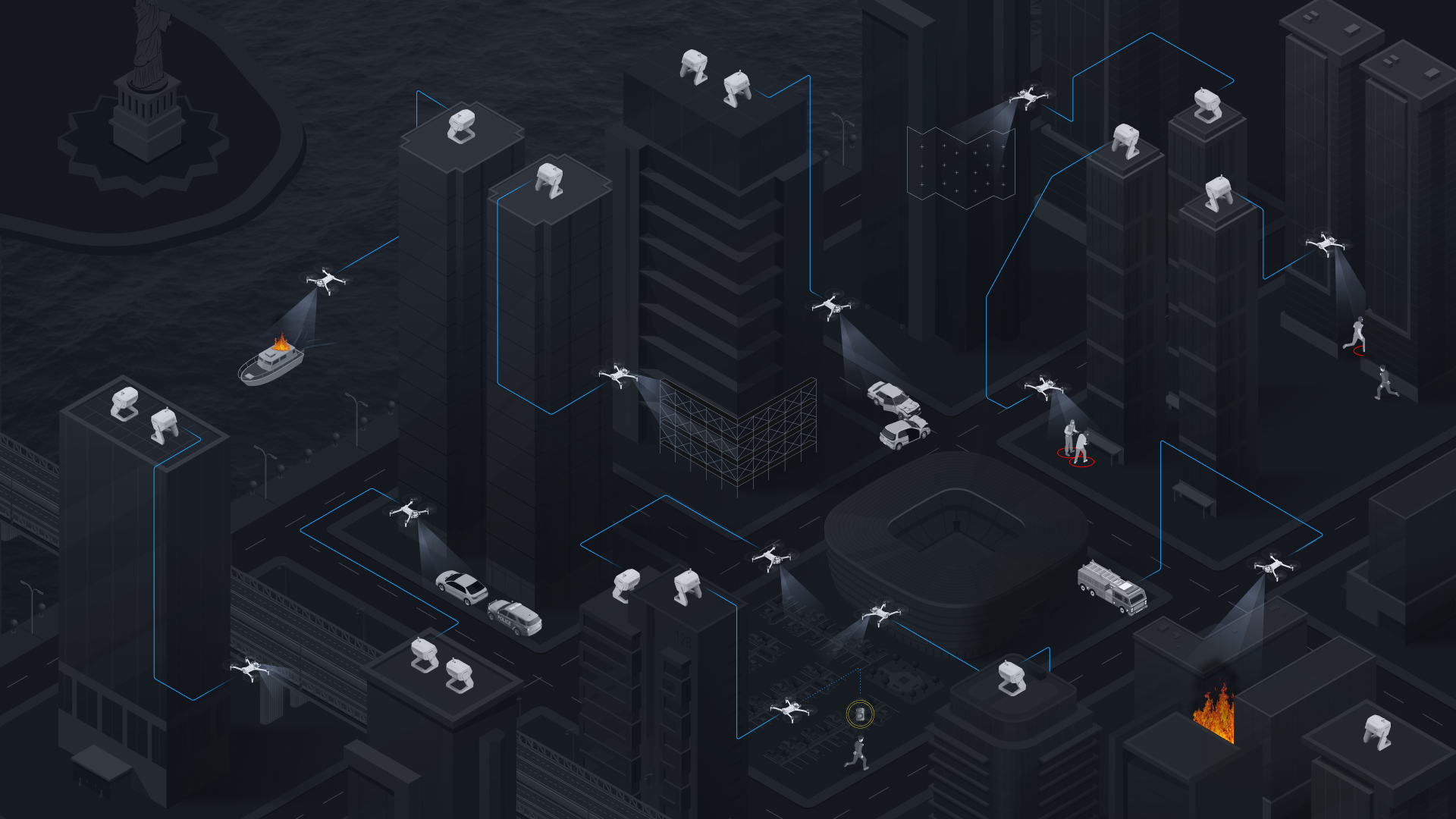
When cities invest in DFR as infrastructure, the return goes far beyond faster law enforcement response. It builds safer neighborhoods, more resilient operations, and smarter coordination across departments.
This is a new layer of public safety infrastructure and every agency in the city will benefit from it.
The DFR blueprint is built. Now make it yours.
Rethinking DFR means shifting the question. It’s not “how far can a drone fly?” but “how many calls can we cover, and how fast?” The real measure of success is putting the right number of drones in the right places so they’re ready when calls come in.
That’s why Skydio uses your call-for-service data to build deployment models. With just 12 months of history, we can show you how many docks are needed, where they should be placed, and the level of coverage you can achieve. The result is a clear path to scale: prove value with a single site, then expand as your city’s needs demand.