3D Scan Example - Mock Car Crash
 Skydio
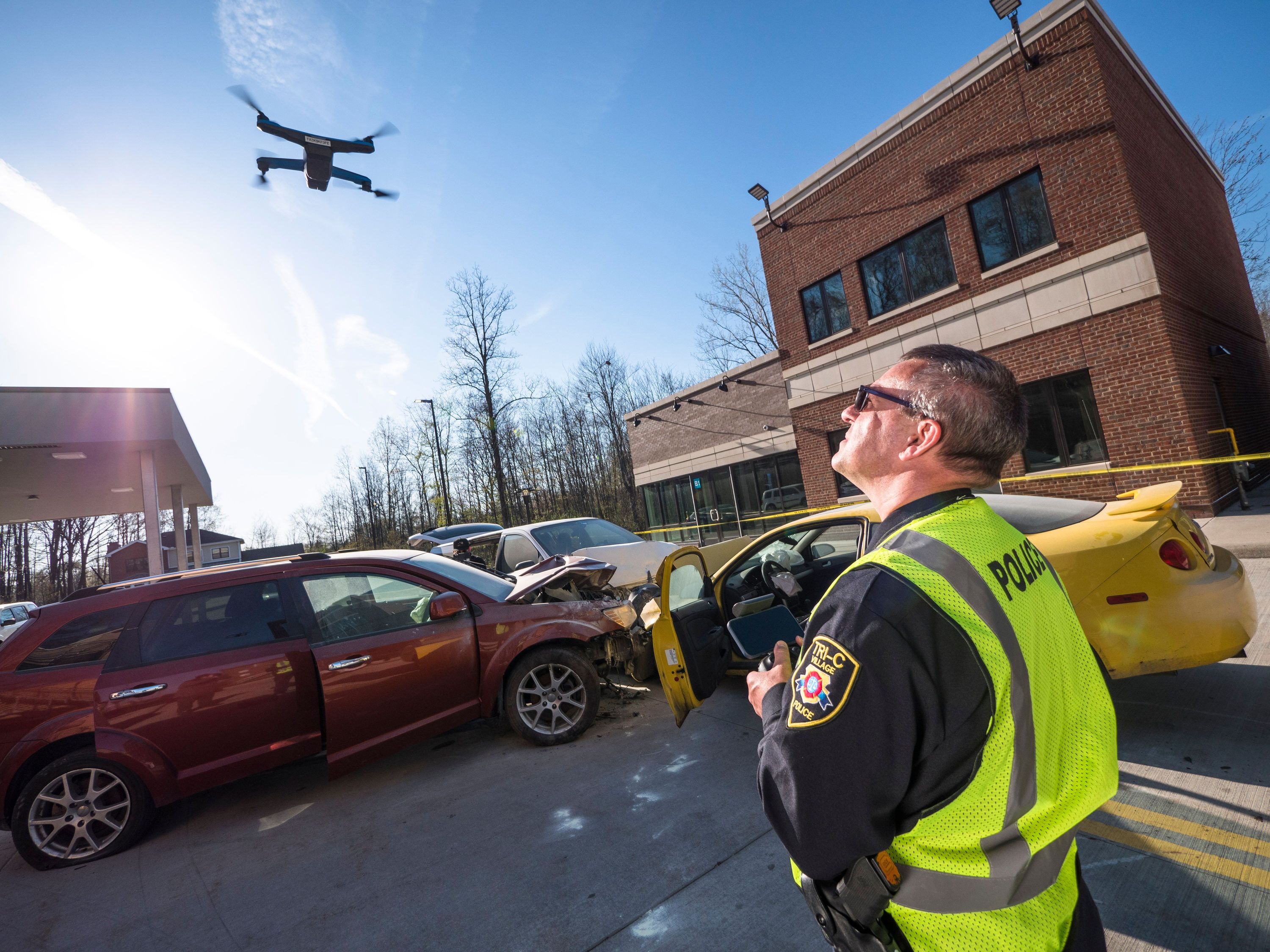
Before we get into this week’s epic 3D Scan we wanted to bring your attention to Skydio’s biggest virtual event ever on June 2nd at 9amPT from the U.S. Space & Rocket Center in Huntsville, AL. Register for the live event to hear Skydio executives and special guest speakers discuss our latest breakthroughs in autonomous inspection technology.
As we have mentioned and shown in our Sneak Peek blog series, Skydio 3D Scan is a first-of-its-kind adaptive scanning software built on top of Skydio Autonomy. Skydio 3D Scan automates data capture of any scene with comprehensive coverage and ultra-high resolution so that drone operators can perform higher quality data capture in less time and with minimal pilot training.
In previous blogs, we have shown 3D Scan models that are primarily relevant to enterprise inspectors. Check out some of our favorite sneak peek 3D Scans such as a lunar lander, the Sepulveda Dam, and a mock helicopter crash site. This time, we are excited to show the impact that 3D Scan will have for public safety officials documenting evidence. Today’s model speaks to the future of accident scene reconstruction, which is a key use case for 3D modeling by public safety agencies.
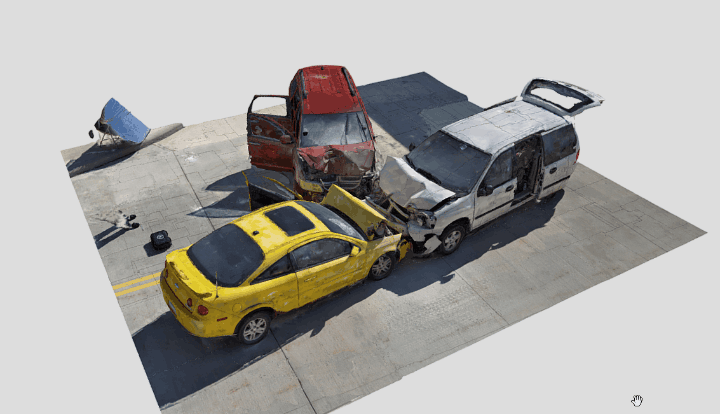
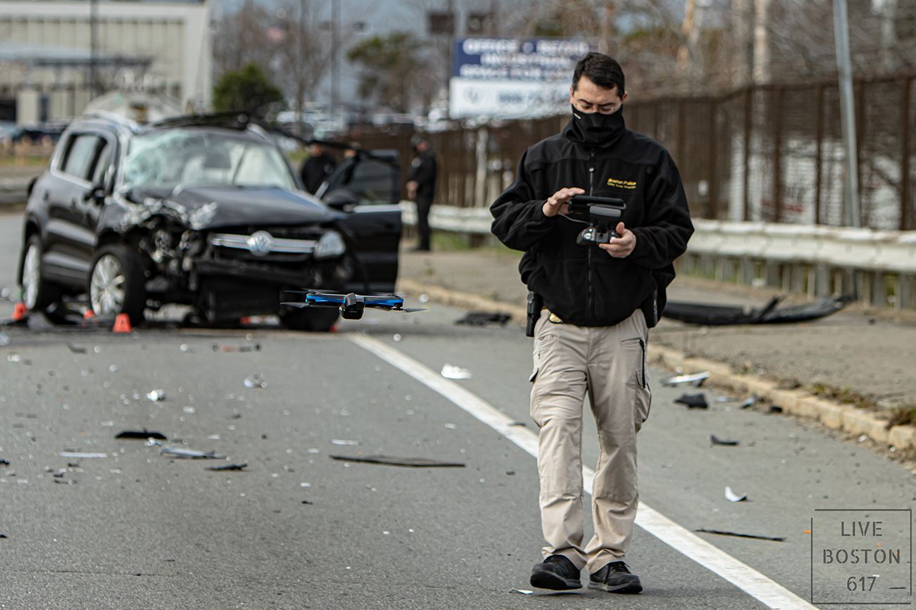
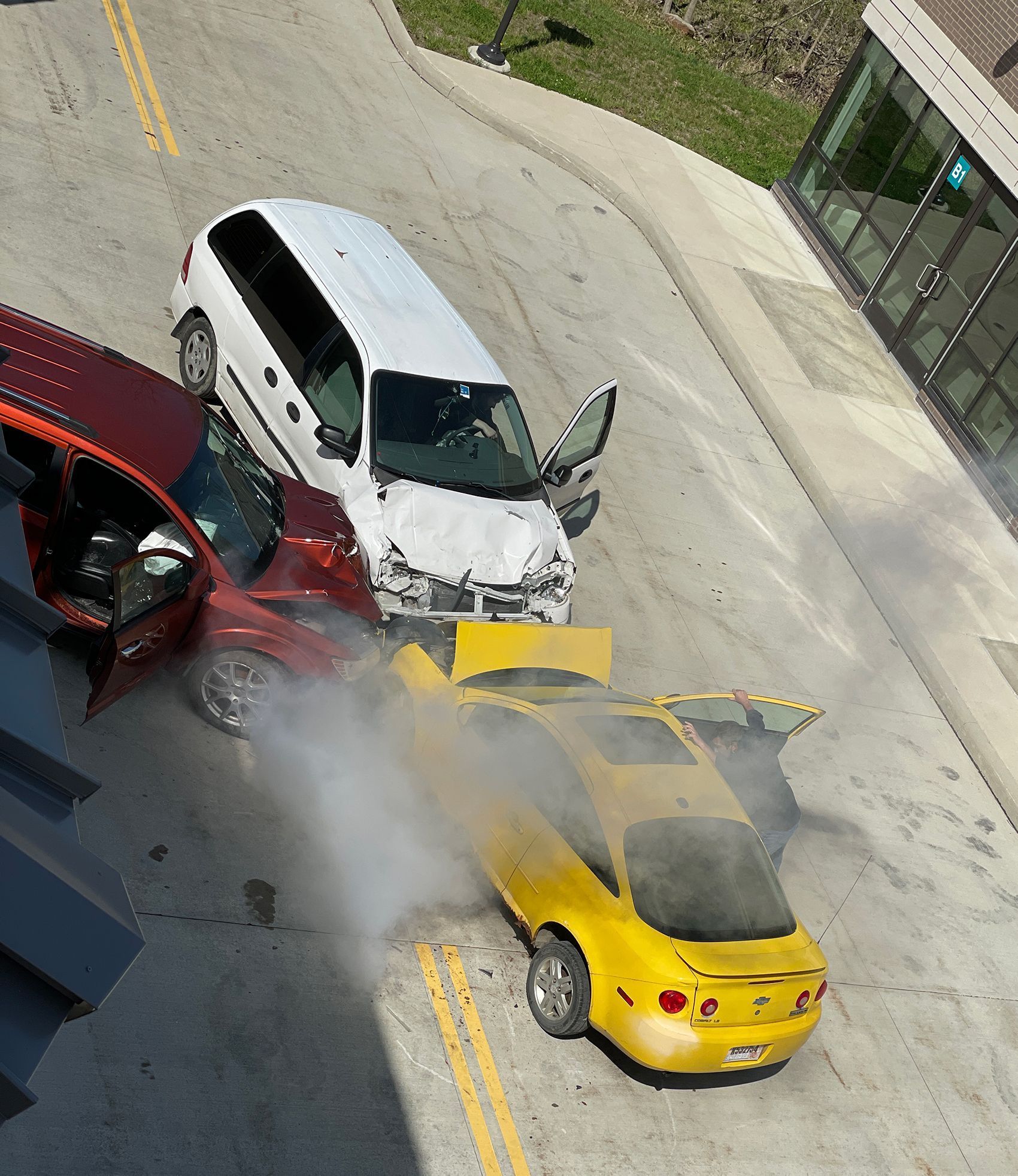
The model (click here to see it in 3D on the Skydio Sketchfab!) is of a mock car crash staged during our recent visit to the Tri-C Public Safety Training Center the likes of which are all too common for traffic accident reconstructionists. These crashes, especially those with fatalities, must be fully documented with photographs and precise measurements.
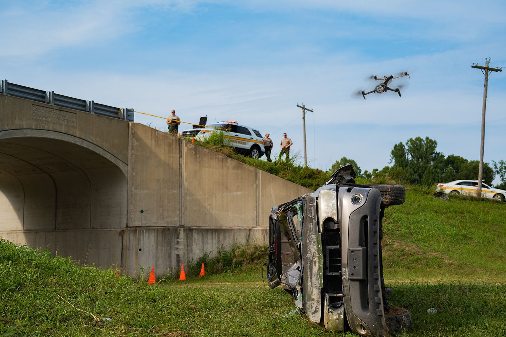
Before the era of autonomous drones, capturing precise views of these accidents would pose significant challenges to law enforcement officials. Traditionally, accident reconstructionists had been limited to simple photographs and tape measurements to document the scene. Naturally, they were unable to capture top down imagery that would show the relative positions of the cars in 3D space, which significantly limited the quality of the evidentiary data. Another side effect was the societal disruption of closed lanes during the lengthy process of evidence documentation.
Law enforcement drones have amazing potential to solve many of these problems. However, manual drones cannot be trusted to fly up close to these kinds of accident scenes. The complex area around a car crash with street signs, other cars, people, vegetation, and structures is difficult for a manual drone to navigate near. So, to capture a car crash, a manual drone operator would have to maintain a long standoff distance from the scene, and rely on an expensive and delicate zoom camera to generate precision imagery from a high-altitude grid pattern.
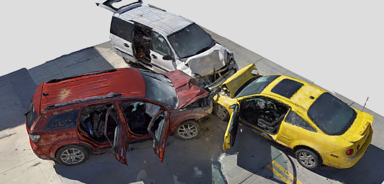
Not so with Skydio drones and 3D Scan. Skydio AI is different. Our drones use six 4K cameras to build a map of their surroundings, deep learning algorithms to understand what they're seeing, and advanced AI to predict into the future and make intelligent decisions. 3D Scan adds new AI skills to automate the entire photographic data capture of any scene. The Adaptive Mapping algorithms of 3D Scan allows Skydio drones to iteratively design a structure-specific 3D scanning path, and follow it with full obstacle avoidance engaged. As a result, the drone can capture imagery up close, from multiple angles, giving the accident investigators a holistic view of what happened. This ability to create a 3D digital twin provides the necessary context of vehicles in an accident that is hard or impossible to capture with a 2D flight pattern map or still photography. With 2D capture, the operator is creating a top down or satellite view of the scene, but fundamentally limits the amount of information collected by the reconstructionist. Being able to understand what is happening on the sides of the accident and to fully see the depth of the scene is where the real value of having a 3D model comes from. Being able to accomplish all this with minimal operator preparation and in record time to minimize the societal impact is where the unique value of Skydio 3D Scan is realized.
In most crash scenarios, first responders need to focus on many things at once, including saving lives, clearing the site as fast as possible to minimize disruption, and documenting the scene of the incident. Skydio 3D Scan makes the scene documentation process easy with adaptive mapping algorithms that pilot the drone to make a structure-specific 3D scanning path, and follow it with full obstacle avoidance engaged. This unique hardware and software combination gives first responders an easy to use tool that really makes a difference in the field.
Additional capture details are below. To learn how you can apply this incredible new technology to your inspection operations, please do not hesitate to contact us.
Capture
Platform: Skydio 2
Date: 4/13/2021
Distance: 2.2m
GSD: 0.927mm
Overlap / Sidelap: 80/70
Photos: 422
Fly Time: 17.5 minutes
Processing
Package: Bentley ContextCapture
CPU: 16 Core Threadripper AMD