How Skydio Drones with 3D Scan Work for Public Safety
 Skydio
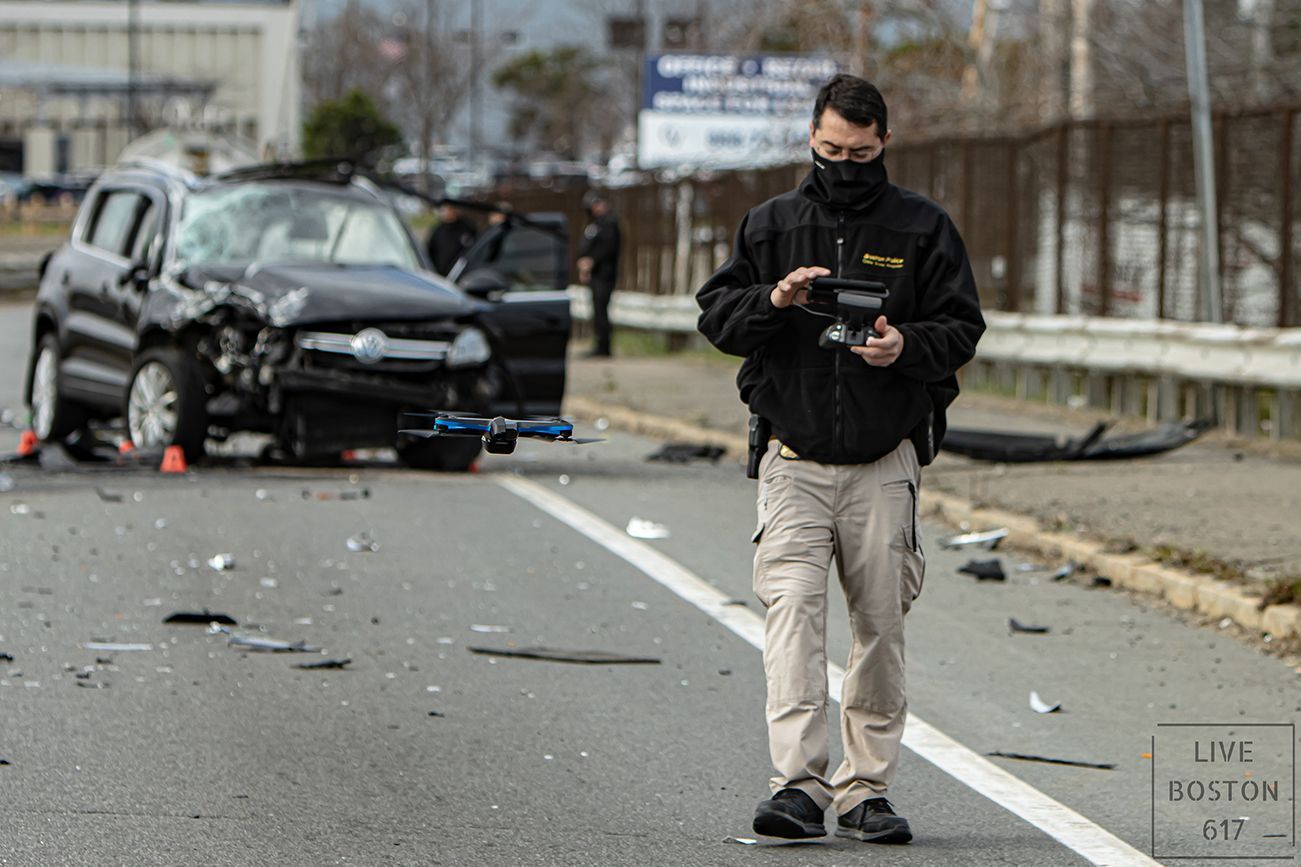
Law enforcement and firefighters have some of the most difficult jobs on the planet. On a daily basis, they put their safety on the line in order to protect our communities. Having readily accessible information about the scenes they encounter is critical to the rapid and safe resolution of their missions. Additionally, increasing accountability with first responder efforts further helps to protect the emergency response personnel and the public at large. Here at Skydio, we see the incredible potential of drones for public safety to have a positive impact on the world. In our most recent police drone webinar with Police1.com, we got to hear from Carl Blando who is a sergeant detective and 20+ year veteran of the Boston Police Crime Scene Response Unit. He shared his insights about his experience in the early access program for Skydio 3D Scan. Joining Blando, we had Fritz Reber, Skydio's Head of Public Safety and a retired patrol captain for Chula Vista Police Department (CVPD), and Vern Sallee, a UAS strategist from Axon and subject matter expert and former patrol operations division captain with CVPD. They explained how autonomous drones from Skydio will soon integrate with Axon's network of connected devices through Axon Air. This blog highlights some of the key parts of the webinar such as how Skydio’s U.S. manufactured drones are different from other drones on the market and the potential for 3D Scan to make documenting evidence in the crime and accident scene-reconstruction for police much easier.
Drones for police, fire, and search and rescue
Drones for Search and Rescue
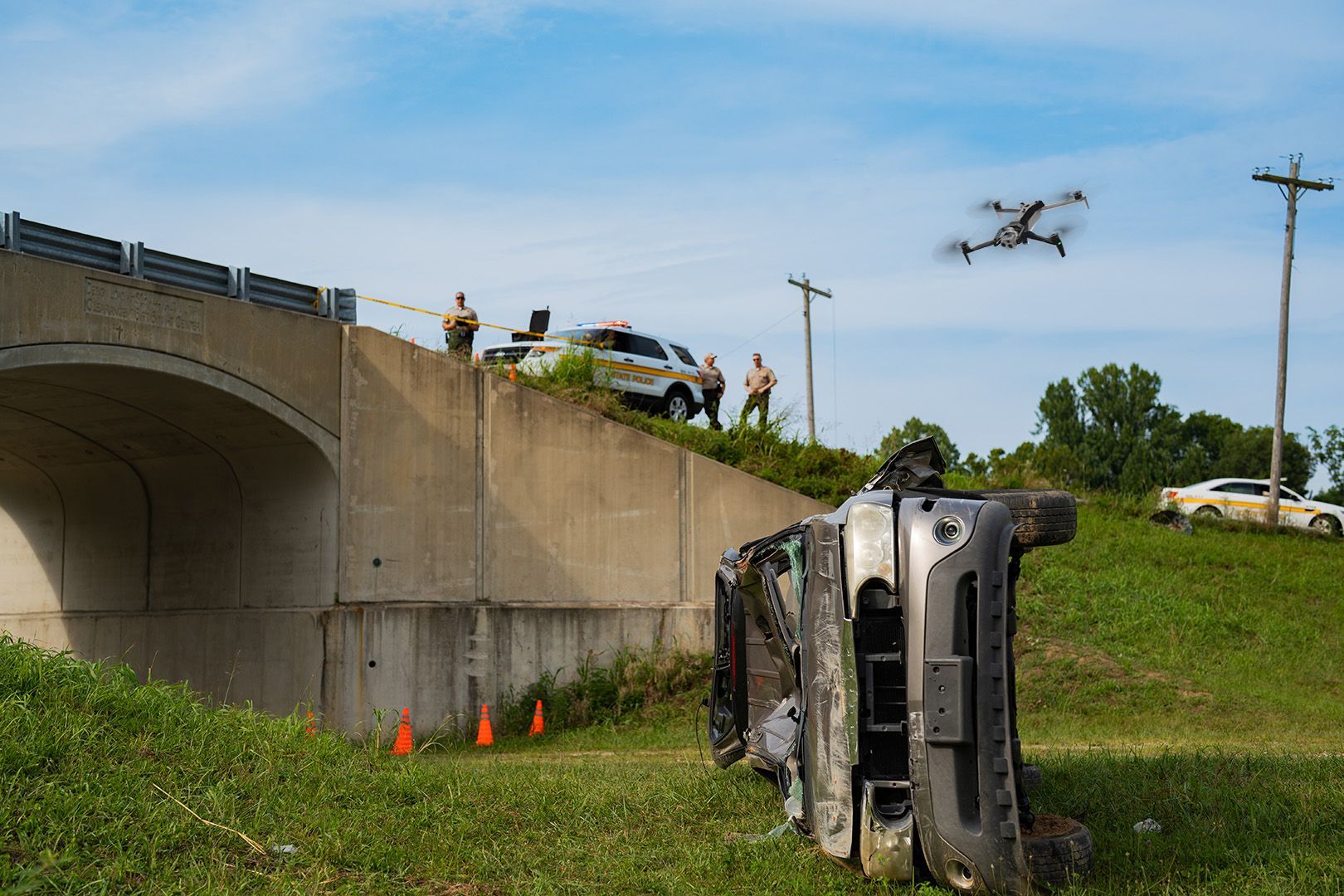
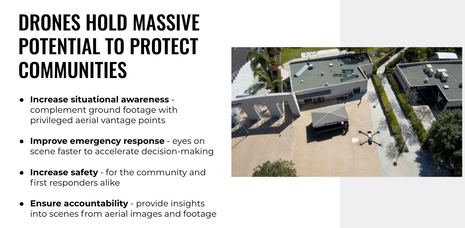
When searching for a missing person, imagine if law enforcement had the ability to quickly take out a small drone from the back of a standard patrol car, set it up in a matter of seconds, and fly it high above the scene to get a better view of the area. Then, if something of interest is detected, they could then have the ability to fly down below the tree line to further investigate. This is what Skydio autonomous drones enable, thanks to their groundbreaking 360 degree obstacle avoidance. Once the person is found, the drone operator can relay their location to the search team on the ground. In addition to quickly and efficiently providing critical situational awareness, this approach for rapid emergency response also increases safety as the drone is able to get to hard-to-reach places that would otherwise be too dangerous to access by foot.
Drones for situational awareness
These capabilities are equally valuable during disasters, when drones can have the ability to fly at eye level through the trees or even around a wall to see what is behind it without sending personnel into a dangerous situation and without the risk of crashing. These capabilities unique to Skydio autonomous tactical drones add an incredible amount of security for search and rescue personnel who might otherwise be forced to risk their own safety to accurately understand the complexities of the scene. This ability to get situational awareness in even the most challenging environments is something that only a search and rescue drone can provide.
Quickly deployable small drones
With the drone being smart, small and quickly deployable, you can launch the drone into areas that are dangerous and can decide beforehand which resources and support to take with you into the situation. The Skydio X2 thermal drone is an extremely capable small foldable drone that has additional benefits on top of Skydio Autonomy, such as a 35 min flight time and a thermal camera. The quick deploying nature of the Skydio X2 saves lives, time, and accelerates decision making.
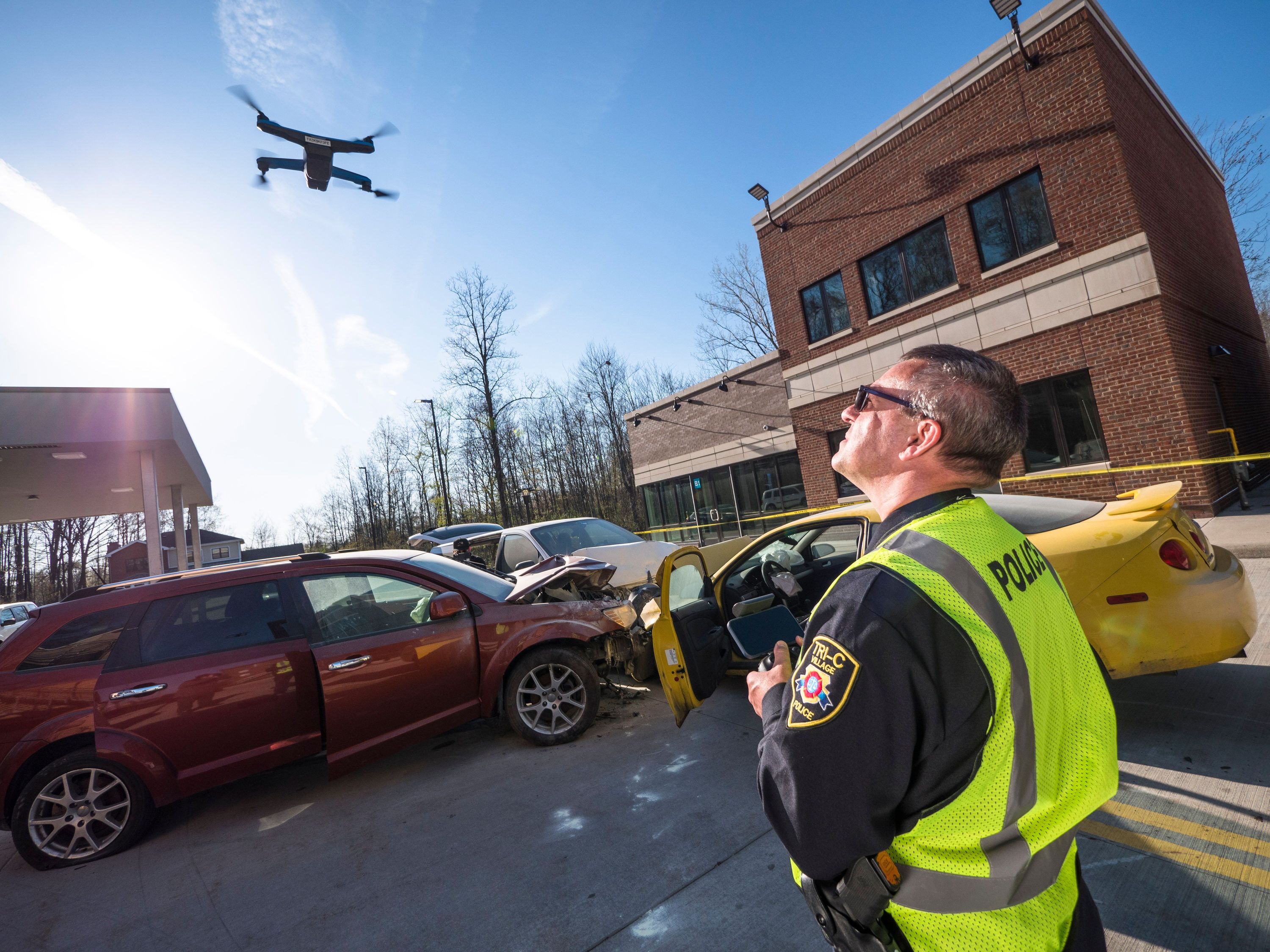
Providing transparency and accountability for Our communities
Similar to what we are seeing with police-worn body and car dash cameras, there is increased accountability with aerial images and footage captured during a law enforcement event. Having airborne emergency response with cameras that can document the actions of everyone on the scene ensures transparency between the public and public safety officials. Skydio drones are able to capture information from vantage points that are not accessible to traditional manual drones, further increasing their positive influence in this area.
Responsible use of drones in public safety
At Skydio, we take pride in developing solutions that earn the trust of first responders and all our customers. But we know that can only be the beginning. In order to realize the full potential of unmanned flight, the public must trust the technology, and the way it is used—and that requires private sector companies to bake responsible engagement into their DNA.
That's why we developed the Skydio Engagement and Responsible Use Principles – a groundbreaking set of policy and ethical principles to guide our work and drive the industry forward. These principles capture our commitment to considering the holistic impact our products will have on communities and convey our core values of accountability, transparency, and the protection of privacy and civil liberties.
We also partnered with DRONERESPONDERS—the leading association focused on first responder drone programs— to develop the "Five C's" of responsible drone use by public safety agencies. The 5 C’s outline five core principles--including community engagement, transparency, privacy and civil liberties--that are critical to the success of public safety drone programs.
Skydio Autonomy – The best drone obstacle avoidance
The barriers to deploying drones at scale have been high due to legacy manual drones requiring more extensive training and a high degree of mental focus for operators. We here at Skydio have taken a different approach to building drones. Using Skydio Autonomy, a breakthrough AI-driven autonomous flight engine, Skydio's drones are designed to augment the human pilot with the intelligence of an always-on super-computer improving safety and drastically reducing the burden of safe flight away from the operator on the ground. Skydio drones carry six navigation cameras for 360° perception and a GPU that runs nine deep neural networks as part of the Autonomy engine. This combination allows the drones to see and understand their surroundings, plan a path through them, and avoid obstacles so the operator can get the job done faster and safer. No other drone in the market can do this.
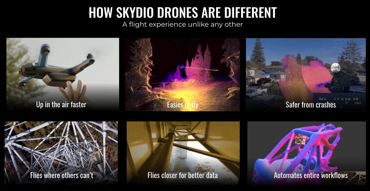
Skydio Autonomy enables not only safer flight but also allows for the drones to fly in GPS-denied environments such as between buildings and under structures. This is important because other drones on the market are not able to fly properly without stable GPS connection. Without stable GPS, the drone will drift around and become even more challenging to operate--often resulting in a crash. Skydio Autonomy, with its vision based navigation system, solves this issue that other drones have with their dependence on the GPS. Skydio drones open up new opportunities for public safety officials to fly confidently.
Digitize the world with drone 3D mapping
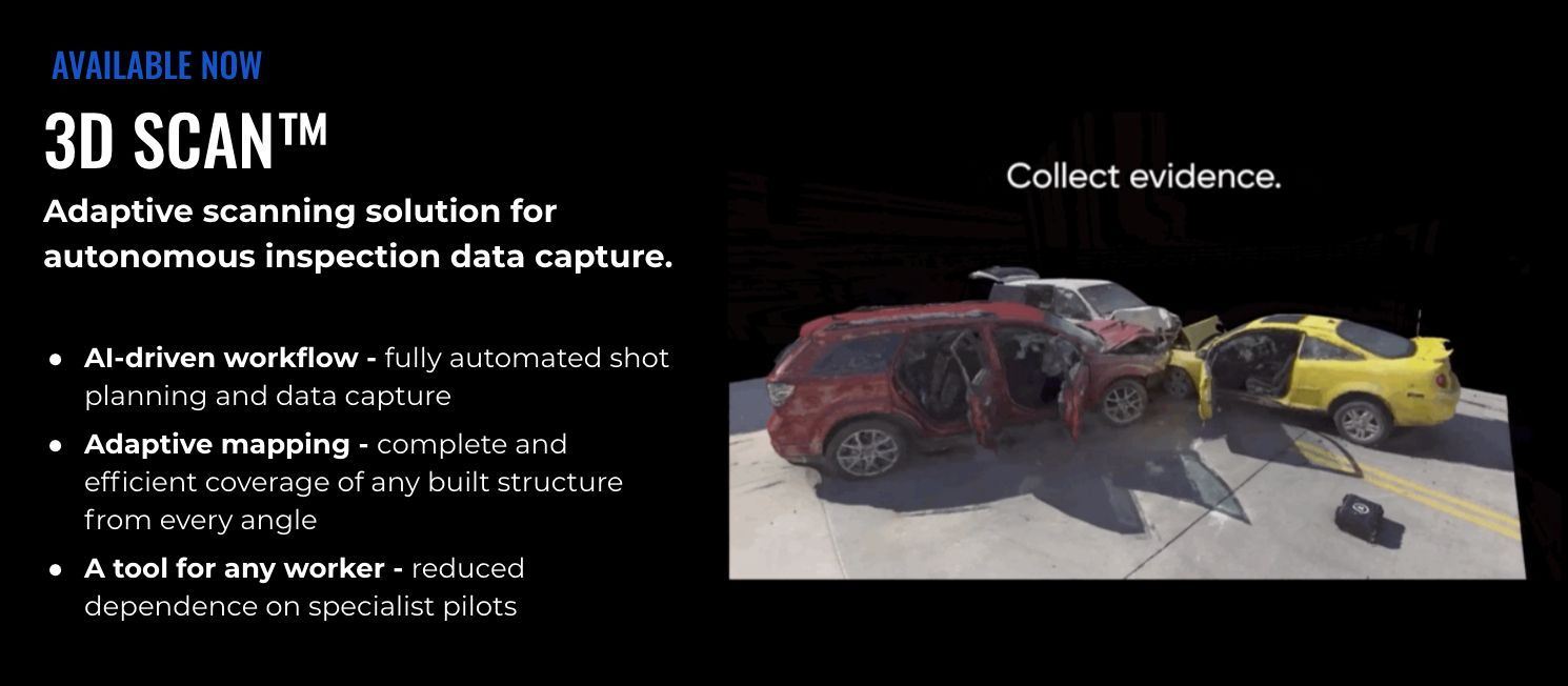
Skydio 3D Scan builds on top of the Skydio Autonomy flight engine. It adds specialized AI skills that enable the Skydio drones to automate the flight patterns required to capture photosets of any surface, complex structures or scene to generate highly-fidelity digital twins. All the operator needs to do is select a volume of space to scan, specify the desired GSD resolution (as low as .06 mm.) and watch the drone operate autonomously to capture a complete, accurate and consistent dataset. This means that professional drone operators of all skill levels can now perform higher quality area mappings, physical asset inspections, and crime or crash scene reconstructions in record time and with minimal training.Boston Police Department and
Skydio 3D scan adaptive mapping drone
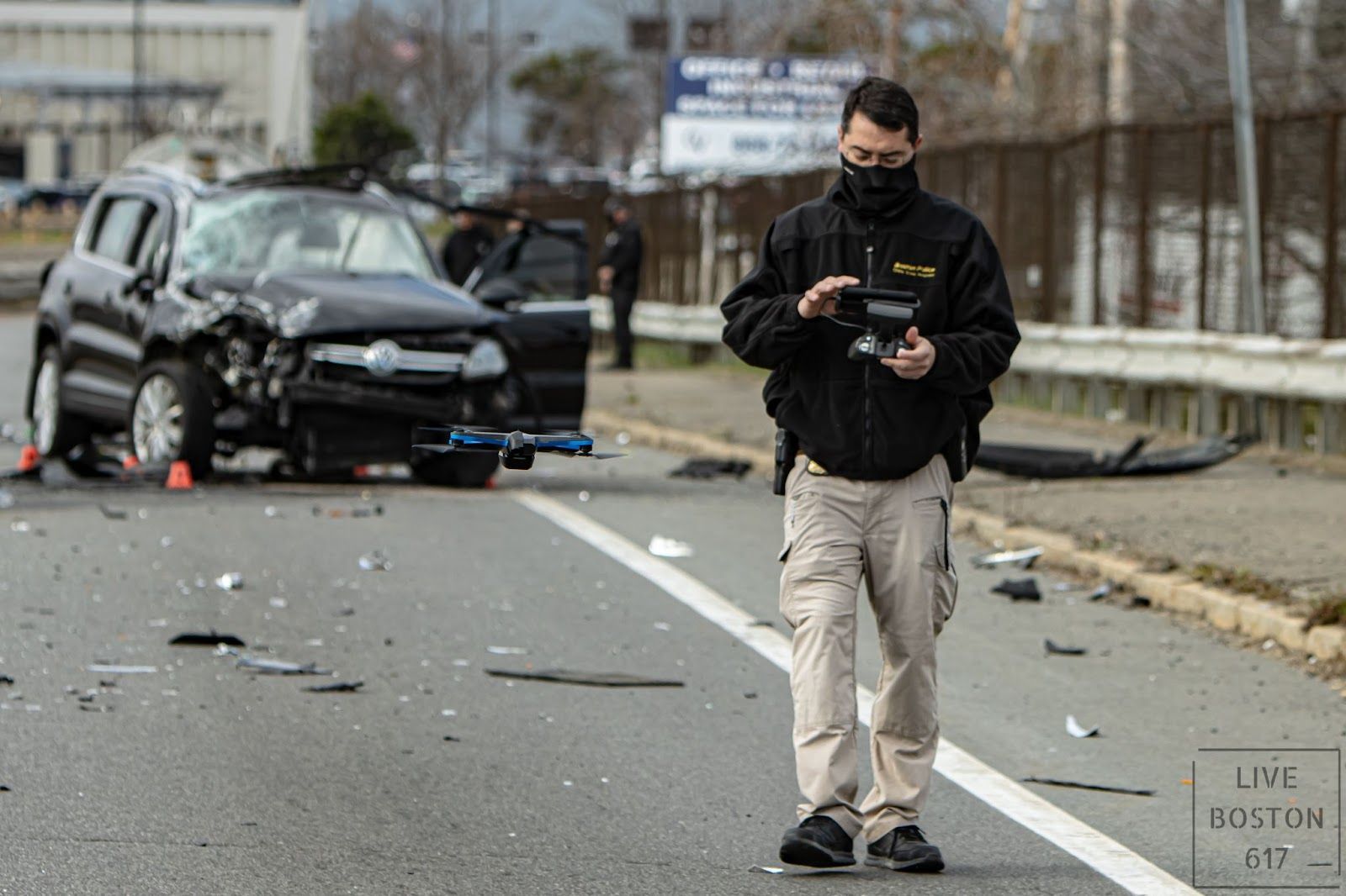
It was our pleasure to host Carl Blando from the Boston PD in a recent webinar on applications of Skydio drones for public safety. Carl is a 22-year veteran with 5 years of experience in the crime scene response unit and 3 additional years as Sergeant detective with the Boston Police Department. As part of the Skydio 3D Scan early access program, he spent time proving and testing out the software in a variety of situations and environments. Below are the results of the two scans that he did with the Skydio 2 and our 3D Scan software.
Scan 1: Salt barn
This salt barn holds salt that the city uses in the winter months to salt the roads. Flying near and around this salt barn would be very challenging for any other drone on the market because it is made out of metal. For legacy drone systems, the drones rely on a magnetometer which is a compass. This compass uses the earth’s natural electromagnetic field to get the drones direction. If large metal objects are present, the compass on the legacy drones will get confused and not fly properly--often leading to a crash. Skydio drones fly confidently in GPS-denied areas and through electromagnetic interference with 360-degree obstacle avoidance due to Skydio’s vision-based autonomous system. This autonomy system is running the entire time a 3D Scan is taking place so the operator does not have to worry about hitting any objects while the drone is autonomously flying around.
This model, featuring 170 photos stitched together in Bentley ContextCapture, contains incredible detail of the front and even inside of the salt barn. This scan would be impossible to do with a traditional high flight, top-down drone scan. Additionally, the ability to fly inside of the barn worry-free and document the amount of salt inside is something that is unique to Skydio. Although this was just a sample scan, it is easy to see how this type of technology would be very useful for real-world documentation of crime and accident scenes. When reconstructing a scene, first responders need to focus on many things at once, including saving lives, clearing the site as fast as possible to minimize disruption, and documenting the scene of the incident. 3D Scan allows first responders to efficiently and accurately generate high-quality data documentation with ease.
This model’s photos were taken with 3D Scan on a Skydio 2 in just 15 minutes!
Scan 2: Crime scene
This mock crime scene was documented in 13 minutes with 110 photos taken. Some things to look for in the model include the shell casings by markers 5 and 6. Additionally, near the black SUV, you can see another weapon. This ability to capture a large area in such a short amount of time makes it easy to see the scene holistically, instead of looking at a bunch of photos and trying to figure out where everything is located. Crime scene reconstructionists face the challenge of documenting the scene quickly and accurately to get high-quality data with minimal disruption. However, photos taken manually often do not tell the full story, and the nature of a crime scene can be difficult for manual drones to navigate. 3D Scan’s Adaptive Mapping algorithms design a unique pattern for each scene to capture full coverage of any accident, and they can create a comprehensive model for crime and accident scene reconstructionists.
This model’s photos were taken with 3D Scan on a Skydio 2, and the reconstruction was performed using Bentley ContextCapture.
A big thank you to Carl Blando from the Boston Police Department for joining us in this webinar and allowing Skydio to share these scans!