Executive summary
The Ohio Department of Transportation (ODOT) is using Skydio drones to streamline critical infrastructure workflows—from high-risk bridge inspections to routine construction monitoring and survey capture. With over 40 trained drone operators and deployments across the state, Skydio’s autonomous flight capabilities are enabling safer, faster, and more effective operations.
What began as a handful of bridge inspectors piloting drones has evolved into a state-wide initiative that reduces inspection risks, increases data quality, and enables departments to respond in near real time to emerging issues. Skydio has become ODOT’s preferred drone platform, replacing legacy equipment and outdated field methods.
Primary workflows:
- Construction progress monitoring
- Survey-grade mapping
- Bridge and Infrastructure Inspections
- Traffic pattern analysis
- Emergency and storm response
Teams involved:
UAS Center, GIS, Survey, Bridge Inspection
Skydio solutions:
Skydio X10, Skydio 2+
Challenges
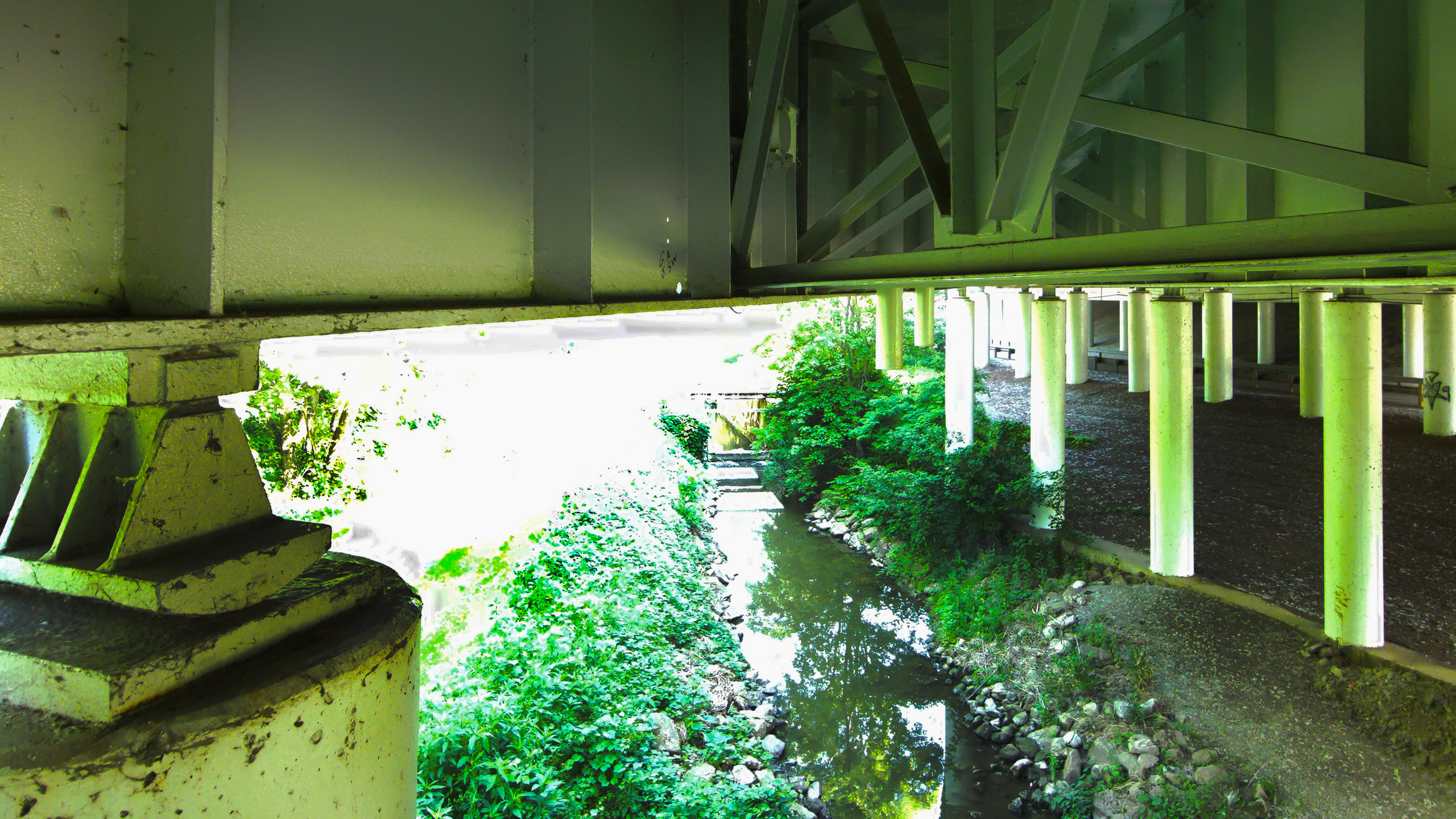
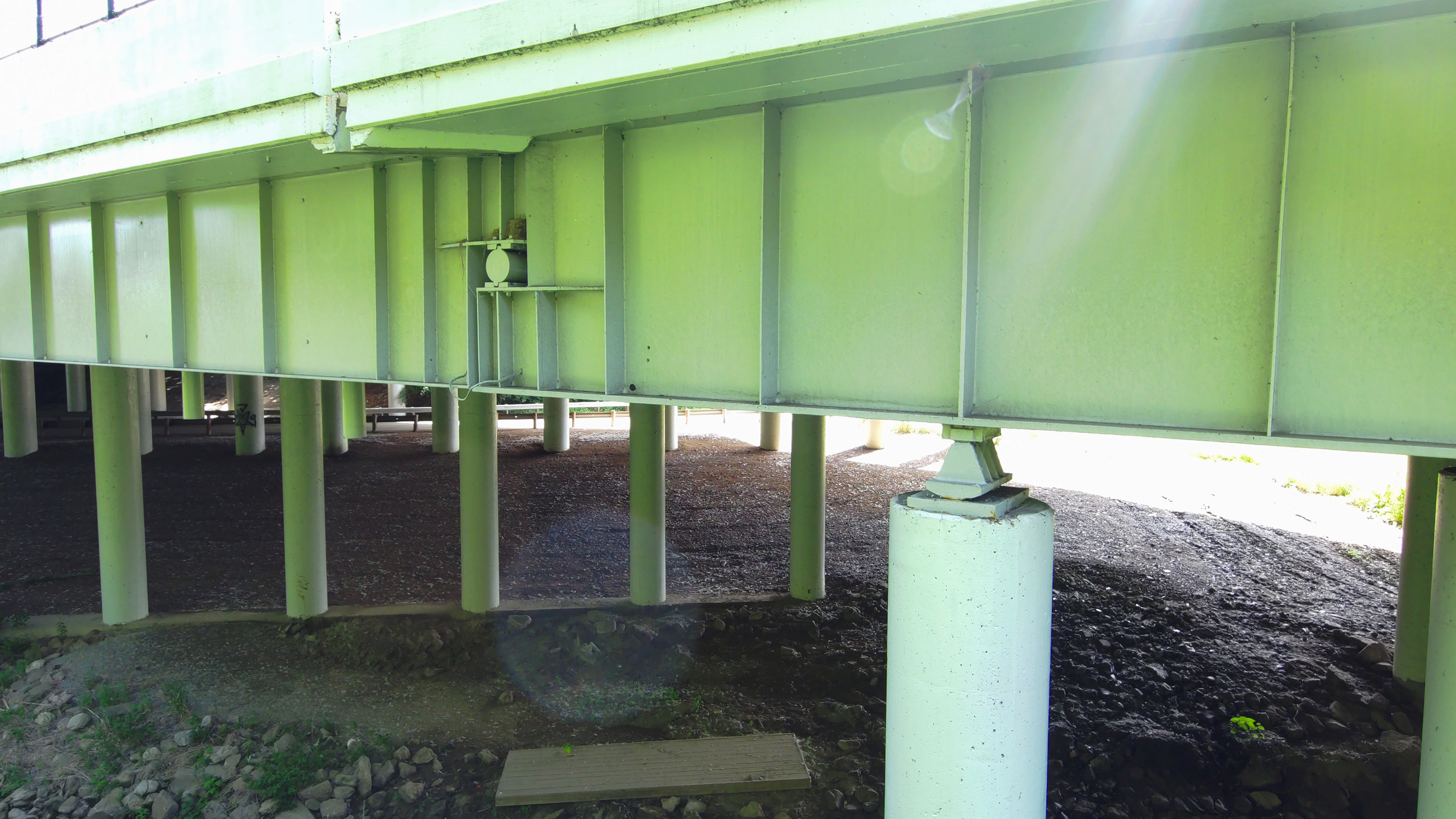
Bridge inspections and construction oversight traditionally required high-risk and high-cost methods. Inspectors climbed superstructures or relied on $800,000+ snooper trucks. Survey crews collected points on active roadways. Construction engineers often lacked updated views of project sites.
“ From a safety perspective, we’re no longer playing Frogger in the middle of the road.”
Solution
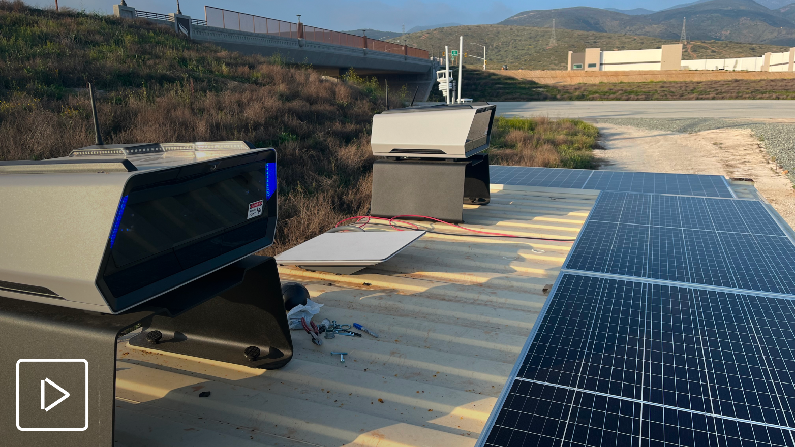
ODOT equips regional staff—bridge inspectors, surveyors, GIS analysts—with Skydio drones, enabling them to collect the exact data they need, independently and safely.
Tailored hardware for each workflow
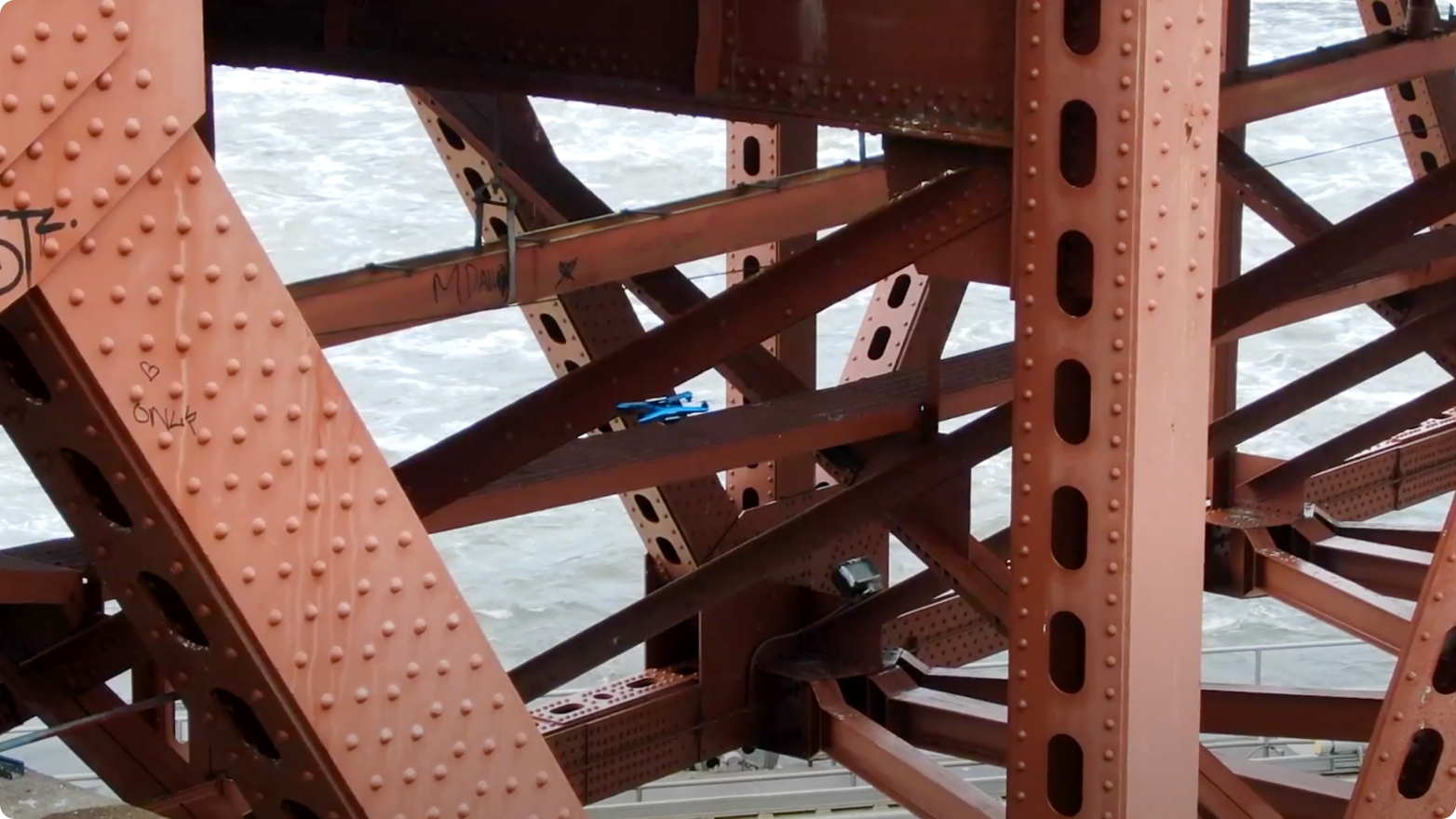
Skydio 2+: Ideal for tight, under-bridge inspections
Skydio X10: High-res mapping and thermal scans with RTK precision
Advanced imaging capabilities
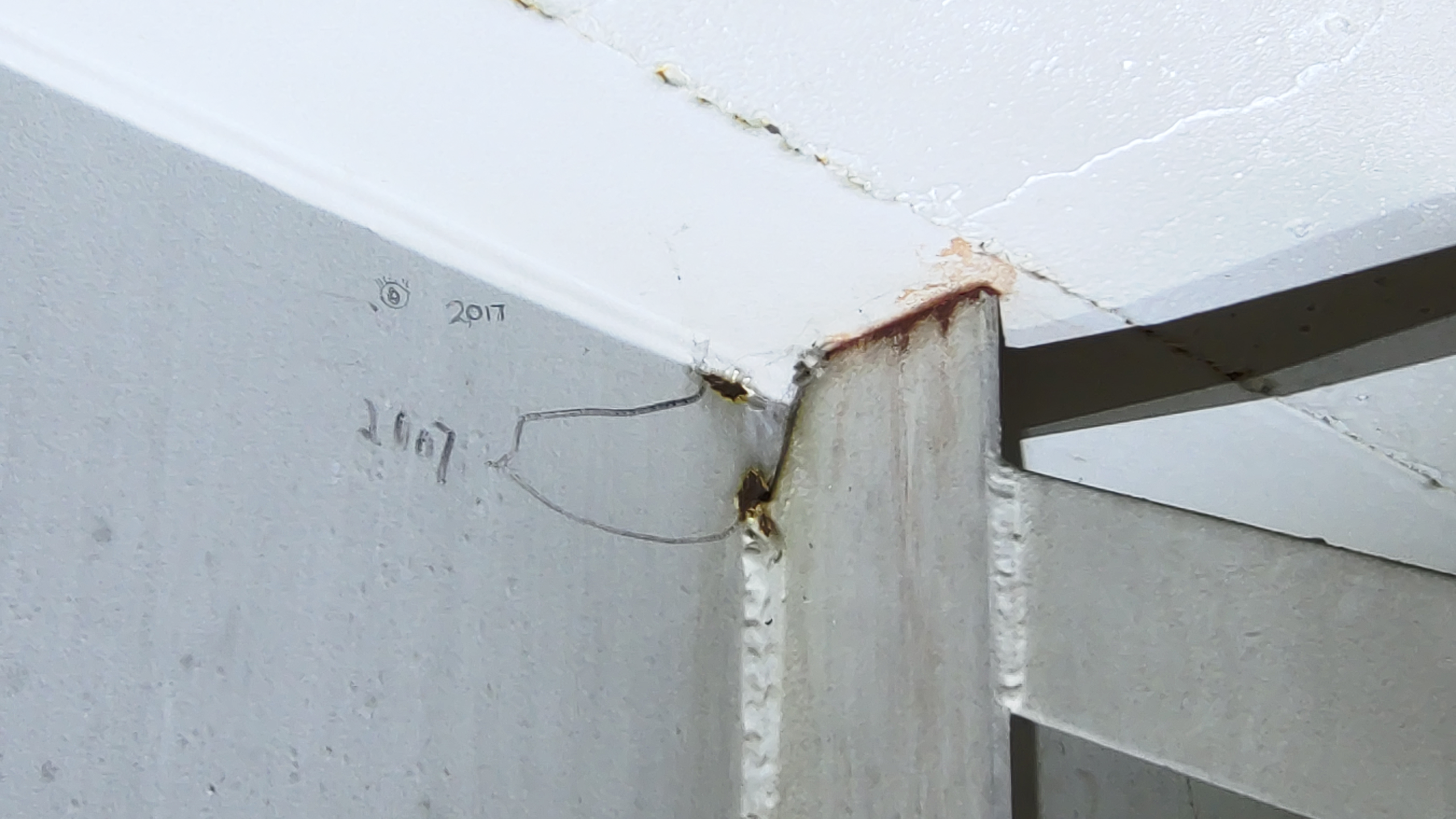
Observe cracks and section loss in steel beams
Capture thermal delamination locations without entering traffic lanes
Achieve 0.2 mm crack resolution on complex structures
Scalable training and operations
Pilots trained via Skydio Academy
Central UAS Center supports a distributed team of 40+ certified drone operators
“ We used to have to suit up in dry suits and cross a flooded river just to photograph crack monitors on pier walls. Now, I just fly the drone from the riverbank.
Results
Construction monitoring
Engineers used drone footage of a Cleveland area repaving project to catch a design issue mid-construction, saving significant time and rework. Missions are now performed on-demand for before/during/after documentation, keeping project stakeholders aligned without repeated site visits.
Learn more about drones for site monitoring.
“ Without the drone footage, they would have missed the issue entirely. It changed the actual job plan.
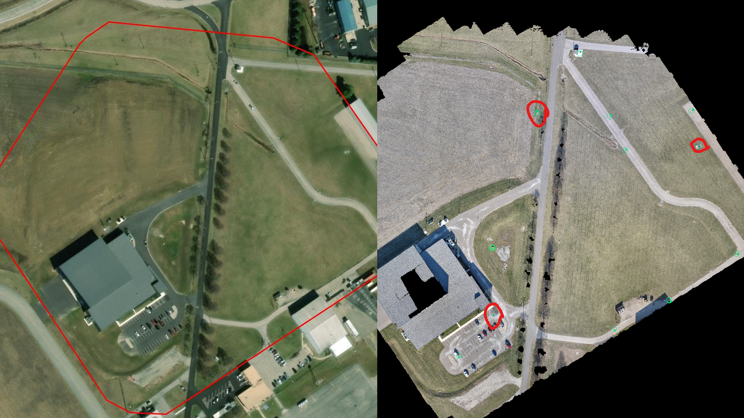
Surveying and mapping
ODOT has transitioned from Phantom 4 RTK systems to Skydio X10 for high-precision mapping, achieving equivalent accuracy with far greater efficiency.
“The X10 gave us the same accuracy as a Phantom 4 RTK in a third of the time.” Jamie Davis, GIS Data Manager, ODOT
“At first, I said you can’t use rolling shutters for surveys. But when I looked at the results side-by-side with Phantom 4 RTK, they were identical.” Jamie Davis
In one example, a project that required 1,000 images and 60 minutes of flight time with the Phantom 4 RTK was completed using 400 images in just 20 minutes with the X10—delivering the same photogrammetric output with dramatically less effort.
Where drones fit in federally regulated inspections.
Skydio drones give ODOT inspectors safer access to bridge areas that once required climbing or snooper trucks. But for certain structures—like Non-redundant Steel Tension Member (NSTM) bridges (formerly classified as fracture-critical)—federal standards still require an arm’s-length inspection.
"A drone can’t be used for those inspections. An arm’s-length inspection is mandatory.” Daniel Breda, Regional UAS Pilot, ODOT
That’s why ODOT uses Skydio drones to identify and prioritize the areas that demand the most attention—so inspectors spend more time where it counts.
Asset management and maintenance
Bridge inspectors now capture high-resolution imagery of beams, decks, and piers without entering traffic or deploying climbing crews.
“We’re identifying defects we couldn’t see before. You can’t fake the level of clarity we’re getting up close with a Skydio.” Daniel Breda
Skydio drones are increasingly used for many inspections that would traditionally require snooper trucks, reducing major costs, lane closures, and risk to staff. ODOT is exploring the use of thermal sensors to map delamination on bridge decks as an alternative to traditional sounding rods—a promising workflow that could reduce exposure to traffic in the future.
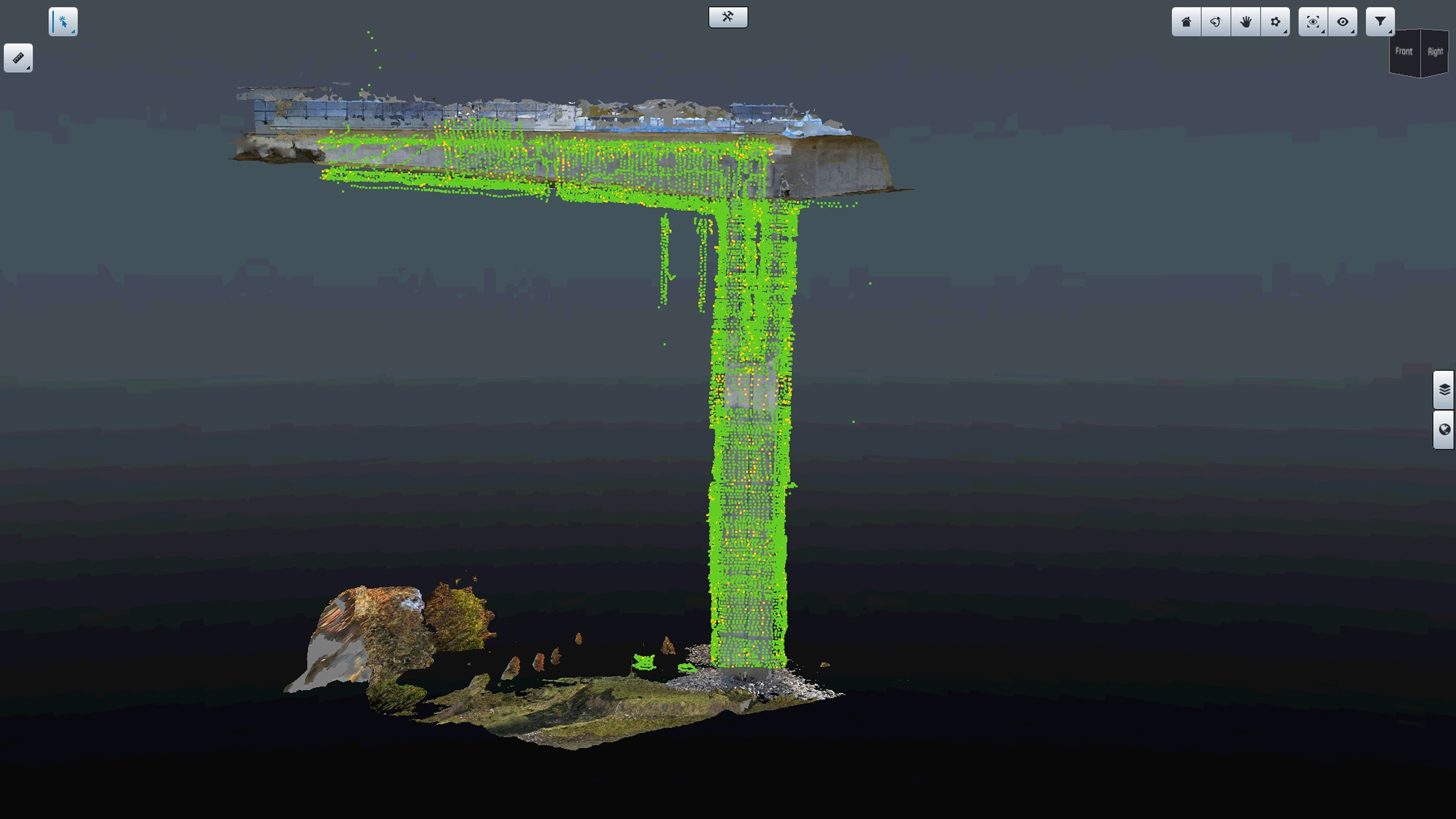
ODOT also uses Skydio drones to build detailed 3D models of large-scale structures, such as the Jeremiah Morrow Bridge, Ohio’s tallest bridge. With visible crack resolution down to 0.2 mm, these models support long-term condition monitoring and set the foundation for automated inspections.
Data access and collaboration
With over 500TB of drone video and imagery archived, ODOT is working to reduce duplication and improve coordination across teams. ODOT is evaluating shared data platforms that could give departments access to existing drone captures—reducing duplication and maximizing the value of each mission.
ODOT also leverages live streaming capabilities from Skydio drones to give engineers, traffic managers, and public information officers real-time visibility into active scenes—without needing to be physically present. Whether monitoring ongoing construction, responding to storm damage, or evaluating traffic flow during peak hours, live streaming enables faster, better-informed decisions across the agency.
Looking ahead
ODOT is actively exploring the next phase of drone-powered operations—including AI-based workflows for crack detection, traffic pattern analysis, and construction zone safety compliance. These tools will help automate inspection reviews and accelerate decision-making across departments.
“We’re hoping to feed all that footage into software that just gives us a daily report—so nobody has to watch hours of traffic video.” Jamie Davis
The team is also evaluating Skydio Dock, which would enable drones to be stationed permanently at key locations for scheduled or on-demand remote flights—further reducing time on site while expanding coverage and operational agility across the state.
With its drone program expanding and modern infrastructure tools in place, ODOT is building a safer, smarter, and more scalable model for public infrastructure management.
THIS PRODUCT OR SERVICE HAS NOT BEEN APPROVED OR ENDORSED BY ANY GOVERNMENTAL AGENCY, AND THIS OFFER IS NOT BEING MADE BY AN AGENCY OF THE GOVERNMENT.