

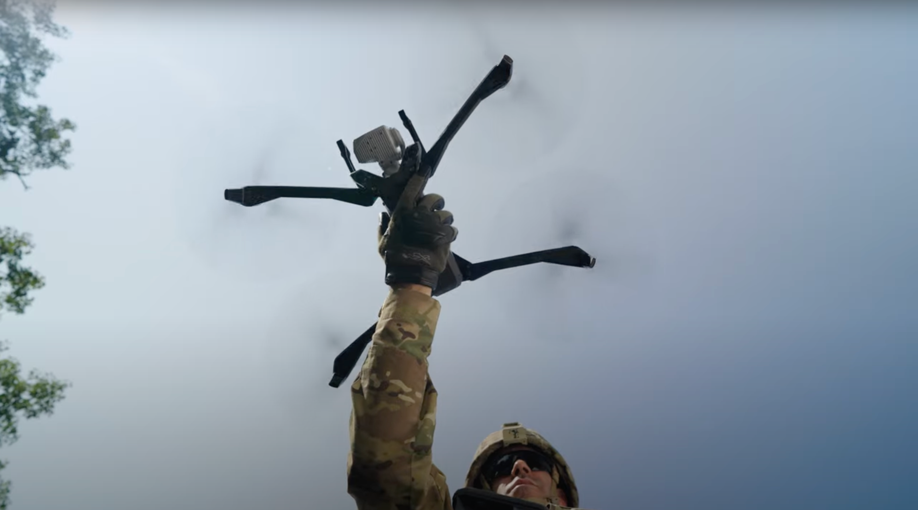
There’s accurate, and then there’s Skydio X10 accurate | Skydio Ascend ’24
Discover how Skydio X10, equipped with RTK/PPK technology, transforms precision in mapping and surveying missions. This session addresses the challenges facing mappers and surveyors and demonstrates how the Skydio X10 solution meets these challenges.
- Thank you all for making it here. Good afternoon, everyone.
- I'm Francis, I'm a senior product manager here at
- Skydio, and I work
- on our high accuracy solutions.
- So today I'm gonna give you a brief overview before we turn it over to the
- panel,
- and we'll be talking a bit more about RTK-PPK technologies and
- answer a bunch of questions from you.
- So I'm excited to talk about a solution that we'll be bringing to market very
- soon. And before we dive into it, just a quick show of hands, how many of
- you are surveyors, or you're surveying as part of your
- everyday jobs?
- Okay.
- I promise I won't pick on anybody.
- Quite a few hands, so I feel like I don't really need to
- preach to the choir here.
- A lot of you are familiar with these use cases.
- You understand the importance of being extremely accurate,
- whether it be critical infrastructure or construction of houses or other
- buildings. You need to be within tolerances,
- within really tight tolerances.
- Or even if you're in public safety and trying to collect evidence,
- you need to make
- sure that you're as accurate as can be, and oftentimes that means a tenth
- of a foot or three centimeters if you use metric.
- So today we'll talk about Skydio X10 with the RTK-PPK
- attachment. It uses the same technology
- as the RTK rovers that you have currently.
- And what that lets you do is get from inaccurate GPS estimates to
- receiving corrections from a base station or some other correction source and get
- down to a tenth of a foot accuracy.
- And you can do this using a base station, using a Cores network, using
- existing infrastructure that you already use, and also
- take this information and process it using the same tools
- that you're familiar with
- today. So use just an attachment. Everything else is stuff that you're
- already familiar with, and it just fits in your workflow.
- We've talked about this before as a concept, but now it's reality.
- It's here. And if you're a beta customer, you'll get to play with
- this before the end of this year.
- And what can you do with this? There are three primary use cases that we're
- targeting. So we're looking at monitoring prog- uh,
- progress.
- This is especially useful in construction.
- You can estimate volumes very accurately, which helps our
- construction customers, but as well, uh, but our customers in mining
- and t- utilities as well. And then, of course, there's also
- always the possibility of measuring distances within your reconstructions,
- and this is especially important for our public safety customers.
- So we'll talk about each of these one by one.
- First one is monitoring progress.
- So a lot of our customers today, they actually use Skydio images,
- and they try to monitor progress by eyeballing it.
- So you look at images today, um, and try to figure out if things are in the
- right place, if things are progressing along.
- But with the georeferenced accuracy of an RTK solution
- with georeferenced photogrammetry, what you can do is you can overlay your
- BIM
- models, you can overlay your construction data,
- and then see if things are
- according to spec. And once you have this, you can make sure that you're always on
- track. You can identify mistakes before they
- become so expensive, and
- by that, you can save on a lot of costs.
- So it's a powerful new way to catch deviations early and help prevent
- cost overruns. And here you can see some data
- that Ted here was very
- gracious to share with us. This is, um, from Maple in
- Canada. They're a general contractor construction
- company.
- And so they were able to use the X10 and overlay their BIM data and iden-
- identify these deviations very quickly.
- Another capability that's unlocked by RTK is estimating volumetric
- changes over time, which is important in construction, but also in
- mining and utilities.
- So what this lets you do is you define a boundary, and
- that gives you a
- volumetric estimate very quickly.
- And because the data is so accurate, you can use this for things like verifying
- how
- much earth has been moved before you make that payment to your contractor.
- In mining and utilities, you can use this to accurately estimate
- your
- stockpile volumes, and that helps you with future planning
- and order.
- Um, so lots of different things that you can do with this to improve your
- workflows in general.
- And the same solution can also be used in a bunch of other use cases.
- So we've heard about beach nourishment immediately after a hurricane.
- That's a pretty interesting use case.
- And you can also do avalanche monitoring with this sort of stuff when you can
- estimate snow volumes.
- And last but not least, measuring distances.
- This is very important for our public safety customers who want to get a very
- accurate reconstruction of an accident scene.
- They want to collect all of this data, make sure that the total station data that
- they collect over- can be overlaid perfectly on all of this,
- and
- it can actually be presented to a court as evidence.
- And so accidents are always unfortunate, but people
- still, um, they're tasked with reconstructing the
- scene as quickly
- as possible and getting this out of the way so traffic can continue flowing, um,
- in
- order to let people keep moving and to make sure that there
- are no more subsequent
- accidents. And so Skydio X10 will be able to help
- with this.
- So what makes all of this possible?
- We've got best-in-class sensors for all of your missions.
- We've got industry re- leading rolling shutter correction.
- Try saying that three times. So this is something that we're really proud
- of and is something that differentiates us from the rest of
- the industry.
- With the VT300L sensor that we have on there,
- despite the lack of a
- mechanical shutter, we're able to achieve highly accurate
- reconstructions through this rolling shutter correction.
- And lastly, we're partnering with the providers of a
- lot of powerful software.
- Some of them are here today. So, um, you'll hear later from James from
- DroneDeploy. We're integrating with TBC.
- We're integrating with Pix4D. So we have a lot of partnerships that are
- ongoing with these companies to make sure that our new camera models, the way
- we do rolling shutter corrections, all of these are accounted for,
- so you don't
- have to take any extra steps to get from data collection to the actual
- insights that you care about
- And for the first time today, we're gonna show you the results of some
- of the
- internal testing that we did with our rolling shutter
- correction.
- So this is just looking at horizontal RMS errors, and you
- see the orange bars that are before we applied rolling shutter
- correction.
- So we collected this data, the same rolling shutter correction
- that runs on
- board on our drone was then applied in post-processing.
- And you're able to see that even without any GCPs, this
- is with checkpoints
- only, we got really, really close to three centimeters in
- almost all of our
- cases. And that gave us the confidence to go
- ahead and build a solution.
- And you can see the same thing on the vertical axis as well.
- Again, orange before applying rolling shutter
- correction, blue is after, and that
- green line over there is the target.
- And this is all results from very early in the development cycle, so we've actually
- made a lot of changes since then, and our results today
- are gonna be a lot better.
- And beyond that, it
- integrates with the tools that you already use.
- So we talked about DroneDeploy, Pix4D, TBC, Bentley,
- and there are a lot more that are not included on this list.
- And then we're also compatible with a bunch of correction, um, sources.
- So you have your own base stations that you can bring.
- You can bring a Tem- Trimble, you can bring your Emlid,
- and then you can a- you can
- also correct, uh, connect to CARS networks, you can connect
- to correction services out there, so PointOne or a SwiftNav
- or Hexagon SmartNET. So a lot of these have already been
- validated, and
- we're continuing to validate a whole ecosystem of a bunch of different tools
- that
- you could be using today.
- And you can also see some more data that we collected over the last few weeks.
- So this is data that was collected by a customer.
- This is iOS, so they were using the iOS state plane coordinate
- system.
- And so you have this reconstruction that they did in GNX.
- And these customers, they primarily use
- Pix4D and, um, Esri. So they were also able to
- provide accuracy targets, uh, accuracy validation here.
- So you can see the RMS values of the X, Y, and Z separately, and
- that green chart over there is that three-centimeter target.
- They used a bunch of GCPs for this, but we've also done a lot of tests without
- any
- GCPs.
- This is another zoomed-in version of the same thing.
- And as I hand over to the panel so everyone can get seated here, you ...
- If you wanna take a look, you can pull out your phones now,
- you can scan these QR
- codes and look at these 3D models on your phones by yourselves.
- Okay. Great.
- Yeah. Thank you.
- [audience applauding]
- Nice.
- Sure. Good job. You guys want it? The one on that side.
- Sure.
- Great. Well, thank you, uh, Francis, for that awesome presentation.
- Um, uh, before we go to the panel, uh, just some quick intros.
- Um, I'm happy to, to start. So I'm the moderator for this panel.
- My name is Gagan Kanwar. Um, I lead tech partnerships with Skydio.
- I'm very excited to be here with all of you talking about high accuracy
- measurements using Skydio Extends.
- Um, and also, um, you know, a lot of the partners
- that we're referencing here
- are people that I work with directly, and, and again, excited to also have that
- opportunity to have them on stage with us.
- Um, so with that said, I will hand it off to Aaron for intros,
- and let's keep maybe
- going down the line.
- Sure. My name's Aaron Chamberlain, uh, California Department of Transportation.
- Uh, you drove through our road work on the way
- here.
- [laughs]
- Uh, all that work is being done by our
- division.
- So we, uh, uh, Cal- Cal- CalTrans is 23,000 employees.
- We have $14 billion under construction currently, about 2,300 projects.
- So I believe we're the largest. Texas is gonna be get a bit mad at me if I say
- that, but we're the largest [laughs] DOT in the,
- in the country right now.
- Uh, so a lot of work going on out there.
- My name's James Pipe. I run the product
- and design teams at DroneDeploy.
- I've been at DroneDeploy for the last eight years, and, uh, we work across many
- different industries. Uh, and I'm excited to speak about high
- accuracy
- data today. It's very important to all of our
- customers.
- Uh, I'm Ted. Um, I'm from Canada. Uh, and I
- bought my first drone in 2017, and I've just been using it for
- services. So I, I own a small company.
- And, uh, typically you can find me out in the field
- collecting data, and I'm also a
- huge photogrammetry nerd. So somehow I find myself on this stage
- talking to you
- guys about that as well.
- And I'm Francis. I'm a senior product manager here at
- Skydio, and I lead our
- RTK solution on the product side.
- Great. Well, thank you. So, um, the first question, uh,
- and the way we'll do this
- is we have, uh, questions for all the panelists,
- we have questions for specific
- panelists, um, and then we'll have audience questions as
- well.
- Um, so this first question is really for all of our panelists.
- Um, and it's basically, what, what are the big problems
- that are out there for high accuracy, and how do you see PPK and RTK
- helping address those problems, uh, broadly for the industry?
- And then what are the implications of that for the kind of stuff you're doing
- individually with your customers or, uh,
- uh, for, for your business?
- Who's going first, me?
- Um, actually, why don't we start, start with Ted?
- Sure. Um, I think one of the biggest bottlenecks is
- just understanding all of the concepts that go into getting
- accuracy out of photos. Um, it, it, it's not a perfect
- science. It's a mixture of art and science.
- And a lot of these blunders can happen very easily.
- They can happen in the field, and they're not really recoverable
- afterwards.
- So, uh, it takes time and it takes, uh, quite a bit of, uh, um, you know,
- trial and error to figure it out, and I think that's one of those things
- that we
- can talk about accuracy, but really that accuracy happens out in the field,
- and it
- happens in an office with a human in front of a screen doing a lot of clicking,
- and all of those things have to work together very well, uh, for it to happen
- consistently.
- I'll start with one word, and that's datums.
- Uh, knowing which datum has been used to
- collect the data and which
- datum you're gonna be using that data in is the biggest problem.
- And the second is trust. And it, it ... Can I trust this data?
- Especially if the data's already been processed and you're downstream of it.
- You know, is this actually good data? Can I make a measurement?
- Uh, there are ... You know, it's extremely difficult to qualify as
- a professional surveyor in the US, for good reason.
- Uh, it's a very hard problem, and it's something that,
- through a bunch of new technology, I'm very excited to see
- becoming easier and easier to, to solve.
- Sure. Um, I would say, well, adding to both of those,
- I would actually say the
- standardization piece, right? So we have really good ASPRS standards.
- Uh, anybody familiar with what I'm talking
- about?
- Or am I just throwing out random acronyms? Yes?
- Nod hand- not, not if you're,
- not if you're here. [laughs]
- [laughs]
- Um, okay. So we got ASPRS standards, right?
- But they don't necessarily work great for highway construction, particularly linear
- corridors, not great, right? So, uh, one thing that actually California and
- Alaska DOT are gonna be leading an effort on is a pooled fund study, uh,
- for, uh, structure for motion photogrammetry
- standards, for bridge inspection
- standards. Uh, basically the gamut of all across the
- board for, at least in our
- industry, for highway-based standards.
- Um, so that we can actually have a base
- product of, okay, what do I need for a
- construction inspection? Do I need two centimeter accuracy?
- Do I need four centimeter, um, for a bridge if I'm doing bridges,
- right? So ASPRS standards are great for nadir imagery.
- What do I do when it comes to a bridge?
- Okay, how many, how many GCPs do I need on the Bay Bridge,
- uh, to be able to
- recreate an active model? Um, nobody really knows the answer to
- that question,
- so we're hoping to be able to tackle some of that stuff with that pooled fund.
- So that's gonna be starting here in about three or four months.
- Uh, and it's gonna take about five years, but we do have, uh, assurances from
- Federal Highway Administration that they're gonna be backing our, uh,
- our, our
- results from that pooled fund study.
- Cool.
- Francis?
- Yeah, I agree with what most of the panelists
- here have said.
- I think it is ultimately a very complex workflow, and you throw a drone in
- there, you're capturing something from 400 feet
- up in the air, 300 feet
- up in the air. You have the precision of an on-
- RTK up there-
- [coughs]
- ... but even, like, a 0.5% change in your focal length
- that you don't account for,
- that means your models are gonna be completely inaccurate.
- So that's the level of precision in engineering that's needed, and then
- there is a whole,
- uh, a very big role of GIS expertise as well.
- So, like you mentioned,
- having a bunch of different datums, knowing what datum you were receiving
- corrections in, what datum you're processing everything
- in.
- And doing all of that and having the knowledge to do all of
- that in
- the right way is also something that you need to make sure you have there
- before
- you can trust those results.
- And that's actually a, a good segue for, uh, for the next question, Francis, which
- is, which is also for you.
- Mm-hmm.
- Um, can you walk us through the development of
- Skydio
- X10's RTK and PPK module, but also
- the, the technology more broadly?
- Um, and what were some of the key
- considerations for you as you were working with
- the engineering team and our customers to build those
- capabilities?
- Mm-hmm.
- So, like the title of this talk, it's about accuracy, but
- zooming out, it's about a lot more than that.
- Um, one of the first things that we did when we
- were developing the solution was go
- out and spend time with customers to see how we were doing these things, and
- one visit was, in fact, with Aaron here.
- And despite how charming and insightful you can be, m- the best pa-
- part of that day was getting back in the car and not having to deal with
- 115-degree heat and no shade.
- [laughs]
- Hey, that's life.
- And so
- I think even-
- Welcome to California.
- [laughs] Even for the most sturdy and outdoorsy, uh,
- people in this room, I think if you were given the chance to simplify
- this process and spend your time doing other,
- more valuable things instead of just
- collecting data, you would take it.
- And so that's been the guiding principle for us developing this product.
- And thinking of the considerations, I guess there are three key ways that
- we can do this. The first is making sure that your flight setup is
- super easy and the actual flight itself is super easy.
- So this involves bringing in your project data, bringing in your construction data,
- so you can plan despite the inaccuracies of whatever map layer may be
- present.
- The second is making sure that you're not making mistakes out
- there in the field, or when you are making mistakes, those
- are super obvious.
- So even with the beta product, we do things like fetching
- and pre-populating a
- mount point list, so where if a single spelling mistake isn't ruining
- your whole
- day that day. We try to make it very obvious
- when your connection drops or
- something else, and to what happens.
- You can see distances to base stations and things like that.
- And the last piece is, of course, integration.
- You have to take all of this, and you have to pass it through powerful
- engines like
- a drone deploy or a TPC to get those results.
- And Gagan and his team have been very fundamental in helping us achieve
- that and establishing these partnerships to make those workflows easy.
- Um, and that's just scratching the surface
- with beta.
- Beyond beta, there are other obvious things.
- We will have RTK solutions that are working on remote flight deck,
- on the extend dock. And so there are, um...
- We know not all of your terrains are gonna be flat,
- so there's gonna be terrain
- following, corridor capture, all sorts of new features
- that we will be building
- to make this whole process easier.
- That's, that's, uh, super interesting.
- Um, uh, next question for Ted. Ted, having
- had early access to the RTK and PPK
- attachment, um, could you share kind of your testing
- process, um, and what results you saw, uh, with that?
- Um, and then how did this sort of early access
- influence your
- approach to precision mapping, uh, and, and what were your key findings
- there?
- Yeah. Well, when I first saw X10, I think it was almost a year
- ago, um,
- I, I, I, I was already a Skydio user.
- And if you've followed my story on LinkedIn, I post a lot of videos.
- You c- you can kind of see the progression of
- that and where I use Skydio,
- uh, vehicles. Um, there are specific use cases that I was
- putting the S2+ in that no other drone could manage.
- Um, inspections specifically, and by the fact that it was
- completely able to function in a completely GNSS-denied environment,
- like under
- a bridge. When I saw X10, there, we had, uh, an
- evol- an evolution of that, but then we also saw, uh, attachments.
- And my mind f- when I saw the RTK attachment first went
- to,
- "Holy cow, 3D scan with RTK or PPK,
- that's, that's what I'm looking forward to,
- and that's what I wanted to test right
- away." But then there's also mapping, because now this drone that I had
- previously, the S2, where I would, I would put that into situations
- that it did
- really well in, but I would maybe use another drone, uh,
- for mapping
- scenarios. The X10 I can use across the board.
- Um, and so it's become really a multi-tool.
- Um, and throughout my testing, that's, that's the type of environments I've put
- it
- through. I made a little video 'cause I like to let
- the data s- kind of
- speak for itself, so we'll play that now.
- All right, so this was a, uh, a building that I scan every year for the
- city I live
- in,
- and this year I did it with the X10, and, uh, past three years I've done it with
- S2. So I was able to PPK tr- uh, correct all the image
- positions, and this is what I'm talking about,
- having accurate priors or
- known positions before a reconstruction gets you this.
- This was 22,000 images.
- It took about two days.
- And then that camera was the next thing I was really excited
- about, the resolution bump.
- So you can see that play out.
- The other thing is having thermal there always capturing,
- plus RTK, lets you do this. Combine a 3D model from the
- RGB, really detailed, but then you can texture
- that with thermal information.
- I put the X10 through, uh, a lot of different situations.
- I'm in Canada, so we see some interesting weather
- sometimes.
- Um,
- wind,
- dust.
- See here an example of volumetrics.
- I say something pretty provocative here, GCP-free volumes.
- Aaron might not agree with that, but-
- [laughs]
- This is a runway, and, uh, I've done a project like this
- before with an M300, and the one thing is that the X10 can fly really,
- really low and map,
- and, uh, other drones are typically limited by
- that minimum altitude.
- So I was able to get two millimeters on one battery.
- Makes this very feasible for larger scale inspections of this type, and it may not
- always be a runway,
- uh, but it's there. And then the rolling shutter correction.
- This is just PPK'd images on ground control.
- And you can see that error. That, that blue circle is where the GPS position
- is.
- So you can see how far off we are, and we can see the error to GCP
- position here is about a centimeter horizontal and
- three vertical, three to four vertical. Now, that's GPS accuracy.
- You're not gonna get better with your receiver anyways.
- Um, but I've also put a X10 through other
- situations, situations that are not
- RTK-dependent, but again, it's that multi-tool aspect of it.
- That thermal camera I love, and I love that it's just there.
- That's, that's one of the biggest bonuses.
- And of course, photogrammetry and 3D scans, why not do them indoors?
- Because you can.
- Mm-hmm.
- And why not throw it into DroneDeploy?
- Because then I don't have to process it and spend any time.
- And you can see that the results are fantastic.
- Another more confined space, um, indoor 3D
- capture here as the time lapse, and another DroneDeploy
- reconstruction. Really great textures.
- And again, that was about, uh, 10 minutes of flying. Very, very quick.
- 400 photos.
- I love demoing the X10 when I'm ar- around my friends.
- That's Adam.
- [laughs]
- That was a booyah. And, uh, this was kind of interesting.
- This was actually Sunday before I came here, and, uh,
- I had some LiDAR GCP targets.
- They're a little interesting, but I couldn't find them.
- I didn't wanna pull out the receiver to go and find the points and then track it
- down. So I actually used X10 with the Night
- Sense on, and I would
- spot them in the air and then just let it hover over,
- and then I'd drive my truck
- over to that beacon. And it was also my work light
- when I needed to pull it out of
- the ground and put it back in the truck.
- [laughs]
- So multi-tool.
- But yeah, I think that sums it up pretty well.
- Um,
- testing's still going 'cause there's so much to test, and that's the beauty of,
- of,
- of photogrammetry and just working with the data.
- We don't really know everything that we can do with it yet, and use cases
- are popping up all the time.
- Thank you, Ted. Um, next question is for James.
- Um, James, how does the precision offered by
- RTK/PPK help, uh, DroneDeploy offer
- more capabilities or better outcomes to customers?
- I was worried I was gonna have to sell DroneDeploy, but thankfully-
- [laughs]
- I've got a team. Um, so, uh, I'll give you
- three examples. So one is, um, so DPR Construction, one of
- the largest GCs in the US, uh, they have spun up
- quite recently an as-building, um,
- workflow for underground utilities.
- Um, scary stat, once every minute in the US
- a construction crew hits an underground utility.
- Costs $30 billion,
- and, uh, 400 people die every year because of it.
- Um, it's a huge problem. And the worst part is often it's the same
- contractor who buried the thing that then hits it.
- [laughs]
- Right? And that's obviously also very
- embarrassing.
- It stops work on job sites. It causes,
- uh, huge problems for critical infrastructure.
- So that's, you know, one workflow is just fly the drone all the
- time. Every time you're digging trenches, every time you're laying underground
- utilities, capture where they are.
- And the accuracy you're, you're, you're gonna get from a drone like
- Skydio X10 with RTK or, or PPK is
- exactly what you need for that problem. Really, really awesome workflow.
- They have a digital dig board so that every, any time anyone's gonna dig,
- they first check the digital dig board, which is just DroneDeploy.
- Um, and they can see their designs in there as
- well.
- And actually, if, um, you, you press play on, uh,
- the video I've got here, you can see.
- The other thing we can do is once those underground utilities have
- been m- modeled
- in their as-built position, you can import those into DroneDeploy as
- well, and then
- just visualize them by making the ground transparent.
- And you can visualize them in 3D, so you can see how far below the surface
- they are
- and, and, and measure that as well.
- Um, the second piece is comparison to design.
- So, uh, again, you can just pull in, visualize your data
- in the, in the format, uh, that you use, and as a result, you can
- see piers underground, you can see the, uh, actual
- infrastructure itself, you can see what you're about to build,
- and you can have a
- look and see if things have been built in the right place.
- You saw it earlier with a, a 2D example of he- here's an overlay, but
- you can also do that in 3D. Again, the key point here
- is everything needs to be in the same datum.
- Every- everything that you're ingesting, you need to know how it was measured.
- Uh, but then you can get these fantastic
- results.
- And then the third thing is, um, topographic mapping and comparison
- over time. So measuring volumes change over time, um,
- measuring the
- amount of materials you're importing or exporting, uh, from, from a job site as
- well. And, uh, ultimately, signing, uh, pay, pay
- applications as a result of that, that, that data.
- Thank you, James. Next question is for Aaron.
- Um, so Aaron, from a transportation engineering
- perspective,
- um, how does the precision offered by RTK
- and PPK, um,
- impact large scale infrastructure projects?
- And could you share some examples of, like, how you would use those in, in real
- life?
- I, I should've had a video. Apparently, I missed that memo, guys.
- [laughs] What the heck? Um, so I don't have a fancy visual for this,
- but anyway,
- we'll talk you through it. Um, yeah so anyway,
- big infrastructure cut going
- on out here. I mean, you all drove through our work zone,
- right? How fun was that?
- And at 2:00 o'clock in the morning it was still busy 'cause they were out there
- paving. I, I know 'cause I came in at 2:00 AM last
- night.
- Um, anyway, all this stuff that's happening out here
- is really important 'cause
- we're spending billions of dollars, right, of ...
- How many of you all live in California?
- So that's all your money, right? You're paying those taxes.
- You want us to be exp- uh, expending it properly.
- Um, you want us to know where that stuff is,
- where all these utility lines are,
- where all are our culverts. Um, right now Caltrans
- is embarking on this big,
- uh, kind of a bigger vision of, uh, of ...
- Anybody familiar with the term BIM, building information modeling?
- Came out of Stanford. Um, previous to that it was called VDC.
- Federal Highway Administration decided to call it BIM for i, so now we got a bunch
- of acronyms that all mean the same thing.
- Um, anyway, none of that process works, right?
- All- BIM- the big BIM push, right, is all involved in 3D modeling.
- Uh, 3D modeling, lots of attributes.
- Um, we can't get to that level if we can't do the reality capture piece
- correctly.
- So that's fundamental to all of this whole BIM world working, is the reality
- capture data and the modeling capture data all come together in one interface
- so we can actually, you know, now start to apply things like machine
- learning.
- Um, we're still, I would say, really early in this process,
- but we're starting to
- see a lot of success with, you know, not yet,
- not necessarily photogrammetry yet,
- but some of our LiDAR products being able to do auto feature extraction, and then
- auto comparison. Um, I think that those technologies
- are gonna come very rapidly to
- some of the structure for motion photogrammetry products as well, uh,
- where we can
- start to do automated inspections.
- So I don't have to send three guys that I can't afford to pay anymore.
- I mean, right now, anybody, any of you are engineers in California and you want a
- job, we have 1,700 vacancies.
- So it's, it's not a great time to be in our
- industry because we just can't get
- people to do things. So to be able to automate a lot of this
- is really gonna be
- critical. That's why we're looking so forward to
- things like Dock.
- Um, so we have three Dock systems of the older
- generation currently used right now
- on active construction projects in, right now.
- So there's one in Northern California, one in Ventura County,
- and one in San Diego.
- Uh, all those things are out collecting data on nearly a daily
- basis.
- Uh, but adding that PPK element to that is what's gonna help us, again,
- build those
- digital as-builts, and start to, to function for, uh,
- trying to alleviate some of those manual workflows that we have historically had
- that are, in some cases, still, uh, I don't wanna say this,
- but some of them are
- still paper-based, or at least PDF.
- But right, those are a lot of these manual workflows
- that we're doing.
- So really, this is gonna take it from this,
- I still say paper-based workflows, or these form based workflows,
- into a complete
- digital workflow where a drone can go fly our job site, give me a
- report, hey, at the end of the week, "Hey, we moved 26,000 yards of dirt." Now I
- have a paper trail that goes with that.
- When I'm paying our contractor $600,000 and they have a dispute and say,
- "Oh, you owe me 700,000." Okay, well let's, you know,
- let's go to the referee.
- Here's the data. W- you know, I'll give you the data. This is what's ...
- You know, we're, we're not gonna have these arguments
- anymore.
- Um, and frankly, those are a big component of what we do.
- I think Caltrans pays out about
- half a billion dollars in, in construction claims every year, uh,
- between change
- orders and claims. Uh, so if we can reduce that even by 50%,
- you know, we're
- saving the taxpayers a lot of money by using technology.
- That's, that's really interesting.
- Um,
- so I think this, we're coming up to the last question here,
- and this one's, again,
- for, for all panelists, so I'll start with, with you on this,
- Francis. Um,
- looking ahead, where do you see the future of RTK/PPK
- technology? Um, and what
- advancements or innovations are you most excited about?
- And actually, before you answer that, I think it, it might be helpful
- if we could
- just clarify for the audience quickly, what is the difference between
- PPK and RTK? And also, like, what are the use cases for PPK
- versus RTK?
- Mm-hmm.
- Yeah, so the primary difference between RTK,
- which is real-time
- kinematic, and PPK, which is post-process kinematic, is,
- um, the real-time aspect of it. So if you're using RTK, you're
- receiving those corrections in real time from a base station or some other
- correction source. Whereas with PPK, you're collecting all of that data
- on the correction source, and then processing it later to try and
- achieve the same accuracy. Um, so with
- these technologies-
- There is a big ecosystem of different players that are coming in and helping
- make this industry a little bit easier for people to understand and work with.
- So in general, there is this trend of the industry moving
- towards an easy
- button of sorts, where you can just collect this data,
- put it
- in something, press a button-
- Mm
- ... and presto, you have results you can trust, right?
- We are not quite at that stage there.
- So what I'm most excited about is extremely talented folks
- from a bunch of different companies coming together to make that a
- reality. And, um, you can see DroneDeploy is already doing
- this, for example, with some of their integrations today,
- where you don't even need
- to go and do any sort of setup. We have ...
- They, they have partnerships with a com- with, um, providers that
- let you get RTK corrections without having to enter any credentials at
- all. So that is a future that I'm personally excited about.
- And if we have something similar, um, that we can build
- and then bring to the market, which ultimately helps bring
- down my taxes in California, I'd be very happy about that.
- [laughs]
- I'll do my best.
- [laughs]
- Ted, do you wanna go next?
- Sure.
- Uh, the one thing that I've been keeping an eye on
- and I'm really excited about is
- this notion or this concept of decentralized physical
- infrastructure. Um,
- accurate positioning is very important today.
- It's only gonna become more and more important as more devices,
- vehicles,
- et cetera, rely on it. And PPK and
- RTK, while they're great, they still depend on the source of
- corrections.
- And for a long time, that source of corrections has been a
- monopoly, maybe
- duopoly. It's, it's, it's a little bit too centralized.
- Um, what, what's sort of emerging is this concept,
- and I think it's probably the
- only use case of crypto that I've seen that I can g-
- get behind and understand the
- value behind it, is, uh, is, is sort of these
- corrections networks
- hosted by individuals. Um, for example, I run a base at my
- home. Uh, it's just on my, my roof, and, uh, all it is is an
- antenna and a box, uh, in my basement.
- Uh, but every hour that that base is collecting information and making it
- available for the network, um, I'm earning some coins.
- And I can use those coins when I'm somewhere else
- and I need to use someone else's
- base station for corrections. And this leads to sort of an incentive to
- just spread these bases because we need them.
- There's no other way to really get these corrections.
- You need to have observations. Um, and, uh, a- and, and, as
- a business owner, one of the biggest pain points has been
- the cost of these
- subscriptions to get the corrections from.
- So we need more, uh, uh, corrections, uh, sources.
- Uh, and I think, uh, this is exciting because there's an actual
- incentive for
- everyday people, uh, to set this up and then, uh, you know, enter
- that, that network.
- I also have a GEODNET
- box running on my roof.
- Oh. [laughs] Oh. Different decentralized network. Fight.
- Okay.
- Um, so for me,
- I, I look at, I look at the challenge here as an
- engineering challenge.
- I ...
- Whilst it is incredibly difficult, and historically has been incredibly
- difficult
- to get reliable high accuracy results every single time, that is an engineering
- problem. Um, that is not inherent in,
- uh, physical reality. And, uh, we have made
- huge strides both through, uh, w-
- as, as you were discussing, an automatic connection to a known
- datum RTK network. Um, we also do a-
- that with PPK. So if you drag and drop data into DroneDeploy, it has
- PPK, uh, observations alongside it.
- We will process that data for you completely automatically
- to a known datum that we know, uh, so that we can, uh,
- compare it either to RTK data or to GCP data that you brought in.
- Um, the huge benefit here is that
- you shouldn't need to know exactly how to design and build a car to drive a
- car and get value from that car. Um, you should be
- able to collect, process, and use high accuracy
- data without needing to understand all of the
- technologies that we use to generate that high accuracy data.
- And for us, really, this is about having thousands of people being
- able to benefit from the high precision information and,
- and making it very, very simple. So that's the future I see is drag
- and drop
- simplicity throughout all the value chain in this, in this area.
- All right. I guess I'm next or last, whatever you wanna say it.
- Um, I, I was gonna say that the thing that I'm actually most looking forward to
- is
- not just RTK, PPK, but actually the integration of that with
- Dock-based UAS. Um, I think that's what a- what's gonna fundamentally allow us
- to actually start to leverage our technology better.
- You know, when I can have Dock-based UAS systems
- sitting out on a job site,
- completely autonomous, they're solar powered,
- they're back Hauled with Starlink or
- 4G or 5G backhaul. Um, I can pre-program missions into those
- systems and say, okay, well, again, this is future state.
- I can't do this 'cause of the FAA right now. [laughs] I wish I could.
- At least right now I can monitor it manually, but yeah, i- anyway,
- the ability to
- do those remote missions over and over and over again without having to have a
- physical person there. I mean, we have projects all over the state.
- We have parts, uh, remote portions of the state that,
- believe it or not, there's
- two hours where you can drive and not have a cell phone service.
- Um, so for staff to be able to have to drive
- all the way out there to be able to do
- maybe a very basic routine inspection and drive all the way home, that
- entire way, they are, they're emitting carbon in their vehicle,
- unless they're
- driving a Tesla or something, which we're in the process of doing
- that too, but
- that's a whole 'nother story. [laughs] Um, anyway, back to the Dock thing.
- Yeah, so these remote Docks, having those out on job sites,
- being able to do these
- repeat operations over and over and over again, where potentially we can
- back off, uh, on the physical inspection piece
- that I can't seem to fill those
- vacancies for anyway now. Uh, so we can actually still get the same
- level of
- quality that we expect out of our contractors to be producing-
- And not have the physical staff there.
- Um, that I think is really the big game
- changer, 'cause if we can do that, again,
- tied with dock-based, uh, you know, the autonomy piece,
- and then the repeatability
- piece with PPK, RTK, uh, you know, now we can actually do these, you know,
- 40, 5D simulations of h- as that contract was built over time.
- And if we do get a contract claim, you know, six months after the fact
- that the
- contractor comes back and says, "Oh, you guys owe us another million dollars
- for,"
- you know, name your made-up thing, right?
- Okay, let's go back, and we could rewind the project.
- We can, we can re-digitally build that thing as it happened.
- Um, so that's, like I said, I think that's the thing I'm most excited
- about.
- That was, that was great, and I think that sort of like, uh, brings us to the,
- the part of the discussion where we open it up to the audience.
- I did have one final question, 'cause I've heard this theme a little bit
- from you
- guys. It sounds like
- where a lot of this is going is that we're gonna be creating digital twins
- for all kinds of different infrastructure, and in order to do that,
- we need drag and drop, really easy-to-use, high-accuracy
- solutions. We need more robotics and remote operations so that
- we don't have to hire 17,000 people or fill those, fill
- those roles necessarily in your case to be able to do that.
- And then the last piece is really just some consistency around
- datums
- and the overall coordinate system that you're operating in so
- that you're making
- sure that you have alignment across those, those data sets you're collecting.
- Um, so it's really exciting for me to see all
- these things.
- Hopefully, we'll get to that future in the next five or so years.
- Um, but with that, let's open it up to the audience
- and see if anyone has any
- questions.
- I see a hand over there.
- I have a question.
- Yeah.
- Front row. [laughing]
- That's for last.
- Hi there. It's, um, Jamie Van Schoor from Duiker Mining
- Services.
- So just listening to a lot of utility discussion this morning,
- but we're a mining
- technology platform in Africa. Um, we challenge, and I, I, I
- know Ted 'cause I watched some of those videos online.
- But, um, under roof, um, mapping, obviously it's not RTK because we're not
- gonna have the signal, but moving into and out of these zones
- is probably something
- that we, we would like. Uh, maybe just some comments from people
- that are doing
- that. Um, I think that's quite a unique thing to be
- able to do GPS tonight, and
- then back in, um, again, coming back to the camera.
- This, this is probably the next discussion.
- Yeah, I can take that one. Um, Skydio fundamentally
- started as a vision-based company.
- When we first launched our product, our navigation was VPS-based,
- visual positioning system based.
- A lot of the stuff that we do today in battlefields don't
- actually
- rely on GPS. So a core part of our history, of
- our engineering talent has actually been focused around
- really accurate reconstructions without any of the, these external sources.
- So while you don't get the accuracy of an RTK solution
- indoors, I think we are pretty well-positioned, and we are
- currently improving the photogrammetry engine that we have in order to get better
- and better precision. So we are always striving to
- improve the accuracy of our reconstructions, regardless of
- what the sources are. Um, it's just a little bit harder
- when you don't have
- an RTK correction source.
- Yeah. Question, yeah?
- Just, just an additional thing there.
- You ca- you could also tie in internally surveyed
- targets, um,
- in- into the, into the situation.
- Yeah. Hey, hey guys. Uh, Gary Chapman here with Turner
- Construction.
- Um, you know, I think we all heard, and you guys mentioned how critical
- accurate
- data will touch, you know,
- an array of industries, whether it's, you know, commercial, indus- you know,
- construction, safety, every- everyone.
- It really opens the doors for
- everything that we're talking about at this conference to kind of take it to the
- next level. So my question is, you know, specifically for, you know,
- Skydio and DroneDeploy, um, how much are you guys
- investing in accurate data, um, within your
- companies? Like this upcoming year, how much have you invested last year, and
- what's your trend? Do you see, um, how much you'll invest in
- your engineering, in your engineers' time to make this,
- you know,
- come to market faster, right? RTK is kind of what the industry's waiting
- for with specifically the X10, so you know, I know everyone here
- is anxious to
- use that. So if it's so important and it changes everything
- and makes everything
- better and possible, why are we not seeing it earlier?
- I'll start. It's extremely hard, uh, is the first problem, and
- actually we're working super closely with Skydio.
- Um, we've got Skydio team along the front here
- who are doing a bunch of hard
- math, uh, to make sure that this stuff's really good.
- I think the, the challenge is you don't
- -- If you release something too early in this
- space, you can lose
- credibility so quickly. And so you can see the diligence
- that the team has here, uh, that they're trying to get
- to an awesome level so that when they hand it over
- to you, it's, it's really, really good.
- Um, from our perspective in terms of
- investment, uh,
- it's one of like two core pillars of, of DroneDeploy,
- high-accuracy aerial survey, and then, uh, more and more
- high-accuracy ground,
- uh, capture and, and survey as well, and merge, fusing
- those two pieces together. Uh, it's gonna continue to be one of
- the most valuable things, and actually we've seen in the last year a
- three X
- increase in the amount of high-accuracy data being uploaded to DroneDeploy.
- Uh, in construction, we're now about thirty-five percent of
- maps are
- controlled either through RTK, PPK, or GCPs, or a combination
- of, of those.
- And that question was more, more to Skydio, right?
- [laughs] I know DroneDeploy, you guys are heavy with accuracy, so-
- That's fine. Yeah
- ... I'd love to hear what Skydio is, is looking to invest their engineering
- groups
- on making that, um, more available in a, in a, in a
- quicker, more rapid pace than- Than what it's been historically.
- Yeah. Um, for sure.
- Not, not that this is critical, but just, you know.
- No, it's, it's a new space for us. Skydio has not typically
- operated in the high precision market.
- Entering this whole DOT construction industry is pretty new for us.
- So we are hoping to learn a lot more from you guys, and that's part of
- the reason why even with the alf- uh, RTK Alpha, we actually came out to a
- bunch of construction companies, um, trying to see what are all of
- the differences they have in the ways that they operate.
- And just the surface area there is extremely large.
- So that is something that we have to account for.
- And while accounting for that surface area and trying to hit that
- extremely high accuracy metric every single time, that has
- taken us a little bit longer than we had originally anticipated.
- But the engineering team is extremely well fun- well-funded.
- So we actually had a review, um, not that long ago, and
- we put- decided to pull more resources in to make
- sure that we're able to get
- this to market as quickly as possible.
- And that's kind of why I have the confidence to say today
- that we plan to have
- this before the end of this year.
- Awesome. Thank you.
- Any final questions?
- All right.
- All right. I'm here to speak up. Moving beyond RTK, what do you
- guys have ... Do you guys have any thoughts on quantum
- GPS?
- Because there's been kind of a, a rise in that technology in
- sub-millimeter accuracy, uh, that's kind of looming probably
- more than five years in the future. But what are some thoughts around that?
- I don't. [laughing]
- Those receivers sound expensive.
- Um-
- Yeah.
- Whenever it gets into, like, this, this measurement of accuracy,
- uh, we have to remember that y- you either a- apply that
- to all situations or just few, you know, a few select
- kinds. Um, most of the time the hardest thing
- is just making sure
- you can compare what you've generated, uh, to a
- known point, and, and is that point accurate or not.
- This, this is a reoccurring theme whenever we
- get into high
- accuracy, uh, um, uh, drone stuff.
- And, uh,
- there, there isn't many situations, I think, uh,
- when you're using a drone, except I, I guess in my experience, um,
- that the precision that we see from laser scanners or total
- stations is really necessary. I think the
- drone is a tool, but those tools will con- those other tools will
- continue to exist. Uh, and it may not be GPS today
- or in the future. Um, and I don't think those tools
- are gonna go anywhere, uh,
- uh, anytime soon either. And Aaron uses a lot of LiDAR.
- I've been using a lot of LiDAR myself.
- And again, like, there's situations where you're gonna use
- LiDAR, you're gonna use
- GPS, you're gonna use a drone. Um, it, it really varies by the,
- the use case, I guess, or the data.
- I was gonna say I'll add to that. Yeah, I mean, we're, we're not, you know, we're
- not using, uh ... We're not viewing drones as the end all be
- all.
- It's one more tool in our toolkit. We're still doing ...
- You know, if you're doing cadastral land work,
- you're doing that with a total
- station, you're doing that with RTK, and you're doing static sessions, right?
- 'Cause that's the level of accuracy you need.
- It's about, again, it's about the standardization piece,
- knowing what the need is.
- What is the level of accuracy needed, and achieving that and no more 'cause if
- you're doing anything more than that, you're actually wasting effort.
- Uh, so again, back to the efficiency piece.
- Uh, if I don't need millimeter accuracy on,
- uh, you know, uh, midway through a
- project earthwork,
- why am I gonna spend the effort to do that?
- Great. Well, thank you everyone, and, uh, let's give a round of applause to the
- panelists please. [clapping]
- Thanks, everyone.
- And a big thank you to the engineering team that's up here as well.
- So if you have really complex technical questions.
- [clapping]
Watch Time
46 Mins 44 Secs
Related Webinars
You've never been inspected like this before
Watch webinar
Turning down the heat: Using drones to mitigate wildfire risk | Skydio Ascend ’24
Watch webinar
Pre-Incident Planning for FIFA: Turning Drone Data into 3D Operational Readiness
Watch webinar