Skydio Extends Its Family of Flying Robots Platform With F10 Lightrunner™ and MegaDock™, Two New Commands, and Fleet-Wide Upgrades
 Skydio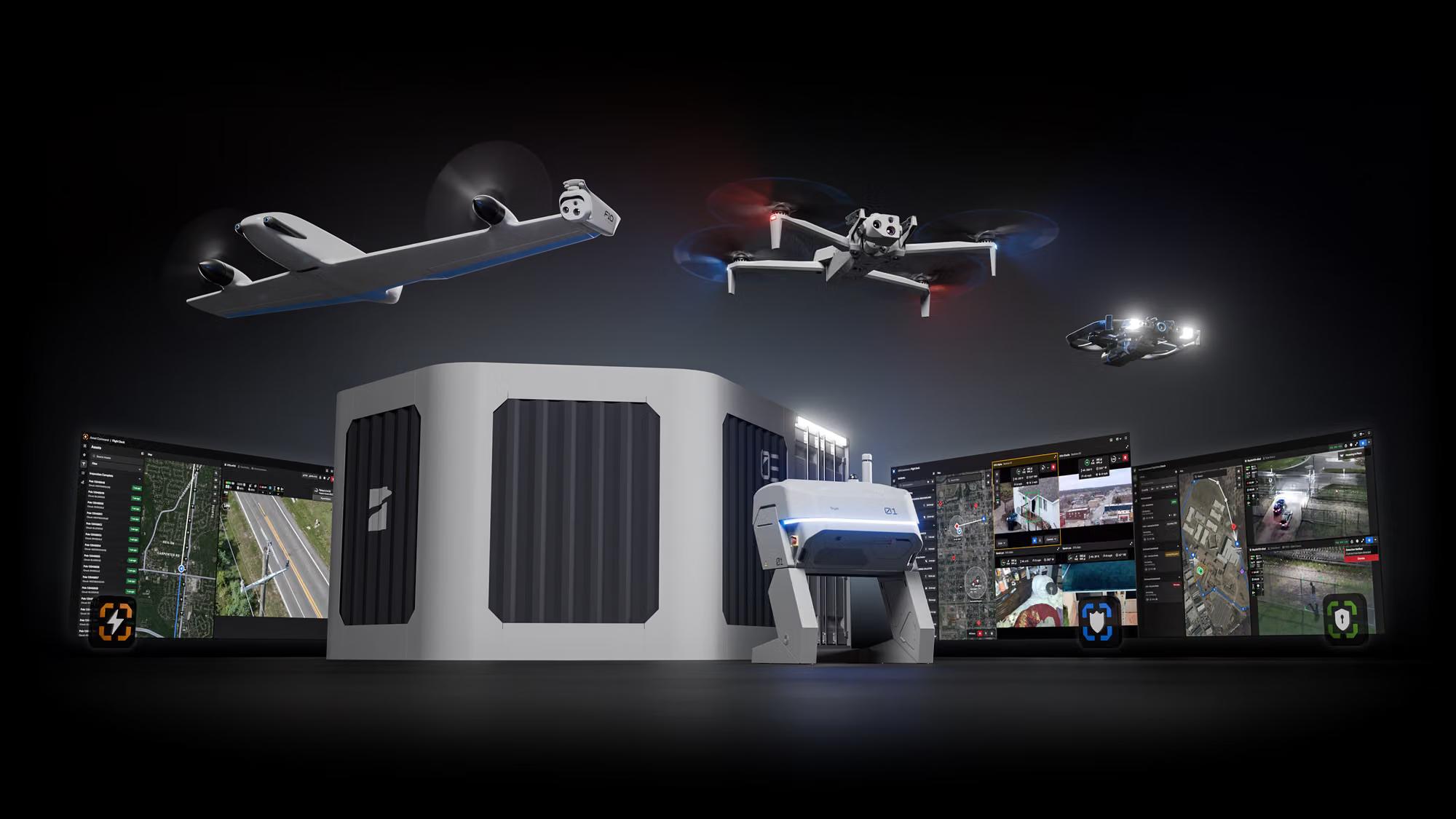
A Decade Building Toward the Same Goal
Skydio was founded in 2014 on a bet that flight shouldn’t need to depend on the expert skill of the person flying it. Over the past three years, that bet has taken the shape of X10 and R10: a quadcopter and an indoor drone, both running the same autonomy engine, both capable of flying a mission with minimal input from an operator. X10 handles outdoor response within a few miles of its dock. R10 brings that same autonomy indoors, into buildings and confined spaces a quadcopter can't clear. Together, they're the start of a family of flying robots built to give superpowers to the people in our most critical industries: eyes in places they couldn't otherwise see, and response times no human team could match alone.
And that family is flying more than ever. Skydio's customer fleet now logs 2,000,000 missions a year, more than half of them from a dock. Skydio Paraverse, the company's digital training environment, has logged over 50,000 practice flights, and operators who train in it are four times less likely to have a real-world incident. Pathfinder, the fully autonomous point-to-point flight capability built into every Skydio aircraft, has now flown more than 600,000 miles on its own.
But what neither aircraft solves is long distance and very high speed. Residents experiencing an emergency in rural counties can find themselves waiting 45 minutes or more for a sheriff’s deputy to arrive because nothing can get eyes on a scene faster. A utility sends a crew dozens of miles down a transmission line to find one fault, because nothing autonomous can fly the corridor and report back. High-speed pursuits stay dangerous for bystanders in part because nothing can safely watch from above at highway speed and highway distance.
Today, Skydio begins to close that gap.
A Revolution in Aerial Intelligence:
F10 Lightrunner and MegaDock
F10 Lightrunner, Skydio's first fixed-wing aircraft, is built for the times when emergency response, search and rescue, and asset inspection missions are measured in miles and time is of the essence. Deploying to customers in 2027, it’s designed to launch in seconds, fly at speeds up to 100 mph, and give leadership a live aerial view while ground units are still en route.

F10's SideEye design moves the camera off-center, outside the rotor plane, keeping the wing out of view. The result is that a subject stays in steady view through every maneuver, without a blind spot forcing a break in the coverage. It's an unconventional-looking airframe built around one job: keep the camera on target.
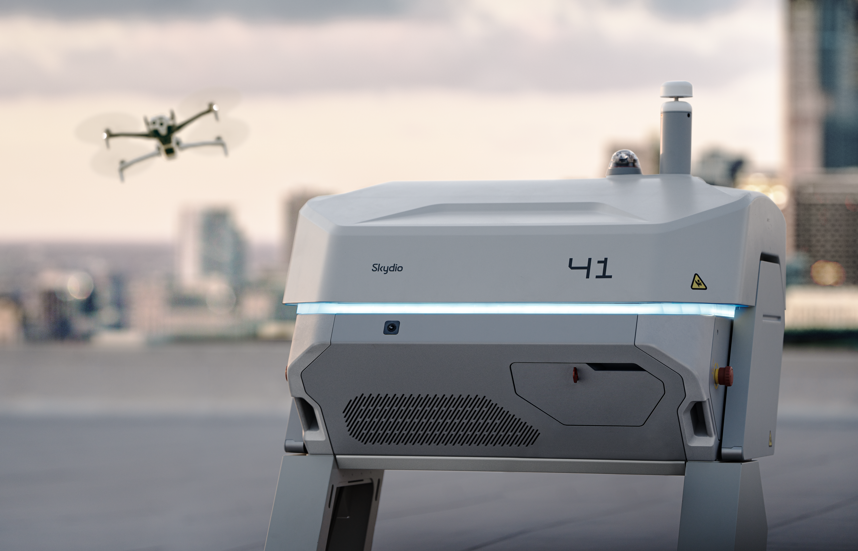
Ground crew won't be required to run it. F10 uses a Robotic Takeoff and Landing (RTOL) system, a suction-based robotic gripper that launches and catches the aircraft on its own. MegaDock, the dock built for it, will house up to five F10s so a team can serve concurrent missions.
It's built to handle real-world conditions, not just easy ones: autonomous launch and landing in significant wind, flight day or night and in moderate rain, an integrated parachute, and Connect Fusion+ combining multiple cellular connections to keep command, control, and live video resilient across a long-range mission. Pathfinder plans F10's route before launch, accounting for terrain, structures, agency boundaries, geofences, and airspace restrictions. Foresight, part of Skydio Autonomy, handles what happens once F10 is airborne: it continuously fuses aircraft state, environmental conditions, and obstacle data to adapt the flight path in real time, maneuvering as conditions change to keep the subject in view and the mission on track. The Skydio Airspace Assurance System (SAAS) combines real-time airspace data, an organization's own policy settings, and onboard perception to keep every flight compliant and safe, including automatic maneuvering away from nearby crewed aircraft if a pilot doesn't respond in time.
None of this required a new autonomy engine. It's the same one already flying hundreds of thousands of X10 missions, extended for the first time to a form factor built for distance, speed, and endurance, and part of the same family of flying robots that includes X10 and R10, all built on one autonomy engine and orchestrated by one set of Skydio Command software.
A single MegaDock, with F10's 30-mile flight radius, puts nearly 3,000 square miles within reach of one launch location, enough to bring a 15-minute response time to an entire rural county that previously waited 45 minutes for lights and sirens to arrive.
One Controller for a Growing Fleet
We also introduced Controller 2, built to deliver a more comfortable and capable flight experience for operators in the field. It's got a big, bright 7-inch display, visible even in direct sunlight, a 5.5-hour runtime, and an IP55 rating to handle moderate rain. Augmented reality street overlays, one of the most requested features from field operators, are coming to Controller 2. It begins rolling out internationally this fall, with availability expanding from there.


A redesigned Cockpit, the flight interface for remote and multi-drone operations, keeps the video feed clear of clutter, with every element in a predictable place so the screen doesn't get harder to read as more aircraft feeds come online. Automated on-station relief extends that further: when one aircraft needs to recharge, another takes its place automatically, so a pilot managing a scene never loses eyes on it.
A Software Platform For the Work You Do: Asset Command & Security Command
We have long believed that the drone should work for you, not the other way around. It’s that belief that has fueled our foundation in Autonomy. Too often, organizations have had to build specialty teams of drone experts who have had to adapt core business workflows to fit the capabilities of a drone program. It’s not an inspection program; it’s a drone program that performs inspections. It’s not a security patrol; it’s a drone flight performing a perimeter patrol.
Two years ago, we announced DFR Command, a software platform that orchestrates fleets of flying robots to deliver better public safety outcomes, built directly into how public safety agencies operate. Since then, we have deployed more than 1,000 docks to public safety agencies, who are now flying close to 100,000 missions each month and arriving on scene first about 70% of the time. The FAA has issued 400 beyond-visual-line-of-sight waivers and 100 multi-drone waivers to Skydio DFR customers, representing 80% of all multi-drone waivers issued to public safety nationwide. Today, 28 million Americans live within response range of a Skydio Dock.
Now, we are announcing two new software platforms to further bring flying robots directly into an organization’s existing workflows.

Asset Command starts from the premise that operations already run on assets, so drone inspections should too. It imports an asset inventory directly from GIS, CMMS, or another system of record, so inspections begin with the same context a team already uses. From there, the software determines the right action for each asset: fly to it, inspect it, or respond to it, with the capture standard and repeat schedule living with the asset rather than the individual mission. Media comes back tagged and sorted automatically, with coverage and completion metrics rolling up as inspections finish. It's built for organizations maintaining large portfolios of fixed infrastructure, and critical infrastructure providers including AEP, Chevron, Dominion Energy, and Southern Company have been early partners in building it.

Security Command turns fleets of flying robots into a scalable physical security force, capable of patrolling, detecting, and responding to threats continuously. An alarm tells a security team something happened, not what. Security Command dispatches a drone with live video in seconds, so a team can verify what's actually happening before anyone is put at risk. Coverage runs on schedule between shifts, after dark, or on short-staffed operations. One operator can oversee multiple drones across multiple sites from a single view, with every flight, detection, and operator action logged automatically so the footage functions as proof, not just video.
Both are available to purchase now, with general availability early next year.
And the software layer underneath every Command, formerly Remote Ops and Skydio Cloud, is now Ops Center: where drone operations come together to plan repeatable missions, fly remotely, and manage a fleet, its users, data, and integrations, and where a customer starts if their work doesn't fit neatly into any Command.
Sharper Eyes for the Existing Fleet
A new telephoto camera, VT300-Z Rev 2, is already shipping with new X10 and X10D units, improving image stability, detail, contrast, and autofocus. Two new software capabilities, available as a free software update, extend what operators can see in difficult light: ThermalBoost, arriving this winter, blends thermal and color imaging so dark areas of a scene stay visible without losing detail in lit ones. Low-Light Enhance, arriving next spring, stacks multiple video frames to clear up scenes that would otherwise look grainy or pixelated.
Transparency in Fundamental, and it starts with Skydio
Drone as First Responder programs have an incredible positive impact, and as a result, the more people understand DFR, the more they tend to support it. The best way to foster that understanding is with transparency. Transparency for public safety agencies takes many forms - sharing video and stories with the community of DFR in action, publishing a record of flying that an agency is doing, sharing the official policy an agency uses in deploying DFR, and more. We are rebuilding our Transparency Dashboard from the ground up, rolling out in phases. Arriving later this year, the new Transparency Dashboard gives public safety agencies control over exactly what gets published: which flight fields appear, how much detail shows in a flight path, a public policies page where agencies can share their DFR rules directly, a redesigned flight activity view, and a program insights page for sharing outcomes with the community.
Transparency means accountability. And that starts with us. We have delivered our quarterly update to our Reliability Dashboard, where we communicate our flight reliability rate, dock landing reliability date, number of parachute recoveries, and more. We publish our flight reliability data for everyone to see, we publish notices on major incidents and issues with our products, and we welcome public scrutiny on what we’re doing since many of our customers purchase our products with public taxpayer dollars.
Sharing Live Streams Just Became Easier, More Secure
Skydio is also launching a new Skydio Mobile App, a more secure, more capable way to share live video with command staff, those responding on the ground and other authorized users. FlightCast, a companion capability, keeps active flights visible on Operations Center screens alongside the rest of the incident picture.
Let’s Go
Twelve years ago, we started Skydio on a bet: build the skills of an expert pilot into the drone so it could fly itself. X10 and R10 proved it indoors and out. F10 proves it works at highway speed and county-line distance.
Watch the keynote to see everything announced at Ascend 2026.


In the coming days, we'll go deeper into F10, Asset Command, Security Command, and the DFR Command updates individually.
- Introducing Asset Command: Run Inspections From the Asset Out: October 6, 2026 1:00 PM - 1:40 PM PDT
- Meet F10 Lightrunner: Follow from above, not from behind: October 7, 2026 11:00 AM - 11:45 AM PDT
- Security Command: Always on guard: October 7, 2026 1:30 PM - 2:15 PM PDT