

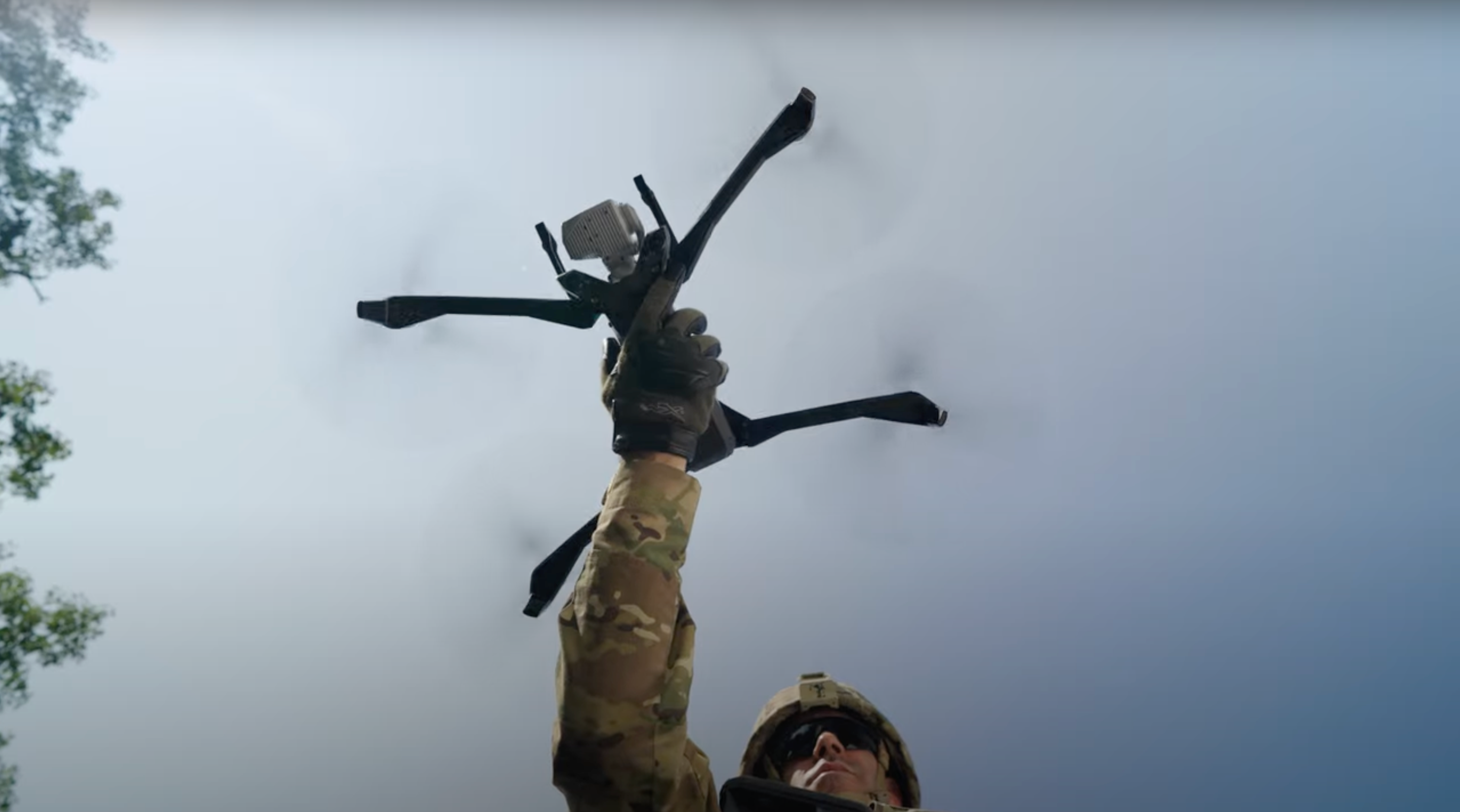
Inspecting the O’Callaghan-Tillman Bridge using drones
Traditional bridge inspection methods are slow, risky, and costly. In this discussion we hear from Michael Marshall, Bridge Engineer and UAS Program Lead at Stantec, to learn about how the company is using Skydio to revolutionize bridge inspections.
Stantec estimates that drone utilization can reduce bridge inspection time and personnel by up to 50%, resulting in valuable data and operational value for businesses. In this talk, you'll get to see firsthand results from an inspection conducted on the Mike O’Callaghan-Pat Tillman Bridge and learn about new inspection workflows that can cut inspection times and crews by up to 75%.
See why over half of state transportation agencies are adopting these workflows, walk through an actual bridge inspection, gain insights on how to quickly improve accuracy, and reduce the number of resources necessary for regular inspections.
Learn more about bridge inspection with Skydio.
- [intro music]
- Okay. Hi, everyone. Good morning, good afternoon, wherever you're
- joining from today. Welcome to this LinkedIn Live.
- Hi, Michael. Hi, Josh. Hi, Emma.
- Hello.
- Hello.
- How are you feeling? [laughs]
- Great.
- Yay.
- Um, I think we need to start by explaining why
- we're all
- wearing the same hoodie. [laughs]
- The best part of the webinar is our hoodies right now.
- Yeah, exactly.
- [laughs]
- Um,
- I think this was a... Josh, Michael, why don't you,
- why don't you explain what the
- hoodie is about?
- Yeah. So, um, it's kind of about our, with the project, we, you know, wanted to
- make sure we're a team. Not just, uh, Stantec, but everyone on site.
- Uh, so our drone team, our rope access team, uh, the DOT, uh,
- our,
- our traffic control folks, um, everyone there got a hold of these
- sweatshirts at least, and, uh, we wear them quite frequently.
- They're very... Yeah.
- Little back that shows the bridge on them and all sorts of stuff, so.
- Yeah. It's very cool. Yeah. It was, it was actually a great, uh, gift that
- Emma and I got, um, after a hard day of work, um,
- in the O'Callaghan Bridge with you.
- Um, so yeah, thank you again for that, for that present.
- Um,
- so let's maybe get started with, uh, some introductions.
- Uh, Michael, why don't you go first?
- Yeah. So my n- name is Michael Marshall.
- Uh, I'm a professional engineer, uh, at Stantec.
- Uh, been doing bridge and tunnel inspection for over 10 years
- now and, uh, a little
- bit of asset management as well. Uh, I'm a SPRAT level one, so a rope
- access technician, which you're gonna see in some of the
- slides, and I'm also a
- drone pilot.
- Cool. Thank you. And Josh, you go next, please.
- Hi. Josh Sexton here. I sit in Bluefield, Virginia with Stantec.
- I'm a reality capture technology manager, and I also, um,
- operate our global, uh, UAS program here at Stantec, so
- it's exciting to be here today.
- Thank you. S- um, yeah, we're delighted to have you here,
- both of you.
- Um, Emma.
- Yes. Hi, everyone. So my name is Emma Richmond.
- I am an enterprise account executive with Skydio.
- I'm also a part 107 certified pilot.
- Um, I'm responsible for helping Skydio
- customers
- identify and solve business problems, usually in the form of scaling a
- drone program. Um, I'm also responsible for assisting our
- customers
- throughout the entire evaluation process of our technology.
- So I do a lot of work with engineering firms, like Stantec, utilities, oil and
- gas, uh, just to name a couple.
- Yeah. Cool. Thank you. And for those who don't know me, um, I'm
- Alicia. Um, I work as a solutions engineer for Skydio.
- Um, actually, I'm helping Emma on the technical side of
- things,
- so helping enterprise customers, um, such as Stantec, optimize their
- workflows with Skydio hardware and software.
- Uh, my background is in surveying.
- I've been in the drone mapping/photogrammetry space, uh,
- for about
- 10 years now and have worked with, um, infrastructure net
- operators and a few, a couple of key, uh, vendors in the space,
- such as Trimble and, uh, Bentley Systems.
- Um, so yeah, welcome again to, to everyone.
- Um, excuse me. So for those who don't know, the bridge,
- the, the project we are gonna be presenting here today, um,
- is about
- the inspection of the Mike O'Callaghan-Tillman Bridge, uh, which is
- in front of the Hoover Dam. Which you, you might know that one better 'cause it's
- been part of a couple of movies, I think, big movies.
- Maybe you cou- like, do you know which ones?
- Transformers. If anyone's seen that, it's a great movie.
- [laughs]
- Cool. [laughs] Um, so yeah, during the last week of January,
- uh, Emma and I and, and Skydio team had the privilege to work
- side by
- side with the bridge inspection team from Stantec,
- um, on the inspection of, uh, the mentioned bridge.
- And, uh, just wanted to share a couple of facts
- about the bridge
- that I was looking up yesterday. The bridge has a length of 1,900
- feet, which is about 600 meters, um, and
- 1,060 feet, uh, of span.
- The striking arch overpass connects Arizona to Nevada
- over the Colorado River. It's actually a stunning place
- if you have the chance to
- go, um, and visit it. Um, and it's the second tallest bridge
- in the USA according to Wikipedia, couldn't find a [laughs]
- more reliable source, so apologies for that.
- Uh, this was definitely the large, largest infrastructure project
- that I've done
- yet with Skydio. Um, and I wanted to mention
- that kind of like to set the context, our collective
- goal, um, if I can say it that way, was to assess the
- value of autonomous drones, of Skydio solutions,
- uh, for bridge inspection, for, for, for the, for the Stantec
- team, um, and the potential of integrating this
- technology from operational practices, as we will see and talk
- about later, all the way up to more reliable
- and informed business
- decisions.
- Um,
- so that's kind of like the context of it.
- And now I'm gonna pass it on to you, Michael, and maybe ask you
- if you could talk a
- little bit more about, um, you know, pre-Skydio,
- pre-drones, uh, what those traditional inspection,
- inspection methods look like.
- Yeah. So, um, outside of the O'Callaghan-Tillman Bridge,
- a traditional inspection
- is typically two people, uh, a team leader and an assistant out on
- site, and they
- might have paper and maybe an iPad on site to take their notes.
- Um, and so the end result is essentially a written report with a few
- photos on
- the end, um, that's delivered to the, the owner of the bridge.
- Um, but here in O'Callaghan-Tillman is, is an example of how we use some other
- techniques such as rope access, uh, snooper trucks, maybe bucket trucks.
- And you can see here in this picture we have a rope access climber on the side
- there, um, with the snooper truck helping us inspect
- the superstructure.
- Uh, so prior to probably 2017 or so, um, it was solely done with
- rope access and snooper work. Um, so climbers
- would rappel down the columns and use what's called a belay technique,
- uh, with
- rope access and look at the arch, look at the columns,
- and then they would also
- rappel the columns individually.
- Um, but around 2017, 2019, we started integrating in, uh,
- drones to the approach columns. Um, and those were just the traditional
- manual drones, um, looking up and down the approach columns
- to try and-
- ... relieve some of that climbing that we had done, uh, for two weeks.
- So, um,
- yeah, that's kind of where it originated, I guess, and then we kind of moved into
- the, the Skydio side.
- Michael, can you, can you share or elaborate a little bit more on
- traditional
- drones and kind of what that, that means to you guys?
- Yeah. So traditionally or in the h- in, in the past, we've, uh,
- subbed out some of the work to, uh, specific drone, uh,
- pilots or companies that, that give us the, the drone work.
- And as, as we've melded into the Skydio system,
- uh, we've
- kind of gone away from that and gone toward,
- more towards the autonomous drones and
- what we're gonna talk about here in a bit.
- But essentially, um,
- before we've just paired a bridge engineer with the pilot or
- the company being used, and they would stand alongside
- and make sure that the data
- capture was sufficient for the inspection.
- Thank you.
- And Josh, maybe, um, you can chip in on,
- and kind of, like, explain how,
- how Stantec started looking into, into drones.
- What were the main key drivers, um, for Stantec to start
- looking into this, you know, new methods or new technologies
- for, um, inspection, uh, process?
- Sure. Um, you know, I think UAS provides a wonderful platform
- when you
- don't need a hands-on inspection, and you're actually gathering a lot more
- data,
- and you can start comparing that data over time.
- So one thing that everyone wants to talk about is a digital transformation, and as
- part of our digital transformation, we're doing better data capture.
- So, you know, we started with video and static photos.
- Now we're moving into 3D models, virtual twins, and then ultimately we
- wanna have digital twins for a lot of these assets.
- So specifically, you know, it's capturing data.
- A lot of times maybe we don't need, um, climbers or bucket trucks for
- hands-on access. Maybe it's just a routine survey,
- so we can take a first
- pass with a UAS. And something that's often, um, you know,
- not referenced is drones are a great, great equalizer too.
- You know, maybe we have staff with physical
- limitations.
- You know, a drone levels the pa- playing field for a lot of those
- individuals.
- It takes our load off our staff. It makes their job generally easier,
- and then
- it also is able to involve more staff.
- So it helps us leverage our staff better, and then it also promotes those people
- that may have phy- physical limitations.
- It promotes their career because this is another tool that they have so they can
- be
- engaged. So it's just a win-win for us.
- Yeah, that's a great point. And, and so I think you touched on a couple of
- points,
- um, you know, about Skydio. So moving on from your, you know, your
- journey looking into drones, uh, starting a drone program at
- Stantec and now, um, moving towards
- Skydio, can you tell us a little bit more about
- that journey?
- What were the main,
- um, maybe like the, the key value of like, you know, integrating
- Skydio into your portfolio and what's, what are the,
- maybe the, the aspects that you already seen or the
- impact that you already, uh, uh, already seen with, uh, integrating
- Skydio in your, in your inspection workflows?
- Absolutely. Um,
- you know, we're real happy with Skydio.
- Uh, we've been flying drones at Stantec since
- 2013.
- Um, we purchased our first drone. We actually had a full
- global governance by 2016, so we have a lot of stick time
- with our 70 pilots globally with drones, but those have all been manual
- drones. And we're seeing a big push in the
- inspection, uh,
- market specifically with transportation, um, and the built environment
- that we're leveraging this technology in new ways.
- And it makes sense for us to have our engineers behind the sticks
- because they know what they're looking for, and this is a tool-
- Mm
- ... for them to have aerial inspection, uh, limited access, hard to reach
- areas, and they can focus their efforts in
- getting there.
- And maybe they don't have to be in a bucket truck or, uh, with rope
- access. It lowers congestion. And with the autonomous drones,
- uh, the drones are getting smaller, the footprint's smaller. Uh,
- they're easier.
- They're more portable. You can carry them on an airplane now.
- And the learning curve is much lower with a Skydio drone we found
- versus, you know, our, our typical inspection rig, which
- is a Falcon 8, which is
- also a very good drone, but it takes a much higher, um,
- level of training, and then it still doesn't have the
- obstacle avoidance that the
- Skydio does. So, um, for a lot of routine inspection, the
- Skydio just makes sense just because of that built-in, um,
- object avoidance, um, 3D scan, all the autonomy that it offers.
- It's just a fantastic platform for this type of inspection.
- Mike, anything to add there? I see, um,
- you're, you're-
- No, I think that was great. Yeah. The, the one thing I'll add th- there is, you
- know, with the, with the traditional drones,
- typically you have a pilot and
- also someone who's, you know, the visual observer possibly operating
- some of
- the camera controls. Uh, so there's a lot of folks on site
- that you're using, plus
- the, the engineer that's also looking over how
- is the data capture
- being done. Um, but with Skydio, we've been able to kind of
- consolidate a lot of that with, especially with 3D scan, into one single
- person, the engineer, the, the 3D scan and the, and the data collection
- all into one hat essentially. And, um-
- Mm
- ... it's been a
- huge game changer.
- Yep.
- And Emma, maybe I can ask, um, you to,
- uh, like what would be the main, like for Stantec, but also,
- like y- you, you've been involved with so many other
- enterprise customers.
- What are the main key, uh, maybe some of the aspects that,
- um, you know, like for example, the way design, assembly, and support in,
- in this
- space? I think that's-
- Yeah
- ... that's one. Do you wanna elaborate on that as well?
- No, I think, I think Michael, um, and Josh said it beautifully.
- I think something that I hear from a lot of customers
- is there's typically this
- kind of complexity gap when it comes to starting a drone program
- or scaling a drone program. A lot of times I hear
- that maybe they have a couple of
- drones, but they just don't really know where to
- go from there, and they don't know
- who they want to have, you know- Piloting the drones,
- they don't wanna have to go
- and, you know, hire, hire expert pilots.
- So for an organization like Stantec, for a lot of customers
- that I'm speaking with,
- I think scalability and ease of use is something that's really
- important and really critical. Um, and it leads to just a lot more
- value for the organization. Um, a lot of times companies
- can, you know,
- start flying maybe a traditional drone, and they just can't necessarily find
- value out of it just because of the scal- scalability reason.
- I think that's a big one.
- Mm-hmm.
- Um, from a, like, Skydio partnership perspective,
- um, I think this is something that's really
- unique about Skydio.
- And, you know, we're, we're definitely not naive to the fact
- that scaling a drone
- program, it can be very difficult.
- It can feel very scary for a lot of companies who haven't started.
- Um, so we, we take a lot of pride in helping our
- customers from the very
- start of their journey to identify, analyze business problems that they
- have, um, and that can be solved by scaling a drone
- program.
- Um, and we, we do this by taking a very consultative
- approach, right?
- So helping our customers evaluate the Skydio drone technology from start to
- finish,
- and this can be in the form of, you know, a lot of different ways.
- So technical workshops, value assessments, and then in a lot of cases,
- and in, in this case we're discussing today for
- Stantec, that could be us coming on
- site and doing a proof of concept, a workshop,
- and getting really hands-on with our
- customers.
- Yeah, absolutely. Yeah. Thank you for that.
- And it is a good example, like you and me going on site, um, you know,
- with Michael, Josh, and the team and helping them to truly
- assess the, the value of our solutions.
- Um, but, but it didn't stop there. We are very continuing growing and,
- and understanding their needs and requirements and helping them to,
- you know, be
- successful, um, integrating this technology
- and optimizing,
- um, their workflows. Um, just for those who are
- maybe less familiar with Skydio, I just wanted to mention very briefly,
- and you can find all this information online, um, but when we talk about Skydio
- autonomy and that obstacle avoidance, as we call it, um, the drone is
- equipped with six 4K cameras, um, which you see the,
- the six bubbles there. So that would be kind of like what the six
- cameras see when,
- when the vehicle is flying. Um, and we have a high performance processor
- on boards which, um, both together creates a map,
- uh, a 3D map of the surroundings, allowing the, the,
- the drone to understand its
- environment and making decisions real time, as you can see, um,
- in those couple of videos. Um, and using the 3D map,
- um, the drone can navigate and avoid obstacles in real time,
- even in complex and dynamic environments.
- Um, this video here is from a, um, another
- tool that we have, which is called the Super Zoom,
- which allows you as well
- to, uh, zoom out for a six- 360 degrees, which is
- super cool when you are, like, in a very tight and confined space.
- It gives you, like, a very good overview, um, of, uh, the
- environment.
- Um,
- yeah, so just wanted to kind of, like, set a, uh, [laughs] for those who haven't
- seen or haven't, uh, are, aren't as familiar with Skydio technology
- as,
- as we are. Um, and maybe just to,
- um, add a little bit more of, um,
- you know, value into the conversation, um,
- uh, we've talked about the pain, uh, we've talked about the value, um,
- maybe high level value. Why don't we, maybe Michael, if you could talk more
- about, you know, the specific, the, the, the changes you've seen.
- And I, and I would love to actually do this
- webinar again in a year from now and at
- two y- in two years from now because I think
- [laughs] I think these numbers are
- gonna be, like, super interesting.
- Um, the- we, we started t- we started work- working together, like,
- a few months
- ago, but you've already seen a massive impact
- on
- certain operational numbers. So why don't you talk more about that,
- please?
- Yeah. Yeah. Exactly. So yeah, traditionally before we,
- we brought drones in,
- uh, this Ocala and Tillman project would take
- around two weeks of at least eight
- climbers, and then you have all the rest of the
- staff on board as well.
- Uh, operators for the snooper trucks, three to four of those.
- Uh, traffic control managers, at least four, possibly more,
- and an officer.
- Uh, and of course, there's, there's more of the team on site.
- But I would say at a minimum, that's what you're looking at for two
- weeks.
- Uh, by just integrating drones, we're able to bring
- that down to just one week.
- Uh, we bring, we keep that same staff of eight
- and then the operators and such,
- uh, but we're able to bring in a drone team
- and just look at a part of the bridge
- and completely reduce the staff down to, say, a drone team of three or so.
- Um, and one week of drone work eliminates or,
- uh, one
- week of drone work eliminates a week of climbing work.
- Uh, but then when we were bringing in Skydio, um,
- the obstacle avoidance and
- other things that we had just talked about, uh, it also reduced
- that down to just a
- couple of days. Um, so traditionally we've been able to use
- manual
- drones to look at corners of the, uh, the columns and go up and down and use
- video that we're gonna talk about here in a bit.
- Uh, but
- with Skydio, we are able to do that exact same data capture, uh,
- in just two and a
- half days. And why was that? It's, it's the pilot did not have the fear of
- crashing into the bridge. Uh, did not have that, even though we would
- lose GPS reception when you get up to the top
- and kind of tuck yourself into that
- steel girder, you're still in full control and,
- and object avoidance.
- So you're not in that fear of hitting the bridge,
- and you can get close to capture
- that data. Uh, so with that, the data capture was much
- quicker.
- For sure. Yeah.
- May- maybe that's a good transition actually
- into, yeah, our next slide here.
- Mm-hmm.
- So I, I guess question for you, Michael, from me, um, you know, so, so we know
- that when making, you know, purchasing decisions,
- organizations typically need to
- consider the financial impact, right?
- So can either you or maybe Josh, whoever wants to chime in here,
- can you guys walk
- us through your thought process when it comes to justifying an
- investment in technology like this for bridge inspections?
- Yeah. I, I could start with the, the bridge side at least, you know.
- In the, in the terms of this project, when you take away
- that amount of labor force
- and, and hours, uh, throughout the week, you can take it down from, let's say, a
- $200,000 cost in two weeks down to about 105,000 in a week.
- Um, so that alone helps you justify the, the purchase of a drone or
- some of the software that comes on board with it Um,
- and then Josh, from your
- perspective, taking it from there.
- So I, I won't talk about the numbers. I'll just talk about the impact.
- Um, you know, with the traffic control, it's a major operation.
- There's a lot of folks involved in a survey like this, especially a big
- one like the Callahan Tillman. You know, there's a lot of congestion, and
- everything we do, we try to do safely, you know.
- But we're taking the load off of our individuals. They're not having to climb.
- You know, we're able to
- access those, um, assets from a safe spot on the ground.
- And, you know, we're not creating traffic congestion
- because we don't have to have
- those folks on the deck, you know, blocking a lane of traffic.
- So, uh, just the impact to, you know, the operations of the
- highway in this instance are just huge.
- Yeah. And actually, uh, following that, I would like to read a question
- for you guys from Ross. Um, did
- the EOR, EOR, sorry, have a contingency
- plan for rope access if anything required a closer look, or
- is the
- drone tech really advanced enough to meet the necessary standard of care
- if an aerial defect is discovered?
- Yeah, you nailed it, Ross. Uh, one thing that we're looking for is,
- is making sure
- we have the bridge engineer on site during the data capture, right?
- So they're reviewing not just the, the pictures and the video being taken,
- but
- also the 3D scan. Um, so yes, when something might be seen,
- uh, we can at least, uh, you know, relay that back to the rope access
- technicians
- and say, "Hey, we, we need to actually rappel this
- and take a look at a certain
- location." And that actually saves time as well.
- You know, we can f- hone in the exact locations where we need
- hands-on
- access to and not necessarily just drone everything.
- 'Cause in the end, you know, hands-on access is still kind of part of
- our industry.
- Uh, but the drone helps us key in on those
- certain locations that we might wanna
- have more attention to.
- And one thing you may wanna bring up, Michael, is the drone can actually get to
- spots that rope access or bucket trucks have a hard time getting
- to.
- So if they see something that they can't easily assess, you can
- send the drone in to take a closer look for them.
- Yep. Great.
- Um, thanks for answering that. And, um, yeah, like I, I
- think one of the
- biggest lessons for me being on site with you guys was,
- um, like, uh, you know, moving on to the,
- your specific journey with Skydio and, you know, um,
- from starting from zero to capturing high quality
- data with, with our solutions. And, um, being part of that
- journey, I could see the massive impact.
- Like we were in on site for a few hours.
- Michael, I don't know if you remember this.
- Um,
- we did a few flights, uh, just kind of like testing, uh, what
- was the best
- approach and which we will, we will talk about a, a bit more about,
- um,
- uh, in the next slides, uh, in terms of like flight planning and, and
- planning your mission. But what I wanted to say is
- that a few hours within, I think
- it was before lunch, you were like, "This is insane.
- Like this is just a, a, you know, we've, uh, we've captured all the data,
- uh, potentially that I needed for, for this specific inspection, and
- I was expecting to have to be flying for a couple of days," or
- something like that. So that, like it was an immediate value,
- um, for you, and that was, for me, was yeah, incredibly
- rewarding to see that on site. Um, yeah.
- Yeah, I mean, it... I had experience with, you know, the other drone work that
- we've done on site and, you know, having a week-
- Mm
- ... long time, it- you have to account for the wind
- conditions and things we're
- gonna go over. But, you know, I expected things to take a lot longer.
- Uh, but when we started, you know, using 3D scan,
- things we're gonna see here,
- yeah, you could immediately see, you know, we're collecting this data rapidly and,
- and accurately as well. It's, uh, we didn't necessarily...
- We actually collected more data in a smor- shorter amount of time with Skydio, so
- it was-
- Yeah
- ...
- it was a great-
- Yeah
- ... experience.
- Um, and actually maybe for, um, people who joined
- today that, that I expect and I, and I hope that they will be,
- uh, um, you know, looking into Skydio, uh, soon for, for
- their workflows and inspections, um, maybe let's talk
- about that's, you know, the journey, your journey on site, kind of like
- learning and getting up to speed with this technology, uh, talking about drones in
- general, but also Skydio. Um,
- so when it comes to flight and mission planning, like I think, uh,
- we were
- rehearsing or, or talking about the presentation a few
- days ago, and I was like,
- "Uh, you know, for me, the very basics, we don't even need to, need to mention
- airspace, permits, weather." It was like, we do need to mention them, right?
- If you're just getting started, um, this, uh, you know, it's very
- easy to, it's very easy to overlook certain things,
- but, um,
- when you go on site, if we haven't planned your mission,
- it's gonna be...
- Yeah.
- Yeah. I mean, the first thing I look up, you know, whenever we get a, a
- prospective bridge to, to inspect with a drone, it's,
- it's airspace, right?
- So in this case of-
- Mm
- ... Callahan Tillman, it was, you know, a part of the airspace was federally
- restricted, so we had to get that permissions done.
- Uh, but also when you're looking at maybe
- Class B airspace and getting closer to
- airports, if you're, if you're having to fly in those
- environments, you need to
- start looking at waivers and permits to, to actually fly in those, uh,
- environments. Uh, but the other big thing with bridges is,
- you know, that you can
- usually not account for is, is the, is the weather.
- Um, wind, you can look at weather reports all day,
- but, uh, bridges
- create this tumbling effect, and, and also the environment around them
- create, uh,
- gusting and then things that could go wrong with drones.
- So, um, having that handheld on site and understanding your weather conditions
- is,
- is really, really important.
- Um, but-
- For sure. Yeah. And it, it might, it might actually like affect even the
- performance of the drones. Like-
- Right
- ... um, so you can't, you can never be, uh, you know, too careful with
- these things. Yeah, for sure.
- Great. Yeah. And then, uh, the next thing for bridges is, you know,
- the bridge is
- there for a reason. Unless you have an o- an o- an underpass underneath the bridge,
- typically the terrain under a bridge is not suitable for, uh, you know,
- a helipad, for example, uh, for a takeoff and landing zone.
- So you need to account for where are we gonna take off
- and safely land this drone,
- uh, and also be able to keep our visual line
- of sight, uh, to check box that,
- check that box off, um, and be able to do all of our work
- efficiently.
- Um, let me just, uh, take a quick break and, and go
- over a question here from Mark. Is there any disruption
- or loss of signal while the
- drone is in the air? Will it be able to navigate back to its
- take-off and landing point automatically?
- Um, do you guys wanna take this one?
- [laughs]
- Yeah, yeah, I can help with the experience.
- So I, prior to Skydio, I had some experience with, uh,
- other types of drones on
- bridges, and I would say the first thing I noticed,
- you know, putting a, a
- conventional drone up underneath a bridge, the GPS loss, and
- of course, that tunneling effect we just talked
- about, it made it really uneasy.
- Uh, and you, you are focusing more on the drone than
- you are the bridge inspection
- in some cases 'cause you're, you're focused on not hitting the bridge
- and losing
- all of your data. Uh, but with that, you know, with Skydio, there
- is an ability to, you know, if we lose signal in any case,
- it is able to come back to us, and also use object avoidance to come back
- to us.
- And on the flip side of that, with the manual drones, on a bridge site,
- if it's,
- you know, has a pier or something in the way
- when it's on its way back, it may not
- avoid that path. Or let's say that path is impeded, even if it follows the same
- path, uh, how it got there, um, it may have a crash.
- But with the Skydio, it's at least able to do object avoidance,
- and you can help
- customize where you want that safe zone to be.
- Yeah.
- Yeah.
- And,
- you know, the loss link procedure is better with the Skydio solution,
- and that's
- one reason why we like it, is because with enterprise autonomy,
- it can
- navigate, uh, based off vision instead of GPS for
- returning to home,
- and that's a huge safety, um, margin that we, we
- enjoy, you know? And that's one reason why we deploy the
- solution.
- Yeah. Yeah, thanks, thanks for answering that.
- And I just wanna ask on top of that, uh, with Skydio,
- which I think we show in one of the earlier videos, you can,
- you can do a take-off
- and landing from the hands, like hand take-off and hand, um,
- landing, which is very handy when you are, like, in a,
- um, you know, you w- you, you, you need to...
- You don't have the space, or you might not have the time to, uh,
- go in different
- locations. Um, so yeah, very easy to deploy, very,
- um, user-friendly for sure, and, um, you know, reliable and
- safe throughout your operations, for sure.
- Um,
- and, uh, just before we move on, I wanted to touch base on the
- hardware and data requirements, um, 'cause this is something that I
- think people overlook when they go on site.
- And it's like, it's always the, uh, the idea is that the more data you
- capture, the better. Um, but I think it needs to come, you know,
- like, before you go on site, you need to think about what
- are the hardware
- and, and software requirements in terms of,
- like, deliverables,
- um, and from there build your mission and identify how
- many batteries are you gonna be requiring, you know, the software that you're gonna
- be processing the data with. Um, maybe Michael, what are the main
- deliverables that you are providing to your customers?
- Well, Michael and Josh, um, in your case, what were the key
- requirements for this inspection?
- Yeah, so I can talk to the baseline, I guess, for bridge inspection
- and give it to
- Josh for the digital side. But, you know, we have to understand that bridge
- inspection traditionally is a written report with photos.
- Uh, so that's at least what we need to get our
- data into at some point in time.
- Uh, but we're migrating more towards the
- digital world, right?
- So we're more, moving more towards the digital twin,
- and how are we gonna deliver
- that to the client? How, um, some clients might not have access
- to the 3D modeling world or have, uh, the ability to process some of
- this data. So, how will we get that data to them and, um, and
- essentially deliver the report in that, in that digital package?
- I have a question if, if I could jump in.
- Um, can you tell us a little bit more, Michael or Josh, like
- why, why a digital twin? Why a 3D model versus, versus manual
- capture, versus just flying the drone, capturing video or just taking, you know,
- a
- handful of images?
- Yeah, so and you'll see 3D modeling here later
- but, you know, with video there,
- there's a time and a place for it, right?
- There's, um, if you just wanna look at a specific
- detail, we can go and,
- and take a look at that, take a video, take a still photo, and integrate that in
- the report quite easily. Uh, but
- the drawback to that is we're not...
- Unless you have a scale right on the structure or very close by,
- we're not able to put a scale to what you're looking at in the video.
- You're also not able to maybe, uh, measure or, you know, annotate ba-
- right on
- top of that. Um, the other drawback is you're at the mercy of how
- that video was
- captured or how the photo was captured, so you're only able to see what was, what
- was given to you. Um, so you're not able to see maybe the
- environment, uh, or
- what's going on around it. Uh, one example of this is, you know,
- with manual
- capture,
- you might see some staining on your pier or something like that, and you might
- write it down as, "Oh, we found staining through this video."
- But that might be
- caused by a drain up above, uh, draining right directly onto the pier
- below.
- So that's where a model could come into play.
- We can see the causes of the defects or the things that we're seeing, uh, and
- not just what is the defect in the video.
- And I think, you know, what the model does give you is that
- actionable visual intelligence that Michael was talking about.
- It gives you perspective. Uh, but going into that,
- if you're gonna create a model,
- you have to realize, are you doing it once, or
- are you doing it multiple times?
- Do you want the models to overlay? You really have to think hard about ground
- control. Um, if you're going to measure off that,
- you have to think about your
- GSD and your ground control plan, uh, you know, to
- accurately, um, align that model and be able to defend it.
- So, um, those are all things that we need to think about going into a
- survey.
- Or are we just looking, um, at the structure and, you know,
- looking for
- defects? Or do we wanna monitor the structure over
- time and use, uh,
- machine learning to map cracks and then see how they're propagating from
- year
- to year? So you know, have to have a good idea of your
- deliverable going in.
- Um, it's not just go out and capture data and figure it out on the
- back end.
- Yeah, for sure. It's the, the, the accuracy you require, the,
- um, pixel resolution, as you were saying, the ground sample distance.
- Um, so in terms of accuracy, just for those not familiar with g- ground
- control points, accuracy, resolution.
- Um, so ground sample distance, GSD, as, um, Josh mentioned,
- is basically the pixel size, um, which, um, Skydio,
- because we can get so much closer than other drone
- platforms to the object of interest, we actually can, can,
- uh, capture submillimeter, uh, pixel ac- uh,
- resolution. And then moving on to the accuracy,
- we have absolute and
- relative. Um, we're very good on the relative accuracy.
- We have a GPS on board.
- Um-
- And that allows us, like, if we-- The relative accuracy is very,
- is very handy when
- you don't need to, um, you know, look into that cadence, um, that we were
- talking about. Josh, Josh mentioned earlier before,
- when you do need to
- start, um, you know, where the object is in, in,
- uh, a place in the world and start measuring time after
- time, then you do need to place to have
- that survey grade that can be
- achieved with, um, control points, for example, or tie points or man- uh,
- manual tie points, um, you know, other software platforms.
- Um,
- cool. Let me, um... Before we move forwards, I saw a
- question coming through, uh, that I want to touch base on.
- Any interest or need in the Dock program to rinse and
- repeat the scans on a regular basis?
- Um, before you answer to that, the, uh, I encourage everyone to,
- uh, Google Skydio Dock. Um, it's, um, we've
- released this recently enough, and you can imagine, let's say someone
- mentioned to me was a, a customer who said it's kind of like a
- parking garage for
- Skydio vehicles. Um, so it basically connects.
- You can place it anywhere. Uh, we have the outdoor version and the indoor
- version, and you can place it anywhere, and the Dock will be safely
- kept, um, connected online.
- Um, so yeah, the idea would be basically for you guys,
- is that something
- you are looking into? Um, how do you see this?
- Yeah.
- Yeah.
- I think task-
- Go ahead, Josh.
- Yeah. I think task real-time visual intelligence
- is going to be
- key as we move into a digital revolution.
- Um, you know, and especially for these cadence surveys
- and also,
- uh, following catastrophic events, whether it be flooding,
- landslides, hurricanes, uh, earthquakes.
- You know, that's where the Dock solution on fixed
- assets, whether they be
- dams, bridges, um, whatever, are gonna be huge.
- And, um, you know, I think that's the next step.
- Um, currently, you know, moving into
- virtual twins and then digital twins, um, and that's when we'll really see the
- Dock solution take hold on a lot of assets throughout, um,
- this infrastructure market.
- Yeah, and I'll add onto that. Yeah, I agree with Josh.
- I, I, I think in terms of a bridge inspection,
- we still need to be there on site,
- right? But, um, in terms of an emergency, I think a lot of our bridge owners are
- starting to see the flooding that's happening throughout the US right now, uh,
- going into the spring season and, and possibly earthquakes.
- So imagine instead of having to deploy multiple teams to go check on your assets,
- we can deploy a Dock solution, uh, right there on site
- and be able to see real
- time what is going on on a day-to-day basis at our bridge site.
- It's, uh, is huge. So yeah, we're looking into that.
- Yeah. Can't, can't wait to start working on
- that with you guys for sure.
- Um, okay. So
- moving from manual data capture, so those videos and
- images, high quality images, um, into the more
- automated, uh, data capture. Um, and that's gonna answer a few
- of the questions that I'm getting right now in terms of
- like did we create a
- three-sixty model? Um, how's the data capture?
- What platforms did we use for the data processing?
- Um, so very briefly, three-D Scan, for those who
- are less familiar with Skydio, let me see if I have a video here.
- Um, so th- three-D Scan is the software that sits, um,
- on our enterprise, uh, subscription, and it
- can visually assess, um, or explore, um,
- as we call it in the software, a specified structure.
- Um, so you create a binding box, um, and then
- autonomously generates and executes a flight path to
- ensure high data quality is captured and then that can be
- used for inspection and three-D mapping, um,
- or three-D modeling. Uh, during the scanning phase, it creates an
- overlap heat map, uh, which I think you can see in this
- slide here. Not
- very easily, but if you google Dash, there's plenty of videos.
- Dash will show you.
- But that's kind of like the purple blurb, uh, blurb, sorry, allows you to,
- uh, see the overlap and the data capture real time combined
- with mixed
- reality. Those are the squares is each of the pictures
- that the drone has taken.
- Um, so it basically takes away the need for
- any
- operators to have any previous experience on photogrammetry.
- You are literally telling the drone, "This is what I want to capture,"
- and then the
- rest, um, you know, Skydio three-D Scan does it for you.
- Is that fair to say?
- Yeah, I think, yeah. The only thing I'd add to that, you know,
- for bridge
- inspection is, you know, before you're, you're maneuvering the, the sticks
- around or maneuvering the, the drone around,
- here we're able to tell it, "Here's my
- object that we're looking for.
- Go get me the data that I need to do a three-D model."
- And while we're doing that,
- I can also view the screen without having to fly and see exactly what,
- what's going on with the bridge and be able to look for those defects
- and things
- like that and really focus on the job at hand. That's, is bridge inspection.
- And one thing I, I will mention there, Alicia, and I know you know this, um,
- you also have to consider what asset you're looking at.
- Concrete is very forgiving for-
- Yep
- ... photogrammetry, but steel girders, for instance, or if you're monitoring
- an area that has a homogenous, um, you know,
- capture area like a forest or sand and so forth, you have to really
- increase that overlap front and side.
- So you do have to have a good basic understanding of photogrammetry to
- get a deliverable that's suitable for your process,
- so.
- Yeah. And this is a very good, uh, thing to
- touch. Like, I, I guess that's even looking at
- Stantec and how you guys do the, the drone inspections, uh, someone as
- experienced as yourself, uh, Josh, is like, you know,
- defining the data requirements as well. So, like, what's the overlap?
- So it's kind of like helping, you know, those bridge inspector, inspectors
- that are
- gonna be flying drones to, to kind of like go on site,
- focus on those high
- quality tasks, and don't worry about...
- You know, they, they will, they will know and,
- and hopefully have that operational
- procedures that tell them, "Hey, this, uh, three-D capture is for a-
- 3D modeling, so you need 80/80 overlap, um,
- 80% overlap and, and so kind of like those couple of
- requirements
- that, uh, you can change with the Skydio, but it doesn't fall,
- um, on the operator. Is that fair to say?
- Yeah, versus a manual drone you're not trying to
- estimate, do I have
- 70/70, 80/80? Which you generally just take too much,
- and that's the beauty
- of the Skydio. Uh, the fact that you do set the front
- and side overlap, and then
- it takes care of the rest.
- Yeah. Exactly.
- So, and it-
- You, you cannot... You can only change the overlap
- and the ground sample distance,
- which is the distance to the objects of interest.
- And it keeps the GSD consistent, which I think shows that helps with the
- stitching process immensely.
- Yeah. Yeah.
- Another, another component that I kind of wanna mention about the 3D
- scan solution
- as well and in addition to the automated workflow is the edge model viewer.
- I don't know, Michael or Josh, if you guys wanna talk about that.
- So, you know, after the drone completes the 3D scan
- mission, um, what you
- guys are actually seeing on your controller after.
- Uh, yeah. I mean, we... There's a lot of different visuals you can
- see, and I don't
- think there will be a video on that, but you're able to see, you know, one,
- how is
- it being captured and what's the total picture of it.
- But what I really liked is, you know, I'm not able to necessarily be on every
- single controller. So when it comes back, we're able to see that ex- that model at
- the very end and, and at least view the data as it came in.
- Um, and see that before we say, "Okay, we have the information we need." Um,
- or the
- bridge inspector can at least look at it and say, you know, "We're not seeing any
- hot button issues that we need to look at with the rope
- access." So yeah, that was
- really helpful.
- I think that's just to... Before we move on really quickly,
- I think that's
- something that I hear from, you know, a lot of engineering firms, a lot of folks
- that are utilizing 3D scan today, right?
- Is after the automated flight plan, you do have that edge model viewer like
- Michael
- was just mentioning. So you see the raw images.
- You can actually see kind of a, a low-resolution version of the model on
- your
- controller. And why that's valuable is it's going to eliminate the
- re-fly time, right? So you don't have to go back to your
- office, home, upload the
- data, process the model to see that there's a bunch of gaps everywhere.
- You can actually see in the field if you have full coverage of that model.
- Um, so it eliminates the re-fly time, which is very valuable.
- Yeah. Thanks for that notes, Emma and rest.
- And before we show you the 3D model, um, I just wanted to
- mention the 2D low cup, uh, functionality.
- So 3D scan has, um, different workflows for
- specific, um, infrastruc- uh, infrastructure types.
- So 3D scan would be for any type of object.
- We have like, um, tower scan, and we also have 2D,
- uh, both GPS and without GPS. And this one here
- was released a few months ago and, um, basically allows
- you to capture, um, collect images with the
- camera facing directly upwards. Um, so this is the
- underside of a bridge. I can... I have a quick video from, uh,
- Tent, Ted from Sky De- Deploy who, um, uh, allow
- me to show this on, on the presentation today.
- And it shows you how the data is actually being captured underneath the,
- the
- bridge. Um, Michael, this was for you.
- Um, I think you mentioned several times the
- value of this type of capture.
- As we saw in the slide before, the flight time was about 20
- minutes for, uh, I think almost like half of the Ocala-On
- bridge. Uh, production time in terms of photogrammetry
- processing was
- an hour, and the number of pictures was roughly
- 236. Um, so like in less than two
- hours, um, you could, you could have like very good
- context of your, of your environment and your, and your
- projects.
- Yeah. Uh, exactly, and, and that's for half of Ocala and H- uh,
- half of
- Ocala and Tillman, right? So when we took a look at maybe a,
- a two-span structure,
- which I've done, uh, such as the one in the video here,
- typically I've been able to knock those out in about 10 minutes of 2D scan up,
- be able to take it back and it, and it stitches in less than an hour.
- So now, not only have, do we have the information back
- from what does the superstructure look like,
- what does the bottom of the deck look
- like, but we also have the ability to take
- that model and then compare it over time
- quite easily. So, um, you know, in terms of 3D scan, you know, it's rather
- quick, but it even faster is just to do that 2- 2D up
- and be able to come
- back from the field with, you know, images that are right up against the
- superstructure. So again, looking at that ground level inspection that we're
- talking about, if I'm just walking underneath the
- structure and looking up, we can
- see quite a, quite a bit. But when we take a drone
- and put it maybe three feet
- below the superstructure and we're taking pictures
- and modeling that,
- now we're able to see even more and, and take that data back and,
- and be able to
- compare it over time.
- Yeah. And it also allowed us to... So k- kind of like part of the
- flight planning was, um, 'cause the, the key goal of
- the inspection was the piers of the bridge of, up one
- side of the bridge. Um, but we, we kind of like wanted to
- explore, if possible, to generate a 3D model,
- and we didn't have any control
- data or tie points. Um, so we were,
- uh, we, we, we're kind of like just testing this
- workflow.
- Um, and so we decided to do the best approach
- was
- to have like a 2D upward capture, so like underneath the bridge.
- Then we need, we, we did, um,
- um, Emma actually captures very successfully
- the 2D upwards and
- downwards, and then we capture each of the piers.
- And the interesting part, and I'm gonna start sharing your screen,
- Josh, is that
- we put all of that data, which was about 16
- flights, if I remember correctly, so the 2D
- and, uh, 14 of the different piers.
- And, uh, we were able to generate a comprehensive
- 3D model of, uh, half of the Ocala-On bridge,
- which I think it was, yeah,
- a massive success. Uh, Josh, why don't you tell us what we're looking
- at
- here?
- Sure. Um, this is the GenX platform.
- So this is one of the cloud solutions that we process this project in.
- And just for full disclosure, if you wanna learn more
- about that, uh, reach out to Russ, Brett, and Abraham on LinkedIn.
- You can find them in GenX. It's a fantastic platform.
- Like I said, it's a great ingestion pipeline for, uh,
- workflows like this.
- And we're looking at the O'Callaghan–Tillman Bridge here.
- You know, the nice thing about this, it puts everything in perspective.
- Uh, we do have some areas highlighted.
- This is a very new bridge, so it's really hard to find distinct
- features and
- failures on this bridge. There weren't any.
- But we just drew some, um, boxes around here so you could see
- representatively if there were problems, you know, how you could annotate those and
- so forth. But it gives you a lot of perspective on
- the ability
- to see the whole asset at one time, and the fact that
- photogrammetry is getting so good that it can process it-
- Mm
- ... you know, as one complete, um, job, not individual
- peers, uh, that was just a major breakthrough for us,
- and we were really happy.
- Um, and a note on this, we did fly this at a fairly coarse
- resolution.
- Um, Alicia, I think it was, what, 24 feet approximately?
- So-
- Um, yeah, probably.
- Yeah. The GSD was a little coarser, but we were, um, showing a pilot test.
- You know, we weren't absolute accuracy on this, um,
- you know, mining it with
- AI for crack detection. This is just, um, you know, capturing
- the asset and showing the possibility of the technology. But we can...
- Uh-
- Go ahead.
- Yeah. Sorry. No, and having that visual context, um, uh, that
- provides a 3D model like, like nothing else.
- Um,
- so
- do you recall the number of pictures, like the total number of pictures, Josh,
- for
- the entire data sets?
- I think it was around 9,000.
- 9,000 pictures. Yeah, that was... It was, it was processing less than...
- I think it was about 20 hours, something like that.
- Yeah.
- So again, in, in a day and a half, um, you know,
- you could be potentially training the team that needs to go next on the
- fields. You could be communicating much better,
- um, across different
- departments. Uh, you know, there's so much value in, in having
- that digital
- twin of your infrastructure. Um,
- Michael, Josh, how do you maybe...
- Oh,
- what are you showing there, Josh?
- [laughs]
- Yeah, we-
- Why, why don't, why don't you tell how, how we found, how we found this
- on site? It was so funny. We were on the call.
- Yeah.
- Michael, you were reviewing some pictures
- and videos.
- Yeah. So what Josh is kind of showing is, you know, how I would go through the
- inspection site. So one thing that I really liked about the Skydio
- drone,
- uh, with the 3D scan, is it's able to tuck itself in between the
- column and the
- rock walls that you're seeing. Uh, super beneficial.
- It's able to do that without the fear of
- hitting, let's say, you know, the pier or a piece of the rock,
- and then falling to
- the ground. And you can see in, in Josh's example, we actually did find,
- um,
- a drone at the base of one of the piers, and possibly a casualty
- of, of that exact thing. So, um, one thing that was amazing
- was just watching that
- Skydio, uh, go around and get the full context of what
- that column
- is, not just staying away from the rock wall,
- but the entire, uh, capture, and
- also turning around and looking at that rock wall so we can find defects
- that are possibly associated with that that could cause us problems with the
- bridge. So, uh, quite amazing.
- Uh, the other thing Josh is kind of showing here too is
- when we can click on the
- model there in GNX, we're able to also look at every photo
- that was taken of a
- specific location, and this was really beneficial for the inspection.
- So now we're back in the office, we're, we're looking through what did we find
- here
- on this bridge and, uh, reviewing our data.
- We're able to quickly move around, as Josh has shown, and, and look at very
- specific locations that maybe we have interest on
- and annotate right on
- top of the model or on top of the picture itself.
- Uh, the other thing I wanna note here is, you know, we have some, uh, video that
- actually came out of this as well as a, as a test run.
- We're able to put in that survey as well.
- So we can stack different surveys and different items on top of this,
- uh, and get a total inspection, uh, right out of this platform.
- Um, I have a question actually, uh, Michael and Josh.
- Um,
- Anthony's asking, "To do a 3D scan, do you have to stop
- traffic on the bridge if the drone flies over the traffic
- lanes?"
- Yeah. So, uh, one thing to note, you know, with, with traditional bridges,
- um, what... The way I've gone about that, yes, you would have to stop traffic.
- If you were to do a, a total 3D scan and just let the drone do everything,
- um, you would definitely have to stop traffic
- 'cause it would be up above the deck
- and possibly in the live traffic lane.
- But one thing that we did here on O'Callaghan–Tillman
- was we kind of divided things
- up and then stitched it all together at the end.
- So every column was essentially its own subject of a 3D scan,
- and you can use this on other bridges as well.
- You can look at just a substructure and say, "Let's scan the substructure.
- Maybe let's use 2D scan up to do the superstructure,
- and then maybe we do a manual
- flight off to the side of the deck if we don't have those traffic closures to
- stay
- away from live traffic." Um, so instead of thinking of it as let's scan
- the whole bridge, maybe let's scan the components
- and then bring all of our data in
- together at the end.
- Yeah.
- Yeah.
- And just maybe worth to mention that under current, uh, regulations,
- you are not supposed to fly over, over traffic.
- Um, but actually, uh, Skydio has a, an amazing
- regulatory service team, um, which, you know, anything that
- sounds overwhelming in terms of, uh, getting pa- permits, waivers,
- um, we have an amazing team that, you know, supports our sco- our
- customers getting a proper consolidated drone program and all the
- waivers and permits necessary, uh, to go along with this.
- Yeah. But just to speak to that too, you know, it, it's part of our procedure.
- We don't fly over people or live traffic.
- You know, we would take those with obliques off to
- the side.
- And a lot of DOTs are actually inspecting the deck of those
- bridges, you
- know, with terrestrial vehicles and systems like that, you know.
- So, um, the primary focus, I think, of a lot of Michael's work, and he can
- speak to this specifically, is the underside of the, you know,
- the superstructure,
- the piers, and that sort of thing. Um, not so much the deck.
- Yeah. Yeah.
- Yeah.
- That's a good point. Um, I have another question coming from
- Daniel.
- "Will an engineer be able to take measurements of cracks
- based on a 3D model?"
- I, I can help. Uh, so-
- Yeah
- ... one thing that we're starting to vet and,
- and QA is essentially the crack
- detection softwares that are coming out.
- Um, so yes, uh, those are starting to, to come to the forefront of our
- inspection softwares. Um, but I would say, you know, in, in this
- case, uh, we were more concerned with trying to vet
- what the notes were from
- previously and be able to carry those forward.
- Um, so yes, we're able to see those cracks
- and possibly measure the lengths.
- The widths, uh, unless you have a, a detailed scale or, uh, possibly
- using AI detection, um, not able to do that exact width very
- easily.
- Yeah. And, and that's where you have to be really
- careful, too.
- Uh, that's where you really wanna make sure
- your GSD is correct and your ground
- control, um, is in place so you can actually defend
- that data.
- Um, and you know, that would be the workflow for that.
- But another thing that is great about the 3D model
- is the textured mesh.
- So if you have an area, uh, that is eroding, you can
- actually see that depth in three dimensions versus a
- 2D photo where you may not get the idea of that depth.
- So, um, it does-
- Yeah
- ... does have a volume behind it, which is nice.
- For sure. And I, I have been, uh, skipping some
- questions that touch, m- you know, topics that are a little bit
- off the discussion today, but I will, we will be following up on all your
- questions
- directly, one-to-one, on LinkedIn or other platforms, so don't worry about
- that. Um, just, uh, maybe like wrapping up and starting
- with closing remarks, um, I like to say
- probably for me, one of the biggest takeaway of this
- project
- was understanding that, um, you know,
- uh, like,
- a- autonomous drones, um, Skydio, is here to
- stay for inspection workflows, um, but are not gonna replace,
- um, you know, or do bridge inspections on its own.
- I think we should consider Skydio drones, and in general autonomous
- drones technology, as a, an additional tool to optimize inspection
- workflows. Um, and I think Michael, as you put it,
- um, uh, while we were there, the same way new hires are
- getting a laptop or an iPad, um, he would like them to get a
- Skydio, basically. So that's kind of like, uh, the, the...
- for me, it was the biggest, the biggest, uh, takeaway from the project.
- Um, let's, let's go around the table and, and hear your, your last thoughts or
- remarks. Maybe Michael, you wanna start?
- Uh, yeah. Uh, this project, I, I tried to look back on and find
- ways that we can improve, and it was quite difficult to do from the drone
- side.
- Um, it was very seamless. You know, a lot of the data was captured in,
- in maybe
- even a day and a half. Uh, and the extra day in there
- was to make sure we
- buttoned things up and had what we needed before we left.
- So I would say the, the sheer shock of seeing how quick, uh,
- drones
- can be integrated with a bridge inspection program, um, the type of data that comes
- back is, is really beneficial. Um, and yeah, it was...
- You know, there's lots of hurdles to think about as
- to where they can be deployed
- and, and how they can be deployed, but when they are, it's,
- it's an absolute game
- changer in bridge inspection.
- Thank you for that. Um, Emma, you wanna go next?
- Yeah, I can jump in. I'm gonna reiterate a little bit of what
- you said, Alicia, but
- I think something that I hear often from a lot of customers,
- right, is
- they're maybe scared that drones are going to replace their job,
- their jobs.
- But, um, here's the thing. Drone, drone technology, technology in general,
- it is meant to make your life easier.
- It's meant to enhance the work that you do, not replace it.
- It's meant to give you that time back so
- that you can focus on the stuff that,
- say, technology can't. So I think my takeaway here is
- that Stantec
- 100% has this mentality, and for this reason, you know,
- they were able to see tremendous value in the form of, you know, it might be
- mitigating potential risk for their employees or, you know, cutting costs
- in half by reducing field time, you know, by 50%.
- Thank you for that, uh, Emma. And Josh,
- how about you?
- I think UAS, uh, data capture is going to be, uh, extremely
- important as all, um,
- business units move into digital transformation.
- You know, and being able to safely compare, uh,
- over time, I think we're gonna
- see a move away from static reports and move into that digital
- intelligence, uh, mindset, creating common operational picture, um,
- where we can be better t- storytellers to our clients, you know.
- And, and being able to have near real-time, um,
- asset monitoring, you know, following events,
- moving into Skydio Cloud, you know.
- Though the one caveat I will say, and I think it's been brought up several
- times,
- is you do have to have a robust, uh, system to support your pilots, make sure
- you're doing everything safely, that you're following the law, um,
- you know, and
- that you're meeting all the require- requirements for your, your client
- and, you know, airspace that you're flying in.
- It's very important to do things the right way.
- And, and that's one thing we're really proud
- of, and that's one thing that Skydio
- also offers, uh, with their solutions, uh, which is great.
- Well, thank you so much to the three of you for
- being here today,
- especially to the Stantec team. There's been a lot of work put into
- this webinar, and I genuinely cannot wait to see
- what is next for Stantec and Skydio working together.
- Um,
- thank you everyone for joining today.
- Um, again, I will be following up on, uh, the team will be following up on all the
- questions and, and comments. Um, feel free to reach out to Michael and
- Josh for, uh, all things Stantec, and to Emma and
- myself for anything about Skydio.
- Um, thank you again, and, uh, hope to see you very soon.
- Thank you guys. Thanks everyone.
- Thank you.
- Thank you.
- Thank you.
Watch Time
54 Mins 47 Secs
Related Webinars
You've never been inspected like this before
Watch webinar
Demo: 1 Remote Operator. 2 Inspections. 1 Response. No Field Dispatch
Watch webinar
How Cross-Functional Data Powers Modern Utilities (Live from DTECH)
Watch webinar