

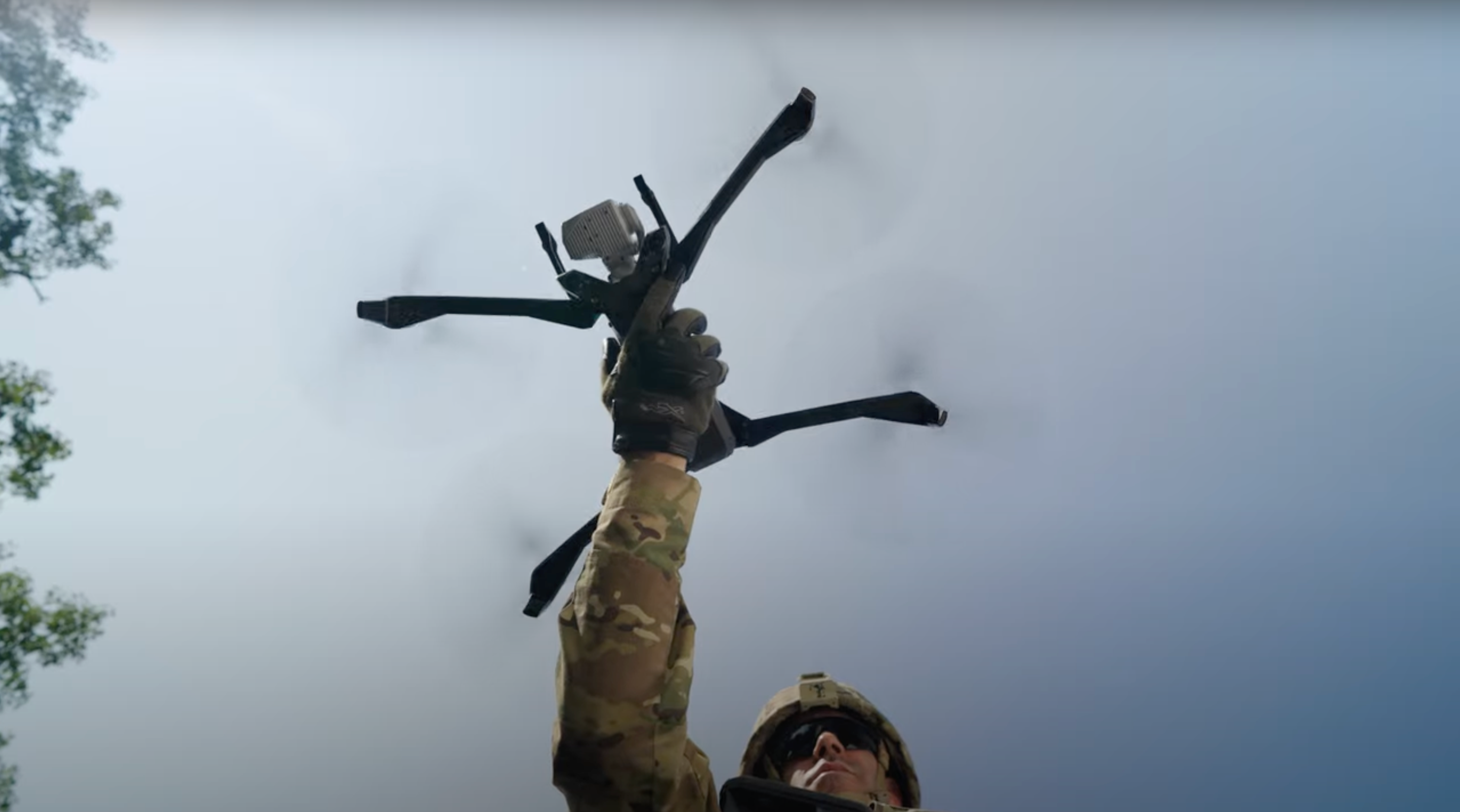
Summiting mount regulation for Drone as First Responder (DFR) programs
Dive deep into Skydio's approach to scaling DFR programs through regulatory efforts and discover how you can navigate the complex path of aviation safety and compliance.
Key Learnings:
- Regulatory navigation: Understand the step-by-step process Skydio uses to help agencies obtain necessary regulatory approvals.
- Safety first: Learn about Skydio's commitment to aviation safety and how they balance it with operational needs.
- Operational expertise: Gain insights from Skydio's team of experienced pilots and operators who bring real-world flying experience to regulatory solutions.
- Technological integration: Explore how Skydio leverages advanced technology, like ADS-B, for enhanced airspace awareness and safety.
Plus, you’ll hear real-world case studies of successful implementations of DFR programs, including tactical operations and remote piloting scenarios.
Learn more about Skydio Regulatory Services and Skydio DFR.
- I'm Jakey Stoltz,
- uh, part of the Skydio regulatory team, and, uh, thanks for taking an
- hour out of your day really to attend this webinar and learn more about our
- approach
- to, uh, scaling DFR through, through regulatory work.
- Um, so I want to pause quickly on, on even the title here of
- the webinar, Summiting, Not Regulation for DFR Programs.
- I just wanna kind of explain that, that analogy quick.
- Uh, this came to me a few months ago
- as a useful way to describe some of what the regulatory team does,
- um, how we help customers and kind of clear these hurdles slowly.
- So,
- uh, like climbing a mountain, uh, the work that we're doing, it's,
- it's a journey,
- so it's not something that's been accomplished overnight.
- Uh, we've been working at this for many years,
- and so it takes persistence and
- teamwork and, and some patience at times to kind of
- navigate our way
- through some uncharted territory, um, on our way to,
- to the summit, so to speak.
- Um, another aspect is safety. So just like climbing a mountain,
- you know, safety is really important.
- And so we do care a lot about aviation safety,
- and when we're working with customers and we're working with the FAA,
- we're always
- trying to find kind of safe ways and, and creative ways to, uh,
- accomplish the mission but still maintain aviation safety.
- And then,
- uh, finally, from kind of a customer's perspective, uh,
- if you're climbing a
- mountain, it does help to have an expert guide
- or expert guides to,
- to help you navigate this. So
- in that way, the, the regulatory team, you know, we aim to be those expert
- guides for our customers to kind of help navigate this, you know, sometimes
- complex, uh, path.
- Uh, so with that, um,
- here's the rest of the regulatory team.
- Uh, so we're, we're a small but highly experienced team.
- And the first thing,
- you know, that we always want people to know is
- that we're actually, you know,
- pilots and operators first and foremost.
- So,
- um, you know, we're, we're just, we're aviation, you know, fans,
- you know, have been for a long time. We're certificated pilots.
- Uh, so myself, I'm a certified flight instructor,
- commercial pilot, um, and
- remote pilot. Uh, Jen Player is a glider pilot, and, and Daniel's a
- remote pilot. So
- we've all spent, you know, a lot of time out in the field flying
- drones, flying crewed aircraft,
- and that gives us kind of that operational experience, so then
- when we're,
- we're working with customers and we're building safety cases,
- we kind of
- understand, like, what it's out-- like to be out in the field,
- what it's like to
- actually fly these,
- and then we're able to kind of translate that into, uh, FAA safety cases.
- Um, we have a combined, you know, twenty-five plus years of experience, uh,
- like I
- said, and, and we've been working, uh, at this for a long time.
- So we've helped big, you know, customers, leaders that are,
- um, leaders of beyond visual line of sight in
- their respective fields achieve
- success.
- Um, and so we're, we're... You know, our goal at the company really
- is to bring all
- that expertise to our customers to help them achieve this as well.
- All right. So
- I-- we always bring this slide up. Um, this was unveiled by the company a couple
- of
- years ago. We call it the Arc of Autonomy.
- And so just like a product team has a roadmap for how
- the, the features they're gonna build kind of
- fit into this cohesive vision of
- a product, you know, you could, you could look at this as our kind of
- regulatory
- roadmap. Um, and in some ways, to even go back to the
- analogy, these could be considered kind of those
- base camps,
- um, that you might set up on that mountain as you're kind of climbing
- to the summit
- there. So,
- uh, the Arc of Autonomy, we have five stages, and we've been s-
- kind of
- incrementally working through these stages, um, over the past, you know,
- decade really. But, um, we, we believe today
- that we're actually kind of firmly in stage three, and stage three is
- characterized by remote operations.
- So the pilot no longer has to be physically located with the drone,
- kind of out in the field with a controller flying it.
- Uh, we're at a point now where we have, uh, over twenty-five customers,
- uh, doing advanced remote operations, and this is also without visual
- observers and, uh, without, you know, kind of
- complicated, uh, technology for airspace awareness.
- Um, but the vision here really, so like that autonomous summit you kind
- of saw in that summiting analogy,
- uh, where we're going and where we wanna be at is in a stage
- five, where actually the pilot becomes optional
- in some ways.
- So
- for DFR, what this could look like someday and,
- or what our goal is,
- is to perhaps have, uh, a self-dispatch drone,
- and that drone would dispatch based on, you know, some set of criteria,
- both from a
- mission standpoint and from a aviation safety standpoint.
- And so the drone would respond to a call, and then as it arrives,
- there would still be the ability for an officer or pilot to, uh,
- kind of jump into the cockpit, so to speak,
- and start manipulating the drone,
- uh, through the scene to, to accomplish the mission.
- So that's kind of our vision for this.
- Um, but today, you know, we, we do believe we're squarely in stage
- three
- already.
- And so just to highlight that a little bit more
- and kind of talk about some of the,
- the, the customers and the ConOps that we've unlocked in the past couple
- years.
- So,
- uh, back in twenty-twenty, uh, we, we kind of entered stage
- one with the tactical beyond visual line of sight concept.
- That approval was, uh, in part with a partnership with Chula
- Vista Police
- Department and Skydio.
- And something that we're always really proud of is when we, we
- achieve success with regulatory wins, and then that becomes
- scalable to other agencies. So,
- uh, since twenty-twenty, that tactical beyond visual line of sight
- concept has been
- issued to over five hundred agencies now.
- Um, and so it's kind of a very common thing
- now that agencies are able to, uh, to
- do that kind of tactical work.
- Um, then in twenty-twenty-one, to kind of now entering into stage three
- in Remote Ops, uh, BNSF received a first of its kind
- approval to start doing remote operations with our, our Dock product.
- Um- And so this was really, like, the first time,
- uh, for small drones, small remote drones, that a pilot was able to fly
- a drone completely remote. So there's no flight crew on site.
- There's no VO,
- um, you know, no pilot that had to do pre-flight
- or anything like that.
- So fully remote operation, and that was based on a early
- concept of shielded operations, ADS-B in, um, and
- it did at that time include a, a non-cooperative detect and avoid sensor.
- Uh, but then in 2023, the pace really picked up,
- and we started to see
- that repeatability and that scalability.
- So,
- uh, we had a couple wins that year. So first with Dominion Energy and NYPA,
- New York Power Authority, uh, they received approvals in early 2023
- to begin doing remote operations, uh, within, like, their power
- generation facilities, their substations, so their, uh, their energy
- networks.
- And this was based on 50-foot shielding, so flying within 50 feet of the
- ground or structures, and ADS-B.
- Um, so there was no extra, um, airspace awareness sensors
- required.
- Then, uh, in middle of 2023,
- uh, Southern Company received a
- first-of-its-kind approval to operate up to 200
- foot, and this is 200 foot shielding within
- critical infrastructure.
- And then finally, uh, in the later half of 2023 and actually,
- uh, just recently in 2024 here, uh, we've unlocked a new type of
- operation where operations can be conducted up to 200 feet AGL,
- and they're not quite considered shielded anymore. It's kind of on that boundary.
- Uh, but in this case, uh, just ADS-B is used in a mode C
- veil to, uh, maintain your space awareness in
- that case.
- Um, so again, we're, we're really excited that these
- are now scalable.
- So besides the companies kind of noted on the slide here, uh, these
- approvals have been issued to, uh, like, over 25 different Skydio
- customers and, uh, just innumerable other, you know,
- companies and operators in the drone industry.
- Uh, so that's something we're, we're really proud of.
- Okay, so now getting to, uh, drones first responder, DFR,
- of course, and that's kind of why everybody's here,
- I'm sure.
- So,
- uh, we wanted to kind of talk a little bit
- about how drones first responder is
- done today, and it is being done. So you, you saw the video,
- uh, with Oklahoma City Police Department, uh, but there's also numerous other
- agencies across the country doing drones first responder today.
- And so how is that done? So,
- uh, it's done today with, uh, an FAA Beyond Visual Line of Sight
- approval
- and visual observers. So
- the approval itself is called a First Responder Beyond Visual
- Line of Sight
- Certificate of Authorization. It's kind of a mouthful,
- but we just kind of
- collectively call it a FR BVLOS COA.
- And this COA, this approval of, does allow for remote
- operations. So
- a pilot can now be remotely located, you know, in some kind of
- real-time crime center or, uh, remote operations center,
- uh, anywhere other than, you know, where the, the drone is physically located
- itself.
- Um, and so since the pilot is no longer able to, to see the drone
- and see the
- surrounding airspace, a visual observer fills that role instead.
- So
- a visual observer,
- they are
- not a remote pilot certificate. Uh, they don't have to hold a remote pilot
- certificate, uh, but they do need a little bit of training
- on their roles and
- responsibilities,
- and they're responsible for scanning two miles of airspace around the
- drone, uh, while it's flying.
- So a lot of agencies will, uh, deploy these visual observers up
- on rooftops. Uh, there's really good sight lines generally
- from those, so they can
- see kind of in all directions and around the drone.
- Um, but it doesn't have to be on a rooftop
- either.
- So it could be an officer
- that's on the street that still has a good view of the
- surrounding airspace.
- Uh, these approvals do allow up to, uh, 400 feet
- AGL operations in non-controlled airspace,
- or in controlled airspace they allow up to the FAA UAS facility map
- altitudes.
- And then finally, a really key point for COAs is that,
- uh, when it's necessary to safeguard human
- life, which a lot of drone
- responder, drones first responder operations are,
- uh, the COAs do allow for, uh, kind of minimal operations over
- human beings. Um, so,
- uh, this is a really key difference between
- COAs and Part 107, where under
- Part 107, kind of the default is that you, you can't operate over
- human beings.
- Um, so COAs allow for, you know, that, that kind of transit operation
- over humans. You know, sort of the drone as it's just flying to
- the call, it might
- just briefly fly over somebody, a pedestrian or a moving
- vehicle, um, and that is allowed under these COAs.
- All right. And so, um, you saw, you know, OCPD again.
- Um, you know,
- they, they had a goal last year
- of deploying docks at a state fair, and so this is a really good example of,
- of an agency that is already doing DFR today and has kind of trialed this.
- So
- the, the, uh, police department, they worked with us to obtain
- this FR BVLOS COA, uh, so we kind of navigated them through that
- process.
- It took approximately two months from the time we kicked off the project to they,
- to the time they had a signed COA in hand. So, uh, it's relatively quick.
- You know, a lot of people think that this FAA process takes, uh, months
- or years, um, and in some cases it does not.
- It can actually go quite quick like this.
- Um, and this approval allowed, uh...
- It, it was obtained early enough so that Oklahoma's police department could
- deploy
- their docks, they could do training, they could do testing at the state fair
- kind
- of all in advance of that. Um, so by the time the state fair came,
- you know, on
- day one they were ready to go, uh, conduct DFR operations.
- So-
- Uh, the, the state fair was a, it was a big success,
- as you can see here on the
- numbers. You know, over 11 days, they flew 341 times.
- That's over once an hour. And the pilots were able to kind of
- be remotely located in a climate controlled, uh, facility
- that was, um, you know, kind of away from the action,
- so it's sterile and,
- and calm, and, and they can just focus on flying.
- Um, and I don't think anybody would, would be, uh, upset about not standing
- on a rooftop with a controller in, in, uh, the Oklahoma heat.
- Um, and then from a visual observer
- standpoint, the, the police department
- used officers that were just already, uh, kind of stationed throughout
- the fair. Um, so those became the visual observers
- and they were
- able to communicate back any, uh, you know, aviation hazards that they saw
- to the pilots.
- And, uh, a, a keynote here too is that, so, you know, the state fair is
- over, uh, but this COA actually continues to support
- the operations there.
- So, uh, now OKCP is, uh ... they're,
- they're still looking at dock-based DFR deployments, but they're also,
- uh, spearheading this patrol and DFR initiative.
- So with X10s in officers' trunks, uh, the, the
- officer can bring those to a call, they can deploy the drone, so they
- can kind of power it on and get it ready for flight,
- but then they can allow a
- remote operator, uh, to kind of take control of that drone and
- fly it for the mission. So the officer are kind of able to offload that
- pilot duty. They become the visual observers,
- so they can just communicate back
- anything that they see.
- Um, but it's a new kind of DFR that we're really excited about and
- that this COA,
- uh, supports as well.
- All right. So
- now that we've kind of talked about how DFR is done today,
- um, you know, there's a lot of agencies that
- are getting tremendous value out of
- this already, and there's just a lot of, uh, kind of excitement about, uh,
- how this is gonna grow and, and mature.
- And so one of the hurdles that, that we see on the regulatory
- team is this visual observer requirement.
- So it, it's not easy, and sometimes it's even untenable
- for, for an agency to, uh, pull an officer away
- to just stand on a roof and scan airspace.
- Uh, you know, agencies are already kind of short-staffed as it
- is, and so this can
- be a difficult proposition.
- Or the alternative is that you hire a contractor, uh, to
- do this, but then it's a budget issue. Um, and those aren't, you know, budget...
- there's not just money laying around, uh, all the time either.
- So,
- uh, this visual observer requirement i- is kind of a key blocker to
- scalable DFR, and that's something that the regulatory team has been working
- on,
- um, working on unlocking now for a year.
- So,
- uh, we're gonna share here kind of our, our approach really to this,
- like how we're
- looking at, uh, the regulatory challenge of removing the
- visual observer
- for DFR.
- So our approach is leveraging kind of three key things.
- Um, shielded DFR operations, Skydio autonomy,
- and the use of ADS-B technology. And so we'll kind of get more into
- these, uh, on the following slides.
- [clears throat] Okay. So first off, we have a concept called shielded DFR
- operations. So you heard me talk a little bit earlier
- about
- shielded operations in like a utilities context, so 50-foot
- shield operations or 200-foot shield operations over
- critical infrastructure.
- Um, [clears throat] we worked a lot with
- agencies to kind of
- understand, like, what,
- what kind of altitude do you need to get the mission done?
- Um, you know, what kind of altitude could we maybe
- settle on that balances aviation
- safety
- and operational capability? [clears throat] And we kept hearing
- 200 feet just kind of being that number.
- Um, a lot of agencies actually limit their
- operations to 200 feet or below today
- already with visual line of sight.
- Uh, this is often the case with a units
- that have, uh, aviation units,
- so helicopters, so it's kind of a nice way to deconflict
- those.
- And so we kind of used the, the progress that we've been making on
- Department of some waivers, and kind of with the feedback from
- agencies,
- we settled on this, uh, kind of hybrid approach.
- So
- shielded DFR operations is gonna be up to 200 feet AGL
- operations, just kind of broadly.
- Or, uh, we know in urban areas there's structures
- above 200 feet,
- so, uh, when you encounter those, we kind of added on that 50 feet,
- uh, shielded operations. So it's kind of a combination approach.
- Um, and again, it, it really just kind of builds on
- that success, uh,
- that we've had on our waivers and we think is a nice balance between
- aviation
- safety and, uh, operational capability.
- Okay. And then, you know, one thing that we did hear a lot with agencies
- is that flying lower, there, there is concern about, you know, hitting
- obstacles, power lines, buildings, trees, and things
- of that nature. So that's part of what kind of drove, uh,
- that
- you're being at a higher altitude up to 200 feet.
- But with Skydio autonomy, you know, that, that kind of really
- reduces or frankly eliminates that, that concern for hitting
- obstacles at lower altitudes. So,
- uh, we've had day- daytime obstacle avoidance, uh, from the
- very beginning really, but now we have nighttime obstacle
- avoidance with Skydio
- Night Sense as well. And so we think this
- is gonna be a really powerful combination
- of, you know, technology that helps pilots kind of avoid obstacles,
- reduces their workload,
- and at the same time enables, uh, kind of that next, you know,
- wave of DFR operations without a visual observer.
- Um, and this, this, uh, quick animation here is just a,
- a quick shot
- of how our, how our X10 with Night Sense navigates
- through a parking lot at, in
- complete just pitch black night.
- Um, and so besides obstacle avoidance, uh, Sky autonomy also includes
- other features that just support, you know, safe operations.
- So things like geofencing, uh, with our sites feature.
- Uh, that sites feature now includes a safe
- landing zone, uh, feature.
- So if the drone is unable to make it to the dock or to the landing
- location, it can just divert itself to, uh, a chosen
- spot. And so you can make sure that the drone is still landing
- somewhere that you, you know, and won't, you know, damage property
- or, or hit a pedestrian, for example.
- [lip smack] And then finally, we, we have a new feature,
- uh, in the moving map where we have street
- overlays.
- And so [clears throat] this can kind of help
- manage that ground risk as well. So
- I talked about how COAs allow transient operations over people where you just kind
- of fly briefly over them.
- Um, but, uh, as a pilot and just kind of making aeronautical
- decision-making choices, you could decide maybe to just adjust the
- flight
- path just a little bit to the right or left to fly over,
- uh, rooftops instead of down a street.
- And so features like this can kind of help you keep situational awareness of what's
- below the drone,
- uh, for, for safety purposes.
- [clears throat]
- Okay.
- And then finally, the third part of our approach
- [clears throat] is using
- ADS-B technology. So,
- uh, I'm sure many that are watching this are familiar with ADS-B,
- but just for
- in case, you know, there are some that don't.
- The really quick primer is that [clears throat] ADS-B technology
- enables aircraft,
- uh, like this helicopter, you know, airlines, general aviation
- aircraft, and so on.
- It enables them to broadcast their position,
- altitude, speed, and a bunch of other information,
- and this is
- broadcast to air traffic controllers.
- Uh, for their use, it's broadcast to other nearby aircraft.
- And this technology has actually been around a, a long time.
- Um, I actually really loved this technology
- back in my, uh, flying
- days. So when I was flight training, um, this was at University of North
- Dakota, where there's, you know,
- it's not uncommon for there to be like twenty, thirty aircraft or more
- all flying in kind of close proximity around Grand Forks, uh, North
- Dakota. And so, you know, kind of even just from a
- crewed aviation standpoint, this is a huge safety feature.
- Like you, just being able to look on a, a pane of glass in your cockpit and see,
- uh, other, you know, my other colleagues nearby,
- other students,
- um, was a, was a huge safety benefit.
- Um, I also loved that when I was flight instructing, you know,
- just to kind of
- coordinate, "Hey, I'm gonna do my maneuvers over here, uh,
- and you stay over
- there. We'll, we'll keep separated."
- Um, so this technology's been around a long
- time, and now we're starting to use it
- to keep drones, uh, from getting near crewed aircraft as
- well.
- So there's really two parts to this.
- So there's the ADS-B out part, and so this is the
- aircraft broadcasting this information.
- And then there's the ADS-B in part, and that is, uh, kind of Skydio's part,
- where
- we're receiving that data and displaying it in a useful way to the
- pilot.
- So just to kind of hit on each one of those a little bit more as well.
- So
- with ADS-B, um, in certain low altitude airspace, it's
- actually, uh, federally required that you broadcast this
- information. So
- this airspace doesn't cover all of the United States, so certainly there's,
- there's
- large areas of the US at low altitude that don't have this
- requirement. Uh, but even in those cases, you know, there's kind of
- estimates of like eighty percent of aircraft nowadays have this
- technology and are using it.
- But in certain airspace like, uh, the
- MOZ/CVLS Class Bravo airspace and Class Charlie airspace,
- it's actually required. And so that percentage of people using it goes
- way
- up, and there's been recent studies even that,
- you know, are, are
- indicating that as many as ninety-eight percent of aircraft, uh,
- are broadcasting in this area.
- And so, uh, that... This is kind of displayed on this graphic to
- the right
- here. So just to kind of really quickly hit
- that a little more.
- So this is, uh, San Francisco is-- This is just an example,
- um, but you can kind of see each one of these
- airspaces on this graphic.
- So you have the San Francisco Airport, uh, kind of in the middle
- with their Bravo airspace, uh, all the way down to the surface.
- Uh, ADS-B out is required. You can also see, uh, Sacramento and
- San Jose airports. Those are Charlies, uh, where again, all the way down to the
- ground ADS-B is required.
- But most importantly, around these, [clears throat] around the busiest
- airports
- like San Francisco, there's what's called a MOZ/CVL,
- and this is a
- thirty-mile ring where, uh, all aircraft inside are
- required to broadcast ADS-B.
- [clears throat] So these make for really great environments where, uh, drone
- operators can fly and use this technology to see,
- uh, other aircraft flying.
- Okay. So that's, uh, the second part of this.
- So Skydio began integrating ADS-B, uh, over a
- year ago,
- and we did this to enable those Part One Oh Seven, uh,
- waivers and the customers doing that, like Dominion, Nightburst,
- other company and
- so on.
- Uh, so we, we added this feature to enable remote
- operations for those companies, and now we're bringing it to DFR as well.
- And so kind of the basics of how this works is there's a receiver that's
- integrated with, uh, Skydio Remote Flight Deck, and that's a
- ground-based or an onboard receiver.
- So with our dock products, we have a, a ground-based receiver.
- With X10, we have an onboard receiver.
- And so that data is brought in, and it's displayed on a map view
- where the drone is as well. So,
- uh, the operator, the pilot will see, uh, where their drone's flying, but they'll
- also see other aircraft, uh, flying in the area, and they'll
- see the position of those aircraft- The altitude and distance
- relative to the drone, uh, and speeds of those aircraft.
- And so, uh, we do some work to kind of minimize the
- number of aircraft that
- we show to the pilot. So we, we filter away, you know, aircraft
- that are just, uh, too far away to even really be a threat
- or too
- high. Um, you know, we don't wanna give, uh, alerts or display
- data for airlines flying overhead at, uh, 30,000 feet, for example.
- Uh, so we kind of filter it down to just
- present the relevant information to the
- operator, and then if an aircraft does get too close,
- and we have
- some, uh, alerting criteria kind of built into the
- system,
- but if an aircraft gets too close, they'll see an alert pop up.
- The target that is too close will turn red, and they'll see some more
- information about it, as kind of shown in the graphic here on
- the right side.
- And then they use that information to make a decision.
- So there's not an automatic maneuver
- because we believe that in not all cases today, the
- operator actually has to, uh, maneuver, you know.
- So for example, if a helicopter just flies a half
- mile kind of past the operational area but not directly over the
- drone,
- um, that, that might be something good for the
- operator to know, "Hey, something's
- kind of nearby." Uh, but it doesn't necessarily necess-
- necessitate a maneuver to get out of their way.
- Um, so it is an operator choice, but we- we've kind of designed Remote
- Flight Deck to just make that, that decision, that choice, kind of as
- simple and easy as possible.
- Okay. So that's kind of the three parts to our
- approach of
- unlocking DFR without visual observers.
- So again, it's kind of leveraging shielded DFR
- operations, flying lower
- to the ground. It's using Skydio autonomy to make
- that safe,
- and then it's using ADS-B technology so that operators can see where other
- aircraft are and give right away if necessary.
- And so I thought we'd- we'd kind of go one level deeper,
- actually,
- and, and just describe a little bit of, like, our rationale and
- kind of our thinking around how we got to this approach.
- Um, so kind of just one, one step deeper to give everyone some
- insights.
- So the, the Skydio regulatory team, uh, we really kind of consider
- ourselves experts in airspace awareness broadly.
- So, uh, both at Skydio and, and, you know, in our past, uh,
- employments, we- we've worked with, uh, almost every
- kind of detect and avoid system out there.
- So we have really extensive experience with this, from ADS-B
- technology to radars, and that's all different kinds of radars.
- So we've interacted with the, the biggest radars, like the FAA
- digital airport surveillance radars.
- Those are kind of those really big, you know, spinning disc radars
- that everybody
- thinks of. Uh, all the way down to, you know, the Echodynes and the
- Fortums, kind of these small panel radars today.
- Uh, we've used the electro-optical systems.
- Uh, so my colleague, uh, actually used to work there, uh, for Iris
- Automation. And we've also used the acoustic systems,
- uh,
- such as Sarah, Sarah TASA system.
- And so, uh, the, the montage on the right i-
- is just kind of some,
- some pictures of, uh, the tests that I've been personally part of over the
- past,
- uh, eight years or so.
- And, uh, just to kind of give everybody example,
- like, one of my favorite ones, uh,
- the picture in the upper left, actually it's, it's me and some colleagues
- standing in front of a General Atomics, uh, Predator.
- Uh, so this is a big- bigger drone, obviously.
- So,
- um, uh, just kind of a, a side story here.
- So the General Atomics, they, they do a lot of flying in the
- United States, obviously for, like, training and testing and developing their
- system.
- And so they're also, uh, kind of beholden to these FAA
- regulations around, uh, beyond visual line of sight.
- And so, uh, for the longest time, the way they would do some of their
- training
- was they would have to, uh, chase this Predator with a chase plane.
- And in that chase plane there would be a pilot and a visual observer.
- Uh, and they would follow this Predator around
- and basically be their, their eyes
- in the sky and communicate any, you know, aircraft that they saw back down
- to the pilots. And so
- obviously this is, like, incredibly inefficient, right?
- To have, uh, this really expensive, you know, large drone
- flying around, and then [chuckles] then having another
- airplane following it around
- just so it can see. Um, and so they approached, uh, us, uh,
- the test site at the time where I was working, about, uh, how do we remove
- this requirement? How do we get rid of this chase plane so
- that we can fly truly
- beyond visual line of sight? So we actually...
- We built a, a concept of operation with
- that FAA radar.
- Um, and many people may not know, but actually air traffic control doesn't
- use the raw data from these radars.
- They don't actually look at what's called primary radar.
- Uh, they use secondary radar that's kind of
- fused with, uh,
- transponders and other information.
- So we actually worked to get the, the raw radar data so that we
- could see all aircraft, not just transponder-equipped ones,
- but also, like,
- those crop dusters and, you know, other types of aircraft that aren't,
- aren't
- equipped. And so,
- kind of long story short, we, we did all this testing, right?
- We had to kind of understand how the radar works, its performance, how far it
- can see, how low it can see. And then we had to test the display.
- So how does that data display to a pilot?
- Um, how can we make that easy? And then we kind of tested the procedures,
- right?
- So if we know an aircraft's coming, what do we do? Do we descend?
- Do we maneuver? And, and we kind of ran all these encounters.
- And so experiences like that, and, and everybody on the Skydio regulatory
- team
- has those. Experiences like that have, have kind of driven how we
- viewed airspace awareness, uh, and this approach that I
- described.
- And so in the end, we, we actually kind of see two types of
- airspace
- awareness. It, it really should be kind of looked at as
- two different use cases.
- Um, that sometimes use the same technology
- but, you know, have
- different objectives. And so, you know, if you're an agency kind of, you know,
- evaluating this technology, uh, w- we would just ask that you kind
- of consider maybe two different types of use cases and how the, the
- technology needs may be different.
- So one type of, uh, airspace and awareness is what
- you might call counter UAS. So it's, it's that need to know what's flying
- around things like airports and jails and special events and,
- and the White House, uh, for example.
- And your objectives there are typically to detect, track,
- identify, you know, is this friend or foe, and then mitigate
- potentially.
- Um, but the second type of use case is more
- about beyond visual line of sight operations.
- Uh, so that's kind of what we were just describing.
- So flying without visually being able to see around the drone.
- And the objectives kind of start the same, so you're still trying to detect and
- track,
- you know, what's around my drone and, and what's flying.
- But it's, it's just slightly different and kind of nuanced in what you do after
- that. So now you're evaluating is that, is that aircraft, uh,
- going to fly right over me, right, right next to my drone or not?
- And then do I need to maneuver? You know, do I need to descend or come
- home or do something to get right away?
- And so
- based on kind of that understanding, the Skydio regulatory team, like, we're
- completely focused on number two.
- We're completely focused on enabling beyond visual line of sight operations
- for our customers, uh, in a safe, scalable
- and effective way. And so that's kind of really what's driven
- that strategy then to
- use shielded DFR operations and ADS-B.
- Um, and that's for a couple reasons.
- So number one,
- ADS-B technology relative to some of these other sensors
- is very inexpensive. So,
- um, you can oftentimes cover, you know, a jurisdiction with just
- one ADS-B receiver or maybe, you know, two or three, but it's a
- relatively small number compared to, uh, for example, like a
- radar that might have a five to seven-mile range.
- You might need multiples of those.
- And so the cost kind of really ramps up from there, and you end up with a
- system that's, uh, at least two times, you know, more
- expensive or, or orders of magnitude, sorry, two, two times more
- order of magnitude expensive than, uh, ADS-B technology.
- Um, and then in the middle here, so ADS-B technology ends up being
- quite simple to use compared to some of these other systems.
- So the data from ADS-B, it comes directly from
- a, uh, GPS source, and oftentimes that's WAAS GPS,
- so it's very
- accurate. And so the pilot can, can know kind of exactly where
- aircraft are,
- uh, how high they are, how fast they're moving and so on.
- And so with that really good information, then we can display that and
- make,
- uh, kind of make things that are easy for the pilot to,
- to make decisions based
- on.
- And that's kind of compared to, uh, a system like radar, for example.
- There's,
- um, you know, some, some companies will kind of say
- that their, their radars
- are really good at detecting birds and they see things like
- that. And, uh, we call that ground clutter with radar.
- So radars are, are actually almost like too good at
- seeing things.
- They see birds, they see, uh, semi-trucks and
- like cars driving down roads. Uh, they see basically anything that's like
- big
- enough to reflect that radar energy back.
- And so if you have all that data,
- now it becomes kind of challenging to actually interpret that.
- And so the pilot may have to interpret is that radar
- target I see, is that a bird or a drone or helicopter?
- Um, and that just adds a lot of workload and,
- and kind of complexity to how to use
- those systems, uh, compared to ADS-B.
- And then finally, um, approvability.
- So we're actually seeing a lot of positive trends with our approach.
- Um, I described how we're already enabling
- this under Part 107 waivers
- today, uh, these similar types of approaches.
- Um, and so, you know, we're seeing just a lot of momentum
- around, uh,
- flying lower altitudes, leveraging ADS-B technology to avoid
- aircraft. Um, and that's kind of compared to, again,
- some of these
- non-cooperative sensors where, you know, there have been approvals,
- um, certainly, uh, but they, they've tended to be a little bit more
- kind of
- one-off and not necessarily scalable.
- And we just q- haven't quite seen yet that, that point,
- that tipping point where
- the FAA is, is willing to approve these widely.
- Um, so again, just kind of more reasons why, um,
- why our approach,
- um, has kind of been geared the way it has
- been.
- So one question here is,
- uh, how does Skydio assist agencies in
- navigating,
- uh, like these programs? Um, or another way to say it maybe
- is like how do
- you help agencies kind of navigate through this and climb that mountain?
- So,
- um,
- we do it a couple ways but, uh, we do obviously kind of informational
- things like this, webinars. Um, we also have a lot of
- one-on-one conversations with agencies where we can kind of deep dive this and,
- and look at it relative to an agency's specific area and goals.
- Um, and we do offer a service actually around
- helping agencies, uh,
- pursue these approvals as well. And so that, that service kind of at a
- high level,
- um, it's roughly four steps. So we would do a kickoff with the
- agency, and that's where we're like looking at the
- jurisdiction, the airspace.
- We're kind of really looking at the details, the goals of the program,
- uh, where we might deploy docks, for example.
- And then the regulatory team, we, uh, go off and develop an FAA
- request package, uh, for the agency.
- So we put together, uh, some kind of technical documents
- that describe the safety
- case, the risk assessment, uh, the, the safety features of the
- system and so on.
- And then we review that with the agency
- and help them submit it to the FAA.
- And then finally, we're there, you know, as the FAA's reviewing that, we're there
- to help answer questions if there are any, you know.
- Um, and then when, even once it's approved, you know, too,
- we're,
- we're helping the agency kind of interpret their COA, you know, answer questions if
- they have any on that. So,
- um, that's kind of a quick high-level overview
- of, like, how we're helping
- agencies, um, navigate through this today.
- Okay. Uh, we have another question here.
- "Are observers looking out for planes, helicopters,
- or other things?" Yeah. So the visual observer's job,
- since the pilot is not there anymore to kind of see their
- drone and then scan that airspace around it to, to
- see if there's hazards, that becomes the visual dr-
- observer's job.
- So
- they're looking for, you know, low-flying aircraft.
- That could be helicopters, uh, airplanes.
- Um, it's not so prevalent with DFR, but I'll kind of speak broadly to, like,
- crop dusters if it's, if it's more of a rural area
- that they're flying in.
- Um, so the observer's kind of scanning the
- airspace for those, and if they
- see, uh, one of those, you know, things flying around,
- helicopter,
- uh, they, they do need to kind of make a decision.
- Like, is this helicopter, does it appear to kind of be just flying
- at, at my
- drone, at the drone,
- um, or is it just way off in the distance
- and it's, you know, not getting
- closer, it's not converging? Um, but it's their responsibility to
- communicate that to the pilot then. You know, "Hey, I see a helicopter.
- It's, uh, you know, off to your north,"
- or, "Hey, there's, there's a helicopter coming inbound,
- you know, and recommend
- you, you descend immediately." So it's their
- job to look for that and then
- communicate that, uh, to the pilot.
- Um, "What models of Skydio drones are recommended for DFR
- use?" So,
- uh,
- today, I mean, so really both our X2 and our X10.
- I mean, our X10 is really, uh, purpose-built for this, um,
- so we certainly would recommend that one.
- But as you saw, uh, like in the OKC PE video, you know,
- agencies are using X2 today. They're using it in both, like, their
- patrol-led initiatives, but they're also, uh, starting to do some
- DFR with it, with our, uh, X2 Dock product.
- So,
- you know, I think, I think what, what, what we wanna just get across is,
- you know,
- you don't have to wait necessarily.
- Like, DFR can be conducted today,
- uh, with X2. Um, it can be conducted today with X10,
- and it's only gonna get better, uh, as our products, uh, continue to
- evolve and we get closer to that, um, [clicks tongue] next generation
- Dock as well, which we're really excited about.
- [keyboard clicking] Um,
- and that...
- [keyboard clicking] Uh, oh, one more here.
- "With AR street overlay, can you add custom labels to
- buildings?"
- Um, I'm actually not sure about that, about that question, but I
- think what we'll do with that one is, is, uh, take it and follow up afterwards.
- Um, so we'll get wo- get our product team on that.
- Um, and we're always looking for fe- feedback, so if it's,
- uh, not something we do, do today, I'm sure the feedback team will be, uh,
- product
- team will be taking notes on that, so, uh, we'll get back on that one.
- Uh, so I think that's actually the last
- question.
- Um,
- so I think with that, uh, we'll kind of sign off here.
- I'll just wrap it up. So again, really thanks for, for everybody's,
- you know, attention and taking time out of your day to attend
- the webinar here,
- learn a little bit more about the approach for DFR.
- Um, my colleague, actually, Daniel Jenkins, um,
- he's gonna be doing a similar
- webinar on July 25th, and that's gonna be focused more on the
- utilities and kind of commercial side with Part 107 waivers.
- So, uh, if you're interested in learning about
- that as well, you're, you're welcome
- to, uh, mark that on the calendar. Uh, again, that's July 25th.
- Um, uh, also gotta note that the recording's gonna be available
- afterwards, and that'll get sent out.
- Um, and so I think, uh, to kind of wrap up the
- day, we're just gonna play maybe one last video
- to wrap up the webinar.
- So again, thanks for everybody for joining, um,
- and we'll see you on the next
- one.
- It's been six months since we shipped our first X10s.
- A lot of those drones are going to public safety customers,
- so I wanted to give
- everyone an update on what's happening in the market.
- We're at just an incredibly exciting time for drones in public safety.
- The impact is phenomenal, and now we're seeing the scale and scope
- of deployments get to another level.
- We're seeing agencies like Las Vegas Metro Police Department lean
- into the patrol-led model, where they're putting drones in the trunks
- of more
- vehicles so they can be available on more scenes.
- We're seeing NYPD do full drone as first responder
- with Skydio drones flying out of docks autonomously in response to
- 911 calls. We're seeing just incredible stuff on a
- daily
- basis from all of our customers having life-saving impact with drones.
- So we've got a lot of great product out there in the wild now.
- I wanna give you an update on what's coming next from a product perspective.
- We're about to ship our spotlight accessory, which pairs beautifully with
- NightSense to give the drone and the operator perfect
- visibility in zero-light environments by illuminating the scene so you
- can see exactly what you need to see, even at night, even in zero-light
- environments.
- Later this summer, we're gonna ship our speaker and
- microphone accessory [siren blaring] which gives you
- bi-directional communication to help deescalate the most dangerous situations.
- And then on top of all of this, we're doing more with the lights that
- are already
- built into X10, so you'll be able to configure them to do
- flashing red and
- blues, just like you see on a police car, as well as strobe for better aviation
- safety.
- Skydio drones have always had the ability to do live streaming, but now we're
- taking it to the next level with Ready Link.
- Ready Link makes it super easy for the pilot or the operator to
- create a link and share that live stream with whoever needs it
- instantly.
- You just create the link, you can use a QR code,
- and you send it out, and everybody
- on your team instantly gets access to that same live stream data.
- Another area where we've invested quite a bit is on our integrations.
- So we have APIs that make it possible to get geospatial data from
- other systems into Skydio Cloud. This enables you to do things
- like get real-time CAD events, location of 911
- calls coming in, along with the location of other officers,
- maybe from their
- body camera. And then on top of this, we're adding a feature we call
- Fly Here Now, which does exactly what it sounds like.
- It just sends the drone to that location, and this means that you can dispatch
- drones to the incoming location of calls or to the
- location of responding officers.
- One of the features that I'm most excited about
- that our team built is this
- side-by-side view with a 3D map that's oriented with the same point of
- view with the drone's camera. So this gives you the ability to see
- street
- names as well as other augmented reality information, like
- the location of that call or the location of that officer, right
- alongside the live feed, which takes situational awareness just up
- to that next
- level. As I mentioned, we already have customers doing dock-based
- operations in
- public safety. But the thing that's really gonna complete
- this story
- is the dock for X10, which I am touching right now.
- You can't see it, but it's coming later this year.
- So look, it's a super exciting time for the market,
- and we know there are competing solutions out there.
- It's no secret that DJI makes really good hardware, and there's other companies
- that have tried to Frankenstein together a DFR solution on
- top of DJI drones.
- But at their core, DJI drones are designed to be manually flown.
- One of the things that we think is really important for a successful DFR
- program to
- reach scale is autonomy, which is of course something we bet really big
- on at
- Skydio and we continue to lead the way on.
- But another concept that we're finding to be increasingly
- important is the tight
- integration of the hardware and the software to run a DFR program.
- So we design the drones, the docks, the autonomy software running on
- board, the connectivity, the cloud streaming, the management,
- all of
- these things together to work seamlessly, which generally makes it easier for our
- customers to adopt and scale.
- Of course, DFR programs don't stand alone, and the other thing that we focused
- on is partnering with the leading public safety technology company out
- there, Axon, to deliver the complete solution.
- We generally think about drones being the spoke that you wanna plug into your
- existing information hub.
- We've got a lot of great hardware and software out there today.
- As you heard about, there's more coming down the pipeline,
- and there's a lot more
- behind that. But at the end of the day, the technology isn't what
- matters most. What matters is the impact this stuff
- is actually having,
- and it is such an honor for us to get to partner and work closely with
- agencies that are deploying this technology on a daily basis to help save
- lives, help protect c- their communities, help keep everybody safer, uh,
- and that's the journey that we're on with you.
Watch Time
45 Mins 37 Secs
Related Webinars
NYPD’s groundbreaking waiver: Leading the next era of DFR
Watch webinar
Navigating regulations for DFR | Skydio Ascend ’24
Watch webinar
Episode 9: Choosing Your Path: Part 107 vs Part 91 for DFR
Watch webinar