Drone as first responder for metro transit
See first. Decide fast. Reduce disruption.
Real-time aerial visibility across stations, bus terminals, yards, tracks, bridges, and right-of-way conditions before crews arrive.
Transit agencies are responsible for securing vast networks of stations, rail corridors, and critical infrastructure where incidents can unfold quickly and out of sight. Skydio Drone as First Responder (DFR) delivers immediate aerial visibility with autonomous drones that launch in seconds, helping teams detect risks, assess incidents, and respond faster to protect passengers, personnel, and service continuity.
Incidents don’t wait for the right camera angle. Response can’t either.

Transit systems are too distributed for fixed coverage alone.
Stations, yards, tracks, and terminals all need coverage, and incidents rarely happen in isolation.
Responders go in without the full picture.
When an issue is reported, teams often lack clear information on severity, location, and access until someone on scene.
Security failures cause service disruptions.
Copper wire theft, track intrusions, and unsecured facilities don't just create safety incidents, they disrupt service and impact public trust.
Clarity first. Then action.
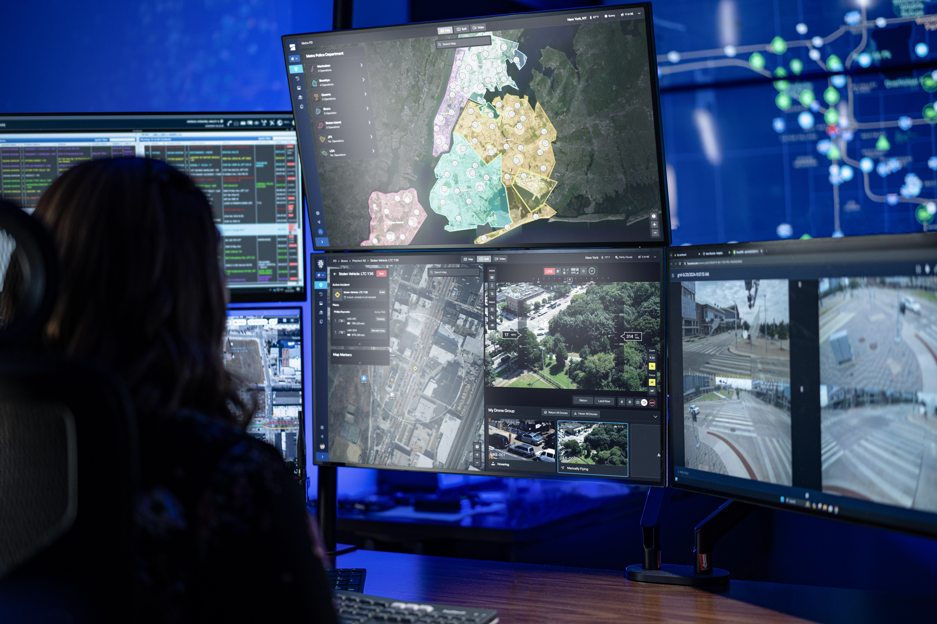
Skydio DFR adds a network of remotely operated drones pre-positioned across your transit system—ready to launch in seconds and provide real-time visibility from a central command center.


From alert to action:
The DFR workflow.
Once an alert is triggered, the nearest drone is already en route. Within moments, teams gain the context to take action.


A family of flying robots working together on one common platform.
Working together on one common platform for consistent performance across complex transit environments.
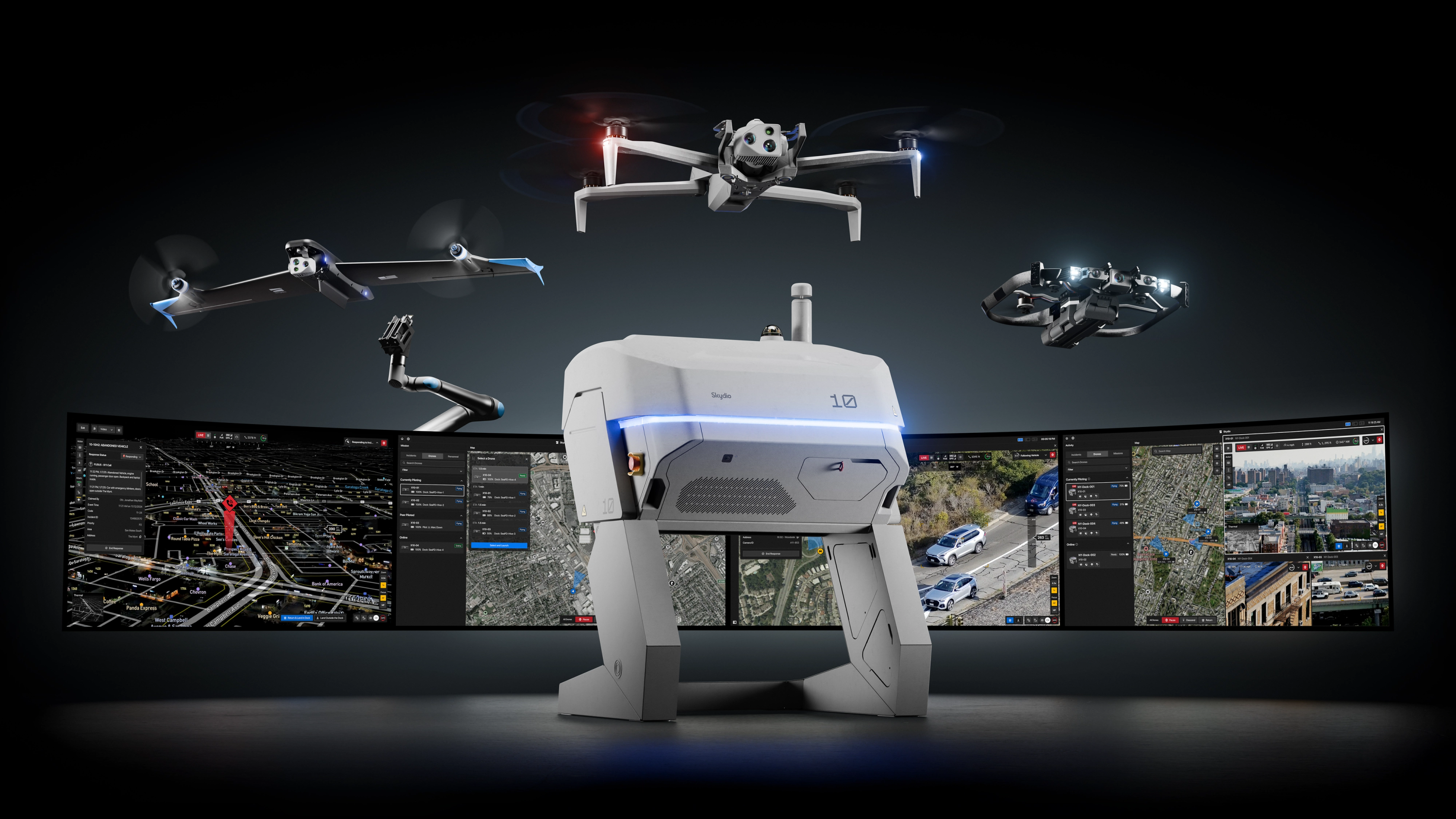
Fly where others can’t.
Only Skydio combines trusted autonomy, resilient connectivity, and advanced navigation to operate in places and conditions where other systems fail.
Connect Fusion
Seamlessly switch between point-to-point and 5G links for the most reliable connectivity across expansive or complex sites.

NightSense
Autonomously avoid obstacles in darkness or low-light environments. Fly 24/7 operations with confidence.

Pathfinder
Automatically fly the safest and most efficient route, avoiding terrain, buildings, and geofences to get on scene fast.

Dedicated support team & expert guidance
Security veterans
Our teams have years of experience from law enforcement, military, and homeland security — they know what it takes to stand up reliable, secure operations. We guide every step, from planning and site setup to integration and data delivery.

Regulatory services
We have experts dedicated to helping you navigate FAA requirements to fly fully autonomously, beyond visual line of sight (BVLOS), with no visual observer.

Training
We get your team up to speed fast with training and certification to manage scheduled and unplanned flights from any browser, anywhere in the world.

Success services
More than support—partnership. Our team guides every phase of your program, ensuring you get operational fast and stay successful as you scale.

Let us help you build a successful DFR program.
Resources
Learn more about building a Metro Transit DFR program with Skydio.

Highway DFR: Accelerating safer, smarter road response

DFR Operational readiness guide