


At first, I said you can't use rolling shutters for surveys. But when I looked at the results side-by-side with Phantom 4 RTK, they were identical.
The X10 gave us the same accuracy as a Phantom 4 RTK in a third of the time.
Surveying and mapping
Get decision-grade data. Autonomously.
Dock-enabled. BVLOS-ready. NDAA-compliant.
Surveying demands more than open-field mapping. In complex, real-world environments, accuracy only matters if it holds up across the entire site. Skydio X10 is built to deliver survey-grade data as your projects scale.
Proven accuracy.
Powered by the Septentrio Mosaic X5, Skydio X10 delivers a fast, stable multi-constellation RTK fix that surveyors rely on. Independent testing from DroneDeploy and Frontier Precision confirmed <1.5" RMS without GCPs, sub-inch with GCPs, and 1.2"–1.6" RMS across mixed terrain under ASPRS-compliant methods.

Skydio X10 works with the most popular GNSS correction sources and more using NTRIP 1.0.

Trusted capture. Processing-ready.
Engineered for high fidelity.
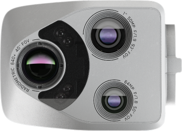
With a 50 MP, 1″ sensor and wide FOV, you cover more per frame at the same Effective GSD. Precise, structure-aware navigation gets you closer for crisp detail and reliable reconstruction.
Rolling shutter made mapping-grade.
By correcting rolling-shutter distortion as you fly, images stay true to shape, so photogrammetry engines align frames reliably without artifacts. The result is predictable processing and mapping-grade outputs you can trust.
Don’t take our word for it. Run a sample through your own photogrammetry workflow.
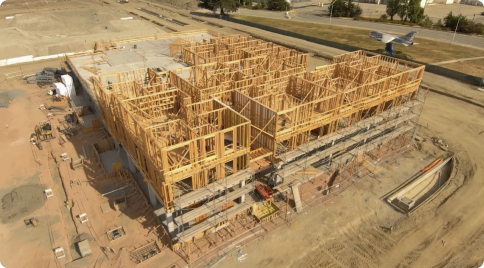
Uneven terrain, handled.
Terrain Follow keeps GSD consistent across slopes and uneven terrain so your reconstruction stays uniform and your measurements stay reliable.

Precision you can repeat.


Autonomous mapping, remotely deployed.
Turn mapping into a routine with Skydio Dock for X10 and Remote Ops. Capture site data autonomously across one or many locations, without a team on the ground. Fly when the site needs data, not when crews are available*.
*with appropriate FAA approvals
Your site demands reliability.
Full coverage in complex spaces. Robust results. Direct support when you need it.
Autonomy in complex spaces means no data holes.
Between buildings, trees, or poles, X10 doesn’t quit. Obstacle-aware autonomy maintains overlap even when GNSS drops, finishing the grid and delivering consistent coverage across the AOI, reducing costly re-flights and giving teams dependable results on any site.
Operate when the site does.
Nightsense, autonomous pathing, and mid-mission resume keep large missions moving day or night.
Reliable by design. Transparent by choice.
With IP55 protection, 27 mph wind resistance, broad temperature tolerance, and published live fleet-level reliability metrics, X10 stays operational on real job sites so you can fly when the work demands it, not only when conditions are perfect.
Put all available connectivity to work.
Skydio Connect automatically adapts between radio and 5G connectivity to maintain reliable control during long or complex mapping missions. When both links are available, they’re fused in real time to extend range and improve throughput, reducing interruptions, re-flights, and the need for pilot intervention.

Skydio is one call away.
Work directly with us, the manufacturer: dedicated support teams, training, solution engineers, API workflow guidance, BVLOS regulatory support, and drone repair coverage.
Workflow Integration
Skydio provides APIs and ICDs to automate workflows and integrate with third-party systems. Our teams offer guidance to help ensure integrations are implemented correctly and perform reliably in production environments.

Regulatory services
We have experts dedicated to helping you navigate FAA requirements to fly fully autonomously, beyond visual line of sight (BVLOS), with no visual observer.

Success services
More than support—partnership. Our team guides every phase of your program, ensuring you get operational fast and stay successful as you scale.

One platform. Many missions.
Reduce fleet complexity, training load, and total cost while raising asset utilization and program resilience. One aircraft, multiple jobs.
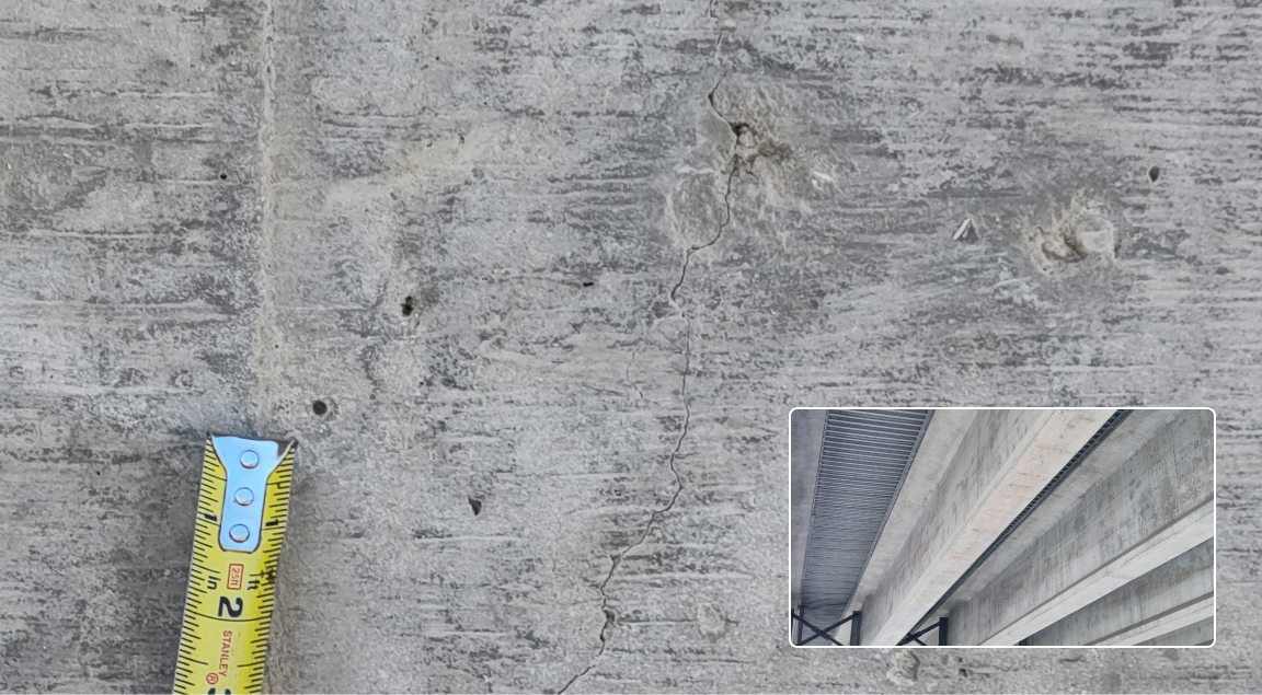
Asset inspection with actionable details
The Skydio X10 telephoto camera focus controls deliver fine detail from a safe distance, capturing what crews need to verify condition and identify defects.

Thermal inspection on the same airframe.
Find subsurface concrete/asphalt defects, solar anomalies, roof and envelope issues—without changing payloads or airframes.

Security & response.
Automated patrols and live-streamed response add site security without introducing a separate fleet or system.
High quality imagery when you need it.
HDR photos, panoramic images, and 4K video support project updates, documentation, and stakeholder communication.
Versatile mapping and surveying solutions anytime, anywhere.
 Stockpile monitoring.
 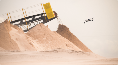 Crash scenes.
 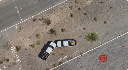 Transportation infrastructure.
 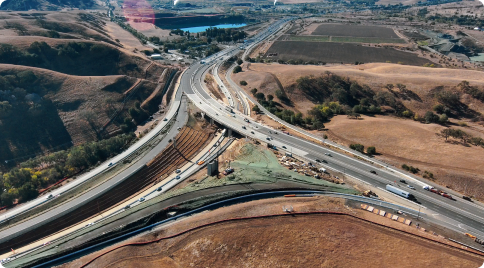 Urban planning.
 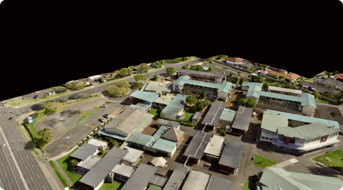 And more.
The Skydio solution for surveying and mapping.


Capture complete, reliable survey data on every flight.
Survey and mapping resources

Oil and Gas—Meet inspection mandates. Reduce operational exposure.

Quantifying image resolution with effective GSD

Precision UAV photogrammetry: Performance analysis of Skydio X10 RTK module for mapping applications

Precision in flight: Skydio X10 RTK accuracy testing
Beyond the baseline: Achieving precision mapping with Skydio’s RTK/PPK technology
