

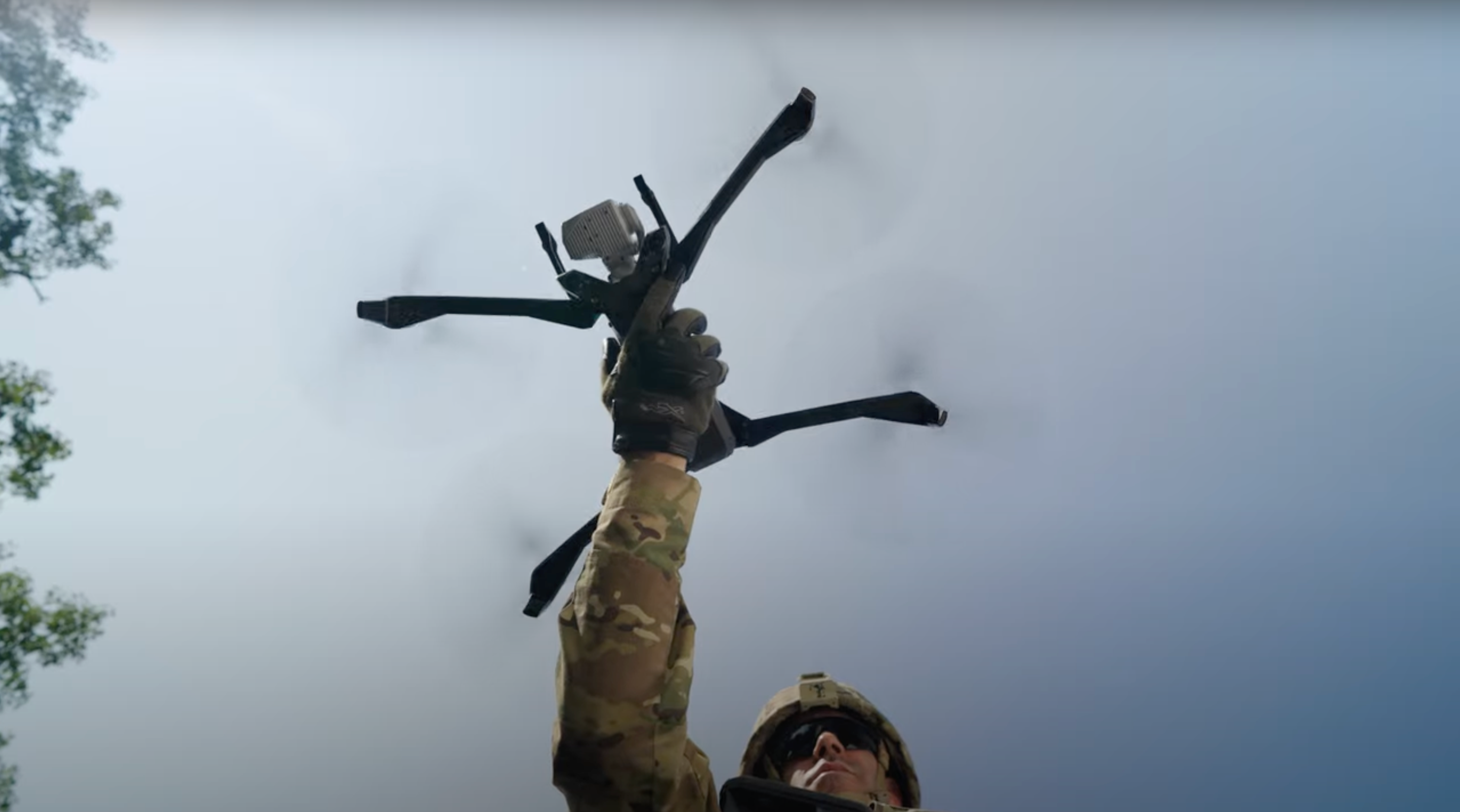
Crash scene documentation: Get better data, faster with drones
Drones are revolutionizing the way law enforcement gathers and analyzes critical evidence in crash and crime scene investigations. The unparalleled aerial perspectives allow for rapid, comprehensive scene documentation. Skydio X10 enables onboard generation of orthomosaic images and 3D modeling, so you can clear a scene with the confidence that you have all the data you need.
Watch this webinar to
- Understand the process for capturing a crash scene with Skydio X10
- View a live demonstration of Skydio 3D Scan capabilities and output
- Review courtroom deliverables generated with FARO Zone 3D Expert software from the drone data
Learn more about Accident Scene Documentation.
- For hanging out with us today as we do a live demonstration of
- crash scene documentation from our warehouse in
- California. Um, I am very fortunate today to be
- joined by Matt, who is part of the Skydio team and has
- experience in the world of crash reconstruction.
- So Matt, you wanna go ahead and introduce yourself?
- Hey, thanks Noreen. Uh, good morning everyone.
- Matt Boerwinkle with Skydio.
- I'm with, uh... I'm a solutions engineer on the SIDS, uh,
- which is our
- state, local, um, mostly law enforcement, uh, driven team.
- And, uh, prior to that, I spent 25 years at Illinois State Police,
- and last four years with the agency, I was a supervisor
- with a, a statewide crash reconstruction team
- and helped set up the program,
- uh, to speed up our, uh, handling of crash scenes.
- And very glad to be here with you today, uh, to talk about a couple of
- topics, uh, related to crash reconstruction.
- Excellent, thanks. And I'm Noreen Charlton.
- I lead public safety strategy and marketing here at Skydio.
- Uh, but my background is in scene documentation.
- I was a crime scene investigator with Las Vegas Metro for more than 10 years,
- and then I dedicated, uh, several years after that to helping
- agencies across the world document their crime scenes for courtroom
- purposes. So a lot of information to, to put out there today for
- everyone. Please, if you have any questions,
- throw them in the chat.
- We will answer those either live or at the end of this session.
- Um, and before we kind of kick off into our
- live demo, I just want
- to remind everyone, or at least let you know in case you
- weren't aware, we did a webinar back in December
- where we kind of covered what drones can do for scene documentation, um, for
- the benefits of having drones, what kind of scenes you can be flying them
- on,
- what kind of data you can get from it.
- And we really focused on our partnership with FARO
- and FARO zone 3D expert software and what you can do with our
- images in that software. So after the demo today, you
- will be provided with the images that are captured in this particular
- demo
- so that you can use them however you want to, um, whatever software of choice
- you, you, you want so that you can process them in
- photogrammetry or
- create diagrams or whatever it is that you wanna do,
- so you can see for yourself
- how it works for you and for your potential cases.
- So if we can go to the next slide, Kendall, um, before we kind of kick it
- off, this, these are the vehicles that you will be seeing today.
- These are located in our warehouse in California,
- and, uh, we do have someone over there to fly,
- and Matt will talk you through the
- process. So without further ado, Matt, we wanna kick it off.
- All right.
- Say the word.
- I'm very excited to talk about, uh, 3D capture and
- how easy, uh, and safe and affordable this is to
- use.
- Um, so many things you can do with this to,
- uh, speed up the capture of your
- scene and get accurate representation.
- So what my partner Dave is doing in the warehouse right now,
- he's labeling
- this crash scene. Uh, and normally, uh, from, as a crash
- reconstruction, uh, person, you would want to put your case
- number or description there of the scene that you're about to capture.
- So Dave's gonna go ahead and
- lock that in, and we're gonna move forward through the
- mapping menu here.
- So Dave's about to launch the aircraft.
- Aircraft's gonna do a quick 360 calibration turn,
- and now he's gonna be able to,
- uh, go right into the return behavior.
- He's gonna use the-- set the launch point.
- Now he's gonna set the floor. Um, a lot of ways you can do this.
- You can use the default. Uh, Dave right now is setting a custom
- default. He's lowering that floor,
- uh, below the level of the vehicles there.
- So by dragging that artificial horizon down, he's able to
- make sure that the cameras are gonna capture everything at the ground
- level,
- uh, all the way down to the wheel base.
- So if there's any crush damage along the side, that's gonna capture in
- each one of those photos there. So now Dave's gonna set the ceiling
- height,
- and all he has to do is fly just above the height of the
- vehicles.
- Uh, he can raise and lower that depending on the environment
- that you're in.
- If you wanted to get, uh, greater context of taller vehicle, uh,
- anything like that. So he's got that locked in.
- Now Dave is gonna set the boundaries,
- very simply, uh, dropping a, a number of pillars all the way
- around your scene. Uh,
- 3D scan requires a minimum of three pillars.
- However, uh, Dave is probably gonna go around and set,
- uh, a
- number of pillars around to ensure that we have adequate coverage
- and to ensure that we're not encompassing anything that doesn't need to be
- in the, in the capture.
- So while he's doing this, uh, we're ensuring that we're getting distance
- away
- from the vehicle, but we're also getting all the detail
- that we need, but
- no, uh, additional that, uh, is unnecessary in that
- scene.
- So he's locking that in. Looks like we've got, uh, about,
- uh, six pillars now. Seven,
- and then
- he'll be done here just momentarily.
- All right, so we've got, uh, a completed, uh, a
- perimeter setup right there. Now, if Dave needed to, he could extend that
- volume outside of the, uh, the realm of what he just, uh,
- dropped those pillars to. We don't need any additional, uh,
- area outside
- of that for context. So now we're looking at the strict
- geofence. So if we had active traffic, uh,
- nearby or, uh, active traffic overhead on an overpass,
- we could set those, uh, various ceilings, floor, or the wall
- to ensure that the drone doesn't pass outside of that space.
- Uh, Dave's got an, a safe distance of about two meters away
- from the vehicles and from the other surfaces there.
- He can set that up or as low as, as he needs to, to ensure
- that the drone stays away, uh, from- Potentially
- blowing away any evidence, you know, with a prop wash.
- So we're gonna leave those geo fences off.
- He's gonna move right into the, uh, review suggested, um,
- auto, uh, augment reality observer point. Very easy to do.
- The drone's gonna go and give us a quick glance of where things
- are at.
- You can also set it manually, uh, where you-- for
- preference and be able to see that view of the entire
- capture area while the drone is flying.
- So now that he's got that set, we're gonna go right in to begin
- exploration phase.
- This is the point where the drone is gonna fly around the
- crash scene and start getting... building a mesh and
- making calculations and decisions on how much,
- uh, data we need to capture to achieve the
- ground sampling distance we
- need for the level of detail that we want in our final rendering.
- So now the
- drone's nearly complete doing that.
- We've got a little printout here that shows us the drone
- is gonna capture about
- sixty-six photos, one battery flight time,
- and we can go in and change any of those settings.
- We've got one point six millimeter
- ground sampling distance, uh, that was in that top corner, so if we needed
- to, we could adjust that. Uh, Dave can also dial
- that distance to surface
- up and down to change that ground sampling distance.
- Uh, we've got good seventy, eighty overlap in
- that middle figure there.
- Those are-- That's typical for, uh, most crash scenes.
- You could even bump it up as high as ninety/ninety if you needed to.
- Uh, but Dave can, uh, keep that down at seventy/eighty,
- and we'll have
- adequate coverage for, uh, our model here.
- Again, you've got the option to, uh, click on those strict
- ceilings, strict floors, strict walls for those geo fence, uh,
- in case you've got
- active traffic in another lane adjacent to you and you wanna make sure that
- drone doesn't fly over there, uh, where it doesn't need to be.
- And then obviously, your safe distance.
- Uh, we also have the option, uh, going on further down to
- adjust our speed. Um, right now at two point five meters per
- second, uh, this is probably
- typical. You could even lower it down a little, uh,
- if you needed to, to,
- uh, take a little bit more time
- in between those captures. And then, uh, you can also
- change your Z-axis, uh, pitch, uh, your
- Y and your X contour slicing, uh, within that scene.
- So if you've got a lot of vertical surfaces like the side of a semi or
- anything like that that you wanna capture, uh, or the top side of a
- vehicle in particular, uh, there's additional evidence up there that
- needs captured, you can turn those on or off.
- And then rolling down a little further, uh, taking best photo.
- I think this is always kind of a no-brainer, but, uh, you can set this for
- stop for photo as well. And I think having stop for photo
- option there, that gives you a little,
- uh, extra clarity on each one of those photos
- if you decide to set that,
- and that's gonna help, uh, keep a clear image of
- your final rendering. And then obviously, the camera field of view, if you wanna
- use wide or narrow,
- uh, this is good for close-up inspection, uh, and a faster scan,
- uh, with the wide angle set up here. So I think we're all set to go.
- Uh, Dave's gonna hit begin on the scan.
- So now the drone is gonna start doing its initial pass.
- Uh, the drone will actually start to make a,
- uh,
- circular pattern around the vehicles capturing that
- area. And as you can see, that yellow mesh is actually
- changing colors now. It's starting to go from yellow to
- green to blue, that eventually it will change that color,
- uh, up to purple, showing saturation of photos in
- that area, ensuring that you've got good coverage within the
- boundaries that you set earlier with those yellow pins.
- And as the drone is going around, we're already moving
- through, uh, we've got about a third of the photos
- already captured.
- X10 is extremely fast, and so is X2 and
- S2 at doing this, uh, three-D capture.
- So the platform works the same on all of our drones.
- Very easy, very safe,
- and this ultimately saves you time, and time is money.
- Uh, we all know that.
- So clearing the crash scene and getting a fair
- and accurate representation
- is the most important component here.
- Uh, and then obv-obviously, uh, officer safety and the
- safety of all the first responders, uh, that are affecting, uh, affected there in
- that crash scene. We wanna ensure that we're minimizing the time
- that we need,
- uh, there to capture the data and get good quality data at that,
- uh, for our final rendering.
- Ultimately, uh, this data could go to court,
- and we wanna ensure that
- we have accurate representation of that crash scene.
- So right now the drone is starting to make its, uh,
- final pass to get around.
- Uh, well, once it completes this final, uh, run here, it
- will make a ninety-degree turn and start making, uh,
- continuous lawnmower passes in the opposite direction,
- or actually at a ninety-degree direction to where it's traveling now.
- So all the while this is going,
- Skydio Autonomy is acting in the background at, at the
- same time. But all-- There are six four K cameras,
- three on top, three on bottom of the aircraft
- that ensure that the
- aircraft is
- staying safe away from objects with a thirty-six-inch obstacle
- avoidance. This is all done in the processor
- while it's
- also capturing all this data and categorizing it with the correct
- telemetry, GPS information,
- and ensuring that we're getting good, accurate coverage, uh,
- and good overlap of the, of the area here.
- We can see now that we're reaching near total saturation,
- there's just a few little areas left that have not had a photo
- taken, and we're-- the drone is still going at it here.
- And we've got, uh, just about-
- 10 photos left here, and then it'll be s- sped up here in just a moment.
- We'll be done, and then
- we'll see that we've got a good model coming out of this momentarily here.
- One of the great things that has come out here with, uh, X2 and
- X10 is that we've got the ability to ensure that we've got coverage
- after we complete the scan so that you're not returning to the office
- later on to do your final orthomosaic and discover that you've got
- voids.
- And we've got ability now to build a model right on screen and be able
- to determine, did we get adequate coverage?
- Do we have everything we need?
- So now that we're at this point, uh, Dave has the option.
- We've completed the, the automatic run of photo collection.
- Dave has the option to do take manual photos.
- If he needed to, he could select that and zoom right in and maybe get, uh,
- license plates or additional crush damage, uh,
- or look inside, and there's Dave R- Wa- giving us a h- uh, wave.
- Dave, I think we're done. We've got everything we need for this, uh,
- rendering.
- If you wanna go ahead and land, and let's have a look at the model
- when you get a
- chance, sir.
- Matt, I just wanna jump in for a second-
- Sure
- ... um, just to make sure that everyone's aware.
- Dave wasn't actually manually flying any of this.
- 3D scan makes it possible that once you've set your kind of, your
- settings and how you want your scene captured, it does it all autonomously.
- So you don't have to be an expert pilot.
- You don't have to sit there thinking about every single image that you wanna take.
- You kind of just set everything up and then let it go,
- and then once it's done, you
- can bring it back and process this onboard model, which
- is what you're seeing on
- the screen now.
- Yep.
- So 3D scan, definitely, uh, to Noreen's point, this en-
- this enables crash and crime scene reconstructionists
- and anyone
- that wants to collect data quickly and get an accurate representation of
- that data. It's an automated process, 14 steps,
- uh, following the cues on screen.
- Lock in your points where you wanna capture, and you're basically
- capturing that volume and doing so very quickly,
- and it's super easy to use.
- Anyone can use this.
- Matt, I'll ask you a question, um, that came in.
- So how do the sidelap and overlap impact both the
- speed and the quality of the data that we're capturing?
- Certainly. So sidelap and overlap, uh, goes
- into your ground sampling distance calculation.
- Sidelap and overlap is that, uh, overlap between photos,
- uh, from side to side, and then your overlap, uh,
- from the front to rear, uh, in each one of those, uh,
- passes where the vehicle is making, uh, overlapping
- photogrammetry, uh, so that we've got good coverage, uh,
- all, ensuring that we've got detail in every,
- uh,
- crevice of those vehicles and on the side, particularly in the
- crush damage area. We wanna ensure that we've got the highest ground sample,
- or
- particularly the lowest number, uh, in that ground sampling distance,
- ensure that we've got really good coverage, and that the
- detail in our final rendering, uh, is very crisp,
- and, uh, inter- can be interpreted by anyone, uh, at a
- courtroom.
- Excellent. Um, I know you're doing a lot of work with
- different crash
- teams across the country, and they're trying to incorporate drones
- into their
- workflows now. How do you see that working for them with the traditional
- methods
- that they're using, whether that's they're still using the old
- roller wheel and
- measuring like that, or they're using total stations?
- How are they bringing drones into their workflow?
- Sure. So drones are, are very rapidly entering
- the workflow of crash and crime scene across the country.
- They're finding that the traditional methods of measurement, while they are
- absolutely accurate, uh, they take a lot of time, and
- time is of the essence, especially when evidence, uh, can
- decay, uh, right on scene if you've got weather rolling in,
- or the temperature, uh, could be affected, um, could affect the scene.
- You also have active traffic lanes and the extreme
- risk of high-speed secondary crashes, uh, that can occur at, at
- the back end of a ta- of a traffic backup.
- So there's a lot of pressure on crash scenes, uh,
- reconstructionists that need to get that scene documented quickly,
- accurately, and then get the roadway clear, uh,
- so that we can get
- traffic moving again and prevent those secondary high-speed
- crashes from
- occurring. So a lot of the traffic crash
- reconstruction units are
- really taking to drone photogrammetry, and they're seeing the
- benefits of doing 2D and 3D capture to
- get those scenes documented quickly and accurately, and they're finding
- that the
- results on the other end are highly accurate.
- Uh, they can measure within those scenes, and we can speak to the accuracy
- of this as we go along here. But, uh, Dave's got our image pulled up already.
- Um, just take a look at this. We can see that we've got,
- uh, a really good-looking model between those
- two vehicles.
- Uh, we can see all the crush damage, uh, on the s- on the front, uh, end of
- those two vehicles, and we're able to
- see all the angles from which those shots were taken
- within that scene, and we can measure within that scene
- if we need to
- using a post-photogrammetry engine.
- Yeah, I think it's really, um...
- Onboard modeling is super exciting, right?
- You can see exactly what you've captured before you leave the scene.
- With a lot of other technologies out there,
- you've gotta kind of cross your fingers
- and take that data back to your computer or back to the office and then process it
- and then hope you got everything that you need.
- But in this case, you have the ability to confirm before you
- leave the
- scene that you have everything you need.
- And if you don't, you can just go ahead
- and fly an additional scan or add extra
- images to, um, what you have there.
- That looks great, Dave.
- Great job, Dave.
- Yeah, we've got, uh, being able to manipulate this model at the
- very end of the
- scan, uh, is a, is a real time saver here, and
- it's a real- it's a very assuring, uh, re-...
- component that we've got all the data that we need before we leave the
- scene because once you tow these vehicles and disturb
- the original context of that scene, it's very difficult to go
- back and get that level of detail. Uh, but now with a
- completed model,
- we'll- we know that we've got everything we need
- within the scene, and we can, uh,
- reasonably, s- uh, go ahead and tow these vehicles
- and get them out of the way,
- get traffic moving again. And we can go back to our
- office and be able to
- load that data into a postfeto- photogrammetry engine of any type
- because our data's agnostic, it can go into any engine.
- And we know that we're gonna get a high quality orthomosaic or
- 3D model that we can use later on for prosecution
- or, uh,
- validating, um, you know, who's at fault or if there's no fault in
- this, at least be able to make that determination.
- Yeah. And I do wanna add with this onboard
- model, what you're seeing is a textured
- mesh that is created right on the controller for the X10, um, that
- is the drone that Dave flew for this, um, data capture.
- And
- if you wanted something that was more of a point cloud
- or something that
- you could do a little bit more with to, um, you know, use it
- in animations or use it in other kind of types of reconstruction,
- all you're gonna do is take these exact same images
- that he captured in the 3D
- scan and then take that into your photogrammetry engine of
- choice.
- Um, additionally, and I know that you had mentioned crash
- photogrammetry, all my travels with law enforcement
- agencies across the
- country, I feel like, uh, a lot of crash and crime scene teams
- are limiting
- themselves to just the 2D images from a drone, which
- is great. You can get yourself, you know, a stitched together
- orthomosaic image that can stand as a basis for your 2D
- diagramming, but you're really missing a huge portion
- of the deliverables you could be making for court by just using these
- images in their 2D form and not converting them to a
- 3D point cloud or a model such as what you're seeing here.
- So a lot of other things, and we can-- we're gonna go through some of those here
- in
- a moment, uh, what you could be doing with these images
- if you aren't already
- thinking about it. Um, but this onboard model is, you
- know, new and unique to Skydio and something that we're all really
- excited about.
- So you could take this off of the controller, off the drone,
- and then you could
- place that into additional forensic software to complete your
- diagrams or whatever else that you're looking to do.
- Yep. To your point, Noreen, we definitely are seeing a lot of, uh,
- crash and crime scene sticking to, um, just
- using that two-dimensional capture when you've got
- three-dimensionality here and capability to get that full
- context of the scene. And there is nothing more
- important than being able to, at the end of the day,
- if this goes to court,
- being able to show a judge and jury and walk them through that scene and
- literally having the ability to fly through it and show them in full
- rich detail all the side angles and everything that's happened at that
- scene, not just a bird's-eye view from directly
- above.
- So the benefit of 3D scan is that you have that oblique
- angles, the very sides where the crush damage
- occurred, and that's
- the most important thing to give the judge and jury a fair and accurate
- representation by giving them that three-dimensional analysis there.
- And I do think drones have been embraced a lot more,
- a lot more, I guess I should just say, with crash teams than they have with crime
- scene teams. Um, and as much as I loved kind of hanging out
- the side of a
- helicopter to photograph an officer-involved shooting or a
- homicide investigation that was out in the desert, um,
- to take images of it,
- drones are really just more efficient and effective and, you know, it's,
- it's not this big scene to kind of get up to your air unit and get into the
- helicopter and get to that scene and, and everything else.
- Um, so a lot of crime scene units are now really
- incorporating drones into their toolbox as well, just for this exact
- same thing, right? You're, you're flying it at outdoor scenes to
- capture your
- data quickly. Think about, um,
- you know, a long shooting investigation
- that spans a long
- stretch of roadway or maybe blocks.
- You've got kind of a,
- you know, just cartridge cases everywhere.
- It's really easy just to fly that drone, capture this data, and within
- minutes, you saw how quickly, uh, we were able to capture both of these
- vehicles.
- But within minutes, not only have all of those images
- captured, but also to be
- able to create the model like you're seeing here on your screen.
- Yeah. We're seeing a lot of the crash sc- crash, uh, units out there
- adopting the drone, uh, mentality and getting, uh, the quick
- capture, getting good data, and, uh, we're also
- finding that it's, it's affordable at the end of the day
- because you're saving
- time, saving money, and you're saving resources of your
- agency and those of, uh, of other participating agencies
- and getting folks out of harm's way out on the road and ensuring that the
- traffic keeps moving. But while at the same time, getting
- accurate data that we need to be able to cre- uh, recreate those scenes
- in three-dimensionality. And so these, uh, crash units are
- adopting the drone model and using that.
- Uh, we're also seeing a lot of
- use of that, uh, data to be able to get the results that we
- want.
- Uh, Matt, I know you do a lot of work helping our
- agencies get up and running with
- this. Can you just speak to the training
- that you think is required for 3D
- scan? Is it something that anyone can kind of learn in a, in,
- you know, just a
- short training session, or is it something that needs a lot of, uh,
- a lot of technological understanding and a lot of practice,
- and it's one of those
- things that, you know, use it or lose it kind of skills?
- Sure. So 3D Scan is really easy to learn.
- It takes, uh, just a matter of minutes to learn the
- walkthrough of the
- menu and be able to understand how those, uh, changing those ground
- sampling distance values can get you the greater detail that you need.
- So most people could relatively pick up a Skydio
- controller, turn on 3D Scan, and be up and operating
- within the hour and really have a good understanding of how it works.
- It is really simple to use. Uh, I would put it at,
- uh, just as easy to turn on your camera on
- your iPhone and be able to
- go start snapping photos. It's very easy to follow that
- menu and understand how it's going to achieve the values that
- you need and create those models, and, uh,
- really speed up your investigation and have quality results
- that you can depend on at court time.
- Yeah, you touched on this earlier, but, uh, some of the questions that I used to
- get all the time were, "What, what is the overlap?
- What's the side lap I need?
- What's the percentage I'm looking for?" And you can see in 3D Scan that
- it was kind of automatically giving you a starting place for that.
- You could obviously bump that up if you wanted more.
- You're just gonna get more images. It's gonna take a little bit longer.
- You're gonna have a little bit better quality.
- But the software itself, after it kind of goes through
- and it sees what the scene
- looks like, it's basically telling you, like, these are the suggested settings for
- it, and those are sufficient, you know, more often than not.
- It just depends, you know, if you wanna spend a little bit of extra
- time and have
- more images captured.
- Sure. Those are, uh, settings between the, I would say, the
- X10. We'll talk about that on, uh, first.
- X10, you can set those settings right at, uh, a 20--
- anywhere from a 10-foot to 20-foot standoff of your
- subject and be able to have, uh, 70, 80 overlap.
- You can go even higher than that, uh, for a 2D capture to,
- uh, get that data.
- The ground sampling distance ultimately is the distance across one pixel,
- uh, on your display view, and ensuring that you get
- a really close value, uh, on that. You wanna be able to
- set that ground sampling distance somewhere, uh, in the one
- to two range, one to two millimeter ra-range.
- It's very easy to do.
- If you need greater detail, you can really
- move the drone in closer and be able to get those, uh,
- very small ground sampling distance number all the way down to .64
- millimeter if you need to. So it's really easy just cha- by changing
- your side lap, overlap, and then also the distance from the
- drone to the subject, and those three values are what
- affect your ground sampling distance.
- Um, and by doing that, you will increase the number of photos
- that you capture.
- However, you're gonna get a greater level of
- detail.
- It all depends on how much time you have available at the scene.
- You may-- This, uh... You may be capturing a scene,
- like what Dave was there,
- uh, and the sun's about to set and you need to get, uh, utilize
- the available sun-sunlight that you've got to illuminate your
- scene if you don't have any artificial light to be able to put on those vehicles.
- If you know you've only got 20 minutes, work within that 20 minutes and set that
- scene up to capture. And the drone will tell you right on the
- menu how many-- an estimation of how many minutes it will
- take to
- fly that mission. And once you set that param-- those
- mission parameters up, 3D Scan takes over and does all the work
- for you. And while you're there holding the
- controller, you can be
- also doing, um, other tasks if you need to or paying more
- attention to your surroundings, officer safety, or
- directing resources, uh, while you're, uh, in the-- within
- that scene.
- As a controller, uh, and pilot of that scene, you also have the option to
- pause the scan and be able to go handle, uh, if you need to,
- to allow people or vehicles through your scene, and then you can
- re-uh, re-engage that scan and hit, hit play, and
- it will pick up right where it left off. The same goes for a battery change.
- Very easy to do. Pause the scan, land the drone,
- save your data that you've collected thus far, swap your battery out, and
- restart, and the drone will pick up right exactly
- where it left off in the middle
- of the scan and be able to continue mission.
- So
- 3D Scan is very intuitive, uh, so no, no matter what part you're in,
- it will, uh, pick up and go right back into, uh, its
- scan management.
- Excellent. Some questions in the chat about the
- availability of 3D
- Scan, and you can, uh, use that on your X2, your
- S2, or X10. However, the onboard
- model, which is what you saw processing after,
- uh, the 3D
- scan flew, that is only available on X10.
- So hopefully that clarifies some questions there.
- Um, Kendall, can we go back into the slide deck,
- and we'll just talk through some
- of the courtroom deliverables? So again, we see a lot of agencies kind of just
- going out, capturing these images, and then they're creating a
- 2D-- one collective 2D orthomosaic image.
- Um, and that's great, and that works kind of as a
- updated satellite image for those of us who used to import Google Maps, uh,
- to create diagrams. Um, but there's so much more
- that you can do with it for
- courtroom purposes. So I do wanna talk through this quick
- scene.
- This is a mock scene that was provided to me, um, from John,
- if you're out here,
- thank you, uh, over in Chicago. And this is a mock crime scene that
- they put together. So you'll see what you
- were seeing prior to this were the
- images that were captured. I believe it was three hundred and five.
- And this was actually with the S2 Plus, so with, uh, our smaller
- little blue drone. And, um, I took all of those images
- and I imported them into Veritone 3D Expert software.
- And at medium quality, because there's different quality you can
- choose,
- it took about fifty minutes for my computer to process all three hundred and
- five images into the point cloud that you're seeing on your screen now.
- And then I just created a quick fly-through so I could show everything
- that was
- captured for this particular instance.
- And so you can see the evidence placards, you can see the vehicles.
- Uh, he even added some evidence placards there
- into the,
- um, inside the vehicle, um,
- as well as there's one kind of tucked in underneath the front of the vehicle,
- the front right corner. So you can see all of those really well.
- Um,
- and this was all just captured with 3D scan.
- So he set up his, um, it s- the scene, he set up the perimeters
- just like you saw at the beginning of this, uh, live demonstration.
- It went and it did its thing, and it came back and he had the 305
- photos.
- So that's great. You can have this 3D point cloud.
- You can create a fly-through video like I did here.
- You can set up perspectives if you needed to.
- So if there were conversations about what someone could or
- couldn't see, you would be able to show
- that because now you have a 3D environment
- from those 2D images that were captured with the drone.
- If we go to the next, um, slide, Kendall, uh, real quickly, I just
- pulled out some measurements. Now, when I processed these images, I just
- did it based on the GPS coordinates that are built
- into the images when they're captured.
- Um, and then I was told, you know, that they had placed down these
- essentially
- ground control points. Uh, one was at 50 feet distance and the other was
- at 25. So real quickly, I just pulled a measurement in the
- software
- to see how close I was to their known measurements.
- Um, you know, there's other ways that you can
- scale your point clouds. You can do it by known measurements
- and images
- prior to processing. You could bring in ground control
- coordinates
- from total stations. There's all different ways
- that you can do it.
- I just did it the easy way. I did it based on the GPS, and these
- are the
- measurements that I got from that.
- In the next slide, um, you can see that I took that point cloud.
- I think I spent less than five minutes. I traced over some of the lines.
- I kept the measurements on there. I threw in some evidence placards and some
- vehicles, and within minutes I had a 2D diagram,
- you know,
- that I could throw in the case file because no matter how technologically
- advanced
- we seem to get, we still just want this 2D [laughs] uh,
- diagram for court. So, um, you can see that same thing
- here. Uh, and this was just by tracing over the point cloud
- that I had in the
- software. We are agnostic, so you can bring
- our images into any photogrammetry software.
- Um, you could then take that data into other forensic
- diagramming software. I am a diehard,
- longtime CADzone, CrimeZone, FaroZone user,
- so that's just my choice, uh, when I start creating my deliverables.
- And then I think we have one more slide
- here, Kendall. Oh, no, just the Q&A.
- Um, so just kind of an example of the
- deliverables that you can make with just
- capturing these images and the 3D scan.
- Um, looks like we have a question, and Matt, I don't know if you wanna take
- this, um, or we can talk about this together, but,
- "How do you manage the photos
- and the data? Does Skydio integrate with other evidence
- platforms?"
- Yeah, so managing the photos and data, uh, you've got several options to
- offload the data, uh, to your computer for use later on.
- You can use Media Sync if you've got, uh, Wi-Fi back at
- your home station, and that can be, uh, that's where the drone will
- actually upload, uh, through API connection right to
- either to your cloud or up to a thirdfo- party
- photogrammetry engine or to a file system.
- Uh, perhaps you have Axon, evidence.com, or you've got
- another photogrammetry service that, uh, is able to
- ingest the, all the photos. You also have the option to take the
- SD card right off the aircraft and put it into a card
- reader and, uh, load that locally on your computer.
- And then, uh, with that, once you have that data, uh, in a
- folder, you can use that, uh, those JPEGs in
- any photo, post-photogrammetry engine such as
- GenX, um, Pix4D, Bentley, any of
- those. They're all they, they're all agnostic.
- Uh, our photos are agnostic, and they can be imported in there.
- And then you also have, uh, a auto-generated CSV file that's
- included with those photos that you can help use as a key
- in some of those post-photogrammetry engines to ensure that you have the proper
- alignment of all the X, Y, Z axis, everything, all the telemetry
- data that is ingested in with those photos.
- And then
- looks like we have another, uh, question here.
- Uh, "Does the photo, 3D scan require a subscription?"
- Well, map capture, 2D map capture is included with
- X10 as part of your operating system, uh, on X10.
- However, if you want the benefit of 3D scan
- and a lot of the
- other capabilities that, uh, come with that,
- that's all in part of a 3D sc- uh, 3D scan subscription, and you
- can reach out to us, uh, for pricing on a 3D scan subscription,
- and those come in one and three-year packages.
- Excellent. I think we'll take, uh, one or two more questions, so
- if you have them,
- go ahead and drop them in the chat. Um,
- but the question was, "Are we compatible with Pix4D or
- Bentley software?" And the answer is yes, we're agnostic.
- So the images that you're getting, um, from the
- drone, you can put those into any photogrammetry
- software and process them
- however you choose. Um, and then if you were taking it out of
- that software and then putting it into any kind of forensic software for
- diagramming, that will work as well.
- Um, let's see, what else do we have here?
- I think that might be it. [clears throat] Five minutes
- early.
- All right.
- All right. Well, Matt, I really appreciate your time
- and all of your insight for
- using drones for crash documentation.
- To Dave in the background, thank you so much for all of your help in
- flying
- for us today. Um, we really appreciate it.
- Like I said, uh, you will receive a link with all of these
- images post, uh, webinar once I get those,
- and you can do with them what you want, see how it works out for you.
- So if you wanna go process th- those into, um, photogrammetry
- software, if you want to create an orthom- or- orthomosaic.
- Can't get my words out today. Um, if you want to, you know, do an
- analysis on the crush that you're getting from the vehicle
- there, you could do that
- as well. So, uh, more to come there, and hopefully this
- was helpful so you can understand a little bit more about how Skydio products are
- helping to capture crash and crime scenes.
- We really appreciate you hanging out with us today. Matt, any final words?
- Uh, well, we're always available to take questions
- later on.
- If you've got, uh, questions, particularly with 3D scan or
- how you can use, utilize our drones in your
- workflow to get, uh, better accuracy, uh, faster
- results, we're always here to help. Uh, thank you, Noreen. Appreciate your time.
- Yeah, absolutely. All right, thanks everyone. Take care. Stay safe.
Watch Time
37 Mins 26 Secs
Related Webinars

Go Beyond the Door: Live Indoor DFR with Skydio R10
Read article
Drone as First Responder: Changes in Policing, Changes in Prosecution
Watch webinar
Meet F10 Lightrunner: Fixed Wing Performance with Quadcopter Simplicity
Watch webinar